|
Cape May–Lewes Ferry
The Cape May–Lewes Ferry is a ferry system on the East Coast of the United States that traverses a crossing of the Delaware Bay connecting North Cape May, New Jersey with Lewes, Delaware. The ferry constitutes a portion of U.S. Route 9 and is the final crossing of the Delaware River-Delaware Bay waterway before it meets the Atlantic Ocean. It is one of only two year-round direct crossings between Delaware and New Jersey, the other being the Delaware Memorial Bridge. System The Cape May–Lewes Ferry, operated by the Delaware River and Bay Authority (DRBA), consists of three ferry vessels and two terminal facilities. Its operations are based at its Cape May terminal, which is actually located in North Cape May, on the north shore of the Cape May Canal. The three vessels in the fleet carry both vehicles (passenger cars, buses, RVs, tractor trailers, motorcycles, and bicycles) and foot passengers. Each has a capacity of 100 vehicles and 800 passengers, selling out in adv ... [...More Info...] [...Related Items...] OR: [Wikipedia] [Google] [Baidu] |
North Cape May, New Jersey
North Cape May is an unincorporated community and census-designated place (CDP) located within Lower Township in Cape May County, in the U.S. state of New Jersey. It is part of the Ocean City Metropolitan Statistical Area. At the 2010 United States Census, the CDP's population was 3,226.DP-1 - Profile of General Population and Housing Characteristics: 2010 Demographic Profile Data for North Cape May CDP, New Jersey , . Accessed October 18, 2012. The [...More Info...] [...Related Items...] OR: [Wikipedia] [Google] [Baidu] |
Delaware Breakwater East End Light
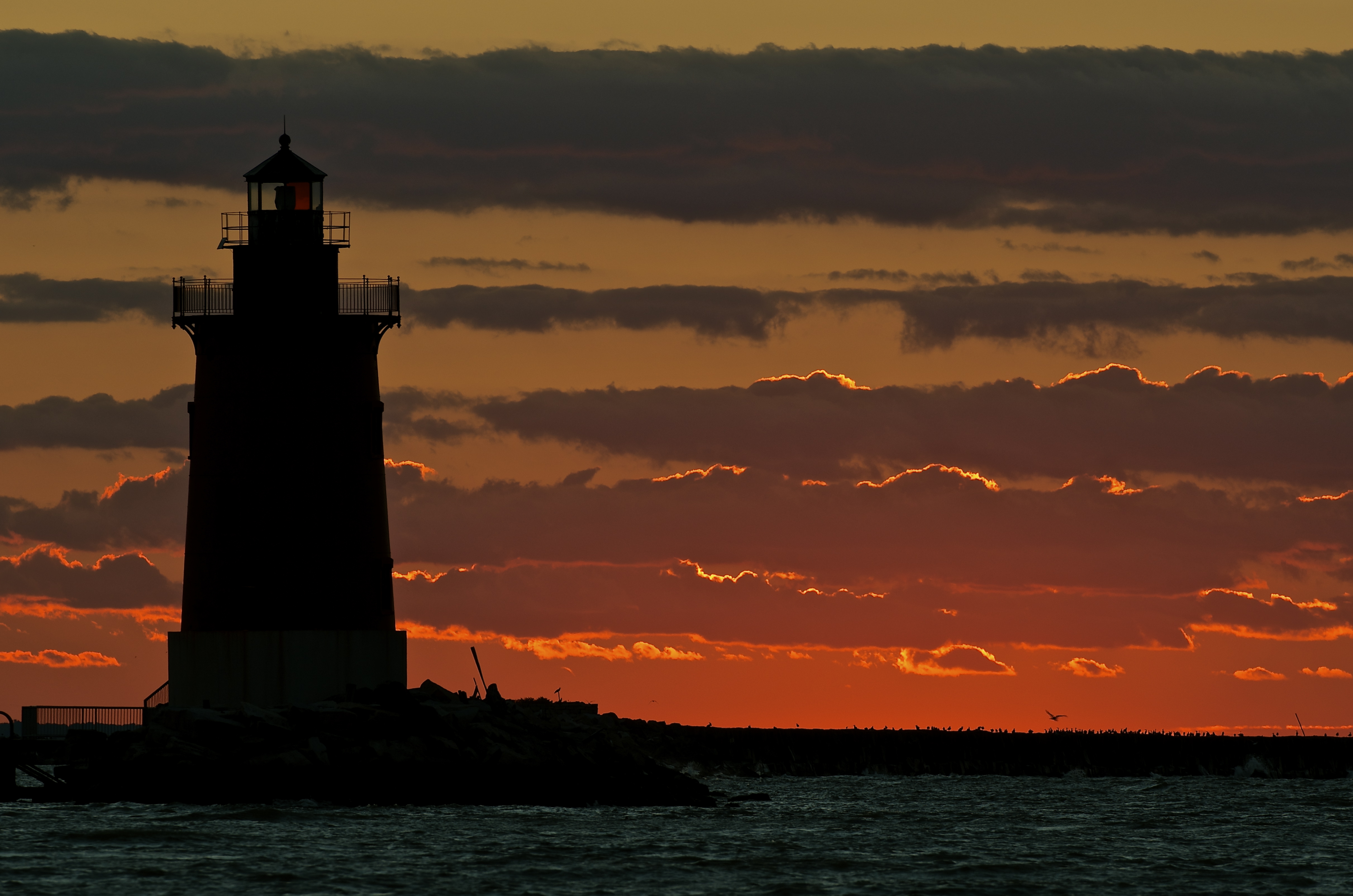
The Delaware Breakwater East End Light is a lighthouse located on the inner Delaware Breakwater in the Delaware Bay, just off the coast of Cape Henlopen and the town of Lewes, Delaware. Construction and early use In 1884 a light was commissioned for the east end of the Delaware Breakwater. The light was built to replace the Cape Henlopen Beacon, which was rapidly deteriorating at the time and was taken out of service later that same year. Construction began in 1885 and a temporary light on a wooden frame was placed near the building site during the process. The foundation of the tower was embedded into the breakwater. The iron structure, which was listed at tall as of 1914, was completed on October 2, 1885. The tower was fitted with a fourth-order Fresnel lens—which is still in the lighthouse to this day—and also included one red sector in order to warn vessels approaching the nearby Hen and Chickens Shoal. A fog signal was installed about a month later. During the follow ... [...More Info...] [...Related Items...] OR: [Wikipedia] [Google] [Baidu] |
SS Princess Anne
SS ''Princess Anne'' was a Virginia Ferry Company (VFC) steamship that plied the route across Chesapeake Bay between Little Creek, near Norfolk, and Kiptopeke Beach, at the southern end of the Eastern Shore of Virginia. She was known for her streamlined superstructure, designed by Raymond Loewy, which attracted the attention of the newsreels and the nautical press. ''Princess Anne'' continued in service on Chesapeake Bay until 1964, when the opening of the Chesapeake Bay Bridge–Tunnel made the ferry service redundant. Sold to the Delaware River and Bay Authority, she was renamed ''New Jersey'' and placed on a route between Cape May, New Jersey, and Lewes, Delaware. In 1979, she was sold again, renamed ''Greenport'', and subsequently operated between New York and Rhode Island. After a failed attempt to convert her into a casino ship, she was sunk in 1993 as an artificial reef and scuba diving site off the coast of West Palm Beach, Florida. Design and construction ''Princess A ... [...More Info...] [...Related Items...] OR: [Wikipedia] [Google] [Baidu] |
SS Pocahontas
A number of steamships have been named ''Pocahontas'', including: * , an ocean liner in service 1920–22 * , served under Virginia Ferry Corporation's Cape Charles—Little Creek ferry service; sold 1963 and renamed operating as Cape May–Lewes Ferry The Cape May–Lewes Ferry is a ferry system on the East Coast of the United States that traverses a crossing of the Delaware Bay connecting North Cape May, New Jersey with Lewes, Delaware. The ferry constitutes a portion of U.S. Route 9 and ... 1964 to 1974 * , a Liberty ship in service 1942–60 {{DEFAULTSORT:Pocahontas Ship names ... [...More Info...] [...Related Items...] OR: [Wikipedia] [Google] [Baidu] |
Chesapeake Bay Bridge–Tunnel
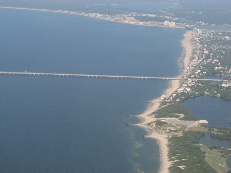
The Chesapeake Bay Bridge–Tunnel (CBBT, officially the Lucius J. Kellam Jr. Bridge–Tunnel) is a bridge–tunnel that crosses the mouth of the Chesapeake Bay between Delmarva and Hampton Roads in the U.S. commonwealth of Virginia. It opened in 1964, replacing ferries that had operated since the 1930s. A major project to dualize its bridges was completed in 1999, and in 2017 a similar project was started to dualize one of its tunnels. With of bridges and two tunnels, the CBBT is one of only 14 bridge–tunnel systems in the world and one of three in Hampton Roads. It carries US 13, which saves motorists roughly and hours on trips between Hampton Roads and the Delaware Valley and points north compared with other routes through the Washington–Baltimore Metropolitan Area. , over 140 million vehicles have crossed the CBBT. The CBBT was built and is operated by the Chesapeake Bay Bridge and Tunnel District, a political subdivision of the Commonwealth of Virginia gov ... [...More Info...] [...Related Items...] OR: [Wikipedia] [Google] [Baidu] |
Little Creek-Cape Charles Ferry
The Little Creek-Cape Charles Ferry was a passenger ferry service operating across the mouth of the Chesapeake Bay from the 1930s until 1964. Known also as the ''Princess Anne-Kiptopeke Beach Ferry'' or ''Little Creek-Kiptopeke Beach Ferry'', the service connected Virginia Beach, Virginia (then Princess Anne County) with Cape Charles on the Eastern Shore of Virginia. Departures from and arrivals to Cape Charles were matched with times of Pennsylvania Railroad passenger trains such as the ''Del-Mar-Va Express'' and the ''Cavalier'' that operated the length of the Delmarva Peninsula. Beginning in the 1940s the ferry began accommodating vehicles as well as passengers, with the service then linking the Ocean Highway, a major coastal route. The service was acquired by an agency of the Commonwealth of Virginia in 1954, ceased operations in April 1964, and was replaced by the Chesapeake Bay Bridge-Tunnel. During its peak, the Little Creek Ferry operated 90 one-way trips each day wi ... [...More Info...] [...Related Items...] OR: [Wikipedia] [Google] [Baidu] |
Motor Vessel
A motor ship or motor vessel is a ship Marine propulsion, propelled by an internal combustion engine, usually a diesel engine. The names of motor ships are often Ship prefix, prefixed with MS, M/S, MV or M/V. Engines for motorships were developed during the 1890s, and by the early 20th century, motorships began to cross the waters. History The first diesel-powered motorships were launched in 1903: the Russian (the first equipped with diesel-electric transmission) and French ''Petite-Pierre''. There is disagreement over which of the two was the first. See also * Gas turbine#Marine applications, Gas turbine ship (GTS) – prefix for a jet-engine/turbine-propelled ship * Steamship (SS) – a steamship is a ship propelled by a steam engine or steam turbine. The name of steam ships are often prefixed with SS or S/S * Royal Mail Ship (RMS) – Royal Mail Ship * Ship prefix References External links Ship types {{ship-type-stub ... [...More Info...] [...Related Items...] OR: [Wikipedia] [Google] [Baidu] |
Barge
A barge is typically a flat-bottomed boat, flat-bottomed vessel which does not have its own means of mechanical propulsion. Original use was on inland waterways, while modern use is on both inland and ocean, marine water environments. The first modern barges were pulled by tugs, but on inland waterways, most are pushed by Pusher (boat), pusher boats, or other vessels. The term ''barge'' has a rich history, and therefore there are many types of barges. History of the barge Etymology ''Barge'' is attested from 1300, from Old French ''barge'', from Vulgar Latin ''barga''. The word originally could refer to any small boat; the modern meaning arose around 1480. ''Bark'' "small ship" is attested from 1420, from Old French ''barque'', from Vulgar Latin ''barca'' (400 AD). A more precise meaning (see Barque) arose in the 17th century and often takes the French spelling for disambiguation. Both are probably derived from the Latin ''barica'', from Greek language, Greek ''baris'' "Eg ... [...More Info...] [...Related Items...] OR: [Wikipedia] [Google] [Baidu] |
Delaware State Route 1
Delaware Route 1 (DE 1) is the longest numbered state highway in the U.S. state of Delaware. The route runs from the Maryland state line in Fenwick Island, Sussex County, where the road continues south into that state as Maryland Route 528 (MD 528), north to an interchange with Interstate 95 (I-95) in Christiana, New Castle County, where the roadway continues north as part of DE 7. Between Fenwick Island and Dover Air Force Base in Dover, Kent County, DE 1 is a multilane divided highway with at-grade intersections and occasional interchanges. The route heads north through the Delaware Beaches resort area along the Atlantic Ocean before it runs northwest through rural areas, turning north at Milford to continue to Dover. Upon reaching Dover, DE 1 becomes the Korean War Veterans Memorial Highway, a freeway that is partially tolled. Between Dover and Tybouts Corner, DE 1 parallels U.S. Route 13 (US 13), crossing o ... [...More Info...] [...Related Items...] OR: [Wikipedia] [Google] [Baidu] |
New Jersey Turnpike
The New Jersey Turnpike (NJTP) is a system of controlled-access highway, controlled-access toll roads in the U.S. state of New Jersey. The turnpike is maintained by the New Jersey Turnpike Authority (NJTA).The Garden State Parkway, although maintained by the New Jersey Turnpike Authority, is not considered part of the turnpike. The mainline's southern terminus is at the Delaware Memorial Bridge on Interstate 295 (Delaware–Pennsylvania), Interstate 295 (I-295) in Pennsville Township, New Jersey, Pennsville Township. Its northern terminus is at an interchange with U.S. Route 46 (US 46) in Ridgefield Park, New Jersey, Ridgefield Park. Construction of the mainline, from concept to completion, took a total of 22 months between 1950 and 1951. It was opened to traffic on November 5, 1951, between its southern terminus and exit 10. The turnpike is a major thoroughfare providing access to various localities in New Jersey, and the toll road provides a direct bypass ... [...More Info...] [...Related Items...] OR: [Wikipedia] [Google] [Baidu] |


