|
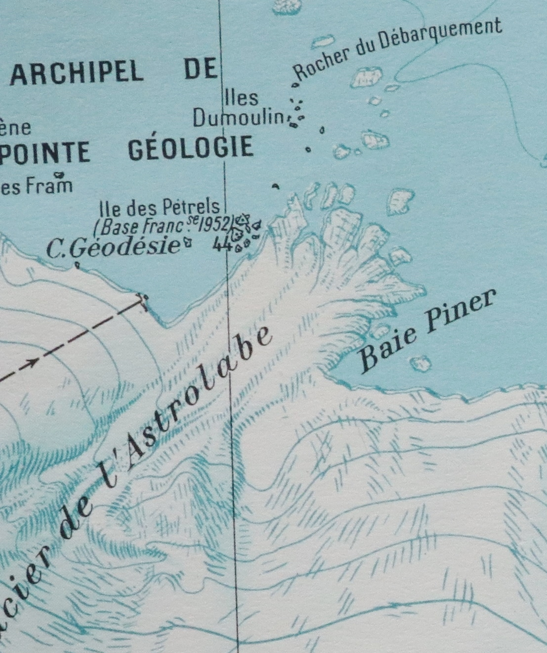
Cape Géodésie
Cape Géodésie () is a low, ice-covered point marked by prominent rock outcrops at its northeast end, lying northwest of the mouth of Astrolabe Glacier, Antarctica. It was photographed from the air by U.S. Navy Operation Highjump, 1946–47. It was charted by the French Antarctic Expedition, 1951–52, and so named by them because of the extensive geodetic program undertaken in this region, particularly in the Géologie Archipelago The Géologie Archipelago, also known as the Pointe Géologie Archipelago, Geology Archipelago or Cape Geology Archipelago, is a small archipelago of rocky islands and rocks close to the north of Cape Géodésie and Astrolabe Glacier Tongue, ext ... close offshore. References Headlands of Adélie Land {{AdélieLand-geo-stub ... [...More Info...] [...Related Items...] OR: [Wikipedia] [Google] [Baidu] |
Outcrops
An outcrop or rocky outcrop is a visible exposure of bedrock or ancient superficial deposits on the surface of the Earth and other terrestrial planets. Features Outcrops do not cover the majority of the Earth's land surface because in most places the bedrock or superficial deposits are covered by soil and vegetation and cannot be seen or examined closely. However, in places where the overlying cover is removed through erosion or tectonic uplift, the rock may be exposed, or ''crop out''. Such exposure will happen most frequently in areas where erosion is rapid and exceeds the weathering rate such as on steep hillsides, mountain ridges and tops, river banks, and tectonically active areas. In Finland, glacial erosion during the last glacial maximum (ca. 11000 BC), followed by scouring by sea waves, followed by isostatic uplift has produced many smooth coastal and littoral outcrops. Bedrock and superficial deposits may also be exposed at the Earth's surface due to human excav ... [...More Info...] [...Related Items...] OR: [Wikipedia] [Google] [Baidu] |
Astrolabe Glacier
Astrolabe Glacier is a glacier wide and long, flowing north-northeast from the continental ice and terminating at the coast in a prominent tongue at the east side of Géologie Archipelago. History It was first sighted in 1840 by the French expedition under Captain Jules Dumont d'Urville, although no glaciers were noted on d'Urville's chart of this coast but a formidable icy dike with perpendicular flanks of 37.7 m high according to the joined plate, corresponding to the glacier tongue. The glacier was photographed from the air by U.S. Navy Operation Highjump in January 1947. It was charted by the French Antarctic Expedition, 1949–51, and named after d'Urville's flagship, the ''Astrolabe''. Glacier Tounge The Astrolabe Glacier Tongue () is a prominent glacier tongue about wide and long, extending northeast from Astrolabe Glacier. Located in the Terre Adélie-George V Land section of East Antarctica, Astrolabe Glacier streams out from the interior of Antarctica to dum ... [...More Info...] [...Related Items...] OR: [Wikipedia] [Google] [Baidu] |
Operation Highjump
Operation HIGHJUMP, officially titled The United States Navy Antarctic Developments Program, 1946–1947, (also called Task Force 68), was a United States Navy (USN) operation to establish the Antarctic research base Little America (exploration base), Little America IV. The operation was organized by Rear admiral (United States)#Rear admiral, Rear Admiral Richard E. Byrd, Jr., USN, Officer in Charge, Task Force 68, and led by Rear Admiral Ethan Erik Larson, USN, Commanding Officer, Task Force 68. Operation HIGHJUMP commenced 26 August 1946 and ended in late February 1947. Task Force 68 included 4,700 men, 70 ships, and 33 aircraft. HIGHJUMP's objectives, according to the U.S. Navy report of the operation, were: # Training personnel and testing equipment in frigid conditions; # Consolidating and extending the United States' sovereignty over the largest practicable area of the Antarctic continent (publicly denied as a goal before the expedition ended); # Determining the feasibility ... [...More Info...] [...Related Items...] OR: [Wikipedia] [Google] [Baidu] |
Géologie Archipelago
The Géologie Archipelago, also known as the Pointe Géologie Archipelago, Geology Archipelago or Cape Geology Archipelago, is a small archipelago of rocky islands and rocks close to the north of Cape Géodésie and Astrolabe Glacier Tongue, extending from Helene Island on the west to the Dumoulin Islands on the east, in Adélie Land, Antarctica. History The French expedition under Captain Jules Dumont d'Urville landed on Débarquement Rock in the Dumoulin Islands on 22 January 1840. Because rock samples were obtained, they gave the name "Pointe Géologie" to a coastal feature charted as lying south of Débarquement Rock. The archipelago was delineated, in part, from aerial photographs taken by the U.S. Navy's Operation Highjump in 1946–47. Following surveys by French Antarctic Expedition parties during the 1950–52 period, the French gave the name "Archipel de Pointe Géologie" to the entire archipelago, as d'Urville's coastal feature is believed to correlate with portions of ... [...More Info...] [...Related Items...] OR: [Wikipedia] [Google] [Baidu] |

