|
Cachet, Markham
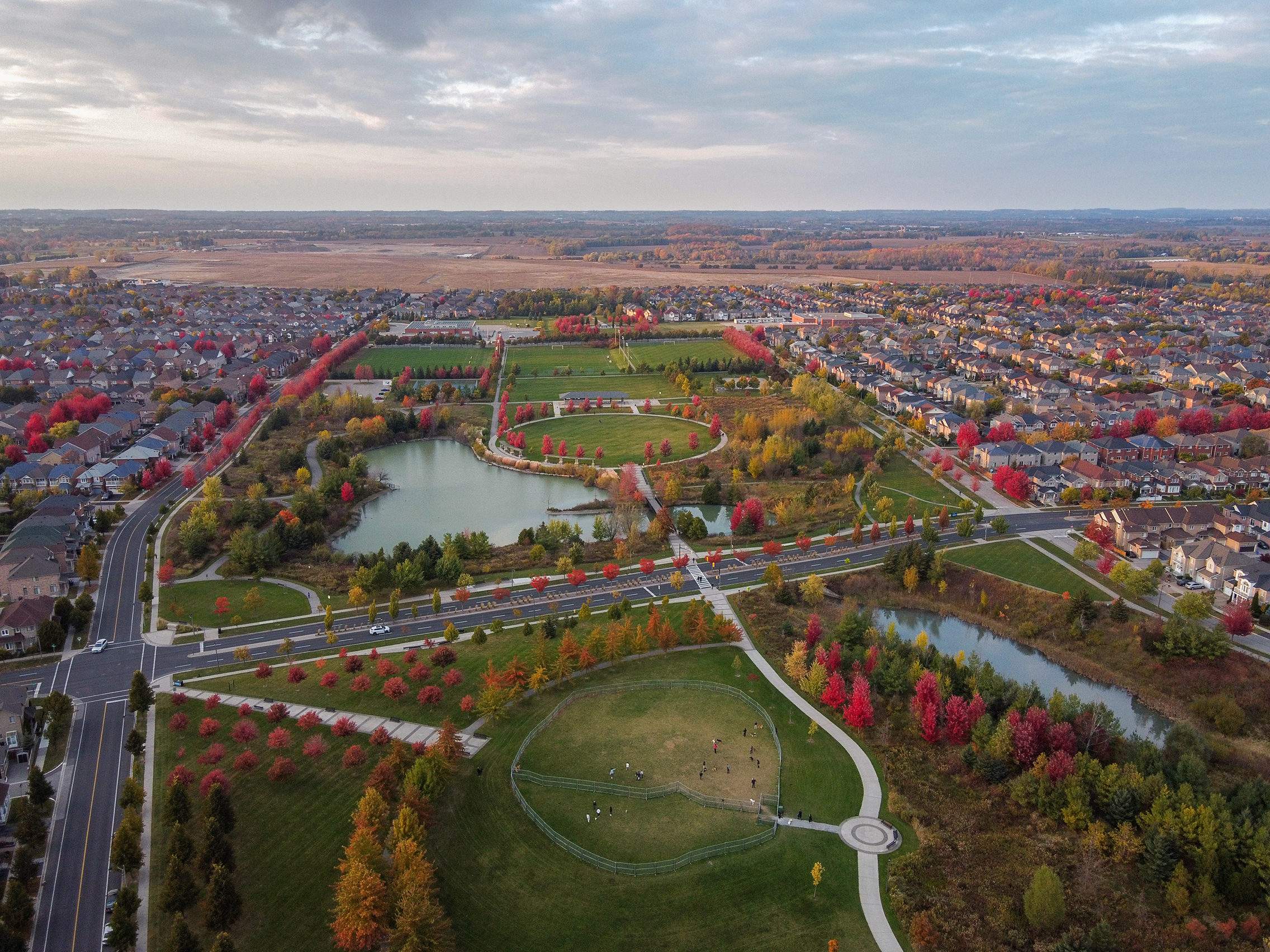
Cachet (''Pronunciation: cash-AY'') is a neighbourhood within northwestern Markham, Ontario, Canada. It is bounded by 16th Avenue to the south, Major Mackenzie Drive East to the north, Warden Avenue to the east and Highway 404 to the west. The area is a residential development that has replaced farmland that once defined the area. The residents of Cachet consist mostly of middle to upper-income families and the housing consists of large single family homes. The Cachet Centre is a small strip mall that services mainly to local residents. There is also an Asian shopping centre at the intersection of Woodbine Avenue and Markland Street, called King Square. The population of the community is predominantly Chinese and small minority of European heritage. The Rouge River and Berczy Creek flows through the community. This neighbourhood is also home to Ashton Meadows Public School, St. Monica Catholic Elementary School, and St. Augustine Catholic High School. The Ashton Meadows co ... [...More Info...] [...Related Items...] OR: [Wikipedia] [Google] [Baidu] |
Canada
Canada is a country in North America. Its Provinces and territories of Canada, ten provinces and three territories extend from the Atlantic Ocean to the Pacific Ocean and northward into the Arctic Ocean, making it the world's List of countries and dependencies by area, second-largest country by total area, with the List of countries by length of coastline, world's longest coastline. Its Canada–United States border, border with the United States is the world's longest international land border. The country is characterized by a wide range of both Temperature in Canada, meteorologic and Geography of Canada, geological regions. With Population of Canada, a population of over 41million people, it has widely varying population densities, with the majority residing in List of the largest population centres in Canada, urban areas and large areas of the country being sparsely populated. Canada's capital is Ottawa and List of census metropolitan areas and agglomerations in Canada, ... [...More Info...] [...Related Items...] OR: [Wikipedia] [Google] [Baidu] |
Chinese Canadians
Chinese Canadians are Canadians of full or partial Chinese people, Chinese ancestry, which includes both naturalized Chinese immigrants and Canadian-born Chinese. They comprise a subgroup of East Asian Canadians which is a further subgroup of Asian Canadians. Demographic research tends to include immigrants from Mainland China, Taiwan, Hong Kong, and Macau, as well as overseas Chinese who have immigrated from Southeast Asia and South America into the broadly defined Chinese Canadian category. Canadians who identify themselves as being of Chinese ethnic origin make up about 5.1% of the Canadian population, or about 1.77 million people according to the 2016 census. While other Asian groups are growing rapidly in the country, the Chinese Canadian community fell slightly to 1.71 million, or 4.63% of the Canadian population, in the 2021 Canadian census. The Chinese Canadian community is the second largest ethnic group of Asian Canadians after Indians, constituting approximately 30 ... [...More Info...] [...Related Items...] OR: [Wikipedia] [Google] [Baidu] |
Angus Glen, Ontario
Angus Glen (Canada 2006 Census, 2006 Population 2,596) is a suburban neighbourhood in the city of Markham, Ontario, Markham. It is roughly bounded by Warden Avenue on the west, Kennedy Road on the east, Sixteenth Avenue on the south, and Major Mackenzie Drive on the north. Developed in the late 1990s, the original Angus Glen East Village, comprising approximately 500 single family homes and townhouses, was planned with the "New Urbanism" concept, to allow for the homes to be designed with the appearance of historic houses, with separate garages on rear laneways. In the mid-2000s the land west of the small creek on the west border of the East Village section commenced development, and is still under construction, known as the West Village. Throughout this period the East Village had a tract of land which had originally been sold to the school board for a possible school. However, the demographic studies could not support a school and after many years of negotiations the developer r ... [...More Info...] [...Related Items...] OR: [Wikipedia] [Google] [Baidu] |
Richmond Hill, Ontario
Richmond Hill ( 2021 population: 202,022) is a city in south-central York Region, Ontario, Canada. Part of the Greater Toronto Area, it is the York Region's third most populous municipality and the 27th most populous municipality in Canada. Richmond Hill is situated between the cities of Markham and Vaughan, north of Thornhill, and south of Aurora. Richmond Hill has seen significant population growth since the 1990s. It became a city in 2019 after being a town since 1957. The city is home to the David Dunlap Observatory telescope, the largest telescope in Canada. History The village of Richmond Hill was incorporated by a bylaw of the York County Council on June 18, 1872, coming into effect January 1, 1873.; see also Archaeological Services, Inc.,Town of Richmond Hill Official Plan: Archaeological and First Nations Policy Study," October 2009;The Stage 4 Salvage Excavation of the Orion Site," Dec. 2008. In September 1956, the Ontario Municipal Board approved its elevatio ... [...More Info...] [...Related Items...] OR: [Wikipedia] [Google] [Baidu] |
Cathedraltown, Ontario
Cathedraltown is a planned neighbourhood with an estimated population of 3,000 in the City of Markham, just north of Toronto. Cathedraltown was named after the Cathedral of the Transfiguration, around which the neighbourhood was built. Geography Cathedraltown is bordered on the north to Major Mackenzie Drive, on the south to Elgin Mills Road, on the west to Victoria Square Boulevard, and on the east to Highway 404. History The land occupied by Cathedraltown was originally farmland owned by Romandale Farms, a breeder and exhibitor of Holstein cows. Stephen B. Roman, the late founder of Romandale Farms, built the Cathedral on land he donated. In the early 2000s, his daughter, Helen Roman-Barber, working with Donald Buttress, Surveyor of the Fabric Emeritus of Westminster Abbey, developed the design concept for Cathedraltown, based on European cathedral towns. The neighbourhood's first residents moved in by 2006 with the completion of homes north of the Cathedral. Since then, sin ... [...More Info...] [...Related Items...] OR: [Wikipedia] [Google] [Baidu] |
Buttonville Airport
Buttonville Municipal Airport or Toronto/Buttonville Municipal Airport was a medium-sized airport in the neighbourhood of Buttonville in Markham, Ontario, Canada, north of Downtown Toronto, which closed in November 2023. It was operated by Torontair. Due to its location within Toronto's suburbs, there were several strict noise-reduction procedures for aircraft using the airport, which was open and staffed 24 hours a day, 365 days a year. In 2014, Buttonville was Canada's 20th busiest airport by aircraft movements. There was also a weather station located at the airport, which was still operational on the site but closed along with the airport (weather data for Markham is now referencing to Toronto City Centre Airport by Environment Canada). The airport was classified as an airport of entry by Nav Canada and was serviced by the Canada Border Services Agency (CBSA) on a call-out basis from Oshawa Executive Airport during weekdays and Billy Bishop Toronto City Airport on the T ... [...More Info...] [...Related Items...] OR: [Wikipedia] [Google] [Baidu] |
Ontario Highway 404
King's Highway 404 (pronounced "four-oh-four"), also known as Highway 404 and colloquially as the 404, is a north-south 400-series highways, 400-series highway in the Provinces and territories of Canada, Canadian province of Ontario. A continuation of the municipal Don Valley Parkway (DVP) north of Ontario Highway 401, Highway 401, it connects Toronto with East Gwillimbury. The controlled-access highway, controlled-access freeway also connects with Ontario Highway 407, Highway 407 in Markham, Ontario, Markham and the Don Valley Parkway in North York and Toronto, which formed the northeastern ring road of the Greater Toronto Area until the opening of Ontario Highway 412, Highway 412 in 2016. Highway 404 provides access to the eastern edge of Richmond Hill, Ontario, Richmond Hill, Aurora, Ontario, Aurora and Newmarket, Ontario, Newmarket and the western edge of Whitchurch-Stouffville, Ontario, Whitchurch-Stouffville, in addition to the southern edge of Keswick, ... [...More Info...] [...Related Items...] OR: [Wikipedia] [Google] [Baidu] |
York Regional Road 3
York is a cathedral city in North Yorkshire, England, with Roman Britain, Roman origins, sited at the confluence of the rivers River Ouse, Yorkshire, Ouse and River Foss, Foss. It has many historic buildings and other structures, such as a York Minster, minster, York Castle, castle and York city walls, city walls, all of which are Listed building, Grade I listed. It is the largest settlement and the administrative centre of the wider City of York district. It is located north-east of Leeds, south of Newcastle upon Tyne and north of London. York's built-up area had a recorded population of 141,685 at the 2021 United Kingdom census, 2021 census. The city was founded under the name of Eboracum in AD 71. It then became the capital of Britannia Inferior, a province of the Roman Empire, and was later the capital of the kingdoms of Deira, Northumbria and Jórvík, Scandinavian York. In the England in the Middle Ages, Middle Ages it became the Province of York, northern England ... [...More Info...] [...Related Items...] OR: [Wikipedia] [Google] [Baidu] |
Berczy Village, Ontario
Berczy Village is a residential neighbourhood in Markham, Ontario, Markham, Ontario, Canada. It is bounded to the north by York Regional Road 25, Major Mackenzie Drive, to the east by York Regional Road 67, McCowan Road, to the south by York Regional Road 73, 16th Avenue, and to the west by York Regional Road 3, Kennedy Road. This area is north of Unionville, Ontario, Unionville. The community is named after William Berczy, Markham's founder. The name is shown on limestone plaques throughout the community's arterial road entrances. The community is known for its variety of mixed-income dwellings and the green space found in most subdivisions. Townhouses and some semi-detached homes can be found along Bur Oak Avenue, whereas semi-detached and detached homes are found on residential streets. It is also noted for the many garage alleyways behind the townhomes and some semi-detached homes and the plentiful spacious Shortcut (road), catwalks. Berczy Village adheres to the city of M ... [...More Info...] [...Related Items...] OR: [Wikipedia] [Google] [Baidu] |


