|
Bridges In Seattle
The city of Seattle, Washington, United States, has multiple bridges that are significant due to their function, historical status, or engineering. Bridges are needed to cross the city's waterways and hilly topography. Twelve bridges have been granted historical status by the city, federal government, or both. Seattle also has some of the only permanent floating pontoon bridges in the world. Original crossings over Seattle's mudflats were typically supported by timber piles. Lake Washington and Puget Sound are to the east and west of the city, respectively. They connect via a series of canals and Lake Union that are collectively known as the Lake Washington Ship Canal. The four double-leaf bascule bridges crossing the Ship Canal are the oldest still used in the city, having opened between 1917 and 1930. The easternmost—the Montlake and University bridges—connect neighborhoods south of the canal to the University District. The Fremont Bridge crosses the center of the ... [...More Info...] [...Related Items...] OR: [Wikipedia] [Google] [Baidu] |
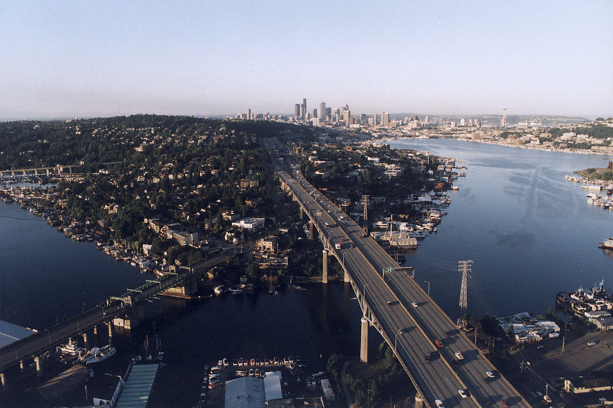
Ship Canal Bridge And Downtown Skyline, 2000
A ship is a large watercraft that travels the world's oceans and other sufficiently deep waterways, carrying cargo or passengers, or in support of specialized missions, such as defense, research, and fishing. Ships are generally distinguished from boats, based on size, shape, load capacity, and purpose. Ships have supported exploration, trade, warfare, migration, colonization, and science. After the 15th century, new crops that had come from and to the Americas via the European seafarers significantly contributed to world population growth. Ship transport is responsible for the largest portion of world commerce. The word ''ship'' has meant, depending on the era and the context, either just a large vessel or specifically a ship-rigged sailing ship with three or more masts, each of which is square-rigged. As of 2016, there were more than 49,000 merchant ships, totaling almost 1.8 billion dead weight tons. Of these 28% were oil tankers, 43% were bulk carriers, and 13% were con ... [...More Info...] [...Related Items...] OR: [Wikipedia] [Google] [Baidu] |
Washington State Route 520
State Route 520 (SR 520) is a state highway and freeway in the Seattle metropolitan area, part of the U.S. state of Washington. It runs from Seattle in the west to Redmond in the east. The freeway connects Seattle to the Eastside region of King County via the Evergreen Point Floating Bridge on Lake Washington. SR 520 intersects several state highways, including Interstate 5 (I-5) in Seattle, I-405 in Bellevue, and SR 202 in Redmond. The original floating bridge was opened in 1963 as a replacement for the cross-lake ferry system that had operated since the late 19th century. In 1964, SR 520 was designated as a freeway connecting I-5 to I-405. An extension to Redmond was proposed later in the decade. In the 1970s and 1980s, sections of the freeway between Bellevue and Redmond were opened to traffic, replacing the temporary designation of SR 920. Since the 1990s, SR 520 has been expanded with high-occupancy vehicle lanes (HOV lanes) and new ... [...More Info...] [...Related Items...] OR: [Wikipedia] [Google] [Baidu] |
Swing Bridge
A swing bridge (or swing span bridge) is a movable bridge that has as its primary structural support a vertical locating pin and support ring, usually at or near to its center of gravity, about which the swing span (turning span) can then pivot horizontally as shown in the animated illustration to the right. Small swing bridges as found over canals may be pivoted only at one end, opening as would a gate, but require substantial underground structure to support the pivot. In its closed position, a swing bridge carrying a road or railway over a river or canal, for example, allows traffic to cross. When a water vessel needs to pass the bridge, road traffic is stopped (usually by traffic signals and barriers), and then motors rotate the bridge horizontally about its pivot point. The typical swing bridge will rotate approximately 90 degrees, or one-quarter turn; however, a bridge which intersects the navigation channel at an oblique angle may be built to rotate only 45 degrees, or ... [...More Info...] [...Related Items...] OR: [Wikipedia] [Google] [Baidu] |
Spokane Street Bridge
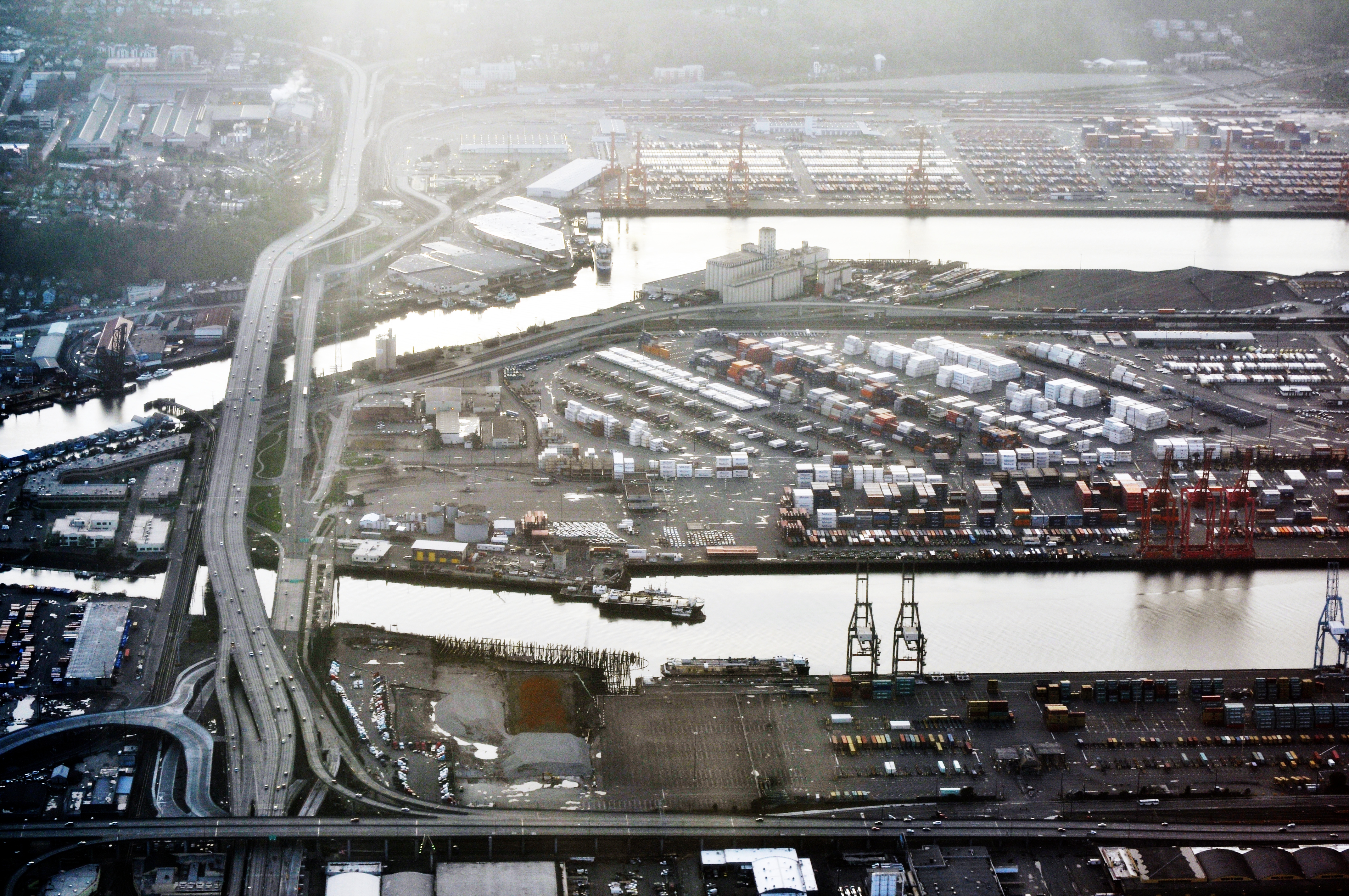
The Spokane Street Bridge, also known as the West Seattle Low-Level Bridge, is a concrete double-leaf swing bridge in Seattle, Washington. It carries Southwest Spokane Street over the Duwamish River, connecting Harbor Island to West Seattle. It has two separate end-to-end swing-span sections, each long. Its construction was finished in 1991, replacing an earlier bridge destroyed by a collision. It is named after Spokane Street, which itself is named after Spokane, Washington, which is named after the Spokane people. Each leaf of the bridge floats on a steel barrel in hydraulic oil, situated in center piers at each side of the river. As the bridge intersects the river at an oblique angle, both leaves rotate only 45 degrees (one-eighth turn) to clear the shipping channel instead of the 90-degree turn of most swing spans. It is claimed to be the only bridge of its type in the world and it has received several awards for its innovation, including the Outstanding Engineeri ... [...More Info...] [...Related Items...] OR: [Wikipedia] [Google] [Baidu] |
West Seattle Bridge
The West Seattle Bridge, officially the Jeanette Williams Memorial Bridge, is a cantilevered segmental bridge that serves as the primary connection between West Seattle and important highways such as State Route 99 (and the tunnel through downtown), the Spokane Street Viaduct, and Interstate 5. It was built between 1981 and 1984 after the previous bascule bridge was deemed inoperable as a result of being struck by the freighter ''Antonio Chavez'' in 1978. The high-level bridge was closed in March 2020 after cracks in the underside were found to be growing rapidly, necessitating a major repair amid the COVID-19 pandemic. The Seattle Department of Transportation conducted repairs over a two-year period and reopened the bridge on September 17, 2022. Construction The bridge spans the east and west channels that form the mouth of the Duwamish River at Elliott Bay, crossing over Harbor Island. Its main approaches are Fauntleroy Way S.W. from the west and the Spokane Street Viadu ... [...More Info...] [...Related Items...] OR: [Wikipedia] [Google] [Baidu] |
Duwamish River
The Duwamish River is the name of the lower of Washington (state), Washington state's Green River. Its industrialized estuary is known as the Duwamish Waterway. In 2009, the Duwamish Longhouse and Cultural Center was opened on the west bank of the river as part of the tribe's reassertion of its historic ... [...More Info...] [...Related Items...] OR: [Wikipedia] [Google] [Baidu] |
West Seattle
West Seattle is a conglomeration of neighborhoods in Seattle, Washington, United States. It comprises two of the thirteen districts, Delridge and Southwest, and encompasses all of Seattle west of the Duwamish River. It was incorporated as an independent town in 1902 before being annexed by Seattle five years later. Among the area's attractions are its saltwater beach parks along Elliott Bay and Puget Sound, including Alki Beach Park and Lincoln Park. The area is also known for its views of the Olympic Mountains to the west and the Cascade Range to the east. One-third of Seattle's green space and urban forest is located in West Seattle, much of it in the West Duwamish Greenbelt. Neighborhoods High Point High Point is a neighborhood in the Delridge district. It is so named because it contains the highest point in the city of Seattle: the intersection of 35th Avenue SW and SW Myrtle Street, which is above sea level. The neighborhood is located on the east side of 35th Ave S ... [...More Info...] [...Related Items...] OR: [Wikipedia] [Google] [Baidu] |
Magnolia Bridge
The Magnolia Bridge, built in 1930, connects the Seattle neighborhoods of Magnolia and Interbay over the filled-in tidelands of Smith Cove. It is one of only three road connections from Magnolia to the rest of Seattle. It carries W. Garfield Street from Magnolia Way W. in the west to the intersection of Elliott and 15th Avenues W. in the east. Having been damaged in the 2001 Nisqually earthquake, it is currently scheduled for replacement. In 1910, when a bridge was first proposed for this location, Queen Anne Hill and Magnolia were already connected by several trestles across Interbay, each spanning the railway that ran north–south through Interbay. By 1912 a wooden trestle had been built. The wooden trestle was replaced by a concrete structure in 1930 and improved in 1957 to provide a grade separation from Elliott Avenue West. In 1960 the bridge was renamed from the "Garfield Street Bridge" to the "Magnolia Bridge" as a result of community efforts by Magnolia residents. The ... [...More Info...] [...Related Items...] OR: [Wikipedia] [Google] [Baidu] |
Alaskan Way Viaduct
The Alaskan Way Viaduct ("the viaduct" for short) was an elevated freeway in Seattle, Washington, United States, that carried a section of State Route 99 (SR 99). The double-decked freeway ran north–south along the city's waterfront for , east of Alaskan Way and Elliott Bay, and traveled between the West Seattle Freeway in SoDo and the Battery Street Tunnel in Belltown. The viaduct was built in three phases from 1949 through 1959, with the first section opening on April 4, 1953. It was the smaller of the two major north–south traffic corridors through Seattle (the other being Interstate 5), carrying up to 91,000 vehicles per day in 2016. The viaduct ran above Alaskan Way, a surface street, from S. Nevada Street in the south to the entrance of Belltown's Battery Street Tunnel in the north, following previously existing railroad lines. The viaduct had long been viewed as a barrier between downtown and the city's waterfront, with proposals to replace it as early as the ... [...More Info...] [...Related Items...] OR: [Wikipedia] [Google] [Baidu] |
List Of Earthquakes In The United States
The following is a list of notable earthquakes and tsunamis which had their epicenter in areas that are now part of the United States with the latter affecting areas of the United States. Those in ''italics'' were not part of the United States when the event occurred. List of earthquakes Earthquake swarms which affected the United States: * 1962–71 Denver earthquake swarm * Enola earthquake swarm * 2008 Reno earthquakes * Guy-Greenbrier earthquake swarm * Oklahoma earthquake swarms (2009–present) Earthquakes which affected the United States but whose epicenters were outside the United States borders: * 1925 Charlevoix–Kamouraska earthquake – magnitude 6.2 earthquake, no injuries or fatalities anywhere * 1979 Imperial Valley earthquake – magnitude 6.4 earthquake with an epicenter less than 1 km inside Mexico – significant damage and injuries on both sides of the border (60 in the US) * 2010 Baja California earthquake (Mexico near S California) – magnitude ... [...More Info...] [...Related Items...] OR: [Wikipedia] [Google] [Baidu] |
2001 Nisqually Earthquake
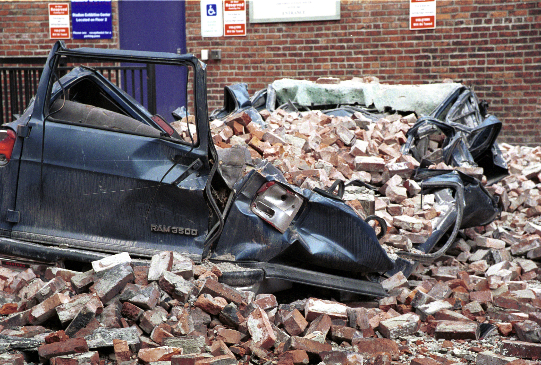
The 2001 Nisqually earthquake occurred at on February 28, 2001 and lasted nearly a minute. The intraslab earthquake had a moment magnitude of 6.8 and a maximum Mercalli intensity of VIII (''Severe''). The epicenter was in the southern Puget Sound, northeast of Olympia, but the shock was felt in Oregon, British Columbia, eastern Washington, and Idaho. This was the most recent of several large earthquakes that occurred in the Puget Sound region over a 52-year period and caused property damage valued at $1–4 billion. One person died of a heart attack and several hundred were injured. Tectonic setting The Puget Sound area is prone to deep earthquakes due to the Juan de Fuca tectonic plate's subduction under the North American Plate at 3.5 to 4.5 cm a year as part of the Cascadia subduction zone. Three types of earthquake are observed in the area: rare megathrust events, such as the 1700 Cascadia earthquake, shallow events within the North American Plate and deeper int ... [...More Info...] [...Related Items...] OR: [Wikipedia] [Google] [Baidu] |
Lacey V
Lacey may refer to: People Surname A–L * Andrew Lacey (1887–1946), Australian politician * Bill Lacey (American football) (born 1971), American football player and coach * Bill Lacey (footballer) (1889–1969), Irish footballer * Bob Lacey (born 1953), American baseball player * Bruce Lacey (1927–2016), British inventor * Catherine Lacey (1904–1979), English actress * Denzil Lacey (born 1990), Irish radio presenter * Deon Lacey (born 1990), American football player * Dermot Lacey (born 1960), Irish politician * Des Lacey (1925–1974), Irish footballer * Dinny Lacey (1890–1923), Irish Republican * Edmund Lacey (died 1455), English bishop * Edward S. Lacey (1835–1916), American politician * Francis Lacey (1859–1946), English cricketer * Frederick Bernard Lacey (1920–2017), American judge * Genevieve Lacey (born 1972), Australian recorder player * Ian Lacey (born 1984), Australian rugby league player * Ingrid Lacey (born 1958), British actress * Isaac L ... [...More Info...] [...Related Items...] OR: [Wikipedia] [Google] [Baidu] |


