|
Bidston
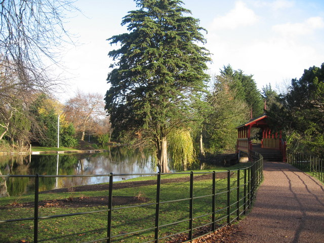
Bidston is a village, a parish and a suburb of Birkenhead, on the Wirral Peninsula, in the modern county of Merseyside. The area is a mixture of the well-preserved Bidston Village, Bidston Hill, a modern housing estate, and the Bidston Moss nature reserve, industrial estate and retail park. Administratively, it is also a ward of the Metropolitan Borough of Wirral. Before local government reorganisation on 1 April 1974, it was part of the County Borough of Birkenhead, within the geographical county of Cheshire. At the 2001 Census, the population of Bidston was 10,446, consisting of 4,725 males and 5,721 females. By the time of the 2011 Census the electoral ward was called Bidston and St. James (St James is part of Bidston and not a separate locality). This ward includes Beechwood to the south of Bidston and extends into much of Birkenhead to the east, including all of the south side of the Great Float. The total population of this ward at this Census was 15,216 of which 7,117 ... [...More Info...] [...Related Items...] OR: [Wikipedia] [Google] [Baidu] |
Bidston Hill
Bidston Hill is of heathland and woodland containing historic buildings and ancient rock carvings, on the Wirral Peninsula, near the Birkenhead suburb of Bidston, in Merseyside, England. With a peak of , Bidston Hill is one of the highest points on the Wirral. The land was part of Sir Robert Vyner's estate and purchased by Birkenhead Corporation in 1894 for use by the public. Etymology Bidston Hill bears the name of the village of Bidston, the name being recorded in 1260 as ''Bedistan''; origin possibilities include variations of the Old English name ' Beda' or 'Byddi' combined with ''ton'', or from 'bytle stan', meaning a dwelling on a rock, or possibly a reference to a 'bidding-stone' for a venerated Saxon. Geography Bidston Hill is in the north-east of the Wirral Peninsula and reaches at its highest point. Geology The exposed ridgeline along Bidston Hill is composed of brown, buff and grey Delamere Pebbly Sandstone of fluvial origin, part of the Helsby Sandston ... [...More Info...] [...Related Items...] OR: [Wikipedia] [Google] [Baidu] |
Birkenhead
Birkenhead (; cy, Penbedw) is a town in the Metropolitan Borough of Wirral, Merseyside, England; historically, it was part of Cheshire until 1974. The town is on the Wirral Peninsula, along the south bank of the River Mersey, opposite Liverpool. At the 2011 census, it had a population of 88,818. Birkenhead Priory and the Mersey Ferry were established in the 12th century. In the 19th century, Birkenhead expanded greatly as a consequence of the Industrial Revolution. Birkenhead Park and Hamilton Square were laid out as well as the first street tramway in Britain. The Mersey Railway connected Birkenhead and Liverpool with the world's first tunnel beneath a tidal estuary; the shipbuilding firm Cammell Laird and a seaport were established. In the second half of the 20th century, the town suffered a significant period of decline, with containerisation causing a reduction in port activity. The Wirral Waters development is planned to regenerate much of the dockland. Toponymy The ... [...More Info...] [...Related Items...] OR: [Wikipedia] [Google] [Baidu] |
Beechwood, Merseyside
Beechwood is a housing estate in the west of Birkenhead, on the Wirral Peninsula, in Merseyside, England. Administratively it is within the Metropolitan Borough of Wirral as part of Bidston and St James Ward. The area is bounded by Bidston to the north, Upton to the west and Noctorum to the south. The elevation of Bidston Hill is immediately to the east. The estate was built in the 1960s as the Ford Estate and completed in the mid to late 1970s, to house people moving from the North End of Birkenhead and providing a better standard of living. Most of Beechwood is former council property, bought from Wirral Borough Council by local tenants who formed a community housing association. Some of the council houses have been sold under the Right to Buy scheme. The estate is the most northerly of three housing estates within a mile of each other, the other two being at Woodchurch and Noctorum. The estate is now separated into three sections, these being Upper Bidston Village, Be ... [...More Info...] [...Related Items...] OR: [Wikipedia] [Google] [Baidu] |
St Oswald's Church, Bidston
St Oswald's Church is in Bidston, an area of Birkenhead, Wirral, Merseyside, England. It is recorded in the National Heritage List for England as a designated Grade II listed building. It is an active Anglican parish church in the diocese of Chester, the archdeaconry of Chester and the deanery of Birkenhead. History The original church dates back to the 13th century. The tower was built in 1520. The rest of the church was rebuilt in 1855–56 by W. and J. Hay in Gothic Revival style. An extension was made to the chancel in 1882 by G. E. Grayson. Architecture Exterior The church is built from coursed and squared rubble in large blocks with a roof of Westmorland slate with ridge cresting. Its plan consists of a west tower, a nave, north and south aisles with gable roofs, a south porch, and a chancel. Heraldic shields over the west door date it between 1504 and 1521. The tower is in three stages with angle buttresses and an embattled parap ... [...More Info...] [...Related Items...] OR: [Wikipedia] [Google] [Baidu] |
Wallasey Pool
Wallasey Pool was a natural tidal inlet of water that separated the towns of Wallasey and Birkenhead on the Wirral Peninsula, England. Originally flowing directly into the River Mersey, it was converted into the sophisticated Birkenhead Dock system from the 1820s onwards by land reclamation, with the main portion of the pool becoming known as the Great Float. In 1933, with the exception of a small lake, the head of Wallasey Pool at Poulton was converted into Bidston Dock. By 2003, this dock had been filled in. Redevelopment A new development was approved for Birkenhead docks in 2010. The Wirral Waters development will transform the docklands area into business, leisure and retail facilities. Bridges Four road bridges cross the former Wallasey Pool, over what is now Birkenhead Docks: Egerton Bridge is situated between Egerton Dock and Morpeth Dock and is a bascule bridge. It was built between 1928 and 1931, replacing an earlier hydraulic swing bridge. The bridge and the machi ... [...More Info...] [...Related Items...] OR: [Wikipedia] [Google] [Baidu] |
Wirral Peninsula
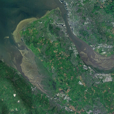
Wirral (; ), known locally as The Wirral, is a peninsula in North West England. The roughly rectangular peninsula is about long and wide and is bounded by the River Dee to the west (forming the boundary with Wales), the River Mersey to the east, and the Irish Sea to the north. Historically, the Wirral was wholly in Cheshire; in the Domesday Book, its border with the rest of the county was placed at "two arrow falls from Chester city walls". However, since the Local Government Act 1972, only the southern third has been in Cheshire, with almost all the rest lying in the Metropolitan Borough of Wirral, Merseyside. An area of saltmarsh to the south-west of the peninsula lies in the Welsh county of Flintshire. The most extensive urban development is on the eastern side of the peninsula. The Wirral contains both affluent and deprived areas, with affluent areas largely in the west, south and north of the peninsula, and deprived areas concentrated in the east, especial ... [...More Info...] [...Related Items...] OR: [Wikipedia] [Google] [Baidu] |
Great Float
The Great Float is a body of water on the Wirral Peninsula, England, formed from the natural tidal inlet, the Wallasey Pool. It is split into two large docks, East Float and West Float, both part of the Birkenhead Docks complex. The docks run approximately inland from the River Mersey, dividing the towns of Birkenhead and Wallasey. The Great Float consists of of water and more than of quays. History Unlike in Liverpool, where the docks were built along the coastline of the River Mersey, Birkenhead Docks were designed as an inland system by enclosing the tidal inlet of Wallasey Pool. The construction of a cofferdam enabled land reclamation and excavations to take place. After the establishment of the Great Low Water Basin, Morpeth Dock and Egerton Dock, the Great Float was formed between 1851 and 1860 from most of what remained of Wallasey Pool. The plans for its construction were originally shown in 1844 in the ''Liverpool Standard'' newspaper. Designed by James Meado ... [...More Info...] [...Related Items...] OR: [Wikipedia] [Google] [Baidu] |
Moreton, Merseyside
Moreton is a town on the north coast of the Wirral Peninsula, Merseyside, England. It is located approximately to the west of Wallasey. Historically part of Cheshire, it is now within the Metropolitan Borough of Wirral. The town was divided in 2004 between the local government wards of Leasowe & Moreton East and Moreton West & Saughall Massie. Moreton is also part of the parliamentary constituency of Wallasey. In the 2001 census it had a population of 17,670. History Prior to the Norman conquest, the Lingham area of Moreton was a possible location for Dingesmere, mentioned with regard to the Battle of Brunanburh, in Egil's Saga. At the time of the Domesday Book, the area was a township in the parish of Bidston, within the Wirral Hundred. In the twelfth century, it formed part of the estates of Hamo de Mascy. The name Moreton was first recorded in 1278, as Meretun, and derives from Anglo-Saxon words meaning a settlement (''tun'') beside a lake (''mere''). The village jo ... [...More Info...] [...Related Items...] OR: [Wikipedia] [Google] [Baidu] |
Claughton, Merseyside
Claughton ( ) is a village and suburb of Birkenhead, on the Wirral Peninsula, Merseyside, England. It is situated approximately to the west of Birkenhead town centre, adjacent to Birkenhead Park. Administratively, Claughton is a ward of the Metropolitan Borough of Wirral. Before local government reorganisation on 1 April 1974, it was part of the County Borough of Birkenhead, within the county of Cheshire. At the 2001 census, the population of Claughton was 13,723. For the 2011 census the total population of Claughton Ward, which also included Noctorum, was 14,705. History The name is of Viking origin, deriving from the Old Norse ''Klakkr-tun'', meaning "hamlet on a hillock". Claughton Manor House was built in about 1850 by local benefactor Sir William Jackson, with its gardens designed by Sir Joseph Paxton. It occupied a site between Egerton Road and Manor Hill until it was pulled down in the 1930s. Recalling his childhood in Claughton in the 1860s, the artist Harry ... [...More Info...] [...Related Items...] OR: [Wikipedia] [Google] [Baidu] |
Birkenhead (UK Parliament Constituency)
Birkenhead is a constituency represented in the House of Commons of the UK Parliament since 2019 by Mick Whitley of the Labour Party. Profile The constituency of Birkenhead covers the town of Birkenhead, on the Wirral Peninsula, and the Birkenhead suburbs of Bidston, Claughton, Oxton, Prenton, Rock Ferry and Tranmere. It forms the relatively densely populated mid-east of four parliamentary constituencies within the Metropolitan Borough of Wirral, itself a major contributor to (and the ex-Cheshire part of) the Metropolitan County of Merseyside envisaged in 1958 and created in 1974, considered as any other county (albeit with very limited powers and no elected councillors) for the enacted purposes of the Boundary Commission in its periodic reports. The urban parts of the town unite with Liverpool on the opposite side of the narrows of the estuary in having an early socially reformist movement in local measures, and its choice of many elected representatives since the 1850 ... [...More Info...] [...Related Items...] OR: [Wikipedia] [Google] [Baidu] |
Merseyside
Merseyside ( ) is a metropolitan and ceremonial county in North West England, with a population of 1.38 million. It encompasses both banks of the Mersey Estuary and comprises five metropolitan boroughs: Knowsley, St Helens, Sefton, Wirral and the city of Liverpool. Merseyside, which was created on 1 April 1974 as a result of the Local Government Act 1972, takes its name from the River Mersey and sits within the historic counties of Lancashire and Cheshire. Merseyside spans of land. It borders the ceremonial counties of Lancashire (to the north-east), Greater Manchester (to the east), Cheshire (to the south and south-east) and the Irish Sea to the west. North Wales is across the Dee Estuary. There is a mix of high density urban areas, suburbs, semi-rural and rural locations in Merseyside, but overwhelmingly the land use is urban. It has a focused central business district, formed by Liverpool City Centre, but Merseyside is also a polycentric county with five m ... [...More Info...] [...Related Items...] OR: [Wikipedia] [Google] [Baidu] |
Cheshire
Cheshire ( ) is a ceremonial and historic county in North West England, bordered by Wales to the west, Merseyside and Greater Manchester to the north, Derbyshire to the east, and Staffordshire and Shropshire to the south. Cheshire's county town is the cathedral city of Chester, while its largest town by population is Warrington. Other towns in the county include Alsager, Congleton, Crewe, Ellesmere Port, Frodsham, Knutsford, Macclesfield, Middlewich, Nantwich, Neston, Northwich, Poynton, Runcorn, Sandbach, Widnes, Wilmslow, and Winsford. Cheshire is split into the administrative districts of Cheshire West and Chester, Cheshire East, Halton, and Warrington. The county covers and has a population of around 1.1 million as of 2021. It is mostly rural, with a number of towns and villages supporting the agricultural and chemical industries; it is primarily known for producing chemicals, Cheshire cheese, salt, and silk. It has also had an impact on popular culture, producing not ... [...More Info...] [...Related Items...] OR: [Wikipedia] [Google] [Baidu] |


