|
Bayreuth (district)
Bayreuth () is a ''Landkreis'' (district) in Bavaria, Germany. It surrounds, but does not include the city of Bayreuth. The district is bounded by (from the north and clockwise) the districts of Kulmbach, Hof, Wunsiedel, Tirschenreuth, Neustadt an der Waldnaab, Amberg-Sulzbach, Nürnberger Land, Forchheim and Bamberg. History The district was established in 1972 by merging the former districts of Bayreuth and Pegnitz, adding the town Gefrees of the former district of Münchberg and the town of Speichersdorf of the former district of Kemnath. Geography The sources of the White Main and the Red Main are both located in the district. The Red Main rises in the very south in the hills of the Frankish Alb, the White Main has its source in the Fichtel Mountains in the east. Both rivers run to the northwest, but do not meet within the district's borders. The valley of the Red Main separates the two major geographical regions of the district from each other: the hilly countryside ... [...More Info...] [...Related Items...] OR: [Wikipedia] [Google] [Baidu] |
Bayreuth
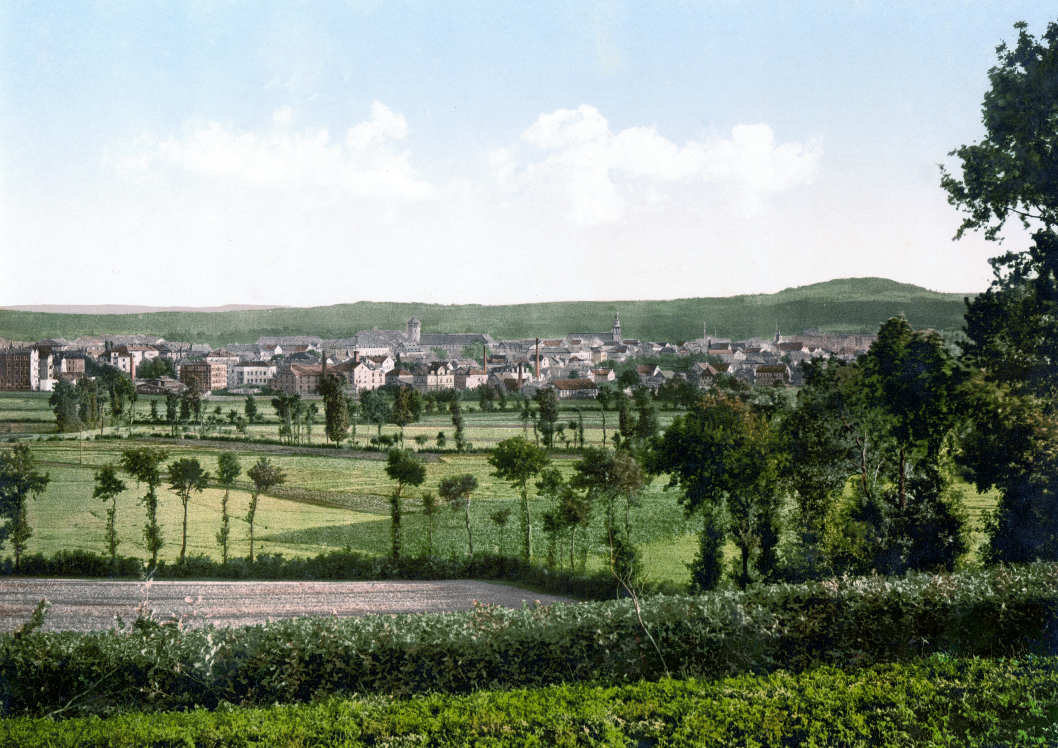
Bayreuth (, ; bar, Bareid) is a town in northern Bavaria, Germany, on the Red Main river in a valley between the Franconian Jura and the Fichtelgebirge Mountains. The town's roots date back to 1194. In the 21st century, it is the capital of Upper Franconia and has a population of 72,148 (2015). It hosts the annual Bayreuth Festival, at which performances of operas by the 19th-century German composer Richard Wagner are presented. History Middle Ages and Early Modern Period The town is believed to have been founded by the counts of Andechs probably around the mid-12th century,Mayer, Bernd and Rückel, Gert (2009). ''Bayreuth – Tours on Foot'', Heinrichs-Verlag, Bamberg, p.5, . but was first mentioned in 1194 as ''Baierrute'' in a document by Bishop Otto II of Bamberg. The syllable ''-rute'' may mean ''Rodung'' or "clearing", whilst ''Baier-'' indicates immigrants from the Bavarian region. Already documented earlier, were villages later merged into Bayreuth: Seulbitz (in 1 ... [...More Info...] [...Related Items...] OR: [Wikipedia] [Google] [Baidu] |
Speichersdorf
Speichersdorf is a municipality in the district of Bayreuth in Bavaria in Germany. It is situated near the Fichtelgebirge The Fichtel MountainsRandlesome, C. et al. (2011). ''Business Cultures in Europe'', 2nd ed., Routledge, Abingdon and New York, p. 52. . (german: Fichtelgebirge, cs, Smrčiny), form a small horseshoe-shaped mountain range in northeastern Bavaria ..., 18 km eastern of Bayreuth. It has a population of about 6,200. References External linksOfficial website(German) Bayreuth (district) {{Bayreuthdistrict-geo-stub ... [...More Info...] [...Related Items...] OR: [Wikipedia] [Google] [Baidu] |
Pegnitz (town)
Pegnitz () is a town in the Bayreuth district in Upper Franconia, Bavaria, Germany, with a population of approximately 15,000 inhabitants. It is also the source of the river Pegnitz. The city Bayreuth is about 27 km to the north. The villages ''(Ortsteile)'' in Pegnitz are: Annual events are the Christmas market, the Open-Air Rock Festival ''Waldstock'', and above all, the seasonal A season is a division of the year based on changes in weather, ecology, and the number of daylight hours in a given region. On Earth, seasons are the result of the axial parallelism of Earth's tilted orbit around the Sun. In temperate and po ... strong-beer festival called ''Flinderer''. References Bayreuth (district) {{Bayreuthdistrict-geo-stub ... [...More Info...] [...Related Items...] OR: [Wikipedia] [Google] [Baidu] |
Hollfeld
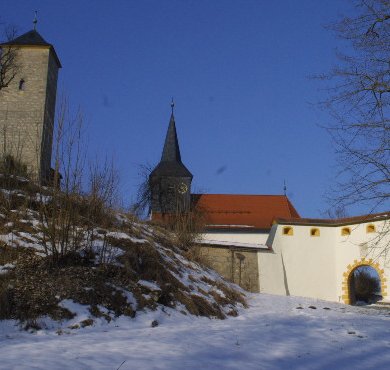
Hollfeld is a town in the district of Bayreuth, in Bavaria, Germany. It is situated 20 km west of Bayreuth, and 30 km east of Bamberg. Sport The towns association football club, ASV Hollfeld, experienced its greatest success in 2012 when it qualified for the new northern division of the expanded Bayernliga, the fifth tier of the German football league system The German football league system, or league pyramid, refers to the hierarchically interconnected league system for association football in Germany that in the 2016–17 season consisted of 2,235 leagues in up to 13 levels having 31,645 teams ..., where it played for two seasons until 2014. Gallery File:Mariae Himmelfahrt Hollfeld 03.JPG, Mariä Himmelfahrt File:Gangolfsturm Hollfeld 01.JPG, Gangolfsturm Villages References External links Website(German) Bayreuth (district) {{Bayreuthdistrict-geo-stub ... [...More Info...] [...Related Items...] OR: [Wikipedia] [Google] [Baidu] |
Goldkronach
Goldkronach (East Franconian: ''Gronich'') is a town in the district of Bayreuth, in Bavaria, Germany. It is situated near the Fichtelgebirge, 12 km northeast of Bayreuth. History On 25 June 1836, at 22:15, residents awoke to a man yelling "Fire! Fire!". In almost 2 hours, almost half of the eastern part of the town burned down, including the parish church, all two schools, the City Hall, 55 houses, and 16 other buildings. 127 families were rendered homeless. Three years later, on 18 June 1839 midnight, another fire broke out in the market. Within two hours, 29 houses and 17 buildings in the south side of town became the victims of the fire. Population development * 1961: 2945 * 1970: 2935 * 1987: 2903 * 2000: 3598 * 2010: 3606 Sons and daughters of the city * Sigismund von Reitzenstein (1766-1847), politician and diplomat of Baden Personalities who lived and worked in Goldkronach * Georgius Agricola (1494-1555), scholar of the Renaissance and the father of the mine ... [...More Info...] [...Related Items...] OR: [Wikipedia] [Google] [Baidu] |
Creußen
Creußen is a town in the district of Bayreuth in Bavaria, Germany. It is situated on the Red Main river, 13 km southeast of Bayreuth. Creußen is famous for its stoneware beer steins. Creußen is the starting point of the Red Main branch of the Main-Radweg bicycle path which stretches about 600 km along the Main until the mouth into the Rhine ), Surselva, Graubünden, Switzerland , source1_coordinates= , source1_elevation = , source2 = Rein Posteriur/Hinterrhein , source2_location = Paradies Glacier, Graubünden, Switzerland , source2_coordinates= , so .... Notable people * Christoph Wirth (1870–1950), German physicist and inventor References Bayreuth (district) {{Bayreuthdistrict-geo-stub ... [...More Info...] [...Related Items...] OR: [Wikipedia] [Google] [Baidu] |
Betzenstein
Betzenstein () is a town in the district of Bayreuth, in Bavaria, Germany. It is situated in the Franconian Switzerland, 35 km northeast of Nuremberg Nuremberg ( ; german: link=no, Nürnberg ; in the local East Franconian dialect: ''Nämberch'' ) is the second-largest city of the German state of Bavaria after its capital Munich, and its 518,370 (2019) inhabitants make it the 14th-largest .... References Bayreuth (district) {{Bayreuthdistrict-geo-stub ... [...More Info...] [...Related Items...] OR: [Wikipedia] [Google] [Baidu] |
Bad Berneck
Bad Berneck () is a spa town in the district of Bayreuth, in Bavaria, Germany. It is situated on the White Main river, in the Fichtelgebirge mountains, 13 km northeast of Bayreuth. Its official title is ''Bad Berneck im Fichtelgebirge''. It lies in the northern part of the Bavarian province of Upper Franconia. Since 1857 it has been a spa, initially based on its climate and whey products. In 1930 it became a Kneipp spa and, in 1950, a Kneipp health spa. Geography The town of Bad Berneck lies on the western edge of the Fichtelgebirge in the Ölschnitz valley, which enters the White Main below the old town or ''Altstadt''. The ''Mainberg'' (624 m above NN) and ''Wolfenberg'' (598 m above NN) are the highest peaks in the parish. Neighbouring communities Bad Berneck's neighbouring parishes (in clockwise order) are: Gefrees, Goldkronach, Bindlach, Harsdorf, Himmelkron and Marktschorgast. The town of Bayreuth is about from Bad Berneck. Sub-divisions H ... [...More Info...] [...Related Items...] OR: [Wikipedia] [Google] [Baidu] |
Hohenzollern
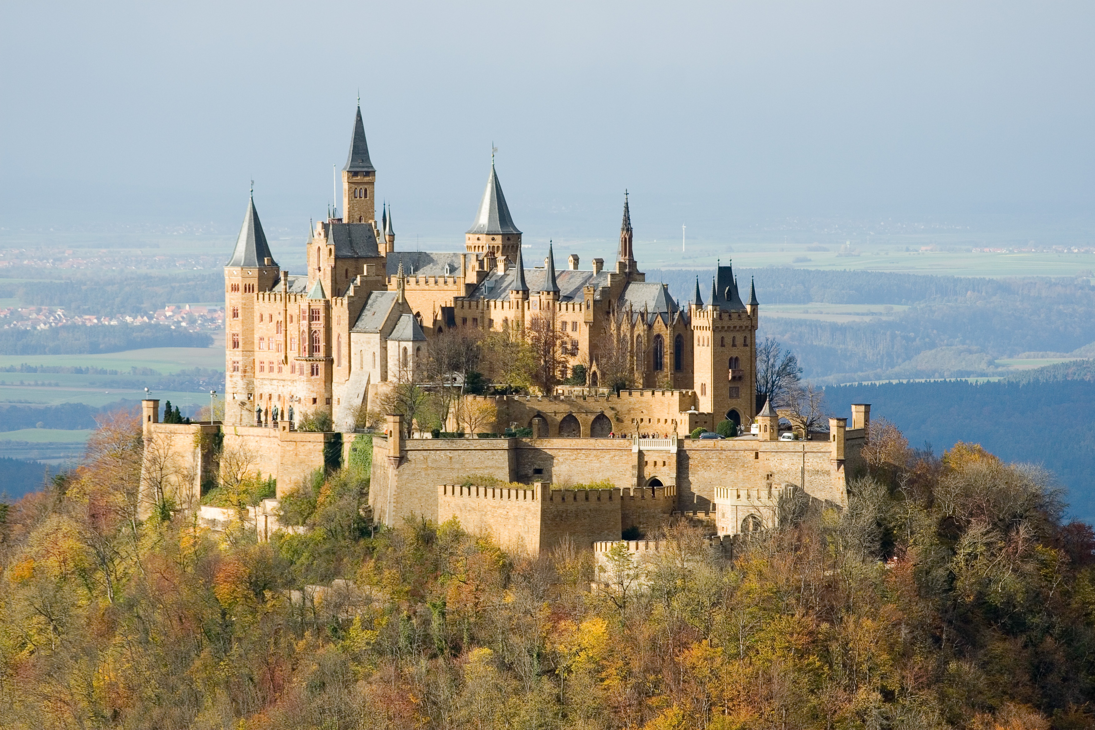
The House of Hohenzollern (, also , german: Haus Hohenzollern, , ro, Casa de Hohenzollern) is a German royal (and from 1871 to 1918, imperial) dynasty whose members were variously princes, electors, kings and emperors of Hohenzollern, Brandenburg, Prussia, the German Empire, and Romania. The family came from the area around the town of Hechingen in Swabia during the late 11th century and took their name from Hohenzollern Castle. The first ancestors of the Hohenzollerns were mentioned in 1061. The Hohenzollern family split into two branches, the Catholic Swabian branch and the Protestant Franconian branch,''Genealogisches Handbuch des Adels, Fürstliche Häuser'' XIX. "Haus Hohenzollern". C.A. Starke Verlag, 2011, pp. 30–33. . which ruled the Burgraviate of Nuremberg and later became the Brandenburg-Prussian branch. The Swabian branch ruled the principalities of Hohenzollern-Hechingen and Hohenzollern-Sigmaringen until 1849, and also ruled Romania from 1866 to 1947. Members ... [...More Info...] [...Related Items...] OR: [Wikipedia] [Google] [Baidu] |
Veldenstein Forest
The Veldenstein Forest (german: Veldensteiner Forst) lies in the east of the Franconian Switzerland-Veldenstein Forest Nature Park between the towns of Pegnitz and Plech. Its name is derived from Veldenstein Castle, a large, well preserved, medieval fortification above Neuhaus an der Pegnitz. The Veldenstein Forest, with its extensive pine and spruce woods has an area of around 70 km2 and is one of the largest contiguous areas of forest in Bavaria. A large part of the Veldenstein Forest lies on the territory of the district of Bayreuth and forms the fourth largest unincorporated area in Bavaria (55.60 km2). Sights A particular attraction in the Veldenstein Forest is the wildlife park. In the east the nature reserve of ''Pegnitzau zwischen Ranna und Michelfeld'' borders immediately on the forest. The forest also has numerous rock formations, caves and dolines, some of which are classified as natural monument A natural monument is a natural or natural/cultural f ... [...More Info...] [...Related Items...] OR: [Wikipedia] [Google] [Baidu] |
Franconian Jura
The Franconian Jura ( , , or ) is an upland in Franconia, Bavaria, Germany. Located between two rivers, the Danube in the south and the Main in the north, its peaks reach elevations of up to and it has an area of some 7053.8 km2. Emil Meynen, Josef Schmithüsen: ''Handbuch der naturräumlichen Gliederung Deutschlands.'' Bundesanstalt für Landeskunde, Remagen/Bad Godesberg 1953–1962 (9 editions in 8 volumes, updated map 1:1,000,000 scale with major units, 1960). Large portions of the Franconian Jura are part of the Altmühl Valley Nature Park. The scenic meanders and gorges formed by the river Altmühl draw tourists to visit the region. Geologically, the Franconian Jura is the eastern continuation of the Swabian Jura. The mountain chains are separated from each other by the impact crater of the Nördlinger Ries The Nördlinger Ries is an impact crater and large circular depression in western Bavaria and eastern Baden-Württemberg. It is located north of the Danube in ... [...More Info...] [...Related Items...] OR: [Wikipedia] [Google] [Baidu] |
Fichtel Mountains
The Fichtel MountainsRandlesome, C. et al. (2011). ''Business Cultures in Europe'', 2nd ed., Routledge, Abingdon and New York, p. 52. . (german: Fichtelgebirge, cs, Smrčiny), form a small horseshoe-shaped mountain range in northeastern Bavaria, Germany. They extend from the valley of the Red Main River to the Czech border, a few foothills spilling over into the Czech Republic. They continue in a northeasterly direction as the Elster Mountains, and in a southeasterly direction as the Upper Palatine Forest. The Fichtel Mountains contain an important nature park, the Fichtel Mountain Nature Park, with an area of . Etymology The first person to write about the Fichtel Mountains, Matthias of Kemnath (actually Matthias Widmann, born 23 February 1429 in Kemnath) reported in 1476: ''Ein bergk, hoch, weitt, wolbekant ligt in Beiern, gnant der Fichtelberg'' ("A mountain, high, wide and well-known, lies in Bavaria, known as the Fichtelberg"). In descriptions of the border in 1499 and 15 ... [...More Info...] [...Related Items...] OR: [Wikipedia] [Google] [Baidu] |


