|
BWIA
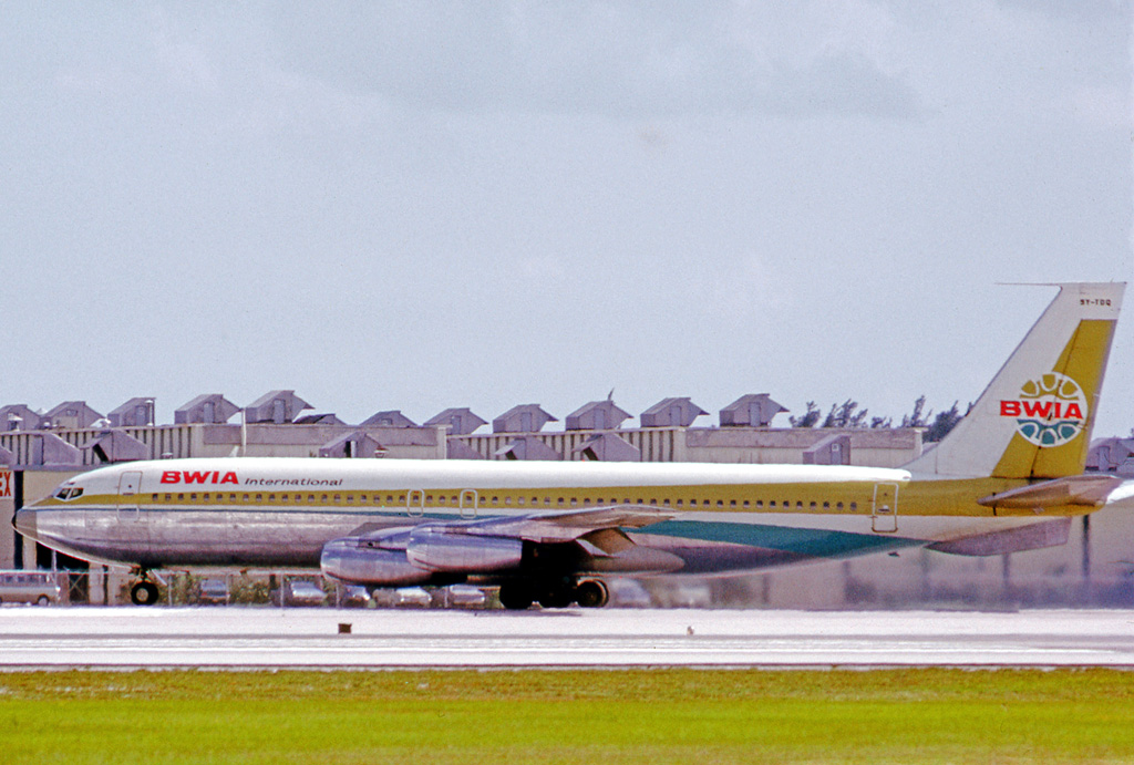
BWIA West Indies Airways Limited, known locally as "Bee-Wee" and also as British West Indian Airways and BWIA International, was the national airline based in Trinidad and Tobago. At the end of operations, BWIA was the largest airline operating out of the Caribbean, with direct service to the United States, Canada, and the United Kingdom. Its main base was Piarco International Airport (POS), Piarco, with major hubs at Grantley Adams International Airport (BGI) and Cheddi Jagan International Airport (GEO) during 2006. It was headquartered in the BWIA Administration Building in Piarco, Tunapuna–Piarco on the island of Trinidad. The company slogan was ''Sharing our warmth with the world.'' The company announced on 8 September 2006 that the airline would be shut down on 31 December 2006. All of the approximately 1700 employees were separated from the company but applied for new contracts with a new entity, Caribbean Airlines. History Early history British West Indian Airways ... [...More Info...] [...Related Items...] OR: [Wikipedia] [Google] [Baidu] |
Caribbean Airlines
Caribbean Airlines Limited is the state-owned airline and flag carrier of Trinidad and Tobago. The airline is also the flag carrier of Jamaica and Guyana. Headquartered in Iere House in Piarco, the airline operates flights to the Caribbean, North America and South America from its base at Piarco International Airport, Trinidad. Presently Caribbean Airlines employs more than 1,700 people and is the largest airline in the Caribbean. The company slogan is ''The Warmth of the Islands.'' History Early years Caribbean Airlines was incorporated in the Republic of Trinidad and Tobago on 27 September 2006. In September 2006, following the recommendation of Peter Davies, the CEO of BWIA West Indies Airways, Caribbean Airlines got approval from the Trinidad and Tobago government to begin operations, after the failed negotiations between the unions and the management of its predecessor, BWIA. As a result, it was announced on 8 September 2006, that BWIA was to be shut down before the ... [...More Info...] [...Related Items...] OR: [Wikipedia] [Google] [Baidu] |
Cheddi Jagan International Airport
Cheddi Jagan International Airport , formerly Timehri International Airport, is the primary airport of Guyana. The airport is located on the right bank of the Demerara River in the city of Timehri, south of Guyana's capital, Georgetown. It is the larger of the two international airports serving Georgetown with the other airport being the Eugene F. Correira International Airport. History The United States obtained rights to locate military facilities in British Guiana as part of the Destroyers for Bases Agreement with the United Kingdom in 1941. On 14 June 1941, the first United States Army forces arrived to survey land for a bomber airfield near Georgetown. Atkinson Field was built 28 miles (45 km) from Georgetown on of land formerly known as Hyde Park, on the Demerara River. The forest was cleared and hills were levelled and a long concrete runway was constructed. On 20 June 1941, the airfield officially opened with the activation of a weather station. The station ... [...More Info...] [...Related Items...] OR: [Wikipedia] [Google] [Baidu] |
British South American Airways
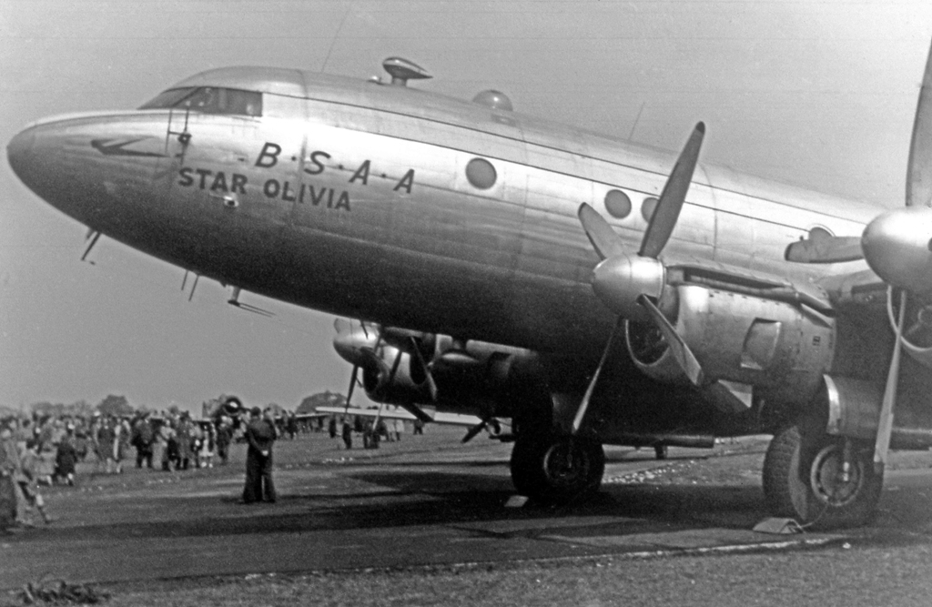
British South American Airways (BSAA) was a state-run airline of the United Kingdom in the mid-late 1940s responsible for services to the Caribbean and South America. Originally named British Latin American Air Lines it was renamed before services started in 1946. BSAA operated mostly Avro aircraft: Yorks, Lancastrians and Tudors and flew to Bermuda, the West Indies, Mexico and the western coast of South America. After two high-profile aircraft disappearances it was merged into the British Overseas Airways Corporation at the end of 1949. Most of BSAA's aircraft were given individual aircraft names beginning with "Star", which have long been used in long-range celestial navigation. History British Latin American Air Lines (BLAIR) was formed on 25 January 1944 by shipping interests (Royal Mail Lines, Pacific Steam Navigation Company, Lamport & Holt Line, Booth Steamship Company and Blue Star Line) to complement the shipping services to South America, at the end of 1945 the com ... [...More Info...] [...Related Items...] OR: [Wikipedia] [Google] [Baidu] |
Lowell Yerex
Lowell Yerex (24 July 1895 – 1968) was born in New Zealand, and attended Valparaiso University in Valparaiso, Indiana United States. He graduated from Valparaiso University in 1916. He volunteered for the British Royal Flying Corps in 1917, was shot down over France and spent four months in a German prisoner-of-war camp. In 1931, he founded Transportes Aéreos Centro Americanos (TACA), but was forced out at the end of 1945. He went on to found British West Indian Airways in Trinidad and Tobago in 1940, at the invitation of Lady Young, wife of Trinidad and Tobago's new governor Sir Hubert Winthrop Young. In 1941, he founded Aerovias Brasil in Rio de Janeiro. After several mergers and acquisitions, the successor companies were eventually acquired by VARIG VARIG (acronym for Viação Aérea RIo-Grandense, ''Rio Grandean Airways'') was the first airline founded in Brazil, in 1927. From 1965 until 1990, it was Brazil's leading airline, and virtually its only international o ... [...More Info...] [...Related Items...] OR: [Wikipedia] [Google] [Baidu] |
Piarco International Airport
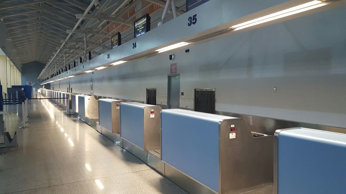
Piarco International Airport is an international airport serving the island of Trinidad and is one of two international airports in Trinidad and Tobago. The airport is located east of Downtown Port of Spain, located in the adjacent town of Piarco. It is the seventh busiest airport in the Caribbean in terms of passengers served and third busiest in the English-speaking Caribbean, after Sangster International Airport and Lynden Pindling International Airport. The airport is also the primary hub and operating base for the country's national airline, as well as the Caribbean's largest airline, Caribbean Airlines. Piarco International Airport has direct scheduled service to destinations in the United States, Canada, Central America, South America and Europe. It is also a significant transit hub for the Southern Caribbean and serves as the primary connection point for many passengers travelling from Guyana. History The Piarco Airport opened on 8 January 1931, to serve Venezuela ... [...More Info...] [...Related Items...] OR: [Wikipedia] [Google] [Baidu] |
Tunapuna–Piarco
Tunapuna–Piarco is one of the 9 regions of Trinidad and Tobago. It is the most populous region in the country by total population and the fifth-largest by total land area. Geographically located in Northern Trinidad, Tunapuna–Piarco shares its borders with the regions of San Juan–Laventille to the west, Couva–Tabaquite–Talparo to the south, the Borough of Chaguanas to the south-west, Sangre Grande to the east and the Caribbean Sea to the north. The region also completely surrounds the Royal Chartered Borough of Arima, which is located in the south-eastern corner of the region. Tunapuna–Piarco is one of the most geographically diverse regions in Trinidad and Tobago. It features the country's two highest mountain peaks, El Cerro del Aripo at 3,084 feet and El Tucuche standing at a soaring 3,070 feet, which both tower the north of the region and the Northern Coast of Trinidad forming the a part of the Northern Range. Geography Tunapuna–Piarco is the fifth larges ... [...More Info...] [...Related Items...] OR: [Wikipedia] [Google] [Baidu] |
Piarco
Piarco is a town in northern Trinidad and is the site of Piarco International Airport . Geography Piarco is the site of one of the few natural savannas in Trinidad and Tobago, the ''Piarco Savanna''. Most of this savanna land has been incorporated into the airport. Piarco is bounded by Orange Grove to the west, Trincity/Maloney to the north and Mausica to the east. Piarco comprises a few areas/villages such as Oropune, Golden Grove and St Helena. Administration Piarco, which is located south of Trincity and Tunapuna, is administered by the Tunapuna–Piarco Regional Corporation. Economy Caribbean Airlines has its headquarters in the Iere House, Golden Grove Road Piarco. Prior to the establishment of Caribbean Airlines, BWIA West Indies Airways BWIA West Indies Airways Limited, known locally as "Bee-Wee" and also as British West Indian Airways and BWIA International, was the national airline based in Trinidad and Tobago. At the end of operations, BWIA was the largest airline ... [...More Info...] [...Related Items...] OR: [Wikipedia] [Google] [Baidu] |
Antigua
Antigua ( ), also known as Waladli or Wadadli by the native population, is an island in the Lesser Antilles. It is one of the Leeward Islands in the Caribbean region and the main island of the country of Antigua and Barbuda. Antigua and Barbuda became an independent state within the Commonwealth of Nations on 1 November 1981. ''Antigua'' means "ancient" in Spanish after an icon in Seville Cathedral, "" — St. Mary of the Old Cathedral.Kessler, Herbert L. & Nirenberg, David. Judaism and Christian Art: Aesthetic Anxieties from the Catacombs to Colonialism'' Accessed 23 September 2011. The name ''Waladli'' comes from the indigenous inhabitants and means approximately "our own". The island's perimeter is roughly and its area . Its population was 83,191 (at the 2011 Census). The economy is mainly reliant on tourism, with the agricultural sector serving the domestic market. Over 22,000 people live in the capital city, St. John's. The capital is situated in the north-wes ... [...More Info...] [...Related Items...] OR: [Wikipedia] [Google] [Baidu] |
Grand Cayman
Grand Cayman is the largest of the three Cayman Islands and the location of the territory's capital, George Town. In relation to the other two Cayman Islands, it is approximately 75 miles (121 km) southwest of Little Cayman and 90 miles (145 km) southwest of Cayman Brac. Geography Grand Cayman encompasses 76% of the territory's entire land mass. The island is approximately long with its widest point being wide. The elevation ranges from sea level at the beaches to above sea level on the North Side's Mastic Trail. Unlike many other Caribbean islands, Grand Cayman is for the most part, flat. This allows for more space to build as the island’s population grows. Island districts Grand Cayman Island includes five of the six districts of the Cayman Islands: Bodden Town, East End, George Town, North Side and West Bay. *Bodden Town – Founded in the 1700s, Bodden Town district comprises the central part of Grand Cayman Island, between the George Town and North ... [...More Info...] [...Related Items...] OR: [Wikipedia] [Google] [Baidu] |
Montego Bay
Montego Bay is the capital of the parish of St. James in Jamaica. The city is the fourth-largest urban area in the country by population, after Kingston, Spanish Town, and Portmore, all of which form the Greater Kingston Metropolitan Area, home to over half a million people. As a result, Montego Bay is the second-largest anglophone city in the Caribbean, after Kingston. Montego Bay is a popular tourist destination featuring duty-free shopping, a cruise line terminal and several beaches and resorts. The city is served by the Donald Sangster International Airport, the busiest airport in the Anglophone Caribbean, which is located within the official city limits. The city is enclosed in a watershed, drained by several rivers such as the Montego River. Montego Bay is referred to as "The Second City", "MoBay" or "Bay". History The Arawak tribe of South America are Jamaica's first known inhabitants and were there to greet Christopher Columbus when he ventured to the island i ... [...More Info...] [...Related Items...] OR: [Wikipedia] [Google] [Baidu] |
Caracas
Caracas (, ), officially Santiago de León de Caracas, abbreviated as CCS, is the capital and largest city of Venezuela, and the center of the Metropolitan Region of Caracas (or Greater Caracas). Caracas is located along the Guaire River in the northern part of the country, within the Caracas Valley of the Venezuelan coastal mountain range (Cordillera de la Costa). The valley is close to the Caribbean Sea, separated from the coast by a steep 2,200-meter-high (7,200 ft) mountain range, Cerro El Ávila; to the south there are more hills and mountains. The Metropolitan Region of Caracas has an estimated population of almost 5 million inhabitants. The center of the city is still ''Catedral'', located near Bolívar Square, though some consider the center to be Plaza Venezuela, located in the Los Caobos area. Businesses in the city include service companies, banks, and malls. Caracas has a largely service-based economy, apart from some industrial activity in its metropolitan ... [...More Info...] [...Related Items...] OR: [Wikipedia] [Google] [Baidu] |
Kingston, Jamaica
Kingston is the capital and largest city of Jamaica, located on the southeastern coast of the island. It faces a natural harbour protected by the Palisadoes, a long sand spit which connects the town of Port Royal and the Norman Manley International Airport to the rest of the island. In the Americas, Kingston is the largest predominantly English-speaking city in the Caribbean. The local government bodies of the parishes of Kingston and Saint Andrew were amalgamated by the Kingston and St. Andrew Corporation Act of 1923, to form the Kingston and St. Andrew Corporation (KSAC). Greater Kingston, or the "Corporate Area" refers to those areas under the KSAC; however, it does not solely refer to Kingston Parish, which only consists of the old downtown and Port Royal. Kingston Parish had a population of 89,057, and St. Andrew Parish had a population of 573,369 in 2011 Kingston is only bordered by Saint Andrew to the east, west and north. The geographical border for the parish of ... [...More Info...] [...Related Items...] OR: [Wikipedia] [Google] [Baidu] |


