|
Bəylik, Lachin
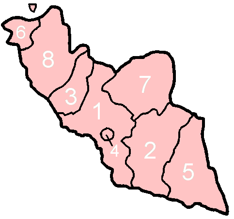
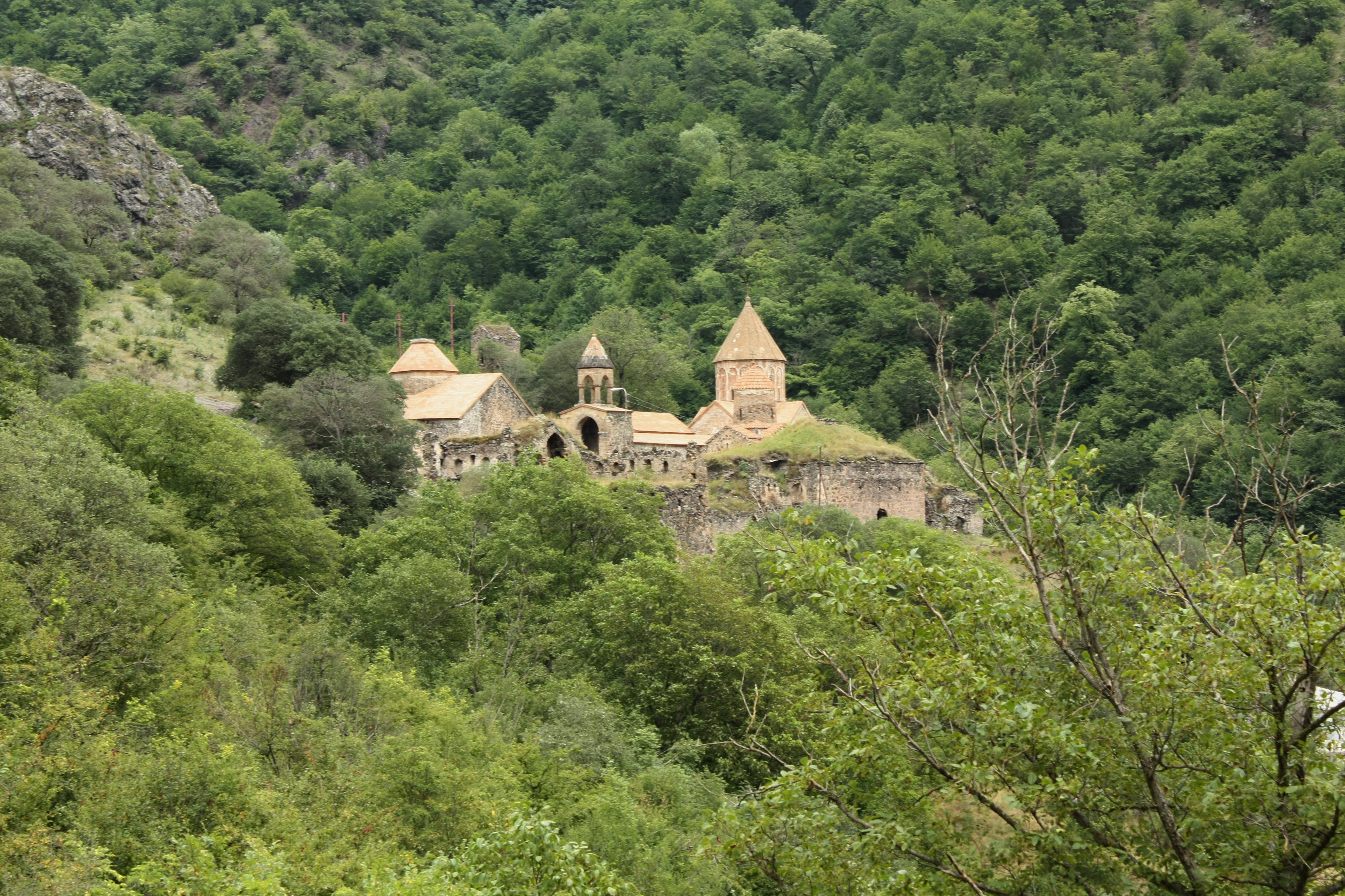
Beylik is a village in Zabukh village administrative territorial district of Lachin district of the Republic of Azerbaijan. Lachin district is located in the south-west of the Republic of Azerbaijan, in a mountainous area. It borders Kalbajar to the north, Khojaly, Shusha and Khojavand to the east, Gubadli districts to the south, and the Republic of Armenia Armenia, officially the Republic of Armenia, is a landlocked country in the Armenian Highlands of West Asia. It is a part of the Caucasus region and is bordered by Turkey to the west, Georgia to the north and Azerbaijan to the east, and Ir ... to the west. History Consisting of the components bey (title) and -lik (affiliation suffix), this oikonym means "village belonging to the groom". References {{Reflist Populated_places_in_Lachin_District Villages in Azerbaijan ... [...More Info...] [...Related Items...] OR: [Wikipedia] [Google] [Baidu] |
Administrative Divisions Of Azerbaijan
Azerbaijan is administratively divided into 67 districts () and 11 cities () that are subordinate to the Republic. Out of these districts and cities, 7 districts and 1 city are located within the Nakhchivan Autonomous Republic. The districts are further divided into Municipalities of Azerbaijan, municipalities (). Additionally, the districts of Azerbaijan are grouped into 14 Economic regions of Azerbaijan, Economic Regions (). On 7 July 2021, President of Azerbaijan Ilham Aliyev signed a decree "On the new division of economic regions in the Republic of Azerbaijan". Administrative divisions Contiguous Azerbaijan The list below represents the districts of contiguous Azerbaijan. For those of the Nakhchivan exclave, see further below. Nakhchivan Autonomous Republic The seven districts and one municipality of the Nakhchivan Autonomous Republic are listed below. Economic regions Nagorno-Karabakh The territory of former Nagorno-Karabakh Autonomous Oblast presently ... [...More Info...] [...Related Items...] OR: [Wikipedia] [Google] [Baidu] |
Lachin District
Lachin District () is one of the 66 districts of Azerbaijan. It is located in the west of the country, belonging to the East Zangezur Economic Region. The district borders the districts of Kalbajar, Khojaly, Shusha, Khojavend, Qubadli, and the Syunik Province of Armenia. Its capital and largest city is Lachin. As of 2020, the district had a nominal population of 78,600. The territory of the district was established in 1930 and given the status of a district. The district was occupied by the self-proclaimed Republic of Artsakh from 1992 until late 2020, when the district was surrendered to Azerbaijan per the 2020 Nagorno-Karabakh ceasefire agreement which ended the 2020 Nagorno-Karabakh War. A small part of the district, excluding its capital, called the Lachin corridor was controlled by a Russian peacekeeping force until 2024. Demographics In 1936, from a total of 20,356 people: * Azerbaijanis 89,8% (18,288) * Kurds 6,5% (1,329) * Russians 2,1% (432) * Armenians 1,1% ... [...More Info...] [...Related Items...] OR: [Wikipedia] [Google] [Baidu] |
Azerbaijan Time
Azerbaijan Time () is the standard time zone in Azerbaijan, four hours ahead of UTC ( UTC+04:00). The daylight saving time adjustment, Azerbaijan Summer Time (), was one hour ahead at UTC+05:00; it was introduced in 1997 and discontinued in March 2016. Azerbaijan Time is the same as Samara Time (Russia), United Arab Emirates Standard Time, Georgia Time, Armenia Time and Seychelles Time. History Azerbaijan, formerly the Azerbaijan Soviet Socialist Republic (Azerbaijan SSR), adhered to timekeeping regulations instituted by the Soviet Union The Union of Soviet Socialist Republics. (USSR), commonly known as the Soviet Union, was a List of former transcontinental countries#Since 1700, transcontinental country that spanned much of Eurasia from 1922 until Dissolution of the Soviet .... In 1930, the Council of People’s Commissars of the USSR implemented " Decree Time," which mandated a one-hour advancement of standard time across the entire Soviet territory. This mov ... [...More Info...] [...Related Items...] OR: [Wikipedia] [Google] [Baidu] |
Zabukh
Zabukh () or Aghavno () is a village in the Lachin District of Azerbaijan. The village came under the control of the Political status of Nagorno-Karabakh, breakaway Republic of Artsakh after 1992 and was renamed Aghavno and settled by Armenians. Following the 2020 Nagorno-Karabakh war, Zabukh came under the control of the Peacekeeping operations in Nagorno-Karabakh, Russian peacekeeping forces in Nagorno-Karabakh. On 26 August 2022, Azerbaijan regained control of Zabukh along with other settlements located along the former route of the Lachin corridor, including Lachin and Sus, Lachin, Sus. Toponymy Zabukh (also rendered Zabuk in Armenian language, Armenian) is also the name of a tributary of the Hakari (river), Hakari River that runs by the village. After coming under Armenian control in 1992, the village was renamed Aghavno, which is one of the Armenian names of the Hakari River. The village is also known as ''Ariavan'' (). History Several Armenian authors identify Zabukh wit ... [...More Info...] [...Related Items...] OR: [Wikipedia] [Google] [Baidu] |
Lachin
Lachin (, , ; ) is a town in Azerbaijan and the administrative centre of the Lachin District. It was located within the strategic Lachin corridor, which used to link the Nagorno-Karabakh region with Armenia. The town was under control of Armenian forces in 1992, during the First Nagorno-Karabakh War, and its local Azerbaijani and Kurdish population was expelled, while Armenians settled in. The town came under the '' de facto'' control of the breakaway Republic of Artsakh, administered as part of its Kashatagh Province. It came under the supervision of the Russian peacekeeping force following the ceasefire agreement that ended the 2020 Nagorno-Karabakh war. Lachin and the villages of Sus and Zabukh were returned under Azerbaijan's control on August 26, 2022, as part of the 2020 ceasefire agreement. History Early history Cuneiform inscriptions dating back to the Urartu, Urartian period have been found in the caves surrounding the town. The area was first mentioned by A ... [...More Info...] [...Related Items...] OR: [Wikipedia] [Google] [Baidu] |
Azerbaijan
Azerbaijan, officially the Republic of Azerbaijan, is a Boundaries between the continents, transcontinental and landlocked country at the boundary of West Asia and Eastern Europe. It is a part of the South Caucasus region and is bounded by the Caspian Sea to the east, Russia's republic of Dagestan to the north, Georgia (country), Georgia to the northwest, Armenia and Turkey to the west, and Iran to the south. Baku is the capital and largest city. The territory of what is now Azerbaijan was ruled first by Caucasian Albania and later by various Persian empires. Until the 19th century, it remained part of Qajar Iran, but the Russo-Persian wars of Russo-Persian War (1804–1813), 1804–1813 and Russo-Persian War (1826–1828), 1826–1828 forced the Qajar Empire to cede its Caucasian territories to the Russian Empire; the treaties of Treaty of Gulistan, Gulistan in 1813 and Treaty of Turkmenchay, Turkmenchay in 1828 defined the border between Russia and Iran. The region north o ... [...More Info...] [...Related Items...] OR: [Wikipedia] [Google] [Baidu] |
Republic Of Azerbaijan
Azerbaijan, officially the Republic of Azerbaijan, is a transcontinental and landlocked country at the boundary of West Asia and Eastern Europe. It is a part of the South Caucasus region and is bounded by the Caspian Sea to the east, Russia's republic of Dagestan to the north, Georgia to the northwest, Armenia and Turkey to the west, and Iran to the south. Baku is the capital and largest city. The territory of what is now Azerbaijan was ruled first by Caucasian Albania and later by various Persian empires. Until the 19th century, it remained part of Qajar Iran, but the Russo-Persian wars of 1804–1813 and 1826–1828 forced the Qajar Empire to cede its Caucasian territories to the Russian Empire; the treaties of Gulistan in 1813 and Turkmenchay in 1828 defined the border between Russia and Iran. The region north of the Aras was part of Iran until it was conquered by Russia in the 19th century, where it was administered as part of the Caucasus Viceroyalty. By the la ... [...More Info...] [...Related Items...] OR: [Wikipedia] [Google] [Baidu] |
Kalbajar District
Kalbajar District () is one of the 66 Administrative divisions of Azerbaijan, districts of Azerbaijan. It is located in the west of the country and belongs to the East Zangezur Economic Region. The district borders the districts of Lachin District, Lachin, Khojaly District, Khojaly, Agdam District, Agdam, Tartar District, Tartar, Goranboy District, Goranboy, Goygol District, Goygol and Dashkasan District, Dashkasan districts of Azerbaijan, as well as the Gegharkunik Province, Gegharkunik and Vayots Dzor Province, Vayots Dzor provinces of Armenia. Its capital and largest city is Kalbajar. As of 2020, the district had a nominal population of 94,100. History In Turkic languages, Turkic ''Kalbajar'' means ''"Castle on the mouth of the river"''. The city of Kalbajar was renamed to ''Karvachar'' () after its occupation in the First Nagorno-Karabakh war, which corresponds to the ancient district of Vaykunik, one of 12 cantons of Artsakh (historic province), Artsakh.Robert H. Hewsen, ' ... [...More Info...] [...Related Items...] OR: [Wikipedia] [Google] [Baidu] |
Armenia
Armenia, officially the Republic of Armenia, is a landlocked country in the Armenian Highlands of West Asia. It is a part of the Caucasus region and is bordered by Turkey to the west, Georgia (country), Georgia to the north and Azerbaijan to the east, and Iran and the Azerbaijani exclave of Nakhchivan Autonomous Republic, Nakhchivan to the south. Yerevan is the Capital city, capital, largest city and Economy of Armenia, financial center. The Armenian Highlands has been home to the Hayasa-Azzi, Shupria and Nairi. By at least 600 BC, an archaic form of Proto-Armenian language, Proto-Armenian, an Indo-European languages, Indo-European language, had diffused into the Armenian Highlands.Robert Drews (2017). ''Militarism and the Indo-Europeanizing of Europe''. Routledge. . p. 228: "The vernacular of the Great Kingdom of Biainili was quite certainly Armenian. The Armenian language was obviously the region's vernacular in the fifth century BC, when Persian commanders and Greek writers ... [...More Info...] [...Related Items...] OR: [Wikipedia] [Google] [Baidu] |
Populated Places In Lachin District
Population is a set of humans or other organisms in a given region or area. Governments conduct a census to quantify the resident population size within a given jurisdiction. The term is also applied to non-human animals, microorganisms, and plants, and has specific uses within such fields as ecology and genetics. Etymology The word ''population'' is derived from the Late Latin ''populatio'' (a people, a multitude), which itself is derived from the Latin word ''populus'' (a people). Use of the term Social sciences In sociology and population geography, population refers to a group of human beings with some predefined feature in common, such as location, race, ethnicity, nationality, or religion. Ecology In ecology, a population is a group of organisms of the same species which inhabit the same geographical area and are capable of interbreeding. The area of a sexual population is the area where interbreeding is possible between any opposite-sex pair within the area ... [...More Info...] [...Related Items...] OR: [Wikipedia] [Google] [Baidu] |


