|
Bärendenkmal B
The Bear Monument () is a monument to bears in the Harz mountains of central Germany. It stands by a forest track and walking trail in woods not far from the Bremer Teich and the Viktorshöhe hill and marks the spot where the last bear was killed in 1696 in the Anhalt Forest. The monument was erected around 1900. It is a glacial erratic boulder on which a cast-iron memorial plate with an inscription has been affixed. Next to the bear monument is a checkpoint (no. 184) which is part of the Harzer Wandernadel network of hiking trails. The last bear in the Upper Harz was killed about 90 years later near Wernigerode. A coachman or carter named Buchtekirch shot it between 1786 and 1788 and received a reward form of two Reichstaler from the Count of Stolberg. A similar monument is the Luchsstein ("Lynx Stone") near Lautenthal, which commemorates the killing of the last wild lynx A lynx ( ; : lynx or lynxes) is any of the four wikt:extant, extant species (the Canada lynx, Ibe ... [...More Info...] [...Related Items...] OR: [Wikipedia] [Google] [Baidu] |
Wernigerode
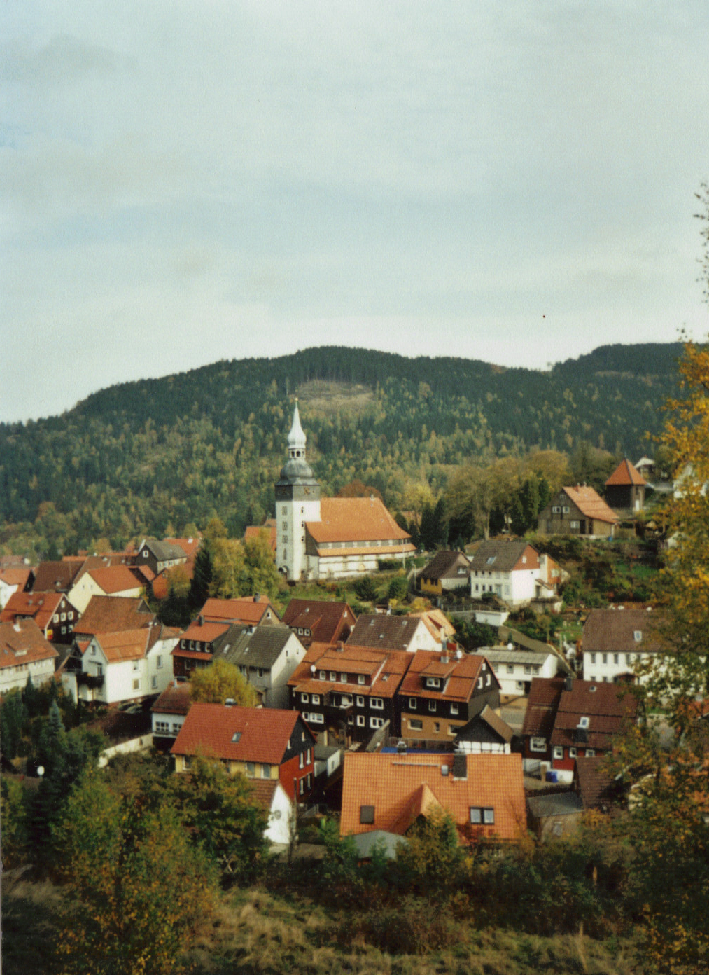
Wernigerode () is a town in the Harz (district), district of Harz, Saxony-Anhalt, Germany. Until 2007, it was the capital of the Wernigerode (district), district of Wernigerode. Its population was 32,181 in 2020. Wernigerode is located southwest of Halberstadt, and is picturesquely situated on the Holtemme river, on the northern slopes of the Harz Mountains. Wernigerode is located on the German Timber-Frame Road. Geography Location The town lies at about above Normalnull, sea level (NN) on the northeastern flank of the Harz Mountains in central Germany, at the foot of their highest peak, the Brocken, on the Bundesstraße 6, B 6 and Bundesstraße 244, B 244 federal highways and on the Halberstadt–Vienenburg railway, railway line from Halberstadt to Vienenburg that links the cities of Halle (Saale) and Hanover. The River Holtemme flows through the town and, not far from its western gate, it is joined by the Zillierbach stream, which is also known as the near its mouth. ... [...More Info...] [...Related Items...] OR: [Wikipedia] [Google] [Baidu] |
History Of Anhalt
The history of Saxony-Anhalt began with Old Saxony, which was conquered by Charlemagne in 804 and transformed into the Duchy of Saxony within the Carolingian Empire. Saxony went on to become one of the so-called stem duchies of the German Kingdom and subsequently the Holy Roman Empire which formed out of the eastern partition of the Carolingian Empire. The duchy grew to become a powerful state within the empire, ruling over much of what is now northern Germany, but following conflicts with the emperor it was partitioned into numerous minor states, including the Principality of Anhalt, around the end of the 12th century and early 13th century. The territories of the Duchy of Saxony, the Principality of Anhalt, and their successors are now part of the modern German state of Saxony-Anhalt. The ducal title and electoral dignity passed to the Ascanian Bernhard of Anhalt, but the title only came with a few small eastern parts of the former territory. Following his death in 1212 his ... [...More Info...] [...Related Items...] OR: [Wikipedia] [Google] [Baidu] |
Lynx
A lynx ( ; : lynx or lynxes) is any of the four wikt:extant, extant species (the Canada lynx, Iberian lynx, Eurasian lynx and the bobcat) within the medium-sized wild Felidae, cat genus ''Lynx''. The name originated in Middle English via Latin from the Greek word (), derived from the Indo-European root (, ), in reference to the luminescence of its tapetum lucidum, reflective eyes. Appearance Lynx have a short tail, characteristic tufts of black hair on the tips of their ears, large, padded paws for walking on snow and long whiskers on the face. Under their neck, they have a ruff, which has black bars resembling a bow tie, although this is often not visible. Body colour varies from medium brown to goldish to beige-white, and is occasionally marked with dark brown spots, especially on the limbs. All species of lynx have white fur on their chests, bellies and on the insides of their legs, fur which is an extension of the chest and belly fur. The lynx's colouring ... [...More Info...] [...Related Items...] OR: [Wikipedia] [Google] [Baidu] |
Lautenthal
The formerly free mining town ('' Bergstadt'') of Lautenthal in Germany is a state-recognised, climatic spa with around 1,570 inhabitants and has been part of the borough of Langelsheim since 1972. Geography Lautenthal lies in the Innerste valley between Clausthal-Zellerfeld and Langelsheim in the northwestern Upper Harz. The town is located at a height of about in a valley bowl, the surrounding mountains being up to . The two rivers of the Innerste and the Laute flow through the town. Towards Langelsheim the Innerste is impounded by the Innerste Dam. History Mining of copper, lead and silver in the area around Lautenthal started about 1225. In the middle of the 14th century, however, the Harz was depopulated because of plague and mining came to an end. Mining in the Harz was started again in 1524. Lautenthal was founded in 1538 as a mining settlement on the river Laute, a small tributary of the Innerste, and had already been given the status of a town by 1580. Sixtee ... [...More Info...] [...Related Items...] OR: [Wikipedia] [Google] [Baidu] |
County Of Stolberg
The County of Stolberg () was a county of the Holy Roman Empire located in the Harz mountain range in present-day Saxony-Anhalt, Germany. It was ruled by a branch of the House of Stolberg. The town of Stolberg was probably founded in the 12th century as a mining settlement. The Counts of Stolberg (''Grafen zu Stolberg'') probably derived from a branch of the counts of Hohnstein castle near Nordhausen in Thuringia. The castle of Stolberg was first mentioned in 1210 as ''Stalberg'', then the seat of one count Henry originally from nearby Voigtstedt. It remained a property of the comital family until its expropriation in 1945. The Stolberg lands, which were located mostly east of the Harz, included Stolberg, Hayn, the lower County of Hohnstein (1417), as well as Kelbra and Heringen (1413/17), the two latter territories being ruled alongside the House of Schwarzburg. The Counts of Stolberg could significantly enlarge their territory when they inherited the County of Wernigero ... [...More Info...] [...Related Items...] OR: [Wikipedia] [Google] [Baidu] |
Reichstaler
The ''Reichsthaler'' (; modern spelling Reichstaler), or more specifically the ''Reichsthaler specie'', was a standard thaler silver coin introduced by the Holy Roman Empire in 1566 for use in all German states, minted in various versions for the next 300 years, and containing 25–26 grams fine silver. ''North German thaler, Reichsthaler'' was also the name of a currency unit worth less than the ''Reichsthaler specie'' introduced by several North German states from the 17th century; discussed separately under ''North German thaler''. Several old books confusingly use the same term ''Reichsthaler'' for the Speciesthaler, specie silver coin as well as the currency unit. This is disambiguated by referring to the full-valued coin as the ''Speciesthaler, Reichsthaler specie'' and the lower-valued currency unit as the ''Reichsthaler currency (courant, kurant)''. History The ''Reichsthaler'' – literally, the ''dollar of the realm'' – was the most successful standard silver coin re ... [...More Info...] [...Related Items...] OR: [Wikipedia] [Google] [Baidu] |
Hiking Trails
A trail, also known as a path or track, is an unpaved lane or a small paved road (though it can also be a route along a navigable waterways) generally not intended for usage by motorized vehicles, usually passing through a natural area. However, it is sometimes applied to highways in North America. In the United Kingdom and Ireland, a path or footpath is the preferred term for a pedestrian or hiking trail. In the US, the term was historically used for a route into or through wild territory used by explorers and migrants (e.g. the Oregon Trail). In the United States, "trace" is a synonym for trail, as in Natchez Trace. Some trails are restricted to use by only walkers, or cyclists, or equestrians, or for snowshoeing, or cross-country skiing, others, for example bridleways in the UK, are shared, and can be used by walkers, cyclists and equestrians. Although most ban motorized use, there are unpaved trails used by dirt bikes, quad bikes and other off-road vehicles, usually fo ... [...More Info...] [...Related Items...] OR: [Wikipedia] [Google] [Baidu] |
Harz Mountains
The Harz (), also called the Harz Mountains, is a Mittelgebirge, highland area in northern Germany. It has the highest elevations for that region, and its rugged terrain extends across parts of Lower Saxony, Saxony-Anhalt, and Thuringia. The name ''Harz'' derives from the Middle High German word ''Hardt'' or ''Hart'' (hill forest). The name ''Hercynia'' derives from a Celtic name and could refer to Hercynian Forest, other mountain forests, but has also been applied to the Rhenohercynian zone, geology of the Harz. The Brocken is the highest summit in the Harz with an elevation of above Normalnull, sea level. The Wurmberg (Harz), Wurmberg () is the highest peak located entirely within the state of Lower Saxony. Geography Location and extent The Harz has a length of , stretching from the town of Seesen in the northwest to Eisleben in the east, and a width of . It occupies an area of , and is divided into the Upper Harz (''Oberharz'') in the northwest, which is up to 800 m high ... [...More Info...] [...Related Items...] OR: [Wikipedia] [Google] [Baidu] |
Harzer Wandernadel
The Harzer Wandernadel is a system of hiking awards in the Harz mountains in central Germany. Hikers (or mountain bikers) can earn awards at different levels of challenge by walking to the various checkpoints in the network and stamping their passbooks to record the visit. With 222 checkpoints in three federal states and across five districts in the Harz and with membership in five figures, the system has gained a following Germany-wide. Purpose The idea of the ''Wandernadel'' (literally "hiking needle/pin" --> "hiking badge") is to give those holidaying in the Harz a worthwhile goal to achieve and encourage them to stay for longer or return. It also aims to encourage those who live in the local area to go hiking and improve their fitness. In addition the system helps tourists and locals to get to know the many different sights and hiking trails in the Harz. To that end, checkpoints have been located at scenic viewing points, places of geological or botanical, culturalbor hi ... [...More Info...] [...Related Items...] OR: [Wikipedia] [Google] [Baidu] |
Glacial Erratic
A glacial erratic is a glacially deposited rock (geology), rock differing from the type of country rock (geology), rock native to the area in which it rests. Erratics, which take their name from the Latin word ' ("to wander"), are carried by glacial ice, often over distances of hundreds of kilometres. Erratics can range in size from pebbles to large boulders such as Okotoks Erratic, Big Rock (16,500 metric tons) in Alberta. Geologists identify erratics by studying the rocks surrounding the position of the erratic and the composition of the erratic itself. Erratics are significant because: *They can be transported by glaciers, and are thereby one of a series of indicators which mark the path of prehistoric Glacial motion, glacier movement. Their lithographic origin can be traced to the parent bedrock, allowing for confirmation of the ice flow route. *They can be transported by ice rafting, which allows quantification of the extent of glacial flooding resulting from ice dam failure ... [...More Info...] [...Related Items...] OR: [Wikipedia] [Google] [Baidu] |


