|
Burwood Heights, New South Wales
Burwood Heights is a suburb in the Inner West of Sydney, in the state of New South Wales, Australia. It is located 10 kilometres west of the Sydney central business district and is situated within the local government area of Municipality of Burwood The Municipality of Burwood (also known as Burwood Council) is a local government area in the inner-west of Sydney, in the state of New South Wales, Australia. The mayor of the Municipality is Cr. John Faker, a member of the Labor Party. The .... Burwood Heights is a residential suburb with no shops, schools or any public buildings. The postcode is 2136, the same as neighbouring Enfield. Burwood is a separate suburb, to the north. History The Geographical Names Board of New South Wales assigned Burwood Heights the status of a separate suburb on 19 January 2007. Population According to the of Population, there were 1,134 residents in Burwood Heights. 46.6% of people were born in Australia. The next most common country of b ... [...More Info...] [...Related Items...] OR: [Wikipedia] [Google] [Baidu] |
Federation Architecture
Federation architecture is the architectural style in Australia that was prevalent from around 1890 to 1915. The name refers to the Federation of Australia on 1 January 1901, when the British colonies of Australia collectively became the Commonwealth of Australia. The architectural style had antecedents in the Queen Anne style and Edwardian style of the United Kingdom, combined with various other influences like the Arts and Crafts style. Other styles also developed, like the Federation Warehouse style, which was heavily influenced by the Romanesque Revival style. In Australia, Federation architecture is generally associated with cottages in the Queen Anne style, but some consider that there were twelve main styles that characterised the Federation period. Definition and features The Federation period overlaps the Edwardian period, which was so named after the reign of King Edward VII (1901–1910); however, as the style preceded and extended beyond Edward's reign, the term ... [...More Info...] [...Related Items...] OR: [Wikipedia] [Google] [Baidu] |
Sydney Central Business District
The Sydney central business district (CBD) is the historical and main Central business district, commercial centre of Sydney. The CBD is Sydney's city centre, or Sydney City, and the two terms are used interchangeably. Colloquially, the CBD or city centre is often referred to simply as "Town" or "the City". The Sydney CBD is Australia's main financial and economic centre, as well as a leading hub of economic activity for the Asia Pacific region. 40.7% of businesses in the CBD fall within the ‘Finance and Financial Services’ or ‘Professional and Business services’ category. It is ranked overall #16 in the 2024 Oxford's Global Cities Index and amongst the top 10 cities in the Human Capital category. Approximately 15% of Sydney's total workforce is employed within the CBD. In 2012, the number of workers operating in the city was 226,972. Based on industry mix and relative occupational wage levels it is estimated that economic activity (GDP) generated in the city in 2023/24 ... [...More Info...] [...Related Items...] OR: [Wikipedia] [Google] [Baidu] |
Municipality Of Burwood
The Municipality of Burwood (also known as Burwood Council) is a local government area in the inner-west of Sydney, in the state of New South Wales, Australia. The mayor of the Municipality is Cr. John Faker, a member of the Labor Party. The municipality is 7 km2, making it the second smallest Local Government Area in New South Wales, being larger than only Hunter's Hill. History The municipality was established on 27 March 1874. The council chambers are located on Conder Street and were designed and built by architect Jack Hennessy in 1877. Hennessy was later a mayor of Burwood. A 2015 review of local government boundaries by the NSW Government Independent Pricing and Regulatory Tribunal recommended that the Municipality of Burwood merge with adjoining councils of: Canada Bay and Strathfield Councils to form a new council with an area of and support a population of approximately 163,000 at the time. In May 2016, Strathfield Council challenged the proposed merge ... [...More Info...] [...Related Items...] OR: [Wikipedia] [Google] [Baidu] |
Electoral District Of Strathfield
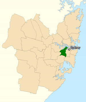
Strathfield is an New South Wales Legislative Assembly electoral districts, electoral district of the New South Wales Legislative Assembly, Legislative Assembly in the Australian state of New South Wales. Since a 2022 Strathfield state by-election, by-election in 2022, it has been represented by Jason Yat-Sen Li of the Australian Labor Party (New South Wales Branch), Labor Party . It was first created in 1988 and derives its name from the suburb of the same name. Strathfield is an urban electorate, covering 19 km² in area. Geography On its current boundaries, Strathfield takes in the suburbs of Belfield, New South Wales, Belfield, Burwood Heights, New South Wales, Burwood Heights, Burwood, New South Wales, Burwood, Croydon, New South Wales, Croydon, Croydon Park, New South Wales, Croydon Park, Enfield, New South Wales, Enfield, Flemington, New South Wales, Flemington, Homebush West, Strathfield, New South Wales, Strathfield, Strathfield South and parts of Ashbury, New S ... [...More Info...] [...Related Items...] OR: [Wikipedia] [Google] [Baidu] |
Division Of Grayndler
The Division of Grayndler is an Electorates of the Australian House of Representatives, Australian electoral division in the States and territories of Australia, state of New South Wales. It is currently represented by Prime Minister of Australia and Leader of the Australian Labor Party, Anthony Albanese. Grayndler covers most of Sydney's newly formed Inner West Council. The electorate includes the suburbs of Leichhardt, New South Wales, Leichhardt, Lilyfield, New South Wales, Lilyfield, Petersham, New South Wales, Petersham, Lewisham, New South Wales, Lewisham, Enmore, New South Wales, Enmore, Haberfield, New South Wales, Haberfield, Summer Hill, New South Wales, Summer Hill and parts of Newtown, New South Wales, Newtown, Ashfield, New South Wales, Ashfield, Dulwich Hill, New South Wales, Dulwich Hill, Marrickville, New South Wales, Marrickville, and Tempe, New South Wales, Tempe. The current Parliament of Australia, MP is Anthony Albanese, the Prime Minister of Australia and ... [...More Info...] [...Related Items...] OR: [Wikipedia] [Google] [Baidu] |
Burwood, New South Wales
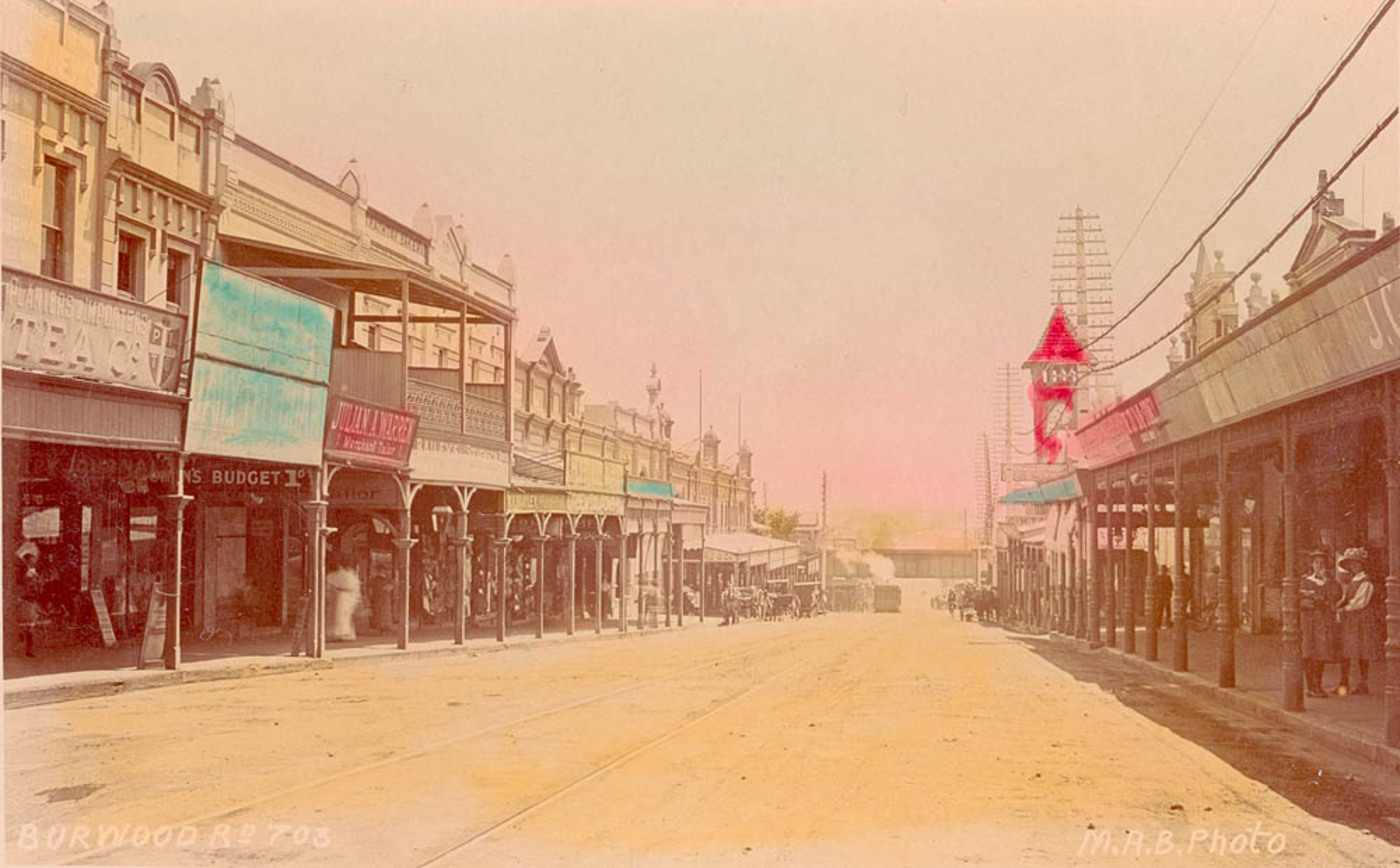
Burwood is a suburb in the Inner West of Sydney, in the state of New South Wales, Australia. It is west of the Sydney central business district and is the administrative centre for the Local government in Australia, local government area of Municipality of Burwood. Burwood Heights, New South Wales, Burwood Heights is a separate suburb to the south. The Appian Way, Burwood, Appian Way is a street in Burwood, known for its architecturally designed Federation architecture, Federation-style homes. History Archaeological evidence indicates people were living in the Sydney area for at least 11,000 years. This long association had led to a harmonious relationship between the Indigenous peoples, indigenous inhabitants and their environment, which was interrupted by the arrival of the British in 1788. The European desire to cultivate the land aided and abetted by a smallpox epidemic that forced the local people, the Wangal people, Wangal clan, away from their source of food and their ... [...More Info...] [...Related Items...] OR: [Wikipedia] [Google] [Baidu] |
Croydon, New South Wales
Croydon is a suburb in the Inner West of Sydney, in the state of New South Wales, Australia. It is located west of the Sydney central business district. Croydon is split between the two Local government in Australia, local government areas of Municipality of Burwood and the Inner West Council. The suburb is nestled between the commercial centres of Ashfield, New South Wales, Ashfield and Burwood, New South Wales, Burwood. It is bounded by Parramatta Road to the north, Iron Cove Creek to the east, Arthur Street to the south and a number of different streets to the west. To the north are Kings and Canada Bays on the closest reach of the Parramatta River, to the northwest is Concord Hospital and the Olympic Games complex at Homebush Bay, New South Wales, Homebush Bay. To the south is Canterbury, New South Wales, Canterbury Racecourse. The suburb shares its name with Croydon, a large district and borough in the south of London in the United Kingdom. The traditional owners of the la ... [...More Info...] [...Related Items...] OR: [Wikipedia] [Google] [Baidu] |
Croydon Park, New South Wales
Croydon Park is a suburb in the Inner West of Sydney, in the state of New South Wales, Australia. Croydon Park is 10 kilometres south-west of the Sydney central business district and is divided between the Local government in Australia, local government areas of the City of Canterbury-Bankstown, Municipality of Burwood and Inner West Council. Croydon, New South Wales, Croydon is a separate suburb, to the north. Croydon Park has a commercial shopping strip along Georges River Road and is in proximity to larger shopping and town centres of Burwood, New South Wales, Burwood, Ashfield, New South Wales, Ashfield and Campsie, New South Wales, Campsie. Croydon Park is relatively large compared to neighbouring suburbs. It is largely residential, but has a commercial strip along Georges River Road, a local arterial that runs through the centre of the suburb. History Croydon Park was originally part of the territory of the Darug people, Darug tribe which occupied much of Sydney. More s ... [...More Info...] [...Related Items...] OR: [Wikipedia] [Google] [Baidu] |
Enfield, New South Wales
Enfield is a suburb in the Inner West of Sydney, in the state of New South Wales, Australia. It is 11 kilometres south-west of the Sydney central business district in the Local government in Australia, local government area of Municipality of Burwood. History The suburb is named after Enfield, London, Enfield, a suburb of London, England. Aboriginal culture Before the arrival of the First Fleet in 1788, the Enfield area belonged to the Wangal people, a clan of the Eora tribe, which covered most of Sydney. In the early years, the Eora people were badly affected by smallpox, which arrived with the British. Many of the clans became unsustainably small and the survivors formed new bands who lived where they could. While it would be wrong to say that the local indigenous population gave no resistance to British land claims (Pemulwuy being a notable example), within thirty years or so of the colony's establishment, most of the land in the inner-west had been conceded to British set ... [...More Info...] [...Related Items...] OR: [Wikipedia] [Google] [Baidu] |
Suburb
A suburb (more broadly suburban area) is an area within a metropolitan area. They are oftentimes where most of a metropolitan areas jobs are located with some being predominantly residential. They can either be denser or less densely populated than the city and can have a higher or lower rate of detached single family homes than the city as well. Suburbs can have their own political or legal jurisdictions, especially in the United States, but this is not always the case, especially in the United Kingdom, where most suburbs are located within the administrative boundaries of cities. In most English-speaking world, English-speaking countries, suburban areas are defined in contrast to core city, central city or inner city areas, but in Australian English and South African English, ''suburb'' has become largely synonymous with what is called a "neighborhood" in the U.S. Due in part to historical trends such as white flight, some suburbs in the United States have a higher population ... [...More Info...] [...Related Items...] OR: [Wikipedia] [Google] [Baidu] |
Inner West
The Inner West of Sydney is an area directly west of the Sydney central business district, New South Wales, Australia. The suburbs that make up the Inner West are predominantly located along the southern shore of Port Jackson (Parramatta River), stretching south to the shores of the Cooks River. The western boundary of the Inner West is approximately the A3 arterial road (Homebush Bay Drive / Centenary Drive), which divides the Inner West from the Greater Western Sydney region. The Inner West is much larger than the Inner West Council local government area. The Inner West roughly corresponds with the Parish of Petersham and Parish of Concord, two cadastral divisions used for land titles. Suburbs The boundaries of the Inner West region are customary, not administrative or legal, and as such are defined differently in different contexts. The northern and southern boundaries are natural and thus generally well defined: they are the Parramatta River and the Cooks River res ... [...More Info...] [...Related Items...] OR: [Wikipedia] [Google] [Baidu] |
Sydney
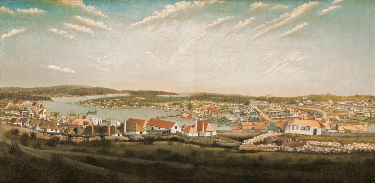
Sydney is the capital city of the States and territories of Australia, state of New South Wales and the List of cities in Australia by population, most populous city in Australia. Located on Australia's east coast, the metropolis surrounds Sydney Harbour and extends about 80 km (50 mi) from the Pacific Ocean in the east to the Blue Mountains (New South Wales), Blue Mountains in the west, and about 80 km (50 mi) from Ku-ring-gai Chase National Park and the Hawkesbury River in the north and north-west, to the Royal National Park and Macarthur, New South Wales, Macarthur in the south and south-west. Greater Sydney consists of 658 suburbs, spread across 33 local government areas. Residents of the city are colloquially known as "Sydneysiders". The estimated population in June 2024 was 5,557,233, which is about 66% of the state's population. Estimated resident population, 30 June 2017. The city's nicknames include the Emerald City and the Harbour City. There is ev ... [...More Info...] [...Related Items...] OR: [Wikipedia] [Google] [Baidu] |


