|
Bungotakada, Ōita
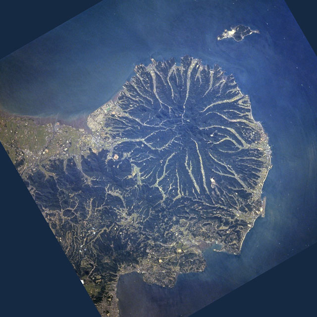
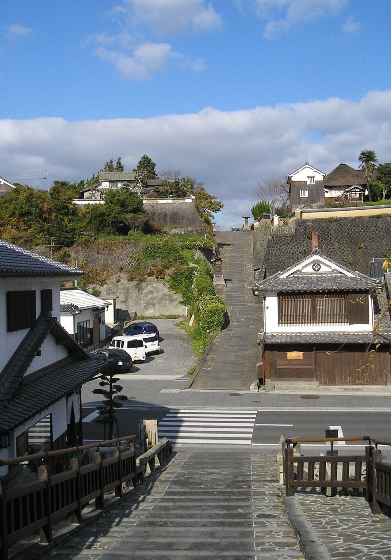
is a Cities of Japan, city located in Ōita Prefecture, Kyushu, Japan. , the city had an estimated population of 21,980 in 11038 households, and a population density of 96 persons per km². The total area of the city is . Geography Bungotakada is located in the western part of the Kunisaki Peninsula in northern Ōita Prefecture, facing the Gulf of Suō at the edge of the Seto Inland Sea. The city center is located in the Takada area, which stretches across the plains along the Katsura River (:ja: 桂川 (大分県), 桂川, ''Katsura-gawa'') and was once a prosperous shipping and commercial town. It is located approximately 30 minutes by car from Nakatsu, Ōita, Nakatsu City and approximately one hour by car from the prefectural capital, Ōita (city), Ōita City. In the Tamatsu district in the north of the city center, there is a hilly area which is the site of the former Takada Castle. Its ''jōkamachi'' castle town was developed from the Edo period onwards. Moving in the ... [...More Info...] [...Related Items...] OR: [Wikipedia] [Google] [Baidu] |
Cities Of Japan
A is a local Public administration, administrative unit in Japan. Cities are ranked on the same level as and , with the difference that they are not a component of . Like other contemporary administrative units, they are defined by the Local Autonomy Law of 1947. City status Article 8 of the Local Autonomy Law sets the following conditions for a municipality to be designated as a city: *Population must generally be 50,000 or greater (原則として人口5万人以上) *At least 60% of households must be established in a central urban area (中心市街地の戸数が全戸数の6割以上) *At least 60% of households must be employed in commerce, industry or other urban occupations (商工業等の都市的業態に従事する世帯人口が全人口の6割以上) *Any other conditions set by prefectural ordinance must be satisfied (他に当該都道府県の条例で定める要件を満たしていること) The designation is approved by the prefectural governor and t ... [...More Info...] [...Related Items...] OR: [Wikipedia] [Google] [Baidu] |
Humid Subtropical Climate
A humid subtropical climate is a subtropical -temperate climate type, characterized by long and hot summers, and cool to mild winters. These climates normally lie on the southeast side of all continents (except Antarctica), generally between latitudes 25° and 40° and are located poleward from adjacent tropical climates, and equatorward from either humid continental (in North America and Asia) or oceanic climates (in other continents). It is also known as warm temperate climate in some climate classifications. Under the Köppen climate classification, ''Cfa'' and ''Cwa'' climates are either described as humid subtropical climates or warm temperate climates. This climate features mean temperature in the coldest month between (or ) and and mean temperature in the warmest month or higher. However, while some climatologists have opted to describe this climate type as a "humid subtropical climate", Köppen himself never used this term. The humid subtropical climate classific ... [...More Info...] [...Related Items...] OR: [Wikipedia] [Google] [Baidu] |
Usa, Ōita
is a city located in Ōita Prefecture, Japan. , the city had an estimated population of 52,808 in 26026 households, and a population density of 120 persons per km2. The total area of the city is . It is notable for Usa Jingū, the head shrine of all 40,000 Hachiman shrines across Japan. Geography Usa is located on the northern base of the Kunisaki Peninsula and faces the Gulf of Suō to the north, Nakatsu City to the west, Kusu Town and Yufu City to the south, and Kitsuki City and Bungotakada City to the east. Three districts have traditionally been economic and cultural centers: the Usa district (particularly Minami-Usa), which developed as the shrine town associated with Usa Jingū (also known as the Usa Shrine), the Yokkaichi district, which developed as the temple town of Hongan-ji Temple and administrative center, and the Nagasu district, which developed as a port town. Neighboring municipalities Ōita Prefecture * Beppu * Bungo-Takada * Hiji * Kitsuki * Kusu * ... [...More Info...] [...Related Items...] OR: [Wikipedia] [Google] [Baidu] |
Kunisaki, Ōita
is a small coastal city located in Ōita Prefecture, Kyushu, Japan. , the city had an estimated population of 25,721 in 13082 households, and a population density of 81 persons per km². The total area of the city is . Geography Kunisaki covers the northeastern part of Ōita Prefecture and almost the eastern half of the Kunisaki Peninsula (excluding the southeastern part), and faces the Gulf of Iyo on the Seto Inland Sea to the north and east. Settlements are scattered in areas near the sea, and the city center is located near the sea in the central eastern part of the city. The western part of the city is located in the central part of the Kunisaki Peninsula and is mountainous. The city center is located approximately 60 km by road (approximately 40 km in a straight line) from Ōita City, the prefectural capital. Neighboring municipalities Ōita Prefecture * Bungo-Takada * Kitsuki Mountains * Mount Fudo (or Hudo) * Mount Futago (Futago-san) at 720m and the tallest * Moun ... [...More Info...] [...Related Items...] OR: [Wikipedia] [Google] [Baidu] |
Kitsuki, Ōita
file:杵築市役所.jpg, 270px, Kitsuki City Hall is a Cities of Japan, city located in Ōita Prefecture, Japan. , the city had an estimated population of 26,761 in 13199 households, and a population density of 96 persons per km2. The total area of the city is . Geography Kitsuki is located in east-central Ōita Prefecture at the southern tip of the Kunisaki Peninsula, across Beppu Bay from the prefectural capital at Ōita City. By land, it is approximately 35 kilometers from the center of Ōita City. The northern and western parts of the city are mountainous. Tateishi Pass, adjacent to Usa City, is the border between the former Bungo Province and Buzen Province. Neighboring municipalities Ōita Prefecture *Bungotakada, Ōita, Bungo-Takada *Hiji, Ōita, Hiji *Kunisaki, Ōita, Kunisaki *Usa, Ōita, Usa Climate Kitsuki has a humid subtropical climate (Köppen climate classification ''Cfa'') with hot summers and cool winters. Precipitation is significant throughout the year, ... [...More Info...] [...Related Items...] OR: [Wikipedia] [Google] [Baidu] |
Place Of Scenic Beauty
is a collective term used by the Japanese government's Law for the Protection of Cultural Properties to denote Cultural Properties of JapanIn this article, capitals indicate an official designation as opposed to a simple definition, e.g "Cultural Properties" as opposed to "cultural properties". as historic locations such as shell mounds, ancient tombs, sites of palaces, sites of forts or castles, monumental dwelling houses and other sites of high historical or scientific value; gardens, bridges, gorges, mountains, and other places of great scenic beauty; and natural features such as animals, plants, and geological or mineral formations of high scientific value. Designated monuments of Japan The government ''designates'' (as opposed to '' registers'') "significant" items of this kind as Cultural Properties (文化財 ''bunkazai'') and classifies them in one of three categories: * * , * . Items of particularly high significance may receive a higher classification as: * * * , ... [...More Info...] [...Related Items...] OR: [Wikipedia] [Google] [Baidu] |


