|
Bruce Bolt
Bruce Bolt (February 15, 1930 – July 21, 2005) was an Australian-born American seismologist and a professor of earth and planetary science at the University of California, Berkeley. Professor Bolt was known as a pioneer of seismic engineering. He served for 15 years on the California Seismic Safety Commission leading public debate on earthquake safety in that state, and acted as a consultant on major projects throughout the world. As well, Bolt published a number of popular and technical books on seismology. His research led to construction of earthquake resilient bridges and buildings. Bolt was elected to the National Academy of Engineering "for application of the principles of seismology and applied mathematics to engineering decisions and public policy". Since 2006, there is an award with his name, the Bruce A. Bolt Medal, to recognize individuals worldwide whose accomplishments involve the promotion and use of strong-motion earthquake data and whose leadership in the tra ... [...More Info...] [...Related Items...] OR: [Wikipedia] [Google] [Baidu] |
Largs, New South Wales
Largs is a developing township adjacent to Bolwarra Heights and is a suburb in the City of Maitland in the Hunter Region of New South Wales, Australia. It is located on the eastern side of the Hunter River, 6 km north of the Maitland CBD. As of 2018, the Maitland LGA is seeing new development along elevated areas adjacent to the river flood plain. Maitland is an established city. Schools and all normal community facilities are available. The City of Maitland covers an area of 390 square kilometres. Name Largs was named in honour of Largs Ayrshire, Scotland, famous for the battle of Largs fought in 1263, and which secured the freedom and independence of Scotland against the invasion of the Norwegians. History The traditional owners and custodians of the Maitland area are the Wonnarua people. In the pioneering days, Largs was established by Cedar getters, before the Lang family settlement in 1821. Largs was industrially important, as it became a river port and boat-buildi ... [...More Info...] [...Related Items...] OR: [Wikipedia] [Google] [Baidu] |
Berkeley Seismological Laboratory
The Berkeley Seismological Laboratory (BSL) is a research lab at the Department of Geology at the University of California, Berkeley. It was created from the Berkeley Seismographic Stations, a site on the Berkeley campus where Worldwide Standard Seismographic Network instruments were first deployed in 1959. Today, BSL's mission is to "support fundamental research into all aspects of earthquakes, solid earth processes, and their effects on society". An experimental early warning system developed by BSL issued a warning 10 seconds before the 6.0 magnitude earthquake that hit the Napa region on August 24, 2014. Such a warning system could potentially give people time to take cover in the event of a quake, preventing injuries caused by falling debris, automatically stopping trains or shutting off gas lines. The system, developed in conjunction with the United States Geological Survey (USGS), the California Institute of Technology and the University of Washington, will eventually co ... [...More Info...] [...Related Items...] OR: [Wikipedia] [Google] [Baidu] |
San Francisco Bay
San Francisco Bay (Chochenyo language, Chochenyo: 'ommu) is a large tidal estuary in the United States, U.S. state of California, and gives its name to the San Francisco Bay Area. It is dominated by the cities of San Francisco, California, San Francisco, San Jose, California, San Jose, and Oakland, California, Oakland. The San Francisco Bay drains water from approximately 40 percent of California. Water from the Sacramento River, Sacramento and San Joaquin River, San Joaquin rivers, and from the Sierra Nevada mountains, flow into Suisun Bay, which then travels through the Carquinez Strait to meet with the Napa River at the entrance to San Pablo Bay, which connects at its south end to San Francisco Bay. It then connects to the Pacific Ocean via the Golden Gate strait. However, this entire group of interconnected bays is often called the ''San Francisco Bay''. The bay was designated a Ramsar Convention, Ramsar Wetland of International Importance on February 2, 2013, and the Port ... [...More Info...] [...Related Items...] OR: [Wikipedia] [Google] [Baidu] |
Bay Area Rapid Transit
Bay Area Rapid Transit (BART) is a rapid transit system serving the San Francisco Bay Area in California. BART serves 50 stations along six routes and of track, including eBART, a spur line running to Antioch, and Oakland Airport Connector, a automated guideway transit line serving Oakland International Airport. With an average of weekday passenger trips as of and annual passenger trips in , BART is the seventh-busiest rapid transit system in the United States. BART is operated by the San Francisco Bay Area Rapid Transit District which formed in 1957. The initial system opened in stages from 1972 to 1974. The system has been extended several times, most recently in 2020, when Milpitas and Berryessa/North San José stations opened as part of the under construction Silicon Valley BART extension in partnership with the Santa Clara Valley Transportation Authority (VTA). Services BART serves large portions of its three member counties – San Francisco, Alameda, a ... [...More Info...] [...Related Items...] OR: [Wikipedia] [Google] [Baidu] |
Trans-Alaska Pipeline System
The Trans-Alaska Pipeline System (TAPS) is an oil transportation system spanning Alaska, including the trans-Alaska crude-oil pipeline, 12 pump stations, several hundred miles of feeder pipelines, and the Valdez Marine Terminal. TAPS is one of the world's largest pipeline systems. The core pipeline itself, which is commonly called the Alaska pipeline, trans-Alaska pipeline, or Alyeska pipeline, (or the pipeline as referred to by Alaskan residents), is an long, diameter pipeline that conveys oil from Prudhoe Bay, on Alaska's North Slope, south to Valdez, on the shores of Prince William Sound in southcentral Alaska. The crude oil pipeline is privately owned by the Alyeska Pipeline Service Company. Oil was first discovered in Prudhoe Bay in 1968 and the 800 miles of 48" steel pipe was ordered from Japan in 1969 (U.S. steel manufacturers did not have the capacity at that time). However, construction was delayed for nearly 5 years due to legal and environmental issues. The ... [...More Info...] [...Related Items...] OR: [Wikipedia] [Google] [Baidu] |
Aswan Dam
The Aswan Dam, or Aswan High Dam, is one of the world's largest embankment dams, which was built across the Nile in Aswan, Egypt, between 1960 and 1970. When it was completed, it was the tallest earthen dam in the world, surpassing the Chatuge Dam in the United States. The dam, which created the Lake Nasser reservoir, was built upstream of the Aswan Low Dam, which had been completed in 1902 and was already at its maximum utilization. Construction of the High Dam became a key objective of the military regime that took power following the 1952 Egyptian revolution. With its ability to better control flooding, provide increased water storage for irrigation and generate hydroelectricity, the dam was seen as pivotal to Egypt's planned industrialization. Like the earlier implementation, the High Dam has had a significant effect on the Economy of Egypt, economy and culture of Egypt. Before the High Dam was built, even with the old dam in place, the annual flooding of the Nile during la ... [...More Info...] [...Related Items...] OR: [Wikipedia] [Google] [Baidu] |
Diablo Canyon Power Plant
The Diablo Canyon Power Plant is a nuclear power plant near Avila Beach in San Luis Obispo County, California. Following the permanent shutdown of the San Onofre Nuclear Generating Station in 2013, Diablo Canyon is now the only operational nuclear plant in California, as well as the state's largest single power station. It was the subject of controversy and protests during its construction, with nearly two thousand civil disobedience arrests in a two-week period in 1981. The plant has two Westinghouse-designed 4-loop pressurized-water nuclear reactors operated by Pacific Gas & Electric (PG&E). Together, the twin 1100 MWe reactors produce about 18,000 GW·h of electricity annually (8.6% of total California generation and 23% of carbon-free generation), supplying the electrical needs of more than 3 million people. The plant produces electricity for about 6 cents per kWh, less than the average cost of 10.1 cents per kWh that PG&E paid for electricity from othe ... [...More Info...] [...Related Items...] OR: [Wikipedia] [Google] [Baidu] |
Golden Gate Park
Golden Gate Park is an urban park between the Richmond District, San Francisco, Richmond and Sunset District, San Francisco, Sunset districts on the West Side (San Francisco), West Side of San Francisco, California, United States. It is the List of parks in San Francisco, largest urban park in the city, containing , and the third-most visited urban park in the United States, with an estimated 24 million visitors annually. The creation of a large park in San Francisco was first proposed in the 1860s. In 1865, landscape architect Frederick Law Olmsted proposed a park designed with species native to San Francisco. The plan was rejected for a Central Park-style park designed by engineer William Hammond Hall. The park was built atop shore and sand dunes in an unincorporated area known as the Outside Lands. Construction centered on planting trees and non-native grasses to stabilize the dunes that covered three-quarters of the park. The park opened in 1870. Main attractions inclu ... [...More Info...] [...Related Items...] OR: [Wikipedia] [Google] [Baidu] |
California Academy Of Sciences
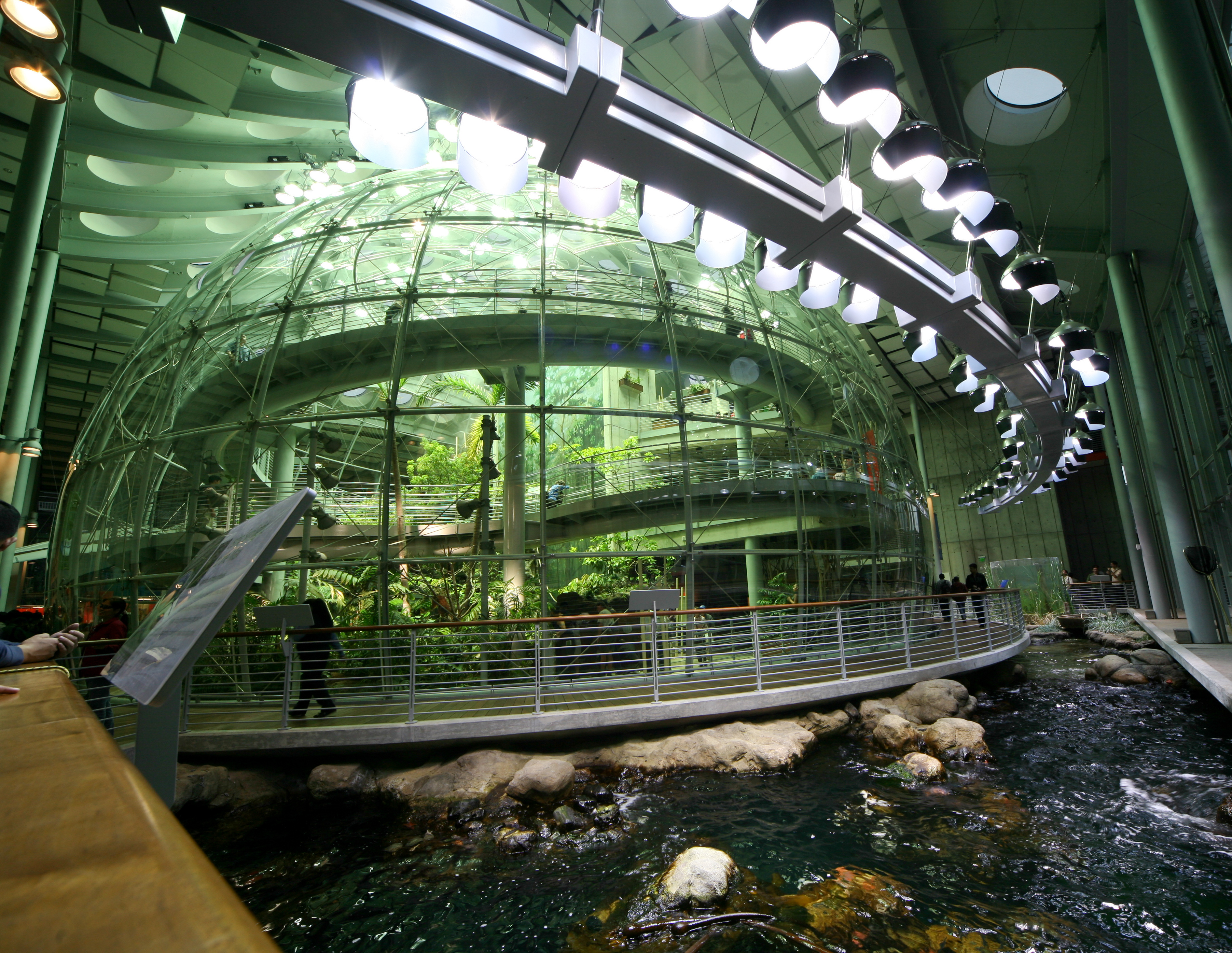
The California Academy of Sciences is a research institute and natural history museum in San Francisco, San Francisco, California, that is among the largest List of natural history museums, museums of natural history in the world, housing over 46 million specimens. The academy began in 1853 as a learned society and still carries out a large amount of original research. The institution is located in Golden Gate Park on the West Side (San Francisco), West Side of San Francisco. Completely rebuilt in 2008, the academy's primary building in Golden Gate Park covers . In early 2020, before the COVID-19 pandemic, the California Academy of Sciences had around 500 employees and an annual revenue of about $33 million. Governance The California Academy of Sciences, California's oldest operating museum and research institution for the natural sciences, is governed by a 41-member board of trustees who are nominated and chosen by the California Academy of Sciences Fellows. The Academy Fello ... [...More Info...] [...Related Items...] OR: [Wikipedia] [Google] [Baidu] |
Marin County, California
Marin County ( ) is a County (United States), county located in the northwestern part of the San Francisco Bay Area of the U.S. state of California. As of the 2020 United States census, 2020 census, the population was 262,231. Its county seat and largest city is San Rafael, California, San Rafael. Marin County is across the Golden Gate Bridge from San Francisco, and is included in the San Francisco–Oakland–Berkeley, CA Metropolitan Statistical Area. Marin County's natural sites include the Muir Woods Sequoia sempervirens, redwood forest, the Marin Headlands, Stinson Beach, CA, Stinson Beach, the Point Reyes National Seashore, and Mount Tamalpais. Marin is one of the List of highest-income counties in the United States, highest-income counties by per capita income and median household income. The county is governed by the Marin County Board of Supervisors. The Marin County Civic Center was designed by Frank Lloyd Wright and draws thousands of visitors a year to guided tours ... [...More Info...] [...Related Items...] OR: [Wikipedia] [Google] [Baidu] |
Olema, California
Olema (Miwok: ''Olemaloke'') is an unincorporated community in Marin County, California. It is located on Olema Creek south-southeast of Point Reyes Station, at an elevation of 69 feet (21 m). Olema is along State Route 1 at its intersection with Sir Francis Drake Boulevard, on the eastern edge of the Point Reyes Peninsula in the western part of Marin County. The name Olema comes from the Coast Miwok placename meaning "coyote valley". Olema was once thought to be the epicenter of the 1906 San Francisco earthquake due the fact that the San Andreas Fault runs in very close proximity to the town, and due to the huge rifts surrounding the fault still visible via a nearby hiking path. There are historical references to this in and around the town, including at shops and restaurants. However, more recent evidence suggests that a location offshore of Daly City is more likely the epicenter. Olema was also the title subject of the late-1960s country-rock song "Hippie from Olema ... [...More Info...] [...Related Items...] OR: [Wikipedia] [Google] [Baidu] |


