|
Brookline, Pennsylvania
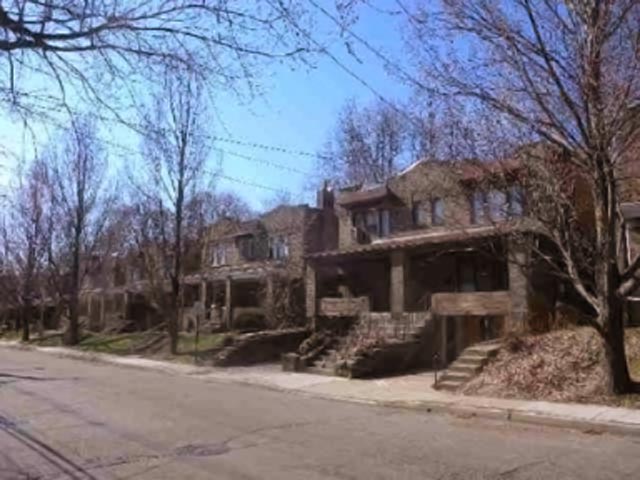
Brookline is an Unincorporated area, unincorporated community in Haverford Township, Delaware County, Pennsylvania, Haverford Township in Delaware County, Pennsylvania, Delaware County, Pennsylvania, United States. Its boundaries are approximately between Mill Road and Manoa Road on its North and South side and Darby Road and Earlington Road on its West and East sides. It neighbors the unincorporated communities of Llanerch, Pennsylvania, Llanerch, Oakmont, Haverford Township, Pennsylvania, Oakmont, Beechwood, Penfield, Haverford Township, Pennsylvania, Penfield, Woodmere Park, and Chatham Park in Haverford. It is a commuting suburb of Philadelphia. Brookline and Oakmont together are considered the town center of Haverford. History The land that would become Brookline was originally owned, at the time of William Penn and the Welsh Tract, by Lewis David in 1681. The land was sold to William Powell and Henry Lewis in 1682. The indication of land ownership shortly before the plannin ... [...More Info...] [...Related Items...] OR: [Wikipedia] [Google] [Baidu] |
List Of Countries
The following is a list providing an overview of sovereign states around the world with information on their status and recognition of their sovereignty. The 205 listed states can be divided into three categories based on membership within the United Nations System: 193 member states of the United Nations, UN member states, two United Nations General Assembly observers#Current non-member observers, UN General Assembly non-member observer states, and ten other states. The ''sovereignty dispute'' column indicates states having undisputed sovereignty (188 states, of which there are 187 UN member states and one UN General Assembly non-member observer state), states having disputed sovereignty (15 states, of which there are six UN member states, one UN General Assembly non-member observer state, and eight de facto states), and states having a political status of the Cook Islands and Niue, special political status (two states, both in associated state, free association with New ... [...More Info...] [...Related Items...] OR: [Wikipedia] [Google] [Baidu] |
Philadelphia And Western Railroad
The Philadelphia and Western Railroad was a high-speed, third rail-equipped, commuter-hauling interurban electric railroad operating in the western suburbs of Philadelphia, Pennsylvania. It is now SEPTA, SEPTA's Norristown High Speed Line, though the Strafford, Pennsylvania, Strafford spur has been abandoned. Part of the abandoned line within Radnor Township, Pennsylvania, Radnor Township is now the Radnor Trail, a multi-use path or rail trail. Lines The current line runs from 69th Street Terminal just west of Philadelphia, west and north to Norristown, Pennsylvania, Norristown, splitting from the original main line at Villanova (SEPTA Route 100 station), Villanova Junction. P&W's previous main line went west to a terminus just east of Sugartown Road in Strafford, Pennsylvania, Strafford, then later, another further, on an extension providing transfer to the Strafford (SEPTA station), Strafford station and a transfer track for freight trains. The Strafford Branch was abandoned ... [...More Info...] [...Related Items...] OR: [Wikipedia] [Google] [Baidu] |
Unincorporated Communities In Delaware County, Pennsylvania
Unincorporated may refer to: * Unincorporated area, land not governed by a local municipality * Unincorporated entity, a type of organization * Unincorporated territories of the United States, territories under U.S. jurisdiction, to which Congress has determined that only select parts of the U.S. Constitution apply * Unincorporated association Unincorporated association refers to a group of people in common law jurisdictions—such as the United Kingdom, Canada, and New Zealand—who organize around a shared purpose without forming a corporation or similar legal entity. Unlike in some ..., also known as voluntary association, groups organized to accomplish a purpose * ''Unincorporated'' (album), a 2001 album by Earl Harvin Trio {{disambig ... [...More Info...] [...Related Items...] OR: [Wikipedia] [Google] [Baidu] |
Census
A census (from Latin ''censere'', 'to assess') is the procedure of systematically acquiring, recording, and calculating population information about the members of a given Statistical population, population, usually displayed in the form of statistics. This term is used mostly in connection with Population and housing censuses by country, national population and housing censuses; other common censuses include Census of agriculture, censuses of agriculture, traditional culture, business, supplies, and traffic censuses. The United Nations (UN) defines the essential features of population and housing censuses as "individual enumeration, universality within a defined territory, simultaneity and defined periodicity", and recommends that population censuses be taken at least every ten years. UN recommendations also cover census topics to be collected, official definitions, classifications, and other useful information to coordinate international practices. The United Nations, UN's Food ... [...More Info...] [...Related Items...] OR: [Wikipedia] [Google] [Baidu] |
Beechwood–Brookline Station
Beechwood–Brookline station is a SEPTA Metro rapid transit station in Haverford Township, Pennsylvania. It serves the M and is located at Edgewood and Strathmore Roads, although SEPTA gives the address as Beechwood and Karakung Drives. All trains stop at Beechwood–Brookline. The station lies from 69th Street Transit Center. It serves the walkable, pre-War neighborhoods of Beechwood and Brookline. It is also situated closely to Haverford's middle and high schools. The station has off-street parking available. The land use around the station is single-family residential and recreation. There is a small shopping district on Edgewood Road in the Brookline/Penfield neighborhoods. It has the third highest boardings of Haverford Township stations, after Ardmore Junction and Penfield, taking 5 minutes to arrive at 69th Street Transportation Center. 69% of commuters parking at the station live within a mile of the station and 36% live within a half mile. There is no bicycle infrast ... [...More Info...] [...Related Items...] OR: [Wikipedia] [Google] [Baidu] |
Llanerch Public School
Llanerch Public School, also known as Llanerch Grammar School, is a former school established in 1913 that operated in the Llanerch neighborhood of Havertown, Pennsylvania. It is on the National Register of Historic Places listings in Delaware County, Pennsylvania, National Register of Historic Places in Delaware County, Pennsylvania. It is built in the Georgian Revival architectural style. It is not to be confused with the Llanerch School that served as Haverford Township School District's high school from 1905 to 1910, which occupied the same site that the former was built on. History The Llanerch School was built in 1913, and served as a public school for residents of Llanerch, Pennsylvania. Shortly after its opening, in 1913, Justice of the peace#United States, Justice of the Peace William B. Cowan struck his head on a pipe and fell on his chin, resulting in his death, while trying to relight a fire for the chimney of the building for the new students and teachers, who were ... [...More Info...] [...Related Items...] OR: [Wikipedia] [Google] [Baidu] |
School District Of Haverford Township
The School District of Haverford Township is a school district in Haverford Township, Delaware County, Pennsylvania, United States. It was created in 1944. The district serves all parts of the township, including Havertown. The current superintendent as of October, 2022 is Dr. Maureen Reusche. Schools Secondary schools High school * Haverford High School Haverford Senior High School is the public high school of Haverford Township, Pennsylvania, Haverford Township, Pennsylvania, United States, operated by the School District of Haverford Township. It is at 200 Mill Road in Havertown, Pennsylvania ... Middle school * Haverford Middle School Elementary schools * Chatham Park Elementary School * Chestnutwold Elementary School * Coopertown Elementary School * Lynnewood Elementary School * Manoa Elementary School Former schools *Brookline Elementary School * Llanerch Elementary School *Oakmont Elementary School References External links * {{Authority control Haver ... [...More Info...] [...Related Items...] OR: [Wikipedia] [Google] [Baidu] |
Brookline Country Club
The Country Club, located in Brookline, Massachusetts, is the oldest golf-oriented country club in the United States. (The Philadelphia Cricket Club, founded in 1854, was the first country club for any sport.) It holds an important place in golf history, as it is one of the five charter clubs that founded the United States Golf Association and has hosted numerous USGA tournaments, including the 1913 U.S. Open won by then-unknown Francis Ouimet. Although the club has 1300 members, it is known for its exclusivity. History On January 14, 1882, a group of men from Boston met to form the club. The club is listed on the USGA's list of the first 100 clubs in America. The original club was focused on horseback-riding and other outdoor activities; the golf course was not built until 1893. For several years there were conflicts between golfers and other club members over land use; in fact the original golf course overlapped with the pre-existing race track. The golf course itself gre ... [...More Info...] [...Related Items...] OR: [Wikipedia] [Google] [Baidu] |
Haverford Historic Society - PSTC-Brookline-Blvd-Center-Door-19610604-HTHS
Haverford may refer to: *Haverford College, a coeducational, undergraduate liberal arts college in Haverford, Pennsylvania *The Haverford School, a private, all-boys preparatory day school in Haverford, Pennsylvania *Haverford High School, a public high school serving all of Haverford Township, Pennsylvania *Haverford, Pennsylvania, a town partly in both Haverford and Lower Merion Townships, Pennsylvania *Haverford Township, Pennsylvania, a township of Delaware County, west of Philadelphia * SS ''Haverford'', an American transatlantic liner used in World War I *Tom Haverford, a ''Parks and Recreation'' character played by Aziz Ansari See also *Havertown, Pennsylvania, the name created to designate ZIP Code 19083, the area of which is wholly within, and a portion of, Haverford Township *Haverfordwest Haverfordwest ( , ; ) is the county town of Pembrokeshire, Wales, and the most populous urban area in Pembrokeshire with a population of 14,596 in 2011. It is also a Community (Wal ... [...More Info...] [...Related Items...] OR: [Wikipedia] [Google] [Baidu] |
Streetcar Suburb
A streetcar suburb is a residential community whose growth and development was strongly shaped by the use of streetcar lines as a primary means of transportation. Such suburbs developed in the United States in the years before the automobile, when the introduction of the electric trolley or streetcar allowed the nation’s burgeoning middle class to move beyond the central city’s borders. Early suburbs were served by horsecars, but by the late 19th century Cable car (railway), cable cars and electric streetcars, or trams, were used, allowing residences to be built farther away from the inner city, urban core of a city. Streetcar suburbs, usually called additions or extensions at the time, were the forerunner of today's suburbs in the United States and Canada. San Francisco's Western Addition, San Francisco, Western Addition is one of the best examples of streetcar suburbs before westward and southward expansion occurred. Although most closely associated with the electric streetc ... [...More Info...] [...Related Items...] OR: [Wikipedia] [Google] [Baidu] |
Center City, Philadelphia
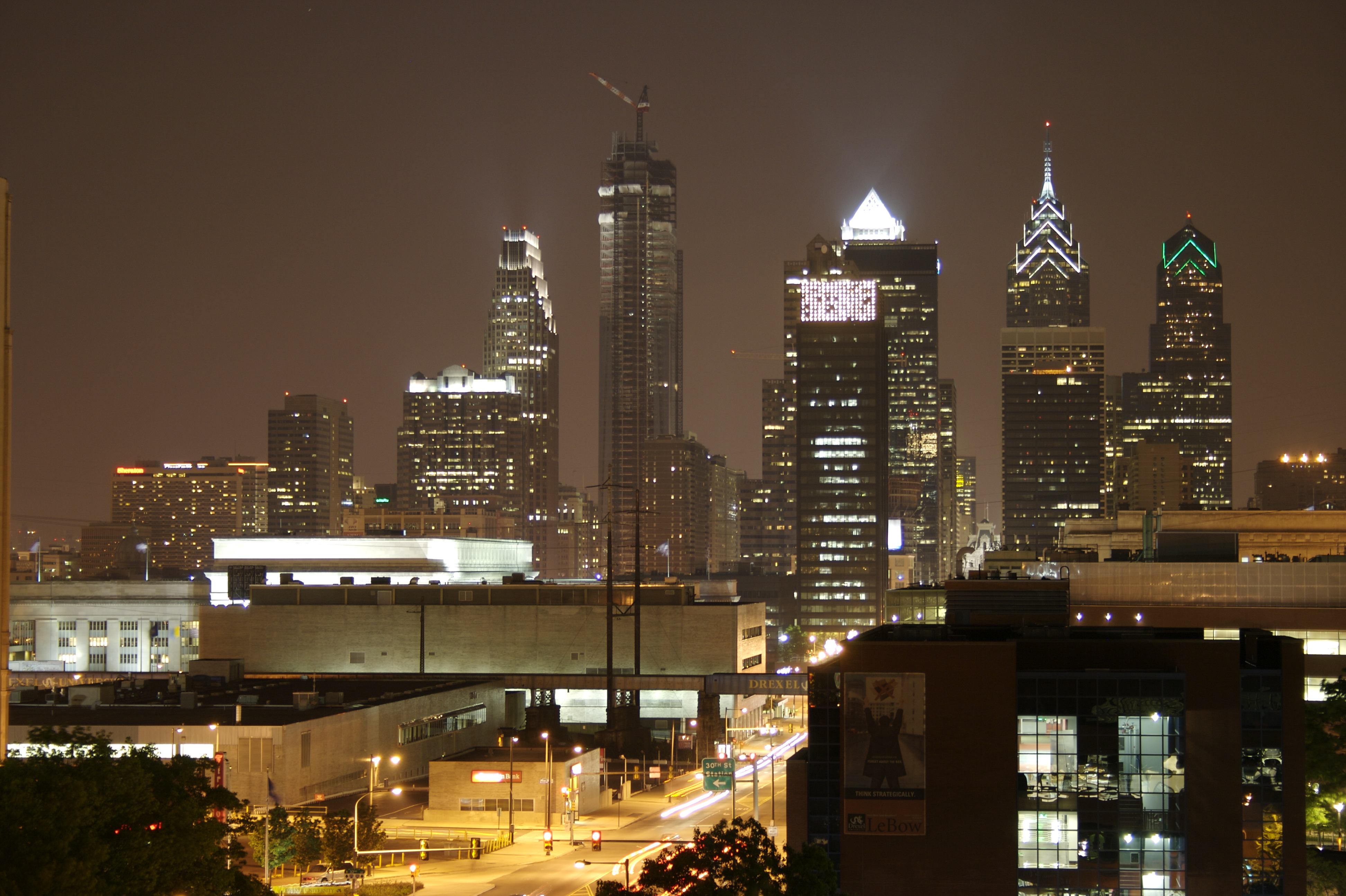
Center City includes the central business district and central neighborhoods of Philadelphia, Pennsylvania, United States. It comprises the area that made up the City of Philadelphia prior to the Act of Consolidation, 1854, which extended the city borders to be coterminous with Philadelphia County, Pennsylvania, Philadelphia County. The area has grown to the second-most densely populated downtown area in the United States (after Midtown Manhattan in New York City), with an estimated 202,000 residents in 2020 and a population density of 26,234 per square mile. Geography Boundaries Center City is bounded by South Street (Philadelphia), South Street to the south, the Delaware River to the east, the Schuylkill River to the west, and Vine Street to the north. The district occupies the old boundaries of the City of Philadelphia before Act of Consolidation, 1854, the city was made coterminous with Philadelphia County in 1854. The Center City District, which has special powers of taxa ... [...More Info...] [...Related Items...] OR: [Wikipedia] [Google] [Baidu] |


