|
Broadmeadows, Victoria
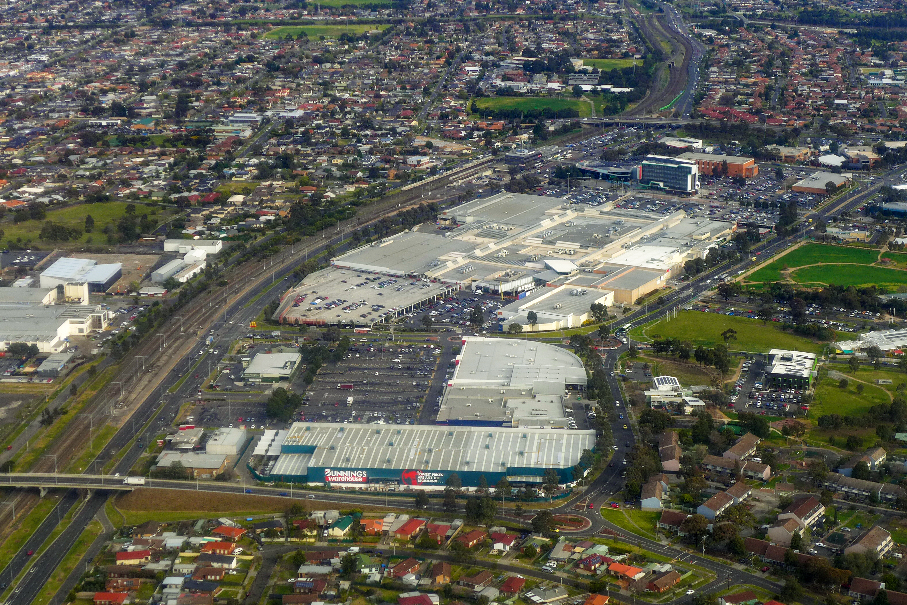
Broadmeadows is a suburb in Melbourne, Victoria (Australia), Victoria, Australia, north of Melbourne's Melbourne central business district, Central Business District and the council seat of the City of Hume Local government areas of Victoria, local government area. Broadmeadows recorded a population of 12,524 at the 2021 Australian census, 2021 census. It is colloquially known as "Broady". Broadmeadows is a sub-regional centre within the northern suburbs of Melbourne, and is often used as a reference for the suburbs around it, although this may be due to its City of Broadmeadows, former status as a municipality. History The Broadmeadows area, home to the Wurundjeri Indigenous Australians, Aboriginal nation prior to European settlement, was settled by pastoralists in the 1840s. The original Broadmeadows (aka "Old Broady") is now known as Westmeadows, Victoria, Westmeadows, which lies to the west of the present Broadmeadows. The first Broadmeadows township was laid out by a ... [...More Info...] [...Related Items...] OR: [Wikipedia] [Google] [Baidu] [Amazon] |
Electoral District Of Broadmeadows
The electoral district of Broadmeadows is an electorate of the Victorian Legislative Assembly. It covers an area of in outer northern Melbourne, and includes the suburbs of Broadmeadows, Victoria, Broadmeadows, Campbellfield, Victoria, Campbellfield, Coolaroo, Victoria, Coolaroo, Dallas, Victoria, Dallas, Fawkner, Victoria, Fawkner, Jacana, Victoria, Jacana and Meadow Heights, Victoria, Meadow Heights. It also includes parts of Glenroy, Victoria, Glenroy, Roxburgh Park, Victoria, Roxburgh Park, Somerton, Victoria, Somerton, and Westmeadows, Victoria, Westmeadows. It lies within the Northern Metropolitan Region of the upper house, the Victorian Legislative Council, Legislative Council. The seat was created in 1955, and though it was initially won by Liberal and Country member Harry Kane (politician), Harry Kane, has been a safe Labor seat for most of its history. Kane held the seat until his death in 1962, and was succeeded by Labor backbenchers John Wilton (Australian politicia ... [...More Info...] [...Related Items...] OR: [Wikipedia] [Google] [Baidu] [Amazon] |
2021 Australian Census
The 2021 Australian census, simply called the 2021 Census, was the eighteenth national Census of Population and Housing in Australia. The 2021 Census took place on 10 August 2021, and was conducted by the Australian Bureau of Statistics (ABS). It had a response rate of 96.1%, up from the 95.1% at the 2016 census. The total population of the Commonwealth of Australia was counted as 25,422,788, an increase of 8.6 per cent or 2,020,896 people over the previous 2016 census. Results from the 2021 census were released to the public on 28 June 2022 from the Australian Bureau of Statistics website. A small amount of additional 2021 census data was released in October 2022 and in 2023. Australia's next census is scheduled to take place in 2026. The census was undertaken during the COVID-19 pandemic. It therefore provided a clear snapshot of how the pandemic impacted Australian society. Overview In Australia, completing the census is compulsory for all people in Australia on census ... [...More Info...] [...Related Items...] OR: [Wikipedia] [Google] [Baidu] [Amazon] |
Cycling At The 1956 Summer Olympics
The cycling competition at the 1956 Summer Olympics in Melbourne consisted of two road cycling events and four track cycling events, all for men only. At the age of 16 years, 121 days, Pakistan's Saleem Farooqi was the youngest of the 161 cycling competitors. The oldest, Australia's Jim Nestor, was 36 years, 331 days old. Out of the 18 medals up for grabs, Italy took 5, followed by France with 4. Medal summary Road cycling Track cycling Participating nations 161 cyclists from 30 nations competed. * * * * * * * * * * * * * * * * * * * * * * * * * * * * * * Medal table References Events at the 1956 Summer Olympics 1956 Events January * January 1 – The Anglo-Egyptian Sudan, Anglo-Egyptian Condominium ends in Sudan after 57 years. * January 8 – Operation Auca: Five U.S. evangelical Christian Missionary, missionaries, Nate Saint, Roger Youderian, E ... 1950s in track cycling 1956 in road cycling 1956 in cycle r ... [...More Info...] [...Related Items...] OR: [Wikipedia] [Google] [Baidu] [Amazon] |
Pascoe Vale Road, Melbourne
Pascoe Vale Road is a major thoroughfare through the northern suburbs of Melbourne Melbourne ( , ; Boonwurrung language, Boonwurrung/ or ) is the List of Australian capital cities, capital and List of cities in Australia by population, most populous city of the States and territories of Australia, Australian state of Victori ..., connecting the outer northern fringe to the inner northern suburbs. Route Pascoe Vale Road starts at the intersection with Somerton Road in Coolaroo, Victoria, Coolaroo and runs south as a four-lane, dual-carriageway road until the underpass with Camp Road and Johnstone Street in Broadmeadows, Victoria, Broadmeadows, where it narrows to a four-lane, single-carriageway road. It continues south over the M80 Ring Road, Melbourne, Western Ring Road through Glenroy, Victoria, Glenroy, under CityLink and over the Craigieburn railway line through Strathmore, Victoria, Strathmore, until the intersection with Fletcher Street in Essendon, Victoria, Essendo ... [...More Info...] [...Related Items...] OR: [Wikipedia] [Google] [Baidu] [Amazon] |
Mickleham Road, Melbourne
Mickleham Road is a secondary road located in Victoria, Australia, north of Melbourne. Route Mickleham Road begins at an intersection with Donnybrook Road and Old Sydney Road in Mickleham, and continues south as a two-lane single-carriageway through Yuroke to the intersection with Somerton Road in Greenvale, widening to a four-lane dual-carriageway road and continues south through Attwood to a large roundabout intersection with Broadmeadows Road in Westmeadows. It widens to a six-lane dual-carriageway road through the suburbs of Gladstone Park and under the Tullamarine Freeway, narrowing back to a four-lane dual-carriageway road until reaching the intersection with Melrose Drive in Tullamarine, where it becomes Broadmeadows Road (which continues south to Sharps Road). History Mickleham Road was signed as Metropolitan Route 39 between Craigieburn Road in Yuroke and Melrose Drive in Tullamarine, in 1989. With Victoria's conversion to the newer alphanumeric system in th ... [...More Info...] [...Related Items...] OR: [Wikipedia] [Google] [Baidu] [Amazon] |
Housing Commission Of Victoria
The Housing Commission of Victoria (often shortened to Housing Commission, especially Colloquialism, colloquially) was a Government of Victoria body responsible for public housing in Victoria, Australia. It was established in 1938, and was abolished in 1984. The main activity of the commission was the construction tens of thousands of houses and flats in Melbourne and many country towns between the late 1940s and the early 70s, providing low rent housing for low income families. The most visible legacy of the commission is the 44 high-rise apartment towers in inner Melbourne, all built using the same pre-cast concrete panel technology as part of a major urban renewal. Many of the larger estates such as: Atherton Gardens (Fitzroy), Debney Estate (Flemington), Horace Petty Estate (South Yarra), Collingwood and Richmond Estates were modelled on the Towers in the park design philosophy popular in large cities around the world such as New York and London. Others such as Park Towers (S ... [...More Info...] [...Related Items...] OR: [Wikipedia] [Google] [Baidu] [Amazon] |
Seymour, Victoria
Seymour () is a town located in the Southern end of the Goulburn Valley in the Shire of Mitchell, Victoria (Australia), Victoria, Australia and is located north of Melbourne. At the , Seymour had a population of 6,569. The township services the surrounding agricultural industries (primarily equine, cattle, sheep and wine) as well as the nearby military base of Puckapunyal (population 1,176), which is an important training centre for the Australian Army. Other important sectors of employment in Seymour include retail, light engineering, agricultural services support, medical services, and education. History The Taungurung people are the traditional owners and inhabitants of the area Seymour now occupies. Specifically, it is the land of the Buthera Balug clan who occupied the area when Europeans first settled the region in the early 1800s. In 1824, Hume and Hovell on their return from Port Phillip, camped by the Goulburn River (Victoria), Goulburn River not far upstream of Seymo ... [...More Info...] [...Related Items...] OR: [Wikipedia] [Google] [Baidu] [Amazon] |
World War I
World War I or the First World War (28 July 1914 – 11 November 1918), also known as the Great War, was a World war, global conflict between two coalitions: the Allies of World War I, Allies (or Entente) and the Central Powers. Fighting took place mainly in European theatre of World War I, Europe and the Middle Eastern theatre of World War I, Middle East, as well as in parts of African theatre of World War I, Africa and the Asian and Pacific theatre of World War I, Asia-Pacific, and in Europe was characterised by trench warfare; the widespread use of Artillery of World War I, artillery, machine guns, and Chemical weapons in World War I, chemical weapons (gas); and the introductions of Tanks in World War I, tanks and Aviation in World War I, aircraft. World War I was one of the List of wars by death toll, deadliest conflicts in history, resulting in an estimated World War I casualties, 10 million military dead and more than 20 million wounded, plus some 10 million civilian de ... [...More Info...] [...Related Items...] OR: [Wikipedia] [Google] [Baidu] [Amazon] |
Broadmeadows Railway Station, Melbourne
Broadmeadows railway station is a commuter, regional and inter-city railway station on the suburban Craigieburn line, the regional Seymour and Albury lines, and the inter-city Southern line. It serves the northern suburb of Broadmeadows in Melbourne, Victoria, Australia. Broadmeadows is a ground level premium station featuring three side platforms. Platforms 1 and 2 are used for broad gauge Metro and V/Line services, while Platform 3 is used for standard gauge V/Line and NSW TrainLink services. The station opened on 1 February 1873, with the current station provided in 1990. Train stabling facilities are located to the north of the station. History The railway past the site of Broadmeadows station originally opened in 1872, as part of the North East line to School House Lane. At the time of opening, the village of Broadmeadows was located some distance from the station, becoming known as "Old Broadmeadows", and now Westmeadows. It was not until the post-World War II hous ... [...More Info...] [...Related Items...] OR: [Wikipedia] [Google] [Baidu] [Amazon] |
North East Railway Line
The North East railway line is a railway line in Victoria (Australia), Victoria, Australia. The line runs from Southern Cross railway station on the western edge of the Melbourne Melbourne City Centre, central business district to Albury railway station in the border settlement of Albury-Wodonga, serving the cities of Wangaratta and Seymour, Victoria, Seymour, and smaller towns in northeastern Victoria. The railway line is both standard gauge and 5 ft 3 in gauge railways, broad gauge. It originally was built as broad gauge the entire length, but another track was built as standard gauge between and , with construction of the standard gauge track commencing in November 1959 and completed in January 1962, completing the Sydney–Melbourne rail corridor, Sydney-Melbourne standard gauge railway. Between 2008 and 2010, the broad gauge track between Seymour and Albury was finally converted to be the line's second standard gauge track. The original section between Southern Cross and ... [...More Info...] [...Related Items...] OR: [Wikipedia] [Google] [Baidu] [Amazon] |
Indigenous Australians
Indigenous Australians are people with familial heritage from, or recognised membership of, the various ethnic groups living within the territory of contemporary Australia prior to History of Australia (1788–1850), British colonisation. They consist of two distinct groups, which include many ethnic groups: the Aboriginal Australians of the mainland and many islands, including Aboriginal Tasmanians, Tasmania, and the Torres Strait Islanders of the seas between Queensland and Papua New Guinea, located in Melanesia. 812,728 people Aboriginality, self-identified as being of Aboriginal and/or Torres Strait Islander origin in the 2021 Australian Census, representing 3.2% of the total population of Australia. Of these Indigenous Australians, 91.4% identified as Aboriginal, 4.2% identified as Torres Strait Islander, and 4.4% identified with both groups. The term Aboriginal and Torres Strait Islander peoples or the person's specific cultural group, is often preferred, though the term ... [...More Info...] [...Related Items...] OR: [Wikipedia] [Google] [Baidu] [Amazon] |
Wurundjeri
The Wurundjeri people are an Aboriginal peoples, Aboriginal people of the Woiwurrung language, Woiwurrung language group, in the Kulin nation. They are the traditional owners of the Yarra River Valley, covering much of the present location of Melbourne. They continue to live in this area and throughout Australia. They were called the Yarra tribe by early European colonists. The Wurundjeri Woi Wurrung Cultural Heritage Aboriginal Corporation was established in 1985 by Wurundjeri people. Ethnonym According to the early Australian ethnographer Alfred William Howitt, the name Wurundjeri, in his transcription ''Urunjeri'', refers to a species of eucalypt, ''Eucalyptus viminalis'', otherwise known as the manna or white gum, which is common along the Yarra River. Some modern reports of Wurundjeri traditional lore state that their ethnonym combines a word, ''wurun'', meaning ''Manna gum''/"white gum tree" and ''djeri'', a species of grub found in the tree, and take the word therefore ... [...More Info...] [...Related Items...] OR: [Wikipedia] [Google] [Baidu] [Amazon] |


