|
Bradner, Abbotsford
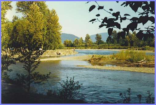
Bradner is a community within the City of Abbotsford, British Columbia, Canada, located in a rural northwest region of that city which also includes Mount Lehman. Bradner occupies a height of land above the Fraser River, immediately across which is the community of Silverdale, a part of the District of Mission, and Ruskin, on the border between Mission and Maple Ridge. On the floodplain below to the west is the Langley rural neighbourhood of Glen Valley, while on the floodplain to the east, which is called Matsqui Prairie, the nearest Abbotsford neighbourhood is Matsqui Village. Bradner was formerly part of the District of Matsqui, which in 1995 was amalgamated into the City of Abbotsford. Bradner was named after Thomas Bradner, a settler in the area who homesteaded there in 1895. A Bradner Post Office was designated in 1912 and Bradner was a station on the British Columbia Electric Railway interurban line from New Westminster to Chilliwack after the expansion in 1910. ... [...More Info...] [...Related Items...] OR: [Wikipedia] [Google] [Baidu] |
Abbotsford, British Columbia
Abbotsford is a city in British Columbia next to the Canada–United States border, Greater Vancouver, and the Fraser River. With a census population of 153,569 people (2021), it is the most populous municipality in the province outside metropolitan Vancouver. Abbotsford–Mission has the third-highest proportion of visible minorities among census metropolitan areas in Canada, after the Greater Toronto Area and the Greater Vancouver CMA. It is home to Fraser Valley Trade and Exhibition Centre, Tradex, the University of the Fraser Valley, and Abbotsford International Airport. As of the Canada 2021 Census, 2021 census, it is the largest municipality of the Fraser Valley Regional District and the List of municipalities in British Columbia, fifth-largest municipality of British Columbia. The Abbotsford–Mission metropolitan area of around 195,726 inhabitants as of the 2021 census is the 23rd largest census metropolitan area in Canada. It has also been named by Statistics Canada as C ... [...More Info...] [...Related Items...] OR: [Wikipedia] [Google] [Baidu] |
Matsqui Prairie
Matsqui may refer to: * Matsqui people, an Aboriginal group in British Columbia, Canada ** Matsqui First Nation * District of Matsqui, a municipality in British Columbia * Matsqui Island, British Columbia {{disambiguation ... [...More Info...] [...Related Items...] OR: [Wikipedia] [Google] [Baidu] |
Netherlands
, Terminology of the Low Countries, informally Holland, is a country in Northwestern Europe, with Caribbean Netherlands, overseas territories in the Caribbean. It is the largest of the four constituent countries of the Kingdom of the Netherlands. The Netherlands consists of Provinces of the Netherlands, twelve provinces; it borders Germany to the east and Belgium to the south, with a North Sea coastline to the north and west. It shares Maritime boundary, maritime borders with the United Kingdom, Germany, and Belgium. The official language is Dutch language, Dutch, with West Frisian language, West Frisian as a secondary official language in the province of Friesland. Dutch, English_language, English, and Papiamento are official in the Caribbean Netherlands, Caribbean territories. The people who are from the Netherlands is often referred to as Dutch people, Dutch Ethnicity, Ethnicity group, not to be confused by the language. ''Netherlands'' literally means "lower countries" i ... [...More Info...] [...Related Items...] OR: [Wikipedia] [Google] [Baidu] |
Chilliwack, British Columbia
Chilliwack ( ) is a city of about 100,000 people and in the Canadian province of British Columbia. It is located about east of the City of Vancouver in the Fraser Valley. The enumerated population is 93,203 in the city and 113,767 in the greater metropolitan area. About two-thirds of city land is protected as part of the Agricultural Land Reserve, and agriculture accounts for about 30 percent of the local economy. The city is bounded on the north side by the Fraser River, on the south side by the Vedder River and Canada–United States border, and is surrounded by tall mountain peaks, such as Mount Cheam and Slesse Mountain. Etymology In Halq'eméylem, the language of the Stó:lō communities around Chilliwack and Sardis, ''Tcil'Qe'uk'' means "valley of many streams". It also lends its name to the Chilliwack River, and group of aboriginal people, the ''Ts'elxwéyeqw'' (also spelt ''Ts'elxwíqw'' or ''Sts'elxwíqw''). The spelling of Chilliwack is sometimes a matt ... [...More Info...] [...Related Items...] OR: [Wikipedia] [Google] [Baidu] |
New Westminster
New Westminster (colloquially known as New West) is a city in the Lower Mainland region of British Columbia, Canada, and a member municipality of the Metro Vancouver Regional District. It was founded by Major-General Richard Moody as the capital of the Colony of British Columbia in 1858 and continued in that role until the Mainland and Island colonies were merged in 1866. It was the British Columbia Mainland's largest city from that year until it was passed in population by Vancouver during the first decade of the 20th century. It is located on the banks of the Fraser River as it turns southwest towards its estuary, on the southwest side of the Burrard Peninsula and roughly at the centre of the Greater Vancouver region. History The area now known as New Westminster was originally inhabited by Kwantlen First Nation. The discovery of gold in BC and the arrival of gold seekers from the south prompted fear amongst the settlers that Americans may invade to take over this lan ... [...More Info...] [...Related Items...] OR: [Wikipedia] [Google] [Baidu] |
Interurban
The interurban (or radial railway in Canada) is a type of electric railway, with tram-like electric self-propelled railcars which run within and between cities or towns. The term "interurban" is usually used in North America, with other terms used outside it. They were very prevalent in many parts of the world before the Second World War and were used primarily for passenger travel between cities and their surrounding suburban and rural communities. Interurban as a term encompassed the companies, their infrastructure, their cars that ran on the rails, and their service. In the United States, the early 1900s interurban was a valuable economic institution, when most roads between towns, many town streets were unpaved, and transportation and haulage was by horse-drawn carriages and carts. The interurban provided reliable transportation, particularly in winter weather, between towns and countryside. In 1915, of interurban railways were operating in the United States and, for a few ... [...More Info...] [...Related Items...] OR: [Wikipedia] [Google] [Baidu] |
British Columbia Electric Railway
The British Columbia Electric Railway (BCER) was an historic railway which operated in southwestern British Columbia, Canada. Originally the parent company for, and later a division of, BC Electric Company (now BC Hydro), the BCER assumed control of existing streetcar and interurban lines in southwestern British Columbia in 1897, and operated the electric railway systems in the region until the last interurban service was discontinued in 1958. During and after the streetcar era, BC Electric also ran bus and trolleybus systems in Greater Vancouver and bus service in Greater Victoria; these systems subsequently became part of BC Transit, and the routes in Greater Vancouver eventually came under the control of TransLink. Trolley buses still run in the City of Vancouver with one line extending into Burnaby. History Streetcar and interurban services were inaugurated in southwestern British Columbia between 1890 and 1891, operated by the following companies: * National Electric ... [...More Info...] [...Related Items...] OR: [Wikipedia] [Google] [Baidu] |
Matsqui, British Columbia
Matsqui is a former district municipality in British Columbia, Canada. It was incorporated in 1892 and merged with the district municipality of Abbotsford in 1995 to create the new City of Abbotsford. Matsqui used to be the western part of what is now Abbotsford. It had commercial growth in the Clearbrook area which then spilled over to Abbotsford. The name Matsqui can also be used to refer to a small historic village located on Matsqui Prairie, known as Matsqui Village, which was also formerly part of the District Municipality of Matsqui. It can be found to the immediate northwest of the present-day junction of Harris Road and British Columbia Highway 11 (just south of the Fraser River) in what is now the City of Abbotsford. A branch line of the Canadian Pacific Railway also runs from Mission, British Columbia, to the US border through the eastern boundary of the village. The Matsqui station of the Canadian National Railway line is northeast of the village, on the far side of Hi ... [...More Info...] [...Related Items...] OR: [Wikipedia] [Google] [Baidu] |
Matsqui Village
Matsqui may refer to: * Matsqui people, an Aboriginal group in British Columbia, Canada ** Matsqui First Nation * District of Matsqui, a municipality in British Columbia * Matsqui Island, British Columbia {{disambiguation ... [...More Info...] [...Related Items...] OR: [Wikipedia] [Google] [Baidu] |
Glen Valley
A glen is a valley, typically one that is long and bounded by gently sloped concave sides, unlike a ravine, which is deep and bounded by steep slopes. The word is Goidelic in origin: ''gleann'' in Irish and Scottish Gaelic, ''glion'' in Manx. The designation "glen" also occurs often in place names. Glens are appreciated by tourists for their tranquility and scenery. Etymology The word is Goidelic in origin: ''gleann'' in Irish and Scottish Gaelic, ''glion'' in Manx. In Manx, ''glan'' is also to be found meaning glen. It is cognate with Welsh ''glyn''. Whittow defines it as a "Scottish term for a deep valley in the Highlands" that is "narrower than a strath". Examples in Northern England, such as Glenridding, Westmorland, or Glendue, near Haltwhistle, Northumberland, are thought to derive from the aforementioned Cumbric cognate, or another Brythonic equivalent. This likely underlies some examples in Southern Scotland. As the name of a river, it is thought to derive fr ... [...More Info...] [...Related Items...] OR: [Wikipedia] [Google] [Baidu] |
British Columbia
British Columbia is the westernmost Provinces and territories of Canada, province of Canada. Situated in the Pacific Northwest between the Pacific Ocean and the Rocky Mountains, the province has a diverse geography, with rugged landscapes that include rocky coastlines, sandy beaches, forests, lakes, mountains, inland deserts and grassy plains. British Columbia borders the province of Alberta to the east; the territories of Yukon and Northwest Territories to the north; the U.S. states of Washington (state), Washington, Idaho and Montana to the south, and Alaska to the northwest. With an estimated population of over 5.7million as of 2025, it is Canada's Population of Canada by province and territory, third-most populous province. The capital of British Columbia is Victoria, British Columbia, Victoria, while the province's largest city is Vancouver. Vancouver and its suburbs together make up List of census metropolitan areas and agglomerations in Canada, the third-largest metropolit ... [...More Info...] [...Related Items...] OR: [Wikipedia] [Google] [Baidu] |
Langley, British Columbia (district Municipality)
The Township of Langley is a district municipality immediately east of the Surrey, British Columbia, City of Surrey in southwestern British Columbia, Canada. It extends south from the Fraser River to the Canada–United States border, and west of the City of Abbotsford. Langley Township is not to be confused with the City of Langley, which is adjacent to the township but politically is a separate entity. Langley is located in the eastern part of Metro Vancouver. History First Nations Throughout the last several millennia, the area that is now Langley Township was inhabited by various Stó꞉lō nations, including the Katzie and Kwantlen First Nation, Kwantlen. There is limited recorded history from this time, as much was passed down through oral tradition rather than written documents. The Kwantlen were a major factor in the salmon trade that later operated out of the Fort Langley. Simon Fraser, while traveling through the Sto:lo territory in 1808 recorded the image of a Kwa ... [...More Info...] [...Related Items...] OR: [Wikipedia] [Google] [Baidu] |


