|
Borzna
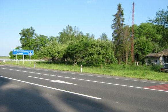
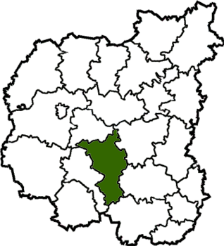
Borzna (, ), also referred to as Borsna, is a city in Nizhyn Raion, Chernihiv Oblast, northern Ukraine. It hosts the administration of Borzna urban hromada, one of the hromadas of Ukraine. Population: Geography Borzna is located on the Desna (river), Desna, next to an international highway connecting Kyiv and Moscow (International E-road network, E101). Chernihiv is about away. Borzna has no Rail transport, railway (the nearest railway stations being Doch () with north–south routes and Plysky () with west–east routes. The city derives its name from the river it lies on, a tributary of the Desna River, Desna. Climate Borzna has a continental climate, humid continental climate (Köppen climate classification, Koppen ''Dfb''). The warmest months are June, July, and August, with mean temperatures of . The coldest are December, January, and February, with mean temperatures of . The highest ever temperature recorded in the town was in July 2010. The coldest temperature ev ... [...More Info...] [...Related Items...] OR: [Wikipedia] [Google] [Baidu] [Amazon] |
Nizhyn Raion
Nizhyn Raion () is a Raions of Ukraine, raion (district) of Chernihiv Oblast, northern Ukraine. Its administrative centre is located at Nizhyn. Population: On 18 July 2020, as part of the administrative reform of Ukraine, the number of raions of Chernihiv Oblast was reduced to five, and the area of Nizhyn Raion was significantly expanded. Four abolished raions, Bakhmach Raion, Bakhmach, Bobrovytsia Raion, Bobrovytsia, Borzna Raion, Borzna, and Nosivka Raions, as well as the city of Nizhyn, which was previously incorporated as a City of regional significance (Ukraine), city of oblast significance and did not belong to the raion, were merged into Nizhyn Raion. The January 2020 estimate of the raion population was Subdivisions Current After the reform in July 2020, the raion consists of 17 hromadas: * Bakhmach urban hromada with the administration in the city of Bakhmach, transferred from Bakhmach Raion; * Baturyn urban hromada with the administration in the city of Baturyn, tran ... [...More Info...] [...Related Items...] OR: [Wikipedia] [Google] [Baidu] [Amazon] |
Borzna Urban Hromada
Borzna urban hromada () is a hromada of Ukraine, located in Nizhyn Raion, Chernihiv Oblast. Its administrative center is the city of Borzna. It has an area of and a population of 16,352, as of 2025. Composition The hromada contains 22 settlements: 1 city (Borzna) and 21 villages: See also * List of hromadas of Ukraine There are 1,469 hromadas (, ) in Ukraine. They were formed in 2020 (there are no hromadas in Kyiv, Sevastopol and in the Autonomous Republic of Crimea). A hromada is designated ''urban hromada'' if its administration is located in a city; ''set ... References {{Chernihiv Oblast subdivisions Hromadas of Nizhyn Raion 2020 establishments in Ukraine States and territories established in 2020 ... [...More Info...] [...Related Items...] OR: [Wikipedia] [Google] [Baidu] [Amazon] |
Plysky
Plysky () is a village in Nizhyn Raion, Chernihiv Oblast, Ukraine. It hosts the administration of Plysky rural hromada, one of the hromadas of Ukraine. The village has a population of 900. American biologist Alexander Petrunkevitch was born in Plysky. Until 18 July 2020, Plysky belonged to Borzna Raion. The raion was abolished in July 2020 as part of the administrative reform of Ukraine, which reduced the number of raions of Chernihiv Oblast to five. The area of Borzna Raion was merged into Nizhyn Raion. References External links Plysky at the Verkhovna Rada of Ukraine siteThe murder of the Jews of Plyskyduring World War II, at Yad Vashem Yad Vashem (; ) is Israel's official memorial institution to the victims of Holocaust, the Holocaust known in Hebrew language, Hebrew as the (). It is dedicated to preserving the memory of the Jews who were murdered; echoing the stories of the ... website. Borznyansky Uezd Holocaust locations in Ukraine Villages in Nizhyn Raio ... [...More Info...] [...Related Items...] OR: [Wikipedia] [Google] [Baidu] [Amazon] |
Chernihiv Oblast
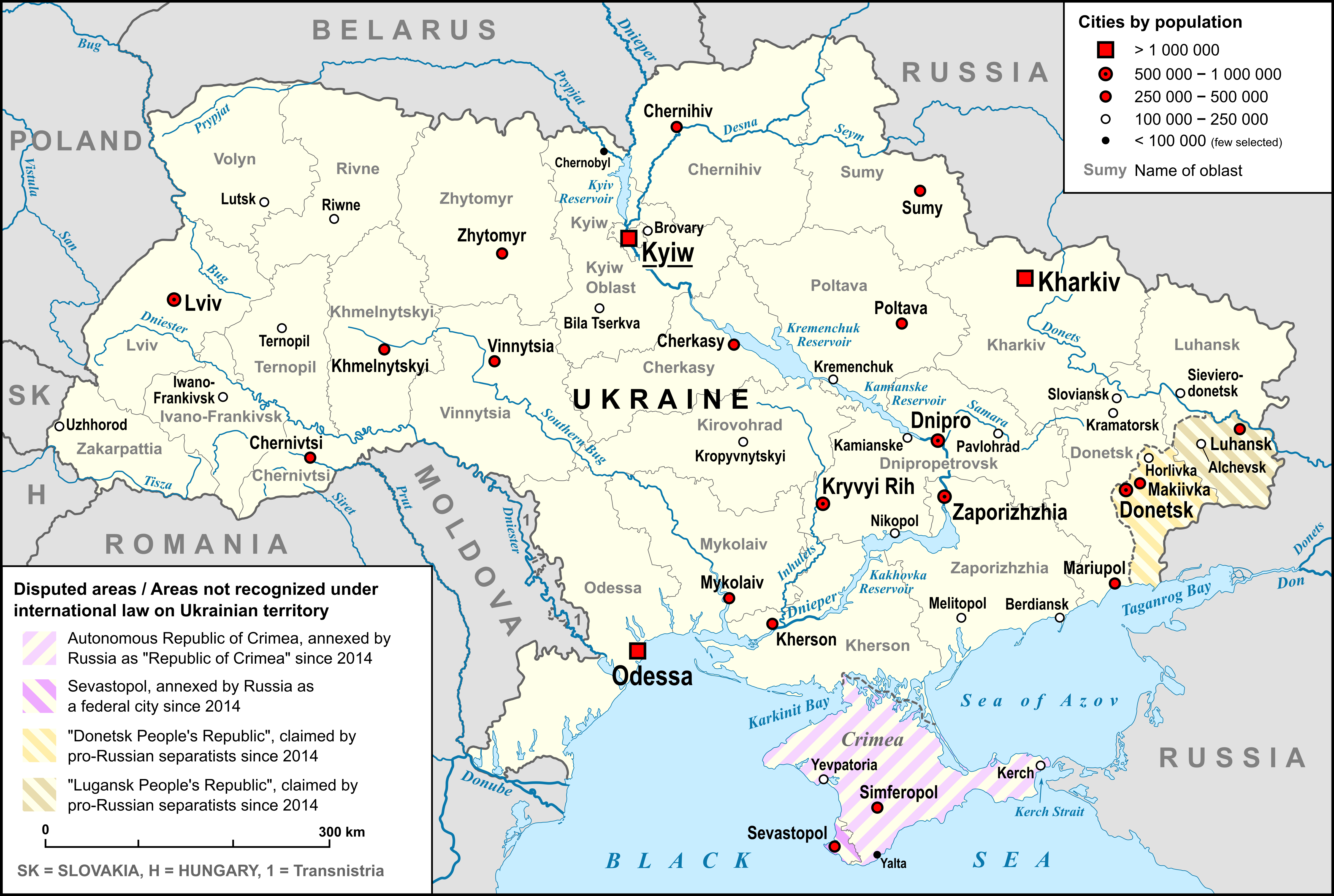
Chernihiv Oblast (), also referred to as Chernihivshchyna (), is an administrative divisions of Ukraine, oblast (province) in northern Ukraine. The capital city, administrative center of the oblast is the city of Chernihiv. There are 1,511 settlements in the oblast, with a total population of Geography The total area of the province is around 31,900 km². On the west, the oblast is bordered by the Kyiv Reservoir of the Dnieper River and Kyiv Oblast, which has a enclave known as Slavutych, which was created from Chernihiv Oblast for the inhabitants of Chernobyl following the Chernobyl disaster. It is bordered by Sumy Oblast to the east and Poltava Oblast to the south. The northern border of the oblast is part of Ukraine's international border abutting Belarus's Gomel Region in the north-west and the Russian Bryansk Oblast in the north-east, respectively. The oblast is bisected into northern and southern sections by the Desna River, which enters the Dnieper just north of t ... [...More Info...] [...Related Items...] OR: [Wikipedia] [Google] [Baidu] [Amazon] |
List Of Cities In Ukraine
There are 463 populated places in Ukraine, populated places in Ukraine that have been officially granted city status () by the Verkhovna Rada, the country's parliament, as of 23 April 2025. Settlements with more than 10,000 people are eligible for city status although the status is typically also granted to settlements of historical or regional importance. Smaller settlements are Populated places in Ukraine#Rural settlements, rural settlements () and villages (). Historically, there were systems of city rights, granted by the territorial lords, which defined the status of a place as a ''misto'' or ''selo''. In the past, cities were self-governing and had several privileges. The list of cities is roughly ordered by population and the 2022 estimates are compared to the 2001 Ukrainian census, except for Chernobyl for which the population is an unofficial estimate. The City with special status, cities with special status are shown in ''italic''. The average population size is 62,000. ... [...More Info...] [...Related Items...] OR: [Wikipedia] [Google] [Baidu] [Amazon] |
Continental Climate
Continental climates often have a significant annual variation in temperature (warm to hot summers and cold winters). They tend to occur in central and eastern parts of the three northern-tier continents (North America, Europe, and Asia), typically in the middle latitudes (40 to 55 or 60 degrees north), often within large landmasses, where prevailing winds blow overland bringing some precipitation, and temperatures are not moderated by oceans. Continental climates occur mostly in the Northern Hemisphere due to the large landmasses found there. Most of northeastern China, eastern and southeastern Europe, much of Russia south of the Arctic Circle, central and southeastern Canada, and the central and northeastern United States have this type of climate. Continentality is a measure of the degree to which a region experiences this type of climate. In continental climates, precipitation tends to be moderate in amount, concentrated mostly in the warmer months. Only a few areas—in th ... [...More Info...] [...Related Items...] OR: [Wikipedia] [Google] [Baidu] [Amazon] |
Rail Transport
Rail transport (also known as train transport) is a means of transport using wheeled vehicles running in railway track, tracks, which usually consist of two parallel steel railway track, rails. Rail transport is one of the two primary means of land transport, next to road transport. It is used for about 8% of passenger and rail freight transport, freight transport globally, thanks to its Energy efficiency in transport, energy efficiency and potentially high-speed rail, high speed.Rolling stock on rails generally encounters lower friction, frictional resistance than rubber-tyred road vehicles, allowing rail cars to be coupled into longer trains. Power is usually provided by Diesel locomotive, diesel or Electric locomotive, electric locomotives. While railway transport is capital intensity, capital-intensive and less flexible than road transport, it can carry heavy loads of passengers and cargo with greater energy efficiency and safety. Precursors of railways driven by human or an ... [...More Info...] [...Related Items...] OR: [Wikipedia] [Google] [Baidu] [Amazon] |
Desna River
The Desna ( Russian and ) is a river in Russia and Ukraine, a major left-tributary of the Dnieper. Its name in means "right hand". It has a length of , and its drainage basin covers .Десна . In Ukraine, the river's width ranges from , with its average depth being . The mean annual discharge at its mouth is . The river freezes over from early December to early April, and is navigable from to its mouth, a length of about . The water level of the river reached its lowest recorded point in ... [...More Info...] [...Related Items...] OR: [Wikipedia] [Google] [Baidu] [Amazon] |
Köppen Climate Classification
The Köppen climate classification divides Earth climates into five main climate groups, with each group being divided based on patterns of seasonal precipitation and temperature. The five main groups are ''A'' (tropical), ''B'' (arid), ''C'' (temperate), ''D'' (continental), and ''E'' (polar). Each group and subgroup is represented by a letter. All climates are assigned a main group (the first letter). All climates except for those in the ''E'' group are assigned a seasonal precipitation subgroup (the second letter). For example, ''Af'' indicates a tropical rainforest climate. The system assigns a temperature subgroup for all groups other than those in the ''A'' group, indicated by the third letter for climates in ''B'', ''C'', ''D'', and the second letter for climates in ''E''. Other examples include: ''Cfb'' indicating an oceanic climate with warm summers as indicated by the ending ''b.'', while ''Dwb'' indicates a semi-Monsoon continental climate, monsoonal continental climate ... [...More Info...] [...Related Items...] OR: [Wikipedia] [Google] [Baidu] [Amazon] |
Climate
Climate is the long-term weather pattern in a region, typically averaged over 30 years. More rigorously, it is the mean and variability of meteorological variables over a time spanning from months to millions of years. Some of the meteorological variables that are commonly measured are temperature, humidity, atmospheric pressure, wind, and precipitation. In a broader sense, climate is the state of the components of the climate system, including the atmosphere, hydrosphere, cryosphere, lithosphere and biosphere and the interactions between them. The climate of a location is affected by its latitude, longitude, terrain, altitude, land use and nearby water bodies and their currents. Climates can be classified according to the average and typical variables, most commonly temperature and precipitation. The most widely used classification scheme is the Köppen climate classification. The Thornthwaite system, in use since 1948, incorporates evapotranspiration along ... [...More Info...] [...Related Items...] OR: [Wikipedia] [Google] [Baidu] [Amazon] |
International E-road Network
The international E-road network is a numbering system for roads in Europe developed by the United Nations Economic Commission for Europe (UNECE). The network is numbered from E1 up and its roads cross national borders. It also reaches Central Asian countries like Kyrgyzstan, since they are members of the UNECE. Main international traffic arteries in Europe are defined by ECE/TRANS/SC.1/2016/3/Rev.1 which consider three types of roads: motorways, Limited-access road, limited access roads, and ordinary roads. In most countries, the roads carry the European route designation alongside national designations. Belgium, Norway and Sweden have roads which only have the European route designations (examples: European route E18, E18 and European route E6, E6). The United Kingdom, Albania and the Asian part of Russia only use national road designations and do not show the European designations at all. All route numbers in Andorra are unsigned. Denmark only uses the European designations ... [...More Info...] [...Related Items...] OR: [Wikipedia] [Google] [Baidu] [Amazon] |


