|
Bilma
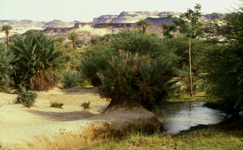
Bilma is an oasis town and commune in north east Niger with, as of the 2012 census, a total population of 4,016 people. It lies protected from the desert dunes under the Kaouar Cliffs and is the largest town along the Kaouar escarpment. It is known for its gardens, for salt and natron production through evaporation ponds, date cultivation, and as the destination of one of the last Saharan caravan routes (the Azalai, from Agadez). Population Its population is mostly Kanuri, with smaller Toubou, Tuareg, and Hausa populations, the last being a reminder of Bilma's role as a key stop in the Trans Saharan trade. Administration and economy Bilma is the administrative seat of the Bilma Department, covering some of north eastern Niger. While it continues to produce salt in large ''natron'' salt pans, and this salt is still sold for livestock use throughout west Africa. Tourism (based out of Agadez and the Aïr Mountains some to the west) is of growing importance. Climate ... [...More Info...] [...Related Items...] OR: [Wikipedia] [Google] [Baidu] |
Ténéré
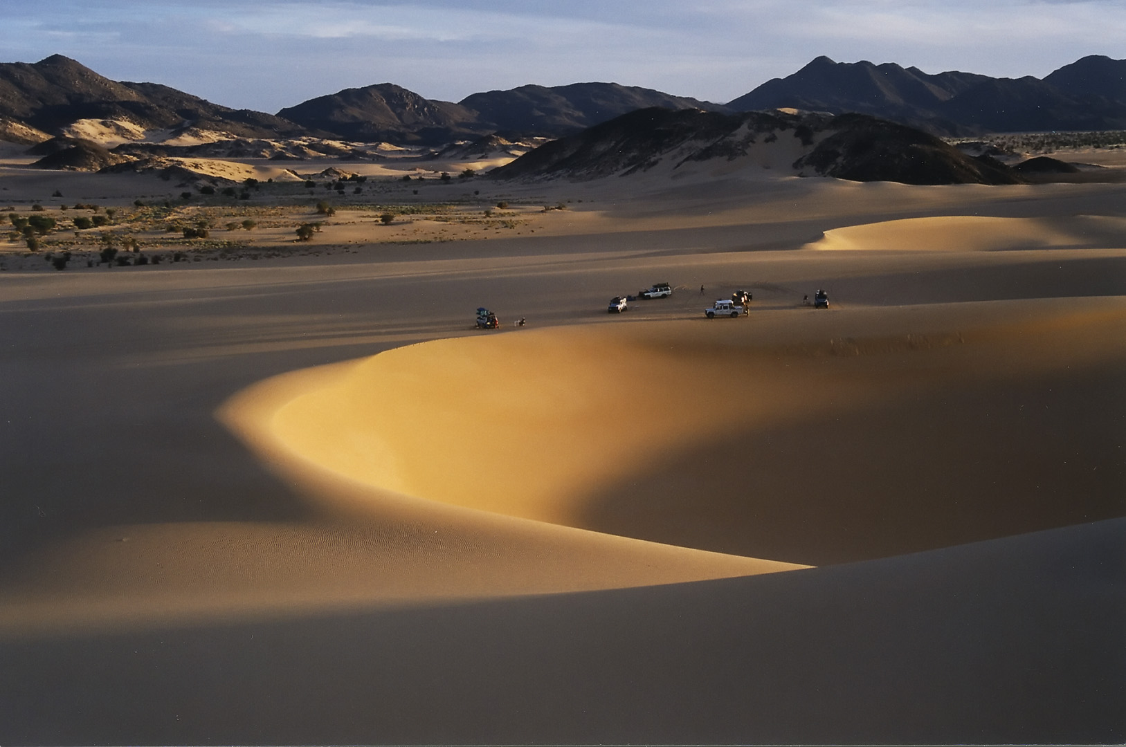
The Ténéré (Tuareg languages, Tuareg: Tenere, literally: "desert") is a desert region in south central Sahara. It comprises a vast plain of sand stretching from northeastern Niger to western Chad, occupying an area of over . The Ténéré's boundaries are said to be the Aïr Mountains in the west, the Hoggar Mountains in the north, the Djado Plateau in the northeast, the Tibesti Mountains in the east, and the basin of Lake Chad in the south. The central part of the desert, the Erg du Bilma, is centred at approximately . It is the locus of the Neolithic Tenerian culture. Name The name ''Ténéré'' comes from the Tuareg languages, Tuareg language, meaning "desert", in much the same way as the Arabic language, Arabic word for "desert", ''Sahara'', came to be applied to the region as a whole. Climate The Ténéré has a hot desert climate (Köppen climate classification ''BWh''), typical of the large Sahara Desert. The climate is hyper-arid, extremely hot, sunny and dry year-rou ... [...More Info...] [...Related Items...] OR: [Wikipedia] [Google] [Baidu] |
Azalai
The Azalai (Tamasheq, var. Azalay) is a semi-annual salt caravan route practiced by Tuareg traders in the Sahara desert between Timbuktu and the Taoudenni salt mine in Mali, or the act of traveling with a caravan along that route. The other major West African salt caravan route, heading from around Agadez to Fachi and Bilma in Niger, is called Taghlamt (in Tamasheq, or Taglem or Tagalem in Hausa language). The two are among the last caravan routes in the Sahara that are still in use. Both caravans have largely been replaced by unpaved truck routes. Timbuktu-Taoudenni At one time the caravan route from Timbuktu extended through Taoudenni to Taghaza, another salt-mining site, and on to the lands north of the Sahara on the Mediterranean Sea. Caravans with up to 10,000 camels carried gold and slaves north, returning with manufactured goods and salt from Taghaza and Taoudenni. Until the 1940s, the Taoudenni caravans were made up of thousands of camels, departing Timbuktu at ... [...More Info...] [...Related Items...] OR: [Wikipedia] [Google] [Baidu] |
Agadez Region
Agadez Region is one of the seven regions of Niger. At , it covers more than half of Niger's land area, and is the largest region in the country, as well as the list of the largest country subdivisions by area, largest African state subdivision. The capital of the department is Agadez. History The region is a centre for palaeontology, with numerous dinosaur skeletons being found here, including the ''Ouranosaurus nigeriensis''. Cave painting and the remains of ancient human settlements are also located here. Tuareg peoples began migrating to the region from the mid-8th century. From the mid-15th century to the early 20th, much of the region was under the control of the Sultanate of Agadez, except for a period when the area came under the rule of the Songhai Empire in the 1500s. The region suffered with the advent of French colonialism as power shifted away to the southwest; Tuareg disaffection with French rule resulted in the Kaocen revolt in 1916–17. This process continued fol ... [...More Info...] [...Related Items...] OR: [Wikipedia] [Google] [Baidu] |
Bilma Department
Bilma is a department of the Agadez Region in Niger. Its capital lies at the city of Bilma. As of 2012, the department had a total population of 17,935 people. Communes *Bilma * Dirkou *Djado *Fachi Fachi is an oasis surrounded by the Ténéré desert and the dunes of the Erg of Bilma in eastern Niger, placed on the western edge of the small Agram mountain outcropping. It has a population of 2,215 people (2012). It is also a stopping poi ... References Departments of Niger Agadez Region {{Niger-geo-stub ... [...More Info...] [...Related Items...] OR: [Wikipedia] [Google] [Baidu] |
Kanuri People
The Kanuri people (Kanouri, Kanowri, also Yerwa, Barebari and several subgroup names) are an African ethnic group living largely in the lands of the former Kanem and Bornu Empires in Niger, Nigeria, Chad, and Cameroon, as well as a diaspora community residing in Sudan. Those generally termed Kanuri include several subgroups and dialect groups, some of whom identify as distinct from the Kanuri. Most trace their origins to ruling lineages of the medieval Kanem–Bornu Empire, and its client states or provinces. In contrast to the neighboring Toubou or Zaghawa pastoralists, Kanuri groups have traditionally been sedentary, engaging in farming, fishing the Chad Basin, trade, and salt processing. Background Kanuri peoples include several subgroups, and identify by different names in some regions. The Kanuri language was the major language of the Bornu Empire and remains a major language in southeastern Niger, northeastern Nigeria and northern Cameroon, but in Chad it is limited t ... [...More Info...] [...Related Items...] OR: [Wikipedia] [Google] [Baidu] |
Kaouar
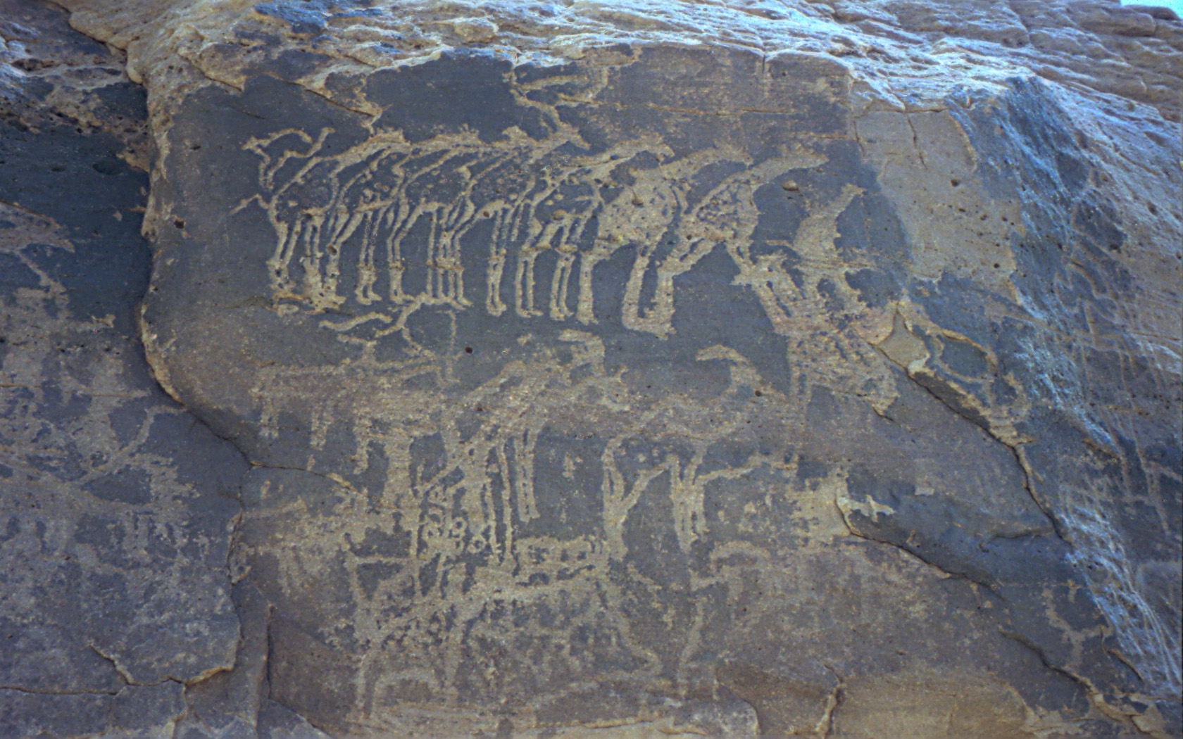
The Kaouar (or Kawar) is a series of ten oases in the southern Sahara in northeast Niger, covering about from north to south, and east to west. They are on the eastern edge of the Ténéré desert, between the Tibesti Mountains in the east and the Aïr Mountains in the west and between the Fezzan in the north and Lake Chad in the south. They lie on the leeward side of a 100-meter-high north–south escarpment and easterly winds striking the escarpment provide easy access to groundwater for the oases. Running south to north, Bilma, Dirkou, Aney and Séguédine are the largest towns. The Kaouar oases are famous for salt and date production, and were along the route of the great Bornu Empire, Bornu to Fezzan caravan trail. This was the major point of contact between the African Sahel and the Mediterranean civilisations until the 19th century. Numerous archeological sites and rock paintings attest to human habitation here reaching back some 10,000 years to when the area was surr ... [...More Info...] [...Related Items...] OR: [Wikipedia] [Google] [Baidu] |
Oasis
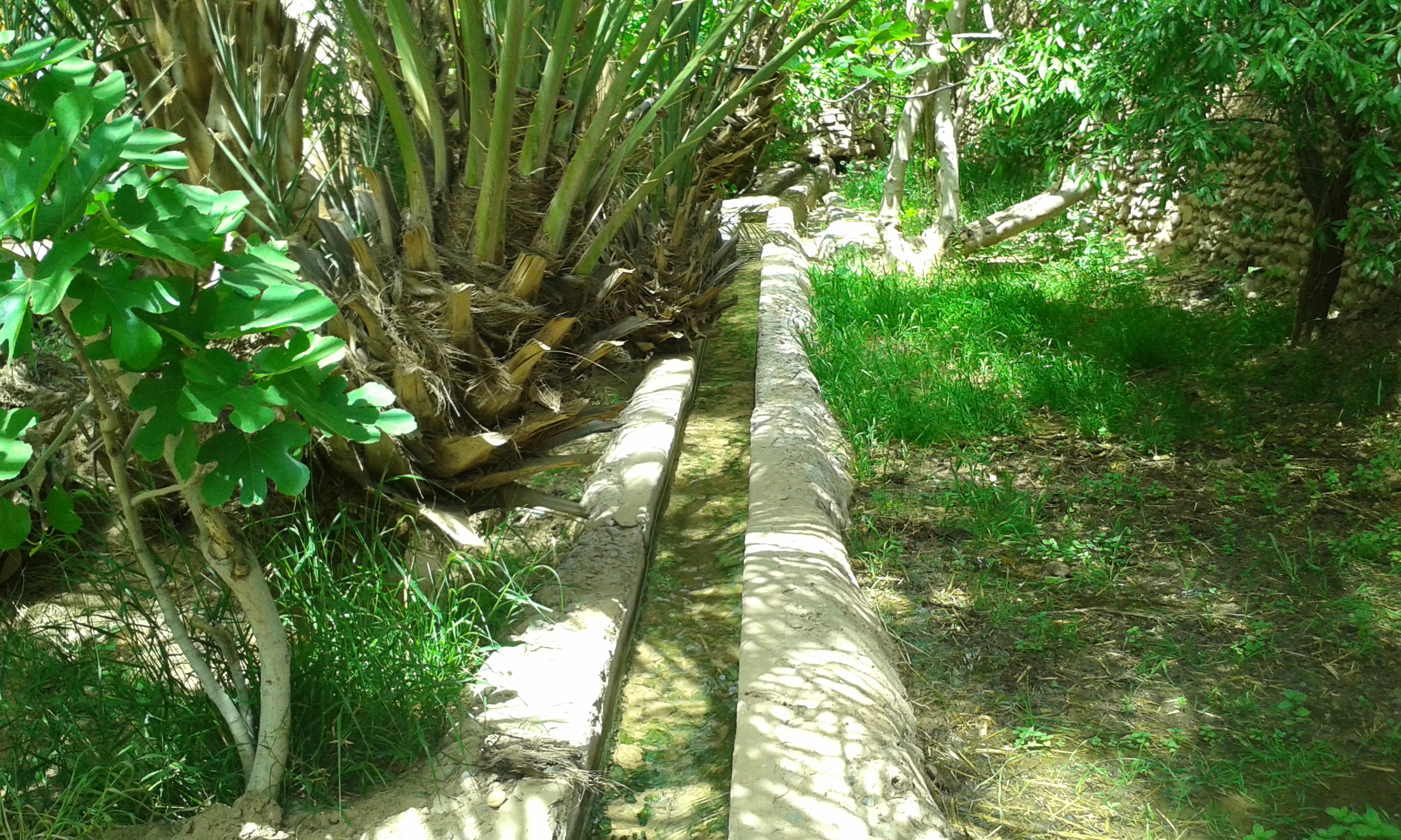
In ecology, an oasis (; : oases ) is a fertile area of a desert or semi-desert environmentBattesti, Vincent (2005) Jardins au désert: Évolution des pratiques et savoirs oasiens: Jérid tunisien. Paris: IRD éditions. . that sustains plant life and provides habitat for animals. Surface water may be present, or water may only be accessible from wells or underground channels created by humans. In geography, an oasis may be a current or past rest stop on a transportation route, or less-than-verdant location that nonetheless provides access to underground water through deep wells created and maintained by humans. Although they depend on a natural condition, such as the presence of water that may be stored in reservoirs and us ... [...More Info...] [...Related Items...] OR: [Wikipedia] [Google] [Baidu] |
Sahara Desert
The Sahara (, ) is a desert spanning across North Africa. With an area of , it is the largest hot desert in the world and the list of deserts by area, third-largest desert overall, smaller only than the deserts of Antarctica and the northern Arctic. The name "Sahara" is derived from , a broken plural form of ( ), meaning "desert". The desert covers much of North Africa, excluding the fertile region on the Mediterranean Sea coast, the Atlas Mountains of the Maghreb, and the Nile, Nile Valley in Egypt and the Sudan. It stretches from the Red Sea in the east and the Mediterranean in the north to the Atlantic Ocean in the west, where the landscape gradually changes from desert to coastal plains. To the south it is bounded by the Sahel, a belt of Tropical and subtropical grasslands, savannas, and shrublands, semi-arid tropical savanna around the Niger River valley and the Sudan (region), Sudan region of sub-Saharan Africa. The Sahara can be divided into several regions, including ... [...More Info...] [...Related Items...] OR: [Wikipedia] [Google] [Baidu] |
Tuareg People
The Tuareg people (; also spelled Twareg or Touareg; Endonym and exonym, endonym, depending on Tuareg languages#Subclassification, variety: ''Imuhaɣ'', ''Imušaɣ'', ''Imašeɣăn'' or ''Imajeɣăn'') are a large Berbers, Berber ethnic group, traditionally nomadic pastoralism, pastoralists, who principally inhabit the Sahara in a vast area stretching from far southwestern Libya to southern Algeria, Niger, Mali, Burkina Faso, and as far as northern Nigeria, with small communities in Chad and Sudan known as the ''Kinnin''. The Tuareg speak Tuareg languages, languages of the same name, also known as ''Tamasheq'', which belong to the Berber languages, Berber branch of the Afroasiatic family. They are a semi-nomadic people who mostly practice Islam, and are descended from the indigenous Berber communities of Northern Africa, whose ancestry has been described as a mosaic of local North Africa, Northern African (Taforalt), Middle Eastern, Genetic history of Europe, European (Early Eu ... [...More Info...] [...Related Items...] OR: [Wikipedia] [Google] [Baidu] |
Niger
Niger, officially the Republic of the Niger, is a landlocked country in West Africa. It is a unitary state Geography of Niger#Political geography, bordered by Libya to the Libya–Niger border, north-east, Chad to the Chad–Niger border, east, Nigeria to the Niger–Nigeria border, south, Benin and Burkina Faso to the Benin-Niger border, south-west, Mali to the Mali–Niger border, west, and Algeria to the Algeria–Niger border, north-west. It covers a land area of almost , making it the largest landlocked country in West Africa and the second-largest landlocked nation in Africa behind Chad. Over 80% of its land area lies in the Sahara. Its Islam in Niger, predominantly Muslim population of about million lives mostly in clusters in the south and west of the country. The capital Niamey is located in Niger's south-west corner along the namesake Niger River. Following the spread of Islam to the region, Niger was on the fringes of some states, including the Kanem–Bornu Empire ... [...More Info...] [...Related Items...] OR: [Wikipedia] [Google] [Baidu] |
Communes Of Niger
The Departments of Niger, Departments of Niger are subdivided into communes. As of 2005, in the seven Regions of Niger, Regions and one Capital Area, there were 36 ''départements'', divided into 265 ''communes'', 122 ''cantons'' and 81 ''groupements''. The latter two categories cover all areas not covered by ''Urban Communes'' (population over 10000) or ''Rural Communes'' (population under 10000), and are governed by the Department, whereas Communes have (since 1999) elected councils and mayors. Additional semi-autonomous sub-divisions include ''Sultanates'', ''Provinces'' and ''Tribes'' (''tribus''). The Nigerien government estimates there are an additional 17000 Villages administered by ''Rural Communes'', while there are over 100 ''Quartiers'' (boroughs or neighborhoods) administered by ''Urban Communes''. The territorial reorganisation of Niger's local administration, known informally as the ''Decentralisation process'', was carried out through a series of laws from 1998 ... [...More Info...] [...Related Items...] OR: [Wikipedia] [Google] [Baidu] |
Departments Of Niger
The regions of Niger are subdivided into 63 Department (country subdivision), departments (). Before the devolution program on 1999–2005, these departments were styled arrondissements. Confusingly, the next level up (regions) had, before 2002-2005 been styled departments. Prior to a revision in 2011, there had been 36 departments. Until 2010, arrondissements remained a proposed subdivision of departments, though none were used. The decentralisation process, begun in the 1995-1999 period replaced appointed Prefects at Departmental or Arrondissement level with elected councils, first elected in 1999. These were the first local elections held in the history of Niger. Officials elected at Communes of Niger, commune level are then selected as representatives at Departmental, regional, and National level councils and administration. The Ministry of Decentralisation was created to oversee this task, and to create a national consultative council of local officials. On 1 August 2 ... [...More Info...] [...Related Items...] OR: [Wikipedia] [Google] [Baidu] |


