|
Betteshanger
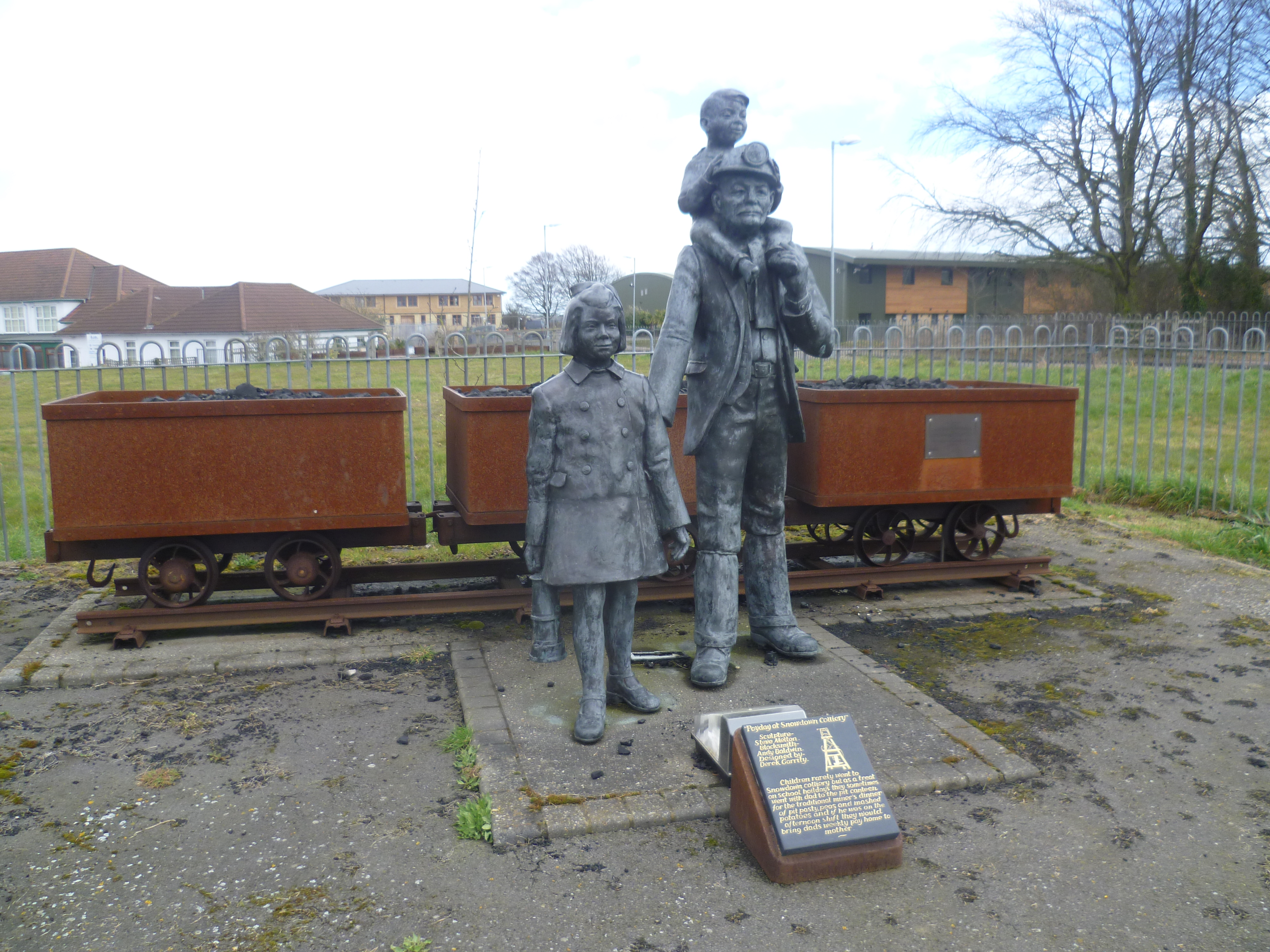
Betteshanger () is a village and former civil parish. now in the parish of Northbourne, in the Dover district, in east Kent, UK, near Deal. It gave its name to the largest of the four chief collieries of the Kent coalfield. In 1931 the parish had a population of 55. On 1 April 1935 the parish was abolished and merged with Northbourne. Before the coal mine Betteshanger parish (with variation 'Betleshangre') has existed at least since Domesday times. It remained a small scattered parish until the advent of the Kent Coalfield. St Mary's Church sits almost alone in woodland in the centre of the parish. At 'Little Betteshanger' a cluster of houses surround Betteshanger Farm and are very close to Northbourne Primary School. Mining in Betteshanger Betteshanger Colliery opened in the late 1920s and was the largest of the Kent collieries. Miners from other coalfields travelled to Deal in the hope of finding work at the new pit, and many lodging houses, cafes and pubs in Deal put up sig ... [...More Info...] [...Related Items...] OR: [Wikipedia] [Google] [Baidu] [Amazon] |
Betteshanger Park
Betteshanger Park (formerly Fowlmead Country Park and Betteshanger Country Park) is a park near Deal, in Kent, England. It covers the site of a former colliery spoil tip. History This park is situated on the site of a former spoil tip of the former Betteshanger Colliery, one of the largest collieries in Kent. The colliery opened in 1924–30 and closed in 1989. The spoil tip was located to the north east of the former colliery. The original area (before the spoil tip) was known as Foulmead Marsh and the community (with help from Dover District Council) chose the name of the new park to be Fowlmead (''Fowl'' – "bird", ''Mead'' - "meadow"). In May 2015, it was announced that the Hadlow Group had acquired Fowlmead and would be rebranding the park as Betteshanger Country Park, as part of the wider Betteshanger Sustainable Parks regeneration program. As of 2017 the organisation's website gives the name of the park as Betteshanger Park. Fowlmead Country Park and Nature Reserve was ... [...More Info...] [...Related Items...] OR: [Wikipedia] [Google] [Baidu] [Amazon] |
1942 Betteshanger Miners' Strike
The 1942 Betteshanger Miners' Strike took place in January 1942 at the Betteshanger colliery in Kent, England. The strike had its origins in a switch to a new Face (mining), coalface, No. 2. This face was much narrower and harder to work than the previous face and outputs were reduced. The miners proved unable to meet management production quotas and the mine owners refused to pay the previously agreed minimum daily wage, alleging deliberate slow working. An arbitrator called in to review the dispute ruled that the quotas were achievable. The miners disagreed and went on strike from 9 January. Under wartime regulations, Order 1305, striking was illegal unless the matter had been referred to the Ministry of Labour and National Service for settlement. Prosecutions were made against the strikers; three union officials were imprisoned and 1,085 men fined. The prosecutions hardened the strikers' attitudes and after the strike entered its third week the government began negotiations. A s ... [...More Info...] [...Related Items...] OR: [Wikipedia] [Google] [Baidu] [Amazon] |
Biodynamic Agriculture
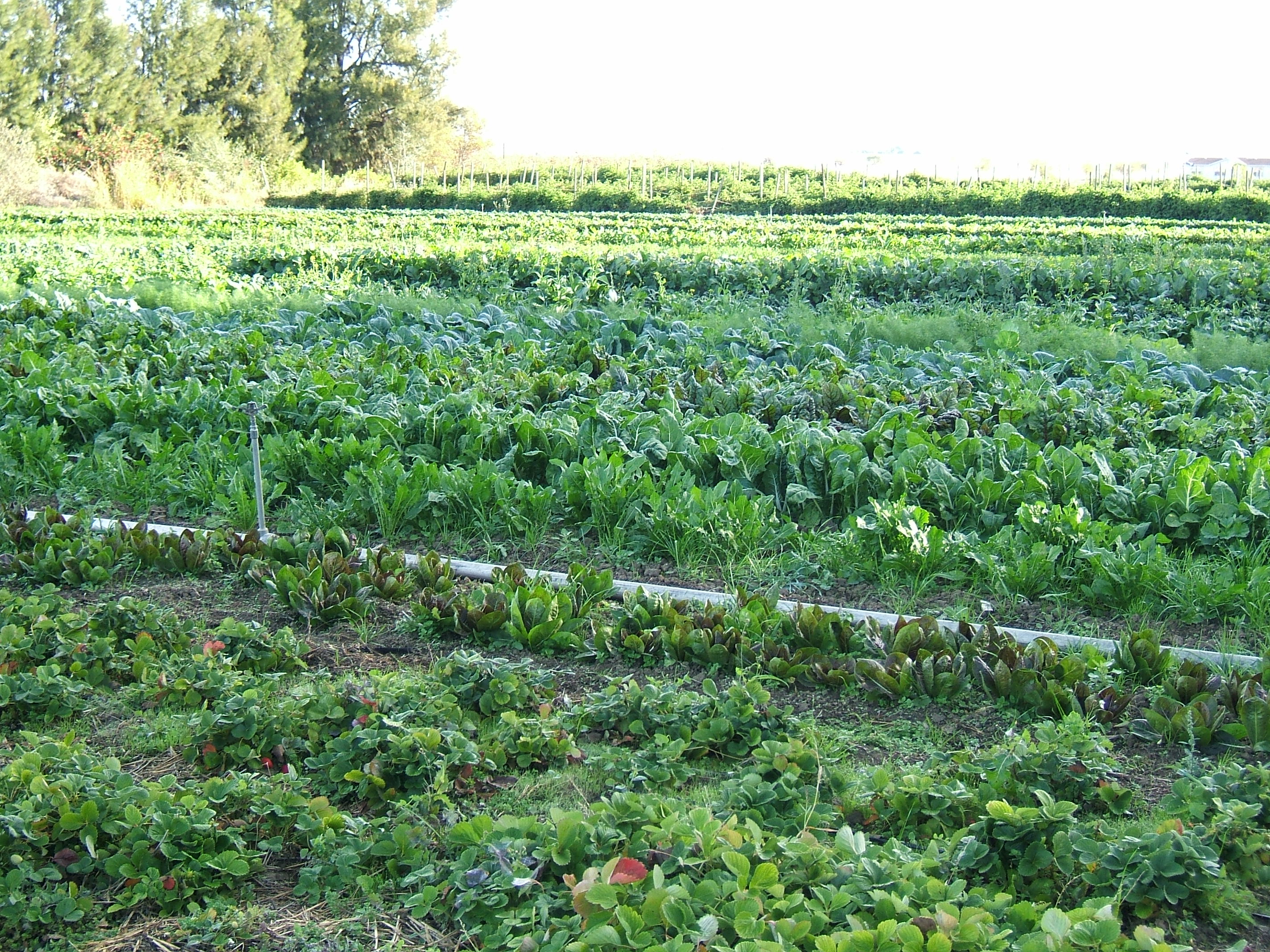
Biodynamic agriculture is a form of alternative agriculture based on pseudoscientific and esoteric concepts initially developed in 1924 by Rudolf Steiner (1861–1925). It was the first of the organic farming movements. It treats soil fertility, plant growth, and livestock care as ecologically interrelated tasks, emphasizing spiritual and mystical perspectives. Biodynamics has much in common with other organic approaches – it emphasizes the use of manures and composts and excludes the use of synthetic (artificial) fertilizers, pesticides and herbicides on soil and plants. Methods unique to the biodynamic approach include its treatment of animals, crops, and soil as a single system, an emphasis from its beginnings on local production and distribution systems, its use of traditional and development of new local breeds and varieties. Some methods use an astrological sowing and planting calendar. Biodynamic agriculture uses various herbal and mineral additives for compost additi ... [...More Info...] [...Related Items...] OR: [Wikipedia] [Google] [Baidu] [Amazon] |
Organic Farming
Organic farming, also known as organic agriculture or ecological farming or biological farming,Labelling, article 30 o''Regulation (EU) 2018/848 of the European Parliament and of the Council of 30 May 2024 on organic production and labelling of organic products and repealing Council Regulation (EC) No 834/2007.''/ref> is an agricultural system that emphasizes the use of naturally occurring, non-synthetic inputs, such as compost manure, green manure, and bone meal and places emphasis on techniques such as crop rotation, companion planting, and mixed cropping. Biological pest control methods such as the fostering of insect predators are also encouraged. Organic agriculture can be defined as "an integrated farming system that strives for sustainability, the enhancement of soil fertility and biological diversity while, with rare exceptions, prohibiting synthetic pesticides, antibiotics, synthetic fertilizers, genetically modified organisms, and growth hormones". It originate ... [...More Info...] [...Related Items...] OR: [Wikipedia] [Google] [Baidu] [Amazon] |
Kent Coalfield
The Kent Coalfield is a coalfield in the eastern part of the England, English county of Kent. The Coalfields Trust defines the Kent Coalfield as the wards of Barham Downs and Marshside in the Canterbury district, and the wards of Aylesham, Eastry, Eythorne & Shepherdswell, Middle Deal & Sholden, Mill Hill and North Deal in the Dover district. Coal was discovered in the area in 1890 when abandoned borings for the first Channel Tunnel project were used to investigate the local geology; the resultant Shakespeare colliery lasted until 1915. In 1911, investigation into whether there was other workable coal was planned. Six 'bore holes' were put down in search of coal (at Rushbourne, Hoads Wood in Sturry, Herne Bay, Reculver, Chitty (which is near Chislet) and Chislet Park near the future site of Hersden). In the early years many collieries were sunk, and the East Kent Light Railway was built to exploit the anticipated business. Extensive plans had been drawn up by 1914 for major co ... [...More Info...] [...Related Items...] OR: [Wikipedia] [Google] [Baidu] [Amazon] |
Ehrenfried Pfeiffer
Ehrenfried Erwin Pfeiffer (19 February 1899 – 30 November 1961) was a German scientist, soil scientist, leading advocate of biodynamic agriculture, anthroposophist and student of Rudolf Steiner. Life Ehrenfried Pfeiffer began work with Rudolf Steiner in 1920 to develop and install special diffuse stage lighting for eurythmy performances on the stage of the first Goetheanum. After Steiner's death in 1925, Pfeiffer worked in the private research laboratory at the Goetheanum in Dornach, (Switzerland). He became manager and director of the experimental biodynamic Loverendale farm in Domburg in the Netherlands. This farm was set up to carry out some of the agricultural studies of the Goetheanum laboratory. The work of testing and developing Rudolf Steiner's Agriculture Course of 1924 was an international enterprise coordinated by Pfeiffer at the Natural Science Section of the Goetheanum. Pfeiffer’s most influential book 'Bio-Dynamic Farming and Gardening' was published in 1 ... [...More Info...] [...Related Items...] OR: [Wikipedia] [Google] [Baidu] [Amazon] |
Lord Northbourne
Baron Northbourne, of Betteshanger in the County of Kent, is a title in the Peerage of the United Kingdom. It was created in 1884 for Walter James, 1st Baron Northbourne, Sir Walter James, 2nd Baronet, who had earlier represented Kingston upon Hull (UK Parliament constituency), Kingston upon Hull in the British House of Commons, House of Commons as a Conservative Party (UK), Conservative. His son, the second Baron, sat as a Liberal Party (UK), Liberal Member of Parliament for Gateshead. The latter's great-grandson, the fifth Baron, who succeeded his father in 1982, was one of the ninety elected hereditary peers that were allowed to remain in the House of Lords after the passing of the House of Lords Act 1999, and sat as a cross-bencher until his retirement in 2018. , the titles are held by his son, the sixth baron, who succeeded his father in that year. The James baronetcy, of Langley Hall, in the County of Berkshire, was created in the Baronetage of Great Britain in 1791 for the ... [...More Info...] [...Related Items...] OR: [Wikipedia] [Google] [Baidu] [Amazon] |
Hadlow College
Hadlow College is a further education, further and higher education college in Hadlow, Kent, England. The curriculum primarily covers land-based subjects including Agriculture, Horticulture, Habitat conservation, Conservation and Wildlife management, Wildlife Management, Animal Management, Fisheries management, Fisheries Management, Horse, Equine Studies and Floristry. Additionally, intermediate and advanced apprenticeships are offered in Golf Greenkeeping, Sports Turf, Agriculture, Horticulture and Land-based Engineering. Origins and history In 1919, a scheme of Agricultural Education for the County, which included the provision of a Farm Institute, was approved at a meeting of the Kent Education Committee. Borden Grammar School at Sittingbourne agreed to sell their property to the Kent Education Committee as soon as a new grammar school was built, but it was not until 1929 that Borden Grammar School was occupied and its building adapted for Kent Farm Institute purposes. Gro ... [...More Info...] [...Related Items...] OR: [Wikipedia] [Google] [Baidu] [Amazon] |
Miner's Way Trail
The Miner's Way Trail is a long-distance circular footpath in England, starting at Sholden, Kent. Linking up the coalfield parishes of East Kent. Including; the parishes of Deal, Kent, Deal, Ash, Dover, Ash, Aylesham, Chillenden, Eastry, Eythorne, Elvington, Kent, Elvington, Goodnestone, Dover, Goodnestone, Nonington, Northbourne, Kent, Northbourne, Coldred, Staple, Kent, Staple, Tilmanstone and Wingham, Kent, Wingham. The trail is approximately in length. A link route creates two shorter walks of around 14 miles each. The Waymark for the trail is a white circle with a Miners lamp, train and leaf. A Cycle Trail also follows most of the trail, starting and finishing at Deal. Sections of the cycling route follow the existing Sustrans National Cycle Network Regional Route 16 (Dover to Canterbury, via Adisham) also and connects with Regional Route 17 (to Sandwich). Linking to the Viking Coastal Trail and National Cycle Route 1. The route can be comfortably completed in a day. ... [...More Info...] [...Related Items...] OR: [Wikipedia] [Google] [Baidu] [Amazon] |
Kent
Kent is a Ceremonial counties of England, ceremonial county in South East England. It is bordered by Essex across the Thames Estuary to the north, the Strait of Dover to the south-east, East Sussex to the south-west, Surrey to the west, and Greater London to the north-west. The county town is Maidstone. The county has an area of and had population of 1,875,893 in 2022, making it the Ceremonial counties of England#Lieutenancy areas since 1997, fifth most populous county in England. The north of the county contains a conurbation which includes the towns of Chatham, Kent, Chatham, Gillingham, Kent, Gillingham, and Rochester, Kent, Rochester. Other large towns are Maidstone and Ashford, Kent, Ashford, and the City of Canterbury, borough of Canterbury holds City status in the United Kingdom, city status. For local government purposes Kent consists of a non-metropolitan county, with twelve districts, and the unitary authority area of Medway. The county historically included south-ea ... [...More Info...] [...Related Items...] OR: [Wikipedia] [Google] [Baidu] [Amazon] |
Dover (district)
Dover is a local government district in Kent, England. It is named after its largest town, the port town of Dover. The council is based in Whitfield on the outskirts of Dover. The district also covers the towns of Deal, Sandwich and Walmer as well as the surrounding rural areas. The district borders Thanet District to the north, the City of Canterbury to the west, and Folkestone and Hythe District to the south-west. To the south and east, it faces the Strait of Dover. History The district was formed on 1 April 1974 under the Local Government Act 1972. It covered the whole area of four former districts and part of a fifth, all of which were abolished at the same time: * Deal Municipal Borough * Dover Municipal Borough * Dover Rural District * Eastry Rural District (except five parishes which went to Thanet) * Sandwich Municipal Borough The new district was named Dover after its largest town. Governance Dover District Council provides district-level services. Count ... [...More Info...] [...Related Items...] OR: [Wikipedia] [Google] [Baidu] [Amazon] |


