|
Bellandur
Bellandur is a suburb in south-east Bangalore, Karnataka, India. It is bounded by HSR Layout to the west, Devarabisanahalli to the east, Sarjapura, Sarjapur Road to the south, and the Bellandur Lake to the north. The Bellandur Lake is the largest lake in Bangalore, and separates Bellandur from the HAL Airport. The Outer Ring Road, Bangalore, Outer Ring Road passes through Bellandur, making the area an important transit point between east and south Bangalore. Initially a rural area, Bellandur has recently experienced a sharp rise in population and real estate development as a result of Bangalore's Information technology in India, information technology (IT) boom. Although most of Bellandur's housing contains modern facilities, the suburb faces challenges such as Water scarcity, water shortage, heavy traffic, and poor drainage which has resulted in severe pollution of Bellandur Lake. The Bruhat Bengaluru Mahanagara Palike (BBMP) has constructed several Borehole, borewells in Bella ... [...More Info...] [...Related Items...] OR: [Wikipedia] [Google] [Baidu] |
Bangalore Urban
Bengaluru Urban district is the most densely populated of the thirty-one List of districts of Karnataka, districts that comprise the Indian state of Karnataka. It is surrounded by the Bengaluru Rural district on the east and north, the Ramanagara district on the west and the Krishnagiri district of Tamil Nadu on the south. Bangalore Urban district came into being in 1986, with the partition of the erstwhile Bangalore district into Bangalore Urban and Bangalore Rural districts. Bangalore Urban has three taluks: Bengaluru City, Yelahanka and Anekal. It has seventeen hoblies, 872 villages, eleven rural habitations, five towns, one List of cities in India by population, tier-three city and one Tier 1 cities in India, tier-one city, administered by ninety-six Gram panchayat, Village Panchayats (''Grama Panchayitis''), ninety-seven Taluk panchayat, Taluk Panchayats (''Taluk Panchayitis''), five Nagar palika, Town Municipal Councils (''Purasabes)'', one Nagar palika, City Municipal Co ... [...More Info...] [...Related Items...] OR: [Wikipedia] [Google] [Baidu] |
HSR Layout
HSR Layout, an abbreviation of Hosur Sarjapura Road Layout, is a suburb in South Eastern Bangalore, India. The locality, initially developed by the Bangalore Development Authority in 1985, has now emerged as a residential area due to its proximity to Electronic City, Sarjapur Road and the Outer Ring Road on which I.T. Parks and other Special Economic Zones are located. It lies in the Bommanahalli constituency of the Karnataka State Assembly. Neighbouring localities of Agara, Parangipalya, Venkatapura, Somsundarapalya, Mangammanapalya and Hosapalya are also part of HSR Layout. Designed based on modern town planning principles, the layout has a centralized BDA Complex, which houses the city administrative offices and also other commercial establishments. Other prominent areas like Koramangala and BTM Layout are also easily accessible. Parks and modern civic amenities are some of the best maintained in the area. Location The area is built on land reclaimed from Agara lake, is ... [...More Info...] [...Related Items...] OR: [Wikipedia] [Google] [Baidu] |
Mahadevapura, Bangalore
Mahadevapura is a suburb and one of the zones of BBMP in Bangalore Urban district in the Indian state of Karnataka. It was a city municipal council. It is well connected with Outer Ring Road, Whitefield Road and Krishnarajapura Railway Station is the nearest station to board trains. It is a developing area, which has a high growth potential in terms of residential development. Leading schools, shopping malls, showrooms have come up in the area. Demographics India census, Mahadevapura had a population of 135,597. Males constitute 54% of the population and females 46%. Mahadevapura has an average literacy rate of 73%, higher than the national average of 59.5%: male literacy is 79%, and female literacy is 66%. In Mahadevapura, 12% of the population is under 6 years of age. Electoral Aspects Mahadevapura is a constituency in the Karnataka Legislative Assembly. Its presently represented by Manjula Aravind Limbavali. She was elected in the 2023 election from here with 181,731 vot ... [...More Info...] [...Related Items...] OR: [Wikipedia] [Google] [Baidu] |
Bangalore
Bengaluru, also known as Bangalore (List of renamed places in India#Karnataka, its official name until 1 November 2014), is the Capital city, capital and largest city of the southern States and union territories of India, Indian state of Karnataka. As per the 2011 Census of India, 2011 census, the city had a population of 8.4 million, making it the List of cities in India by population, third most populous city in India and the most populous in South India. The Bengaluru metropolitan area had a population of around 8.5 million, making it the List of million-plus urban agglomerations in India, fifth most populous urban agglomeration in the country. It is located near the center of the Deccan Plateau, at a height of above sea level. The city is known as India's "Garden City", due to its parks and greenery. Archaeological artifacts indicate that the human settlement in the region happened as early as 4000 Common Era, BCE. The first mention of the name "Bengalooru" is from an ol ... [...More Info...] [...Related Items...] OR: [Wikipedia] [Google] [Baidu] |
Mahadevapura
Mahadevapura is a suburb and one of the zones of BBMP in Bangalore Urban district in the Indian state of Karnataka. It was a city municipal council. It is well connected with Outer Ring Road, Whitefield Road and Krishnarajapura Railway Station is the nearest station to board trains. It is a developing area, which has a high growth potential in terms of residential development. Leading schools, shopping malls, showrooms have come up in the area. Demographics India census, Mahadevapura had a population of 135,597. Males constitute 54% of the population and females 46%. Mahadevapura has an average literacy rate of 73%, higher than the national average of 59.5%: male literacy is 79%, and female literacy is 66%. In Mahadevapura, 12% of the population is under 6 years of age. Electoral Aspects Mahadevapura is a constituency in the Karnataka Legislative Assembly. Its presently represented by Manjula Aravind Limbavali. She was elected in the 2023 election from here with 181,731 vot ... [...More Info...] [...Related Items...] OR: [Wikipedia] [Google] [Baidu] |
Chola Dynasty
The Chola dynasty () was a Tamil dynasty originating from Southern India. At its height, it ruled over the Chola Empire, an expansive maritime empire. The earliest datable references to the Chola are from inscriptions dated to the 3rd century BCE during the reign of Ashoka of the Maurya Empire. The Chola empire was at its peak and achieved imperialism under the Medieval Cholas in the mid-9th century CE. As one of the Three Crowned Kings of Tamilakam, along with the Chera and Pandya, the dynasty continued to govern over varying territories until the 13th century CE. The heartland of the Cholas was the fertile valley of the Kaveri River. They ruled a significantly larger area at the height of their power from the latter half of the 9th century till the beginning of the 13th century. They unified peninsular India south of the Tungabhadra River and held the territory as one state for three centuries between 907 and 1215 CE. K. A. Nilakanta Sastri, ''A History of South In ... [...More Info...] [...Related Items...] OR: [Wikipedia] [Google] [Baidu] |
Megalithic Period
A megalith is a large Rock (geology), stone that has been used to construct a prehistoric structure or monument, either alone or together with other stones. More than 35,000 megalithic structures have been identified across Europe, ranging geographically from Sweden in the north to the Mediterranean Sea in the south. The word was first used in 1849 by the British antiquarian Algernon Herbert in reference to Stonehenge and derives from the Ancient Greek words "wikt:μέγας, mega" for great and "wikt:λίθος, lithos" for stone. Most extant megaliths were erected between the Neolithic period (although earlier Mesolithic examples are known) through the Chalcolithic, Chalcolithic period and into the Bronze Age. Types and definitions While "megalith" is often used to describe a single piece of stone, it also can be used to denote one or more rocks hewn in definite shapes for special purposes. It has been used to describe structures built by people from many parts of the wo ... [...More Info...] [...Related Items...] OR: [Wikipedia] [Google] [Baidu] |
Western Ganga Dynasty
Western Ganga was an important ruling dynasty of ancient Karnataka in India which lasted from about 350 to 999 CE. They are known as "Western Gangas" to distinguish them from the Eastern Ganga Dynasty, Eastern Gangas who in later centuries ruled over Kalinga (historical region), Kalinga (modern Odisha and Northern Andhra Pradesh). The general belief is that the Western Gangas began their rule during a time when multiple native clans asserted their freedom due to the weakening of the Pallava empire in South India, a geo-political event sometimes attributed to the southern conquests of Samudra Gupta. The Western Ganga sovereignty lasted from about 350 to 550 CE, initially ruling from Kolar, Karnataka, Kolar and later, moving their capital to Talakadu on the banks of the Kaveri River in modern Mysore district. After the rise of the imperial Chalukya dynasty, Chalukyas of Badami, the Gangas accepted Chalukya overlordship and fought for the cause of their overlords against the Pal ... [...More Info...] [...Related Items...] OR: [Wikipedia] [Google] [Baidu] |
Hero Stone
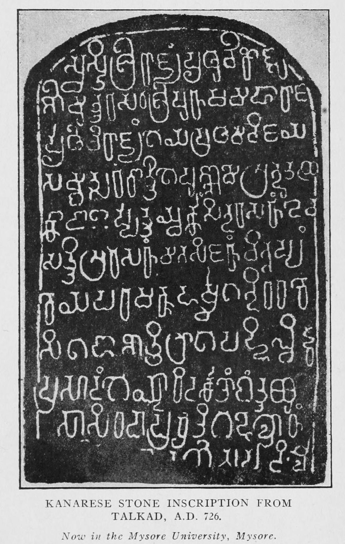
A hero stone (Vīragallu in Kannada, Naṭukal in Tamil) is a memorial commemorating the honorable death of a hero in battle. Erected between the second half of the first millennium BCE and the 18th century CE, hero stones are found all over India. They often carry inscriptions and a variety of ornaments, including bas relief panels, frieze, and figures in carved stone. Usually they are in the form of a stone monument and may have an inscription at the bottom with a narrative of the battle. The earliest and oldest of such memorial hero stones is found in the Indian state of Tamil Nadu is more than 2400 years old that is 4th century BCE. According to the historian Upinder Singh, the largest concentration of such memorial stones is found in the Indian state of Karnataka. About two thousand six hundred and fifty hero stones, the earliest in Karnataka is dated to the 5th century CE.Chapter "Memorializing death in stone", Singh (2009), p48 The custom of erecting memorial stones date ... [...More Info...] [...Related Items...] OR: [Wikipedia] [Google] [Baidu] |
Borehole
A borehole is a narrow shaft bored in the ground, either vertically or horizontally. A borehole may be constructed for many different purposes, including the extraction of water ( drilled water well and tube well), other liquids (such as petroleum), or gases (such as natural gas). It may also be part of a geotechnical investigation, environmental site assessment, mineral exploration, temperature measurement, as a pilot hole for installing piers or underground utilities, for geothermal installations, or for underground storage of unwanted substances, e.g. in carbon capture and storage. Importance Engineers and environmental consultants use the term ''borehole'' to collectively describe all of the various types of holes drilled as part of a geotechnical investigation or environmental site assessment (a so-called Phase II ESA). This includes holes advanced to collect soil samples, water samples or rock cores, to advance ''in situ'' sampling equipment, or to install monitor ... [...More Info...] [...Related Items...] OR: [Wikipedia] [Google] [Baidu] |


