|
Bathpool, Cornwall
Bathpool ( kw, Pollbath) is a small village in the civil parish of North Hill in east Cornwall, England, United Kingdom. It is situated in the River Lynher valley on the southeast fringe of Bodmin Moor, about five miles (8 kilometres) northwest of Callington.Ordnance Survey ''One-inch Map of Great Britain; Bodmin and Launceston, sheet 186''. 1961 See also *Stara Woods Stara Woods is a privately owned woodland in east Cornwall, England, UK, of local interest after being bought by a local resident in 2004 and repurposed as a community woodland. The woods are in the Lynher valley and south-southeast of North Hill. ... Footnotes External links Villages in Cornwall {{NorthCornwall-geo-stub ... [...More Info...] [...Related Items...] OR: [Wikipedia] [Google] [Baidu] |
River Lynher
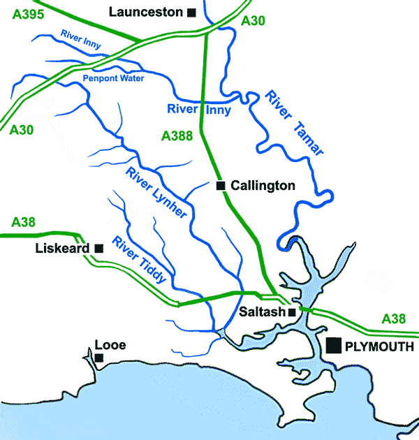
The River Lynher ( kw, Linar) (or St Germans River downstream from its confluence with the Tiddy) flows through east Cornwall, England, and enters the River Tamar at the Hamoaze, which in turn flows into Plymouth Sound. Navigation The normal tidal limit is a weir upstream of Notter Bridge. St Germans is a historic fishing village situated on the River Tiddy just upstream of its confluence with the Lynher. The Quay Sailing Club are based at St Germans Quay. The Queen's Harbour Master for Plymouth is responsible for managing navigation on the tidal Lynher and its tributaries (up to the normal tidal limits). Geography The river is about 21 miles (34 km long), rising at a height of about 920 feet (280m) on Bodmin Moor and flowing into the Tamar Estuary near Plymouth. It has four main tributaries, the largest of which is the River Tiddy. The smaller tributaries include Deans Brook, Withey Brook, Marke Valley and Darleyford streams and Kelly Brook. Ecology The Lynher an ... [...More Info...] [...Related Items...] OR: [Wikipedia] [Google] [Baidu] |
North Hill, Cornwall
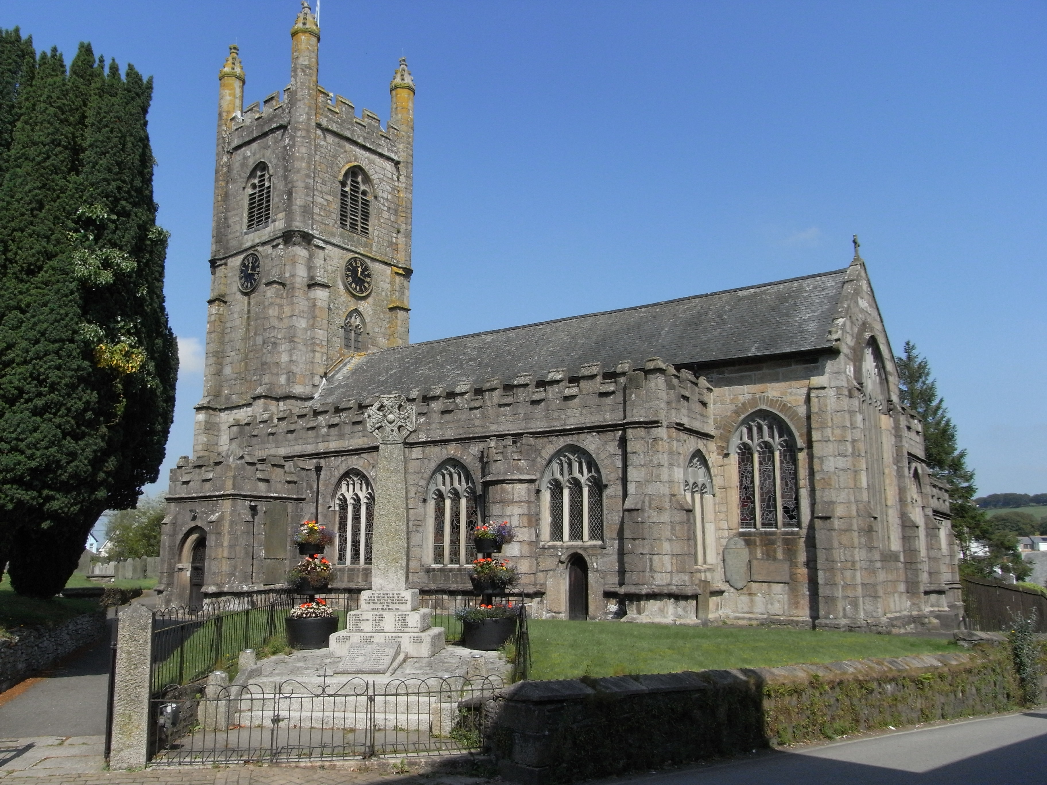
North Hill ( kw, Bre Gledh) is a village and civil parish in Cornwall, England, United Kingdom. The village is situated on the east side of the River Lynher approximately six miles (10 km) southwest of Launceston. North Hill is a large rural parish on the eastern flank of Bodmin Moor bisected northwest to southeast by the River Lynher. It is bounded in the north by Lewannick parish, on the east by Lezant and Linkinhorne parishes, on the south by St Cleer and on the west by Altarnun. GENUKI website; North Hill; retrieved April 2010 Settlements include the Churchtown, Cornwall, church town of North Hill and |
Cornwall Council
Cornwall Council ( kw, Konsel Kernow) is the unitary authority for Cornwall in the United Kingdom, not including the Isles of Scilly, which has its own unitary council. The council, and its predecessor Cornwall County Council, has a tradition of large groups of independent councillors, having been controlled by independents in the 1970s and 1980s. Since the 2021 elections, it has been under the control of the Conservative Party. Cornwall Council provides a wide range of services to the approximately half a million people who live in Cornwall. In 2014 it had an annual budget of more than £1 billion and was the biggest employer in Cornwall with a staff of 12,429 salaried workers. It is responsible for services including: schools, social services, rubbish collection, roads, planning and more. History Establishment of the unitary authority On 5 December 2007, the Government confirmed that Cornwall was one of five councils that would move to unitary status. This was enacted b ... [...More Info...] [...Related Items...] OR: [Wikipedia] [Google] [Baidu] |
Cornwall
Cornwall (; kw, Kernow ) is a historic county and ceremonial county in South West England. It is recognised as one of the Celtic nations, and is the homeland of the Cornish people. Cornwall is bordered to the north and west by the Atlantic Ocean, to the south by the English Channel, and to the east by the county of Devon, with the River Tamar forming the border between them. Cornwall forms the westernmost part of the South West Peninsula of the island of Great Britain. The southwesternmost point is Land's End and the southernmost Lizard Point. Cornwall has a population of and an area of . The county has been administered since 2009 by the unitary authority, Cornwall Council. The ceremonial county of Cornwall also includes the Isles of Scilly, which are administered separately. The administrative centre of Cornwall is Truro, its only city. Cornwall was formerly a Brythonic kingdom and subsequently a royal duchy. It is the cultural and ethnic origin of the Cor ... [...More Info...] [...Related Items...] OR: [Wikipedia] [Google] [Baidu] |
North Cornwall (UK Parliament Constituency)
North Cornwall is a constituency represented in the House of Commons of the UK Parliament by Scott Mann, a Conservative since the 2015 general election. Like all British constituencies, the seat elects one Member of Parliament (MP) by the first past the post system of election at least every five years. The seat was created in 1918. Since 1950, the constituency has been held by MPs from either the Conservative Party or the Liberal Democrats (including the party's predecessor, the Liberal Party). History This constituency was created under the Representation of the People Act 1918. With exceptions in 1997 and 2001 the seat's margin of victory has been less than 20% of the vote; it has been consistently fought over between and won by the Conservative Party and the Liberal Democrats's candidate (or predecessor party in the latter case), and can be considered a marginal seat. In 1997 and 2001 the seat turned out strongly overall for the latter party. However, in the 2019 ... [...More Info...] [...Related Items...] OR: [Wikipedia] [Google] [Baidu] |
England
England is a country that is part of the United Kingdom. It shares land borders with Wales to its west and Scotland to its north. The Irish Sea lies northwest and the Celtic Sea to the southwest. It is separated from continental Europe by the North Sea to the east and the English Channel to the south. The country covers five-eighths of the island of Great Britain, which lies in the North Atlantic, and includes over 100 smaller islands, such as the Isles of Scilly and the Isle of Wight. The area now called England was first inhabited by modern humans during the Upper Paleolithic period, but takes its name from the Angles, a Germanic tribe deriving its name from the Anglia peninsula, who settled during the 5th and 6th centuries. England became a unified state in the 10th century and has had a significant cultural and legal impact on the wider world since the Age of Discovery, which began during the 15th century. The English language, the Anglican Church, and Eng ... [...More Info...] [...Related Items...] OR: [Wikipedia] [Google] [Baidu] |
Bodmin Moor
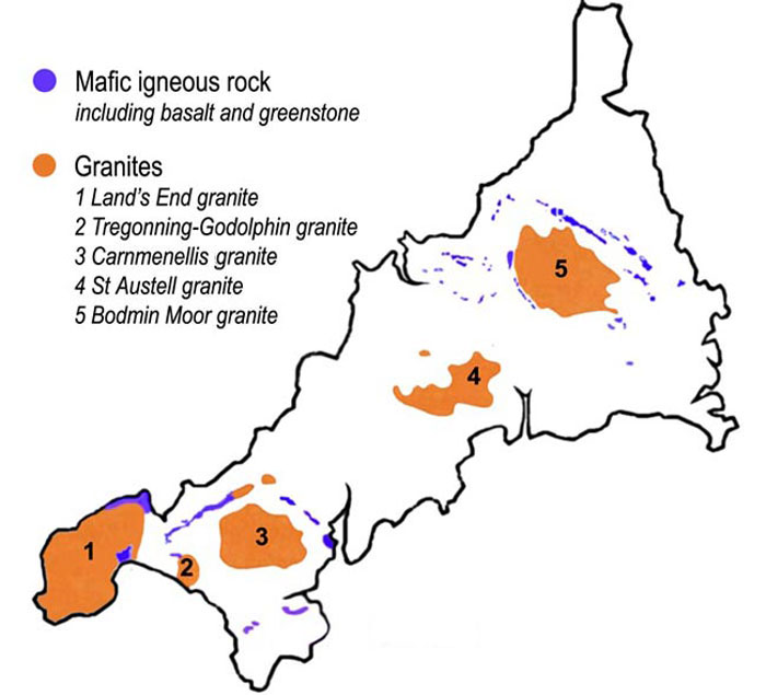
Bodmin Moor ( kw, Goon Brenn) is a granite moorland in north-eastern Cornwall, England. It is in size, and dates from the Carboniferous period of geological history. It includes Brown Willy, the highest point in Cornwall, and Rough Tor, a slightly lower peak. Many of Cornwall's rivers have their sources here. It has been inhabited since at least the Neolithic era, when primitive farmers started clearing trees and farming the land. They left their megalithic monuments, hut circles and cairns, and the Bronze Age culture that followed left further cairns, and more stone circles and stone rows. By medieval and modern times, nearly all the forest was gone and livestock rearing predominated. The name Bodmin Moor is relatively recent. An early mention is in the ''Royal Cornwall Gazette'' of 28 November 1812. The upland area was formerly known as Fowey Moor after the River Fowey, which rises within it. Geology Bodmin Moor is one of five granite plutons in Cornwall that make up ... [...More Info...] [...Related Items...] OR: [Wikipedia] [Google] [Baidu] |
Callington, Cornwall
Callington ( kw, Kelliwik) is a civil parish and town in east Cornwall, England, United Kingdom about north of Saltash and south of Launceston. Callington parish had a population of 4,783 in 2001, according to the 2001 census. This had increased to 5,786 in the 2011 census. Geography The town is situated in east Cornwall between Dartmoor to the east and Bodmin Moor to the west. A former agricultural market town, it lies at the intersection of the south–north A388 Saltash to Launceston road and the east–west A390 Tavistock to Liskeard road. Kit Hill is a mile north-east of the town and rises to with views of Dartmoor, Bodmin Moor and the River Tamar. The hamlets of Bowling Green, Kelly Bray, Frogwell and Downgate are in the parish. Railway station Callington railway station was the terminus of a branch line from Bere Alston, the junction with the Southern Railway's Tavistock to Plymouth line. The railway line beyond Gunnislake to the Callington terminus was ... [...More Info...] [...Related Items...] OR: [Wikipedia] [Google] [Baidu] |
Stara Woods
Stara Woods is a privately owned woodland in east Cornwall, England, UK, of local interest after being bought by a local resident in 2004 and repurposed as a community woodland. The woods are in the Lynher valley and south-southeast of North Hill. Location and natural features Stara Woods is a woodland of circa located west of Rillaton and south of Bathpool in east Cornwall. The name derives from Stara Bridge, a medieval clapper bridge located at the south of the woods. It is made up of three discrete woods: Colquite Wood and Treovis Wood, deciduous woodlands dating back at least to the 17th century; and Broad Wood, a conifer plantation dating to the 1980s, and in process of being replanted with oak, beech and hazel. Treovis and Broad Woods lie on the southern and western oxbow valley of the River Lynher, facing north and east, whilst Colquite Wood is to the east of the river facing west and south; all at elevations from to circa above sea level. A tributary of the Lynher, S ... [...More Info...] [...Related Items...] OR: [Wikipedia] [Google] [Baidu] |


