|
Batam
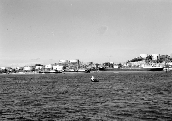
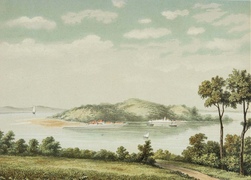
Batam, officially the City of Batam (, not to be confused with ''Batam Kota'', a kecamatan, district within this city), is the largest List of regencies and cities of Indonesia, city in the Indonesian province of Riau Islands. The city administrative area covers three main islands of Batam, Rempang and Galang Island, Galang (collectively called Barelang), as well as Bulan Island, Bulang to the west and several smaller islands. Batam Island is the core Urban area, urban and Zoning, industrial zone, while both Rempang Island and Galang Island maintain their rural character and low-density population; they are connected to Batam Island by short bridges. Bulan Island, Bulang Island and the islands to its north forming Belakang Padang District lie to the west of Batam Island but are also administratively within the city. Batam is an industrial boomtown, an emerging transport hub and part of a free trade zone in the Indonesia–Malaysia–Singapore Growth Triangle, located off Singapore ... [...More Info...] [...Related Items...] OR: [Wikipedia] [Google] [Baidu] |
Riau Islands
The Riau Islands () is a provinces of Indonesia, province of Indonesia consisting of a group of islands located in the western part of the country. It was established in 2002 after being separated from the neighboring Riau Province. The capital of the province is Tanjung Pinang, while the largest city is Batam. It shares a maritime border with Riau and Jambi to the west, Bangka Belitung Islands to the south, Singapore to the northeast, Malaysia and West Kalimantan to the east, and Vietnam and Cambodia to the north. It comprises a total of 2,408 islands (1,798 having names) scattered between Sumatra, Malay Peninsula, and Borneo including the Riau Archipelago. Situated on one of the world's busiest shipping lanes along the Malacca Strait and the Natuna Sea (South China Sea), the province shares water borders with neighboring countries such as Singapore, Malaysia, and Brunei. The Riau Islands also have relatively large potential mineral resources and energy, as well as marine reso ... [...More Info...] [...Related Items...] OR: [Wikipedia] [Google] [Baidu] |
Rempang
Rempang Island () is an Indonesian island, located 2.5 km southeast of the neighbouring Batam Island, with the total land mass size of 165.83 km2. Rempang Island belongs to the three- interconnected islands group of Riau Archipelago known as '' Barelang'' (an abbreviation of Batam-Rempang- Galang), and administratively part of the Riau Islands Province. The nearest urban city to Rempang Island is the Tanjung Pinang City, located on neighbouring Bintan Island. History Rempang Island was originally uninhabited, and remained so until the end of the 20th century. The Barelang Bridge was built by the Indonesian government from 1992 to 1998 in an effort to develop the economic and business sector on the island which was thought as the continuation of business line to connect Rempang to the neighbouring islands of Batam and Galang. Although the island was initially uninhabited, there are claims made by the Malays (the ethnic group of neighbouring Sumatra Island) that R ... [...More Info...] [...Related Items...] OR: [Wikipedia] [Google] [Baidu] |
Barelang
Barelang Bridge () is a chain of 6 bridges of various types built in 1997 that connect the Rempang- Galang island group in the Riau Archipelago with the principal island of Batam to its north. The smaller islands of Tonton, Nipah, and Setotok (considered parts of the Batam island group) connect Batam and Rempang, while a further small island - Galang Baru - is connected at the southern end of the chain. The entire Barelang region covers . Some locals call the bridge ''Jembatan Habibie'' after Jusuf Habibie, who oversaw the project in construction, aiming to transform the Rempang and Galang islands into industrial sites (resembling present-day Batam). The concept design for the 6 bridges were proposed by Bruce Ramsay of VSL. Habibie had requested that the designs should be based on a variation of different structural bridge types, in order to introduce & develop new bridge design & building technologies for the Indonesian market. Over time the bridge sites have grown more into a ... [...More Info...] [...Related Items...] OR: [Wikipedia] [Google] [Baidu] |
Galang Island
Galang (Indonesian: Pulau Galang) is an island of 80 km2 located 25 mi (40 km) southeast of Batam, belonging to a group of three islands called Barelang (an abbreviation of Batam-Rempang-Galang). Part of the Riau Archipelago, Indonesia, Galang is located just south of Batam and Rempang which themselves are just south of Singapore and Johor. Administratively, all three islands form part of the city of Batam; the nearest other city to Galang is Tanjungpinang on Bintan island, about a 30-minute boat ride away. The island is connected by the Barelang Bridge to Rempang and Batam. There was a UNHCR administration office established in Galang to run the Galang Refugee Camp during the 1979-1996 period. Many Vietnamese boat people and asylum seekers were temporarily accommodated in the Galang camp during the determination of their refugee status and their subsequent resettlement in the United States, Australia, and some European countries. Many Vietnamese from their new r ... [...More Info...] [...Related Items...] OR: [Wikipedia] [Google] [Baidu] |
List Of Indonesian Cities By GDP
This is a list of cities in Indonesia by gross regional product (GRP Nominal and PPP) according to the Statistics Indonesia. Methodology GRP Nominal is the regional or provincial counterpart of the national gross domestic product, the most comprehensive measure of national economic activity. The Statistics Indonesia (''Badan Pusat Statistik'') derives GRP for a province as the sum of the GRP Nominal originating in all the industries in the province at current prices market. GRP are the amount of remuneration received by factors of production participating in the production process in a region within a certain period of time (usually one year). With component 1. Household Consumption Expenditures 2. Consumption Expenditures of Non-Profit Institutions Serving Households (NPISHs) 3. Government Consumption Expenditures (GCE) 4. Gross Fixed Capital Formation (GFCF) 5. Changes in Inventories 6. Net Exports (Exports minus Imports) List of Indonesian cities by GDP Nominal and PPP in 20 ... [...More Info...] [...Related Items...] OR: [Wikipedia] [Google] [Baidu] |
Bulan Island
Bulan Island or Pulau Bulang is an island located 2.5 km south-west of Batam Island, with a land area of 100 km2. It is located in the Sijori Growth Triangle, Riau Islands Province, Indonesia. It is the largest island adjacent to Batam on its western side and is administratively part of Batam city. The strait between them is shallow and land reclamation and island amalgamation is feasible. The entire island is operated by PT Indo Tirta Suaka, a subsidiary of the Salim Group The Salim Group is Indonesia's biggest conglomerate and refers to companies where the Salim family holds majority ownership. Its assets include Indofood Sukses Makmur, the world's largest instant noodle producer; Indomobil Group, one of Indon .... The company operates a pig farm, and associated crocodile and orchid farms. References Riau Archipelago Uninhabited islands of Indonesia {{RiauIslands-geo-stub ... [...More Info...] [...Related Items...] OR: [Wikipedia] [Google] [Baidu] |
Telephone Numbers In Indonesia
Telephone numbers in Indonesia have different systems for land lines and mobile phones: land lines use area codes, while mobile phones do not. For land line area codes, the digit "0" is added in front when dialing domestic long distance from within Indonesia, but is always omitted when calling from abroad. Instead, callers would use the Indonesian country code +62, followed by the area code, without the "0". Domestic phone numbers in large cities have 8 digits, and in other areas 7 digits. Mobile phone numbers have a total of 9 to 11 digits for postpaid depending on the operator, whereas prepaid services get 10 to 12 digits determined by the operator. Until October 1999, East Timor was included in the Indonesian telephone numbering plan, using the area codes 0390 (for Dili) and 0399 (for Baucau). To make a phone call to Indonesia from abroad, the following formats are used: For calls to landlines, callers dial +62, followed by the area code and subscriber's number, omitting t ... [...More Info...] [...Related Items...] OR: [Wikipedia] [Google] [Baidu] |
Vehicle Registration Plates Of Indonesia
Motorized vehicles in Indonesia are required to have Vehicle registration plate, registration plates, which must be displayed both at the front and back of the vehicles. The issuing of number plates is regulated and administered by SAMSAT (), which is a collaboration between the Indonesian National Police, provincial offices of regional revenue, and the national mandatory vehicle insurance operator Vehicle insurance#Indonesia, Jasa Raharja. Registration area codes The lettering convention denoting the area of registration is a legacy of the Dutch colonial era and does not reflect the current regional divisions of the country into provinces. They follow the old system of Dutch ''Karesidenan'' or Residency (administrative division), residencies lettering systems, which were adopted in the 1920s, and the Territorial Police system which was abolished in 2010. The list of area codes are: Several areas provide license plates for non-motorized transport vehicles. In Yogyakart ... [...More Info...] [...Related Items...] OR: [Wikipedia] [Google] [Baidu] |
List Of Indonesian Provinces By Human Development Index
This is a list of Provinces of Indonesia, Indonesian provinces by Human Development Index as of 2024. The data are regularly published every year by Statistics Indonesia. Below also contains list of cities and regencies that has classification of very high HDI as of 2024, as well as historical data of HDI of Indonesian provinces. Methodology The figures come from the Indonesia Human Development Report, published by Statistics Indonesia and Human Development Index (by UN Method) of Indonesian provinces since 1990 (2021 revision). By Statistics Indonesia in 2024 Source published by Statistics Indonesia. Cities and regencies List of cities of Indonesia with very high HDI (2024) List of regencies of Indonesia with very high HDI (2024) By UNDP reports Trends by Statistics Indonesia Trends by UNDP reports Notes See also * Economy of Indonesia * List of Indonesian provinces by GDP * List of Indonesian provinces by GDP per capita * List of Indon ... [...More Info...] [...Related Items...] OR: [Wikipedia] [Google] [Baidu] |
List Of Regencies And Cities Of Indonesia
Regency (Indonesia), Regencies () and City status in Indonesia#Kota, cities (''kota'') are the second-level subdivisions of Indonesia, administrative subdivision in Indonesia, immediately below the Provinces of Indonesia, provinces, and above the Districts of Indonesia, districts. Regencies are roughly equivalent to American County (United States), counties, although Lists of populated places in the United States, most cities in the United States are below the counties. Following the implementation of decentralization beginning on 1 January 2001, regencies and city municipalities became the key administrative units responsible for providing most governmental services. Each of regencies and cities has their own local government and legislative body. The difference between a regency and a city lies in demography, size, and economy. Generally, a regency comprises a rural area larger than a city, but also often includes various towns. A city usually has non-agricultural economic acti ... [...More Info...] [...Related Items...] OR: [Wikipedia] [Google] [Baidu] |
Provinces Of Indonesia
Provinces are the first-level administrative divisions of Indonesia. They were formerly called first-level provincial regions (), before the Post-Suharto era in Indonesia, Reform era. Provinces have a local government, consisting of a List of current governors in Indonesia, governor () and a Regional House of Representatives, regional legislative body (). The governor and members of local representative bodies are elected by Election, popular vote for five-year terms, but governors can only serve for two terms. Provincial governments have the authority to regulate and manage their own government affairs, subject to the limits of the Government of Indonesia, central government. The average land area of all 38 provinces in Indonesia is about , and they had an average population of 7,410,626 people in mid-2024. Indonesia is divided into 38 provinces, nine of which have special autonomous status. The terms for special status are "" and "", which translate to "special", or "designat ... [...More Info...] [...Related Items...] OR: [Wikipedia] [Google] [Baidu] |


