|
Barcaldine, Queensland
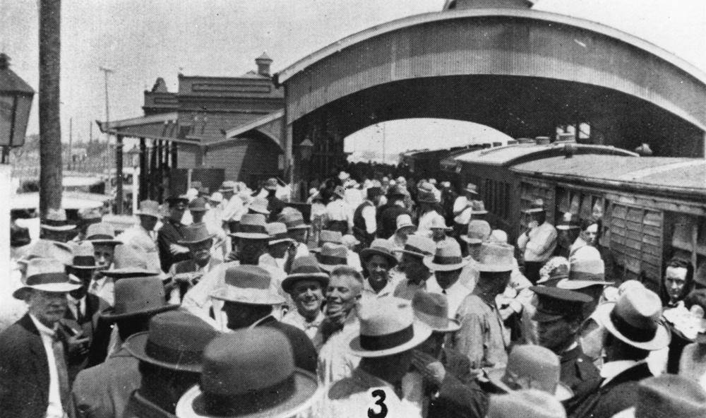
Barcaldine () is a rural town and locality in the Barcaldine Region in Queensland, Australia. This is the administrative centre of the Barcaldine Region. Barcaldine played a major role in the Australian labour movement. In the , Barcaldine had a population of 1,422 people. Geography Barcaldine is in Central West Queensland, approximately by road west of the city of Rockhampton, 406 kilometres (251 mi) north of Charleville. The town is situated on Lagoon Creek, which flows into the Alice River approximately five kilometres south of the Barcaldine. Major industries are sheep and beef cattle rearing. The streets in Barcaldine are named after different types of trees. History Barcaldine lay on the traditional tribal lands of the Iningai. Iningai (also known as Yiningay, Muttaburra, Tateburra, Yinangay, Yinangi) is an Australian Aboriginal language spoken by the Iningai people. The Iningai language region includes the landscape within the local government boundaries of the L ... [...More Info...] [...Related Items...] OR: [Wikipedia] [Google] [Baidu] |
Barcaldine Region
The Barcaldine Region is a local government area in Central West Queensland, Australia. Established in 2008, it was preceded by three previous local government areas which had existed for over a century. It has an estimated operating budget of A$21.6 million. History Barcaldine Region includes the traditional tribal lands of the Iningai. Iningai (also known as Yiningay, Muttaburra, Tateburra, Yinangay, Yinangi) is an Australian Aboriginal language spoken by the Iningai people. The Iningai language region includes the landscape within the local government boundaries of the Longreach Region and Barcaldine Region, particularly the towns of Longreach, Barcaldine, Muttaburra and Aramac as well as the properties of Bowen Downs and catchments of Cornish Creek and Alice River. Kuungkari (also known as Kungkari and Koonkerri) is a language of Western Queensland. The Kuungkari language region includes the landscape within the local government boundaries of Longreach Shire C ... [...More Info...] [...Related Items...] OR: [Wikipedia] [Google] [Baidu] |
Charleville, Queensland
Charleville () is a rural town and locality in the Shire of Murweh, Queensland, Australia. In the , the locality of Charleville had a population of 3,335 people. Geography Located in southwestern Queensland, Australia, Charleville is west of Brisbane (the Queensland capital), 616 kilometres (384 mi) west of Toowoomba, 535 kilometres (333 mi) west of Dalby, 393 kilometres (244 mi) west of Miles and 254 kilometres (158 mi) west of Roma. It is the largest town and administrative centre of the Shire of Murweh, which covers an area of 43,905 square kilometres. Charleville is situated on the banks of the Warrego River. Charleville is the terminus for the Warrego Highway which stretches 683 kilometres (424 mi) from Brisbane. The Mitchell Highway also connects Charleville with: * Augathella - 84 kilometres (53 mi) north * Wyandra - 124 kilometres (77 mi) south * Cunnamulla - 198 kilometres (123 mi) south * Bourke - 454 kilometres ( ... [...More Info...] [...Related Items...] OR: [Wikipedia] [Google] [Baidu] |
Artesian Water
An artesian aquifer is a confined aquifer containing groundwater under positive pressure. An artesian aquifer has trapped water, surrounded by layers of impermeable rock or clay, which apply positive pressure to the water contained within the aquifer. If a well were to be sunk into an artesian aquifer, water in the well-pipe would rise to a height corresponding to the point where hydrostatic equilibrium is reached. A well drilled into such an aquifer is called an ''artesian well''. If water reaches the ground surface under the natural pressure of the aquifer, the well is termed a ''flowing artesian well''. Fossil water aquifers can also be artesian if they are under sufficient pressure from the surrounding rocks, similar to how many newly tapped oil wells are pressurized. From the previous statement, it can be inferred that not all aquifers are artesian (i.e., water table aquifers occur where the groundwater level at the top of the aquifer is at equilibrium with atmospher ... [...More Info...] [...Related Items...] OR: [Wikipedia] [Google] [Baidu] |
Central Western Railway Line, Queensland
The Central Western railway line is a railway line in Queensland, Australia. It was opened in a series of sections between 1867 and 1928. It commences at Rockhampton and extends west to Winton. History Following the separation of Queensland from the colony of New South Wales in 1859, Queensland consisted of a vast area with a population of approximately 30,000 people, most of who lived in the southeast corner of the colony. The new Queensland Government was keen to facilitate development and immigration, and had approved the construction of the Main Line from Ipswich, about to the fertile Darling Downs region in 1864. This was the first narrow gauge () main line in the world. Following the establishment of the settlement of Rockhampton in 1858, and the discovery of gold at nearby Canoona in 1859, there were calls for improved land transportation in the region. Despite the goldrush being short-lived, it established Rockhampton as the main port for Central Queensland, an ... [...More Info...] [...Related Items...] OR: [Wikipedia] [Google] [Baidu] |
British Guiana
British Guiana was a British colony, part of the mainland British West Indies, which resides on the northern coast of South America. Since 1966 it has been known as the independent nation of Guyana. The first European to encounter Guiana was Sir Walter Raleigh, an English explorer. The Dutch Empire, Dutch were the first Europeans to settle there, starting in the early 17th century, when they founded the colonies of Essequibo (colony), Essequibo and Berbice, adding Demerara in the mid-18th century. In 1796, Great Britain took over these three colonies during hostilities with the French, who had occupied the Netherlands. Britain returned control to the Batavian Republic in 1802 but captured the colonies a year later during the Napoleonic Wars. The colonies were officially ceded to the United Kingdom in 1815 and consolidated into a single colony in 1831. The colony's capital was at Georgetown, Guyana, Georgetown (known as Stabroek prior to 1812). The economy has become more divers ... [...More Info...] [...Related Items...] OR: [Wikipedia] [Google] [Baidu] |
Barcaldine, Argyll
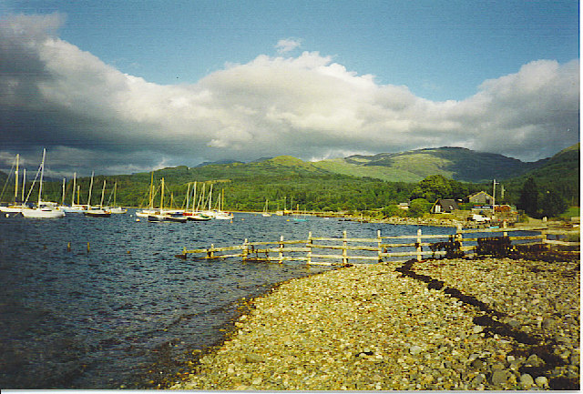
Barcaldine ( gd, Am Barra Calltainn) is a small settlement in Scotland centred on the historic Barcaldine House and located on the banks of Loch Creran between Oban and Ballachulish. There was formerly a railway station here. Barcaldine Castle is located a few kilometres to the west. The castle was built in the 15th century by Sir Douglas Campbell of Glenorchy (or Glen Orchy). There is also Barcaldine House Hotel. The town of Barcaldine in western Queensland ) , nickname = Sunshine State , image_map = Queensland in Australia.svg , map_caption = Location of Queensland in Australia , subdivision_type = Country , subdivision_name = Australia , established_title = Before federation , established_ ..., Australia is named (indirectly) after Barcaldine in Argyll.Reed, A.W. (1973). ''Place Names of Australia'', p. 22 Sydney: A.H. & A.W. Reed. . References Villages in Argyll and Bute Ports and harbours of Scotland {{Argyll-geo-stub ... [...More Info...] [...Related Items...] OR: [Wikipedia] [Google] [Baidu] |
State Library Of Queensland
The State Library of Queensland is the main reference and research library provided to the people of the State of Queensland, Australia, by the state government. Its legislative basis is provided by the Queensland Libraries Act 1988. It contains a significant portion of Queensland's documentary heritage, major reference and research collections, and is an advocate of and partner with public libraries across Queensland. The library is at Kurilpa Point, within the Queensland Cultural Centre on the Brisbane River at South Bank. History The Brisbane Public Library was established by the government of the Colony of Queensland in 1896, and was renamed the Public Library of Queensland in 1898. The library was opened to the public in 1902. In 1934, the Oxley Memorial Library (now the John Oxley Library), named for the explorer John Oxley, opened as a centre for research and study relating specifically to Queensland. The Libraries Act of 1943 established the Library Board of Queensl ... [...More Info...] [...Related Items...] OR: [Wikipedia] [Google] [Baidu] |
Cornish Creek, Queensland
Cornish Creek is a former rural locality in the Barcaldine Region, Queensland, Australia. In the , Cornish Creek had a population of 16 people. On 22 November 2019 the Queensland Government decided to amalgamate the localities in the Barcaldine Region, resulting in five expanded localities based on the larger towns: Alpha, Aramac, Barcaldine, Jericho and Muttaburra. Most of Cornish Creek was incorporated into Muttaburra, except for a small part of eastern Cornish Creek which was incorporated into Aramac. Geography The Thomson River forms the south-western boundary of the locality. Cornish Creek flows through the locality from east ( Upper Cornish Creek) to west ( Tablederry) where it becomes a tributary to the Thomson River. All watercourses in the locality flow into the Lake Eyre drainage basin. The Muttaburra Aramac Road enters the locality from the west ( Muttaburra) and passes through the locality exiting to the south (Sardine). Crossmore Road enters the locality fro ... [...More Info...] [...Related Items...] OR: [Wikipedia] [Google] [Baidu] |
Bowen Downs Station
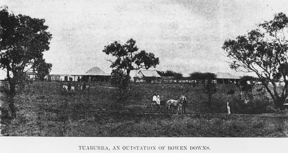
Bowen Downs Station is a pastoral lease that has operated both as a cattle station and a sheep station. It is located about east of Muttaburra and north west of Aramac in the outback of Queensland. It is watered by the Thomson River and tributaries Reedy Creek and Cornish Creek that all run through the property. History The traditional owners of the area are the Iningai peoples. Iningai (also known as Yiningay, Muttaburra, Tateburra, Yinangay, Yinangi) is an Australian Aboriginal language spoken by the Iningai people. The Iningai language region includes the landscape within the local government boundaries of the Longreach Region and Barcaldine Region, particularly the towns of Longreach, Barcaldine, Muttaburra and Aramac as well as the properties of Bowen Downs and catchments of Cornish Creek and Alice River. The first Europeans to visit the area were the explorers William Landsborough and Nathaniel Buchanan who passed through in 1860. Landsborough named the area ... [...More Info...] [...Related Items...] OR: [Wikipedia] [Google] [Baidu] |
Muttaburra
Muttaburra is an outback town and locality in the Barcaldine Region, Queensland, Australia. Muttaburra was the discovery site of the '' Muttaburrasaurus'', one of Australia's most famous dinosaurs. Geography Muttaburra is in the central west of Queensland. The town is located on the banks of the Thomson River, which is part of the Lake Eyre drainage basin. The region is with a sub-basin of the Great Artesian Basin. The Great Artesian Basin supplies water from bores to the towns of Muttaburra and Aramac. The area is well known for its good quality land that is used for sheep and cattle grazing. The main industry of the Muttaburra area is grazing. The undeveloped town of Scarrbury is within the locality (). Scarrbury is located on Aramac Creek along Vera Park Road. History Muttaburra lay on the traditional tribal lands of the Iningai. Iningai (also known as Yiningay, Muttaburra, Tateburra, Yinangay, Yinangi) is an Australian Aboriginal language spoken by the Iningai peo ... [...More Info...] [...Related Items...] OR: [Wikipedia] [Google] [Baidu] |
Longreach Region
The Longreach Region is a local government area in Central West Queensland, Australia. Established in 2008, it superseded three previous local government areas that had existed for more than a century. It has an estimated operating budget of A$22.3m. Traditionally, pastoral activities, tourism, and rural education have been the areas of focus within the region, with a major agricultural college and attractions such as the Australian Stockman's Hall of Fame and the Qantas Founders Outback Museum. History Longreach Region lay on the traditional tribal lands of the Iningai. Iningai (also known as Yiningay, Muttaburra, Tateburra, Yinangay, Yinangi) is an Australian Aboriginal language spoken by the Iningai people. The Iningai language region includes the landscape within the local government boundaries of the Longreach Region, particularly the towns of Longreach, Barcaldine, Muttaburra and Aramac as well as the properties of Bowen Downs and catchments of Cornish Creek an ... [...More Info...] [...Related Items...] OR: [Wikipedia] [Google] [Baidu] |
Australian Aboriginal Languages
The Indigenous languages of Australia number in the hundreds, the precise number being quite uncertain, although there is a range of estimates from a minimum of around 250 (using the technical definition of 'language' as non-mutually intelligible varieties) up to possibly 363. The Indigenous languages of Australia comprise numerous language families and isolates, perhaps as many as 13, spoken by the Indigenous peoples of mainland Australia and a few nearby islands. The relationships between the language families are not clear at present although there are proposals to link some into larger groupings. Despite this uncertainty, the Indigenous Australian languages are collectively covered by the technical term "Australian languages", or the "Australian family". The term can include both Tasmanian languages and the Western Torres Strait language, but the genetic relationship to the mainland Australian languages of the former is unknown, while the latter is Pama–Nyungan, th ... [...More Info...] [...Related Items...] OR: [Wikipedia] [Google] [Baidu] |


