|
Bantwal
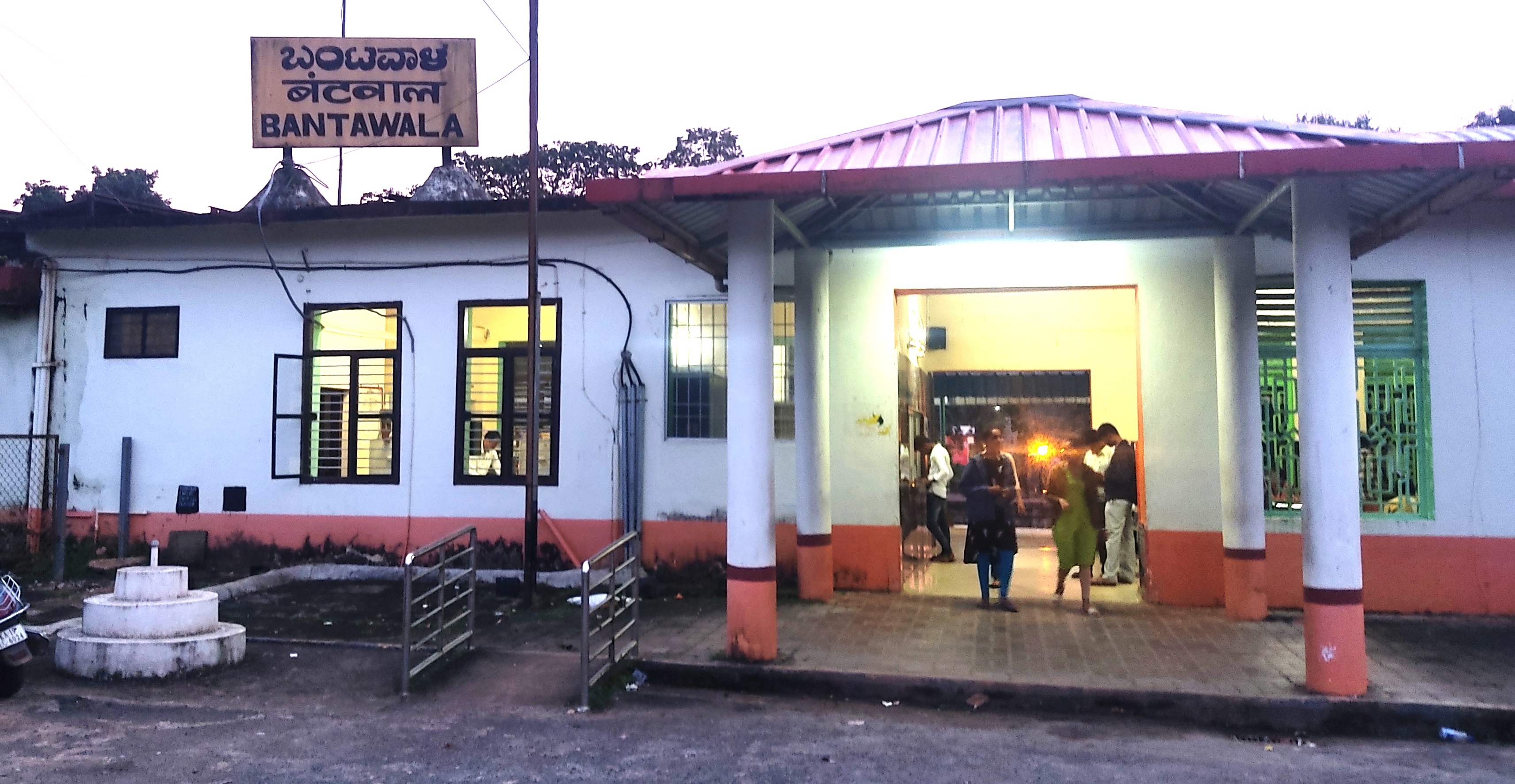
Bantwal () is a city and taluk centre in Dakshina Kannada Districts of Karnataka, district, Karnataka, India, and the headquarters of Bantwal taluk. It is located East of Mangalore, Mangalore city center. BC Road-Kaikamba of Bantwal is one of the fastest developing areas in Dakshina Kannada district of Karnataka. Along with BC Road-Kaikamba, Panemangalore & Melkar regions are also urbanized. They are also developing as the eastern suburbs of Mangalore. Towards east of Mangalore, the stretch to BC Road-Kaikamba region forms a continuous Mangalore Urban Agglomeration area which is currently the second biggest in Karnataka after Bangalore. Bantwal is the fourth largest urban area in Dakshina Kannada district after Mangalore, Ullal (both comes under Mangalore Urban Agglomeration area) & Puttur, Karnataka, Puttur in terms of population. History It is situated on the banks of River Nethravati on the National Highway 73 (India). The adjacent town of B.C. Road (Bantwal Cross Ro ... [...More Info...] [...Related Items...] OR: [Wikipedia] [Google] [Baidu] |
Bantwal Taluk
Bantwal taluk is a taluk of Dakshina Kannada district. The headquarters is the town of Bantwal, an eastern suburb of Mangalore. Prior to 1852, Bantwal Taluk was the largest taluk in the entire of Kanara, Canara Province (then comprising North Canara, Udupi, Mangalore and Kasaragod district, Kasaragod Districts) with 411 villages and a total population of 1,69,416. In 1852, a portion of it was formed into the Taluk of Puttur, Karnataka, Puttur."A Gazetteer of Southern India" published in 1855 Bantwal was an entrepot for the produce of the province on its way to the Mysore Country and had derived a great benefit of late years from the extension of the coffee trade. It contained about thousand scattered houses inhabited by Billava, Bunt (community), Bunts, Bhandary, Ganigas, Kulals, Goud Saraswat Brahmins, Mangalorean Catholics, Konkani Catholics and a few Jains. Geography Bantwal is located along the coast of river Netravathi. Every year due to heavy rains the river floods. The ... [...More Info...] [...Related Items...] OR: [Wikipedia] [Google] [Baidu] |
Dakshina Kannada
Dakshina Kannada district is located in the states and territories of India, state of Karnataka in India, with its headquarters in the coastal city of Mangaluru. The district covers an area nestled in between the Western Ghats to its east and the Arabian Sea to its west. Dakshina Kannada receives abundant rainfall during the Indian monsoon. It is bordered by Udupi district (formerly a part of this district) to the north, Chikmagalur district to the northeast, Hassan district to the east, Kodagu to the southeast and Kasaragod district of Kerala to the south. According to the 2011 census of India, Dakshina Kannada district had a population of 2,089,649. It is the only district in Karnataka state to have all modes of transport like road, rail, water and air due to the presence of a major hub, Mangaluru. This financial district is also known as the Cradle of Indian banking. Geography File:Sullia. Karnataka (3).jpg, Hilly region – Sullia Town File:Tannirubhavi beach 02.JPG, Coasta ... [...More Info...] [...Related Items...] OR: [Wikipedia] [Google] [Baidu] |
Dakshina Kannada District
Dakshina Kannada district is located in the state of Karnataka in India, with its headquarters in the coastal city of Mangaluru. The district covers an area nestled in between the Western Ghats to its east and the Arabian Sea to its west. Dakshina Kannada receives abundant rainfall during the Indian monsoon. It is bordered by Udupi district (formerly a part of this district) to the north, Chikmagalur district to the northeast, Hassan district to the east, Kodagu to the southeast and Kasaragod district of Kerala to the south. According to the 2011 census of India, Dakshina Kannada district had a population of 2,089,649. It is the only district in Karnataka state to have all modes of transport like road, rail, water and air due to the presence of a major hub, Mangaluru. This financial district is also known as the Cradle of Indian banking. Geography File:Sullia. Karnataka (3).jpg, Hilly region – Sullia Town File:Tannirubhavi beach 02.JPG, Coastal plain – Tannirbhavi Beach ... [...More Info...] [...Related Items...] OR: [Wikipedia] [Google] [Baidu] |
Nethravati
The Netravati River or Netravathi Nadi has its origins at Bangrabalige valley, Yelaneeru Ghat in Kudremukha in Chikkamagaluru district of Karnataka, India. This river flows through the famous pilgrimage place Dharmasthala and is considered one of the holy rivers of India. It merges with the Kumaradhara River at Uppinangadi before flowing to the Arabian Sea, south of Mangalore city. This river is the main source of water to Bantwal and Mangalore. Earlier in the 20th century it was known as the Bantwal River; the important town of Bantwal is seen on its banks. A reference to the River Netravati, as unfordable during the South-West Monsoon A monsoon () is traditionally a seasonal reversing wind accompanied by corresponding changes in precipitation but is now used to describe seasonal changes in Atmosphere of Earth, atmospheric circulation and precipitation associated with annu ..., can be seen in the ''Gazetteer of Southern India,'', published in 1855. It has an apparen ... [...More Info...] [...Related Items...] OR: [Wikipedia] [Google] [Baidu] |
National Highway 275 (India)
National Highway 275 (NH-275), also commonly referred to as Bengaluru–Mysuru access-controlled Expressway, part of the Bengaluru–Mangaluru Economic Corridor (EC-34), is a national highway that starts from Bengaluru and goes through Mysuru as a 6-lane expressway of , and again as 4-lane till Bilikere (towards Madikeri), and ends at Bantwal. This highway connects the coastal city of Mangaluru to Bengaluru. It is also a bypass route for the National Highway 75 (NH-75). The Bengaluru to Mysuru section of this highway was upgraded from 4 to 10 lanes, out of which the 6-lane section is the main elevated access-controlled carriageway and the other 2-lane section on both ends of the carriageway are service roads. It claims to reduce the travel time between Bengaluru and Mysuru from 3 hours to 75 minutes. Bengaluru-Mysuru section The Bengaluru–Mysuru access-controlled Expressway is a long, 10-lane, tolled elevated expressway. It has been built at a cost of ₹ 8,000 c ... [...More Info...] [...Related Items...] OR: [Wikipedia] [Google] [Baidu] |
Kanara
Kanara or Canara, also known as Karāvali, is the historically significant stretch of land situated by the southwestern Konkan coast of India, alongside the Arabian Sea in the present-day Indian state of Karnataka. The subregion comprises three civil districts, namely: Uttara Kannada, Udupi district, Udupi, and Dakshina Kannada. Kasaragod was included prior to the States Reorganisation Act. Etymology According to historian Severino da Silva, the ancient name for this region is ''Parashurama Srushti'' (creation of Parashurama). According to him and Stephen Fuchs, the name ''Canara'' is the invention of Portuguese people, Portuguese, Dutch people, Dutch, and English people, English people who visited the area for trade from the early sixteenth century onwards. The Bednore Dynasty, under whose rule this tract was at that time, was known to them as the Kannada Dynasty, i.e., the dynasty speaking the Kannada language. "Karāvalli", the Kannada word for 'coast', is the term used ... [...More Info...] [...Related Items...] OR: [Wikipedia] [Google] [Baidu] |
Bunt (community)
The Bunt (, ) people are an Indian community who historically have inhabited the Tulu Nadu region in South India. Bunts were traditionally a Kshatriya, warrior-class or martial caste community, with agrarian origins, forming the landed gentry of the region. They are the dominant land-owning, farming and banking community of Tulu Nadu and speak Tulu language, Tulu and Kundagannada as their mother tongue. Today, the Bunts are a largely urbanised community, with a population size of less than one million worldwide. Etymology The word ''Bunt'' means ''powerful man'' or ''warrior'' in Tulu language. Bunts are also referred to as ''okkelme,'' which means farmers or cultivators and references their agrarian origins. History American anthropologist Sylvia Vatuk states that the Bunt community was a loosely defined social group. The matrilineality, matrilineal kin groups that constituted the caste were linguistically, geographically and economically diverse, which were united by th ... [...More Info...] [...Related Items...] OR: [Wikipedia] [Google] [Baidu] |
Mangalorean Catholics
Mangalorean Catholics () are an ethno-religious community of Latin Church in India, Latin Christians from the Roman Catholic Diocese of Mangalore, Diocese of Mangalore and the erstwhile South Canara area; by the southern coast of present-day Karnataka, India. Contemporary Mangalorean Catholics descend mainly from the New Christians of Portuguese Goa, who migrated to the Keladi Kingdom 1560-1763, throughout the courses of the Goan Inquisition, the Portuguese–Adil Shahi Wars & the Mahratta Invasion of Goa and Bombay, Mahratta Invasions of Goa and Bombay. They learned Tulu language, Tulu and Kanarese whilst in Canara, but retained the Konkani language and preserved much of their Konkani people, Konkani way of life, which had undergone Christianisation in Goa. The "Canara Christians" faced a Captivity of Mangalorean Catholics at Seringapatam, 15-year-long captivity at Seringapatam, imposed by Tippu Sultan. Following Tippu's defeat and death at the Siege of Seringapatam (1799) by th ... [...More Info...] [...Related Items...] OR: [Wikipedia] [Google] [Baidu] |
Districts Of Karnataka
The southern Indian state of Karnataka consists of 31 districts grouped into 4 administrative divisions, ''viz''., Belagavi, Bengaluru , Gulbarga, and Mysore. Geographically, the state has three principal variants: the western coastal stretch, the hilly belt comprising the Western Ghats, and the plains, comprising the plains of the Deccan plateau. History Karnataka took its present shape in 1956, when the former states of Mysore and Coorg were unified into a linguistically homogenous Kannada-speaking state along with agglomeration of districts of the former states of Bombay, Hyderabad, and Madras as part of the States Reorganisation Act of 1956. The unified Mysore State was made up of ten districts, ''viz''., Bangalore, Kolar, Tumkur, Mandya, Mysore, Hassan, Chikkamagalur, Shimoga, Chitradurga, and Ballari which had been transferred from Madras Presidency to Mysore State earlier in 1953, when the new state of Andhra Pradesh was created out of Madras' northern distr ... [...More Info...] [...Related Items...] OR: [Wikipedia] [Google] [Baidu] |
Panemangalore
Panemangalore is a locality on the banks of the Netravati River near BC Road. It lies in Bantwal taluk of Dakshina Kannada district. The National Highway 75 passes through this region. It is located 27 km east of Mangalore city. It lies in between BC Road and Melkar and forms a continuous urban area with them. They are also developing as the eastern suburbs of Mangalore. References Cities and towns in Dakshina Kannada district {{DakshinaKannada-geo-stub ... [...More Info...] [...Related Items...] OR: [Wikipedia] [Google] [Baidu] |
National Highway 73 (India)
National Highway 73 (NH 73) is a National Highway in India. This highway runs in the Indian state of Karnataka. It starts from sea port city of Mangaluru ( Mangalore) and ends at Tumakuru. Even though named as national highway the road is narrow and prone to landslips and falling of trees in Charmady ghat section of Western ghats. This highway was previously part of national highways 48, 234 and 206 but subsequent to rationalisation of national highway numbers of India by Gazette notification on 5 March 2010 it was changed to National Highway 73. Route The national highway 73 ( NH-73) connects towns of Mangaluru, Bantwal Beltangady, Ujire, Charmadi, Kottigehara, Mudigere, Belur, Halebeedu, Javagal, Banavara, Arasikere, Tiptur, Kibbanahalli, Nittur, Gubbi and Tumakuru in the state of Karnataka. Junctions : Terminal near Mangaluru. : near Bantval : near Mudigere : near Belur : near Banavara : near Kibbanahalli : Terminal near Tumakuru. See also * List o ... [...More Info...] [...Related Items...] OR: [Wikipedia] [Google] [Baidu] |


