|
Bailte Seirbhíse Gaeltachta
A Gaeltacht Service Town () is an area designated under the Gaeltacht Act 2012, situated in or adjacent to Gaeltacht areas in Ireland, that have a population of over 1,000 people, and which play a significant role in providing public services, recreational and commercial facilities for Gaeltacht residents. History In 2016 it was announced that Galway, Galway City, Dingle and Letterkenny would be the first designated Gaeltacht Service Towns subject to local networks co-formulating and adopting approved Irish language plans in conjunction with Foras na Gaeilge and Údarás na Gaeltachta. Údarás na Gaeltachta fund Gaeltacht Service Towns plans within the Gaeltacht and Foras na Gaeilge fund the plans in the towns outside of the Gaeltacht. In August 2020, the Department of Culture, Communications and Sport, Department of Rural and Community Development and the Gaeltacht recognised Dingle and Letterkenny as the first two Gaeltacht Service Towns. There are now 16 Gaeltacht Ser ... [...More Info...] [...Related Items...] OR: [Wikipedia] [Google] [Baidu] |
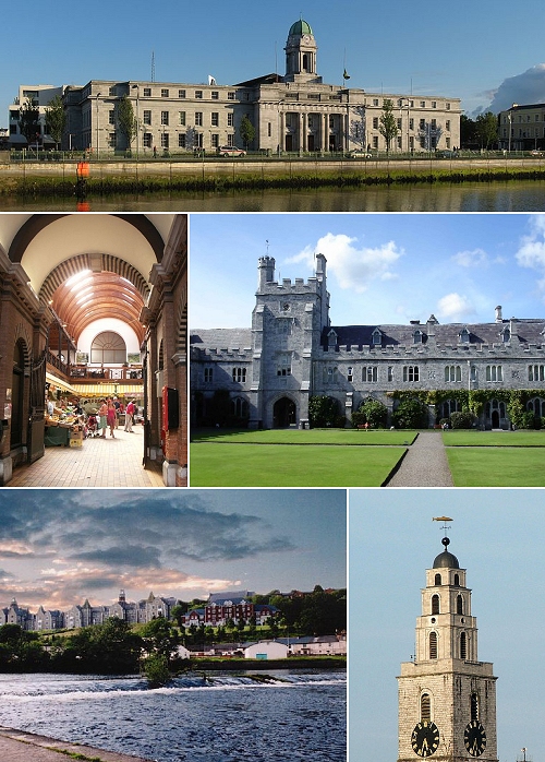
Cork City Montage Quick Collage Of CC Commons Cork Images
"Cork" or "CORK" may refer to: Materials * Cork (material), an impermeable buoyant plant product ** Stopper (plug), or "cork", a cylindrical or conical object used to seal a container ***Wine cork an item to seal or reseal wine Places Ireland * Cork (city) ** Metropolitan Cork, also known as Greater Cork ** Cork Airport * County Cork Historical parliamentary constituencies * Cork City (Parliament of Ireland constituency) * County Cork (Parliament of Ireland constituency) * Cork City (UK Parliament constituency) * County Cork (UK Parliament constituency) United States * Cork, Georgia * Cork, Kentucky Organisations * Cork GAA, responsible for Gaelic games in County Cork * Ye Antient Order of Noble Corks, a masonic order, also known as "The Cork" * Cork City F.C., a football club * Cork City W.F.C., a women's football club Other uses * A particular kind of trick in snowboarding and skiing. * Cork (surname) * Cork City (barony) * Cork encoding, a digital data format * Cork taint ... [...More Info...] [...Related Items...] OR: [Wikipedia] [Google] [Baidu] |
Clifden
Clifden () is a coastal town in County Galway, Ireland, in the region of Connemara, located on the Owenglin River where it flows into Clifden Bay. As the largest town in the region, it is often referred to as "the Capital of Connemara". Frequented by tourists, Clifden is linked to Galway city by the N59 road, N59. History 19th century The town was founded at the start of the 19th century by John D'Arcy (1785–1839), John D'Arcy who lived in Clifden Castle (built around 1818, now a ruin) west of Clifden. He had inherited the estate in 1804 when it was mostly inhabited by fishermen and farmers. The idea of establishing a town on the coast was first voiced by him in 1812. Bad communications and a lack of private capital prevented fast progress until the 1820s when the potato crop failed in 1821–22 and D'Arcy petitioned the government in Dublin for assistance. The engineer Alexander Nimmo was sent to the area in 1822. He constructed a quay at Clifden (finished in 1831) and start ... [...More Info...] [...Related Items...] OR: [Wikipedia] [Google] [Baidu] |
Irish Language Outside Ireland
The Irish language originated in Ireland and has historically been the dominant language of the Irish people. They took it with them to a number of other countries, and in Scotland and the Isle of Man it gave rise to Scottish Gaelic and Manx, respectively. In the late 19th century, English became widespread in Ireland, but Irish-speakers had already shown their ability to deal with modern political and social changes through their own language at a time when emigration was strongest. Irish was the language that a large number of emigrants took with them from the 17th century (when large-scale emigration, forced or otherwise, became noticeable) to the 19th century, when emigration reached new levels. The Irish diaspora mainly settled in English-speaking countries, chiefly Britain and North America. In some instances the Irish language was retained for several generations. Argentina was the only non-English-speaking country to which the Irish went in large numbers, and those emigra ... [...More Info...] [...Related Items...] OR: [Wikipedia] [Google] [Baidu] |
Líonraí Gaeilge
An Irish Language Network () is a designation applicable to areas in both jurisdictions on the island of Ireland. History The Gaeltacht Act 2012 (in the Republic of Ireland) allowed for the designation by the cross-border body Foras na Gaeilge and the Irish Department of Media, Tourism, Arts, Culture, Sport and the Gaeltacht of certain areas as Irish Language Networks () outside the traditional Irish-speaking areas collectively known as the . The designation recognises a certain level of community and State support for the Irish language, and is made by electoral division or settlement name. The designation is to be made where the commitment to the Irish language seems strong enough to justify it, and can be revoked if language plans are not followed-through successfully. In February 2018, Foras na Gaeilge announced that five areas – West Belfast, Loughrea, Carn Tóchair (ga), Ennis and Clondalkin Village – were designated as having the first Irish Language Networks, ... [...More Info...] [...Related Items...] OR: [Wikipedia] [Google] [Baidu] |
Cahersiveen
Cahersiveen (), sometimes Cahirciveen, is a town in the south-west of Republic of Ireland, Ireland, in County Kerry. As of the 2022 census of Ireland, 2022 census, it had a population of 1,297. Geography Cahersiveen is on the slopes of 376-metre-high Bentee, and on the lower course of the River Ferta. It is the principal settlement of the Iveragh Peninsula, near Valentia Island. The town is 50 km west of Killarney. History Evidence of ancient settlement in the area includes a number of ring fort, holy well, ring barrow, and castle sites in the townlands of Cahersiveen, Garranebane and Carhan. These include the stone forts of Cahergall and Leacanabuaile, which stand close to each other a short distance from the town. The ruins of Ballycarbery Castle, a 16th century tower house that was extended into an L-shape plan, are also nearby. In 1597, the Iveragh estate was received by Trinity College Dublin, Trinity College, Dublin as part of a royal grant. It previously belonged t ... [...More Info...] [...Related Items...] OR: [Wikipedia] [Google] [Baidu] |
Tralee
Tralee ( ; , ; formerly , meaning 'strand of the River Lee') is the county town of County Kerry in the south-west of Republic of Ireland, Ireland. The town is on the northern side of the neck of the Dingle Peninsula, and is the largest town in County Kerry. The town's population was 26,079 as of the 2022 census of Ireland, 2022 census, making it the List of urban areas in the Republic of Ireland by population, 15th largest urban settlement in Ireland. Tralee is known for the Rose of Tralee (festival), Rose of Tralee International Festival, which has been held annually in August since 1959. History Situated at the confluence of some small rivers and adjacent to marshy ground at the head of Tralee Bay, Tralee is located at the base of an ancient roadway that heads south over the Slieve Mish Mountains. On this old track is located a large boulder sometimes called Scotia's Grave, reputedly the burial place of an ancient queen. Anglo-Normans founded the town in the 13th century, w ... [...More Info...] [...Related Items...] OR: [Wikipedia] [Google] [Baidu] |
Macroom
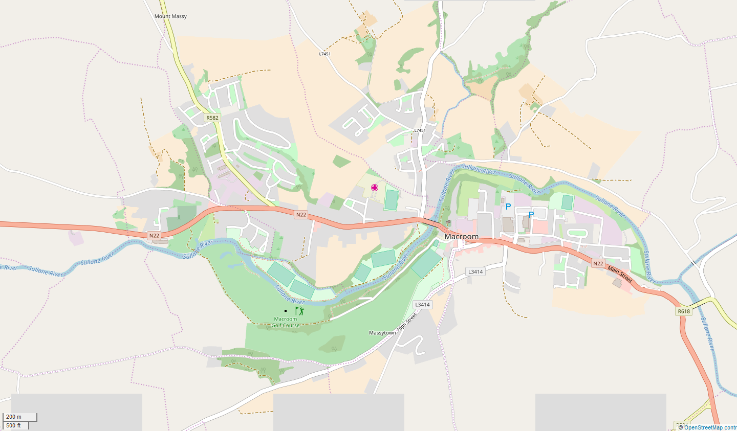
Macroom (; ) is a market town in County Cork, Ireland, located in the valley of the River Sullane, halfway between Cork (city), Cork city and Killarney. Its population has grown and receded over the centuries as it went through periods of war, famine and workhouses, forced emigration and intermittent prosperity. The 2011 census of Ireland, 2011 census gave an urban population of 3,879 people, while the 2016 census of Ireland, 2016 census recorded 3,765 people. The town is in a Civil parishes in Ireland, civil parish of the same name. Macroom began as a meeting place for the druids of Munster. It is first mentioned is in 6th-century records, and the immediate area hosted a major battle involving the Irish king Brian Boru. During the Middle Ages, the town was invaded by a succession of warring clans, including the Murcheatach Uí Briain and Richard de Cogan families. In the early modern period the MacCarthys took control and later the area found prosperity via milling. The MacCa ... [...More Info...] [...Related Items...] OR: [Wikipedia] [Google] [Baidu] |
Dungarvan
Dungarvan () is a coastal town and harbour in County Waterford, on the south-east coast of Ireland. Prior to the merger of Waterford County Council with Waterford City Council in 2014, Dungarvan was the county town and administrative centre of County Waterford. Waterford City and County Council retains administrative offices in the town. The town is in a townland and Civil parishes in Ireland, civil parish of the same name. Dungarvan's Irish name means 'Garbhann's fort', referring to Saint Garbhann who founded a church there in the seventh century. The town had a population of 10,081 at the 2022 census of Ireland, 2022 census, making it the third most populous in the county. Location and access The town lies on the N25 road (European route E30), which connects Cork (city), Cork, Waterford and Rosslare Europort. It is around south-west of Waterford and north-east of Cork. Dungarvan is situated at the mouth of the Colligan River, which divides the town into two parishes - tha ... [...More Info...] [...Related Items...] OR: [Wikipedia] [Google] [Baidu] |
Dungloe
''An Clochán Liath'', known in English as Dungloe (sometimes misspelled as Dunglow; ), is a town on the west coast of County Donegal in Ulster, the northern province in Ireland. It is the main town in The Rosses and the largest in the Donegal ''Gaeltacht''. Dungloe developed as a town in the middle of the 18th century, and now serves as the administrative and retail centre for the west of County Donegal, and in particular The Rosses, with the only mainland secondary school for the area. Name There is a river at the bottom of the town and years ago the only crossing was over a grey granite slab lying in the riverbed, hence the Irish name of the town, ''An Clochán Liath'', which means ''the grey stepping-stone''. The bridge was built in 1782. The name ''An Clochán Liath'' was formerly anglicised as ''Cloghanlea''. The name ''Dungloe'' or ''Dunglow'' is believed to come from the Irish ''Dún gCloiche''. This name came into common English usage in the later years of the 18th ce ... [...More Info...] [...Related Items...] OR: [Wikipedia] [Google] [Baidu] |
Donegal (town)
Donegal ( ; , "fort of the foreigners") is a town in County Donegal in Ulster, the northern province in Ireland. Although Donegal gave its name to the county, now Lifford is the county town. From the 15th until the early 17th century, Donegal was the "capital" of Tyrconnell, a Gaelic kingdom controlled by the O'Donnell dynasty of the Northern Uí Néill. The town is in a civil parish of the same name. Donegal is in South Donegal and is located at the mouth of the River Eske and Donegal Bay, which is overshadowed by the Blue Stack Mountains ("the Croaghs"). The Drumenny Burn, which flows along the eastern edge of Donegal Town, flows into the River Eske on the north-eastern edge of the town, between the Community Hospital and The Northern Garage. The Ballybofey Road (the R267) crosses the Drumenny Burn near where it flows into the River Eske. The town is bypassed by the N15 and N56 roads. The centre of the town, known as The Diamond, is a hub for music, poetic and cult ... [...More Info...] [...Related Items...] OR: [Wikipedia] [Google] [Baidu] |
Belmullet
Belmullet (, IPA:[ˌbʲeːlənˠˈwʊɾˠhəd̪ˠ]) is a coastal Gaeltacht town with a population of 1,019 on the Mullet Peninsula in the barony (Ireland), barony of Erris, County Mayo, Republic of Ireland, Ireland. It is the commercial and cultural heart of the barony of Erris, which has a population of almost 10,000. According to the 2016 census of Ireland, 2016 census 50% of people in the town were able to speak Irish while only 4% spoke it on a daily basis outside the education system. Belmullet has two bays, Blacksod Bay and Broadhaven Bay, linked by Carter's Canal running through the town. History The origin of the name ''Belmullet'' is not clear. It may have come from Irish ''Béal Muileat'' or ''Béal an Mhuileat'', which has been translated as "mouth of the isthmus". Bernard O'Hara in ''Mayo: Aspects of its Heritage'' suggests that "A change from 'L' to 'R', which is quite common in Irish, may have given ''Béal an Mhuireat'' which in turn became ''Béal an Mhuirhead'' ... [...More Info...] [...Related Items...] OR: [Wikipedia] [Google] [Baidu] |
Castlebar
Castlebar () is the county town of County Mayo, Ireland. Developing around a 13th-century castle of the de Barry family, from which the town got its name, the town now acts as a social and economic focal point for the surrounding hinterland. With a population of 13,054 in the 2022 census (up from 7,648 in the 1991 census), Castlebar was one of the fastest growing towns in Ireland in the early 21st century. A campus of Atlantic Technological University and the Country Life section of the National Museum are two important facilities in the area. The town is linked by railway to Dublin, Westport and Ballina. The main route by road is the N5. History Anquity The 5th century saw the construction of Turlough Abbey near Castlebar. Medieval period In the early medieval period, the Castlebar area was dominated by Gaelic clans, notably the Quinns (Ó Coinn), who lent their name to the parish of Aglishcowane, meaning "Church of Ó Coinn". The area featured crannogs and ringforts, ... [...More Info...] [...Related Items...] OR: [Wikipedia] [Google] [Baidu] |


