|
Atworth
Atworth is a village and civil parish in west Wiltshire, England. The village is on the A365 road between Melksham and Box, about northwest of Melksham and northeast of Bradford on Avon. The hamlet of Purlpit lies east of Atworth village, and in the south of the parish are the small village of Great Chalfield and the hamlet of Little Chalfield. The Roman road from Silchester to Bath forms the northern boundary of the parish, and to the south of it is the settlement of Beardwell. History The present-day civil parish of Atworth was created in 1884 from four former parishes or tithings. Atworth Atworth was a tithing in the northeast of the large ancient parish of Bradford on Avon. This land forms the northern half of the modern parish, with the Roman road from Silchester to Bath as its northern boundary. A Roman villa (excavated in 1937 and 1971) was a short distance northwest of the present village of Atworth. Poplar Farmhouse is from the 15th century and Manor Farmhouse is fr ... [...More Info...] [...Related Items...] OR: [Wikipedia] [Google] [Baidu] |
Stonar School
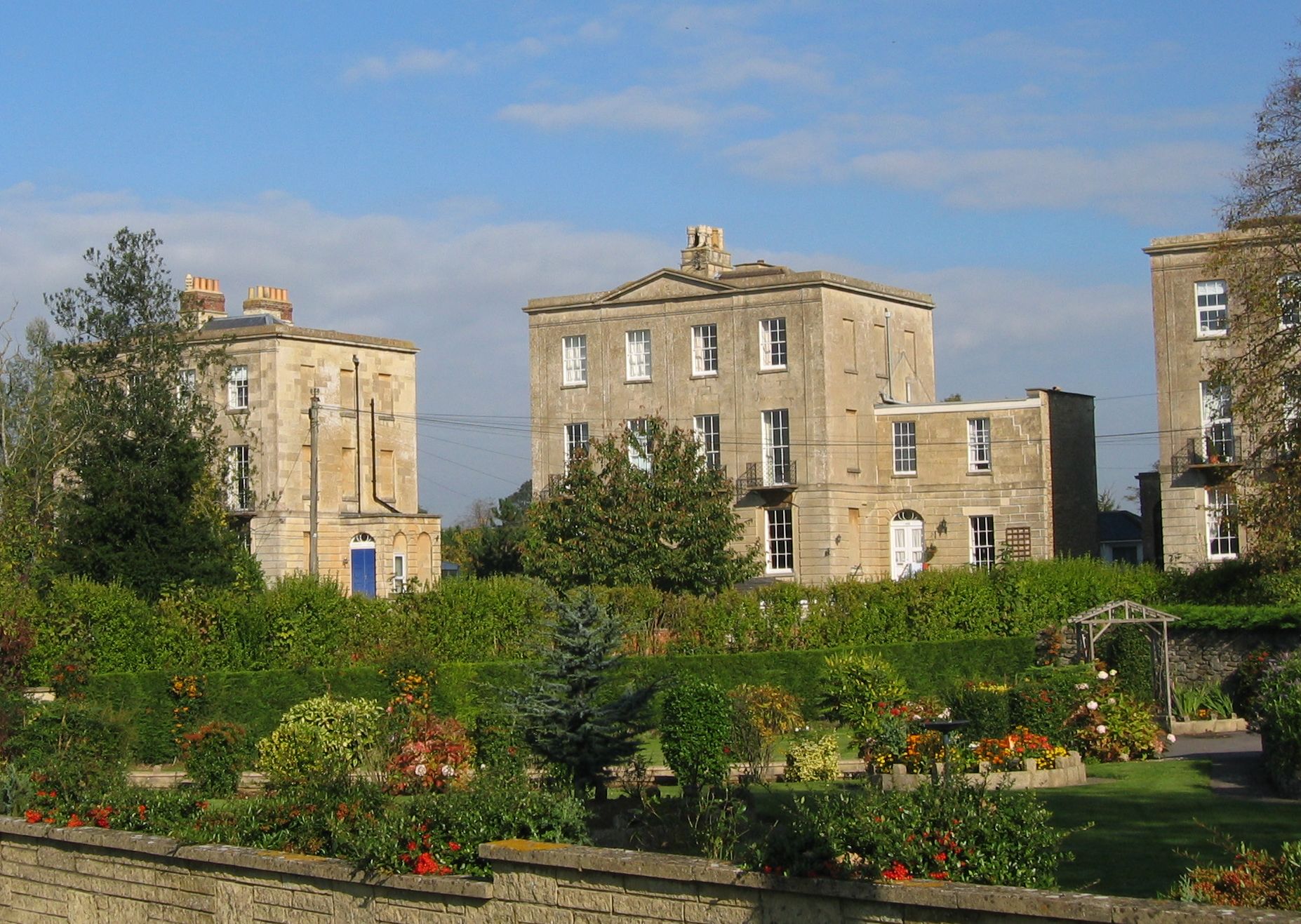
Stonar School, founded in 1895, is a non-denominational UK independent day and boarding school, at Cottles Park, near Atworth, Wiltshire, south-west England. The school occupies 80 acres of parkland and gardens in a location about 8 miles from Bath. There are about 330 pupils of both sexes, girls being in the majority. An ISI inspection in 2018 found the school "excellent". History The school was established in 1895 as a girls' school at Stour House, Sandwich, Kent, and adopted the Stonar name when it moved to the larger Stonar House, also in Sandwich. The school was evacuated to Cottles House when the Sandwich premises were requisitioned by the Ministry of Defence in 1939. The school was acquired in 2013 by Globeducate, a subsidiary of American private equity firm Providence Equity, which operates over 50 schools in several countries. Boys began to be accepted by the school in 2016 and it became fully coeducational. Cottles House The Grade II-listed Cottles House was de ... [...More Info...] [...Related Items...] OR: [Wikipedia] [Google] [Baidu] |
Neston Park
__NOTOC__ Neston Park is an English country house and estate in the village of Neston, some 2 miles (3 km) south of Corsham, Wiltshire. The name of the village of Neston is derived from the name of the house. The present house dates from 1790 and has been extended several times since then. It is ashlar-built in two storeys (three storeys at rear) with a frontage of eight bays, and is Grade II* listed. The grounds of the house contain farmland: the estate extends from north of Neston village, southwards beyond Atworth, to South Wraxall, and includes the certified organic home farm with a herd of Jersey cattle and unusual Aberdeen Angus and Jersey cross-bred cattle. The route of the ancient Roman road from London to Bath crosses the home farm from east to west, about 200 metres (700 feet) south of the house. The local portion of the road is sometimes known as the Wansdyke. History The Neston estate was built up by Thomas Tropenell in the 15th century, passed ... [...More Info...] [...Related Items...] OR: [Wikipedia] [Google] [Baidu] |
Monkton Farleigh
Monkton Farleigh is a village and civil parish in west Wiltshire, England, on high ground northwest of Bradford-on-Avon, and a similar distance east of the city of Bath. The parish includes the hamlets of Farleigh Wick and Pinckney Green. In the west and northwest the parish is bounded by Somerset. It is known for its underground mines of Bath Stone, which were converted into one of the largest Ministry of Defence underground ammunition stores in the country. History The Roman road from Silchester to Bath, and later earthworks which may be part of Wansdyke, run east–west and form the northern boundary of the modern parish. Domesday Book of 1086 recorded a settlement of 24 households, and land held by Brictric and his brother Alwy. The manor passed to the Bohun family, and was held by Humphrey I de Bohun around 1120. The Bohuns founded the Priory of St Mary Magdalene thereafter, and it had a church by c.1150. In the early 13th century the priory was rebuilt with a larg ... [...More Info...] [...Related Items...] OR: [Wikipedia] [Google] [Baidu] |
Great Chalfield
Great Chalfield, also sometimes called by its Latin name of Chalfield Magna, formerly East Chalfield and anciently Much Chaldefield, is a small village and former civil parish in west Wiltshire, England, now part of Atworth parish. Its nearest towns are Melksham, about away to the northeast, and Bradford-on-Avon, at about the same distance to the southwest. The village has a notable manor house, Great Chalfield Manor. History At the time of the Domesday survey (1086) it was found that the manor of Chalfield had belonged to Wallef in the time of King Edward and possessed half a mill worth eighteen pence. This suggests that the two Chalfields (Great and Little, or East and West) shared a water-mill which stood on the stream which lies between them. A corn mill was operating at Great Chalfield in 1645 while it was occupied by a Parliamentary garrison. The 15th-century manor house, Great Chalfield Manor, is a Grade I listed building. It was given to the National Trust in 1943 ... [...More Info...] [...Related Items...] OR: [Wikipedia] [Google] [Baidu] |
South Wraxall
South Wraxall is a village and a civil parish in Wiltshire, England, north of Bradford on Avon. The village is to the east of the B3109 road from Bradford on Avon to Corsham. The parish includes the village of Lower Wraxall, to the south of South Wraxall; one field separates the two villages. The hamlet of Bradford Leigh is in the southeast of the parish. History The name comes from old English ''wrocc'', meaning a buzzard, although it was also used as a personal name. Its name was first mentioned in 1468 as ''Suthwroxhall'', distinguishing it from North Wraxall which is away. Other spellings of the name included ''wroxhal'' (1227) and ''wrokeshal'' (1242). Nevertheless, South Wraxall was not mentioned in Domesday Book, as it was grouped in with Bradford on Avon. Domesday Book recorded a small settlement of seven households at ''Cubrewelle'', in the southwest of the modern parish. The name survives on maps as Great Cumberwell, and in the names of Cumberwell Park golf course a ... [...More Info...] [...Related Items...] OR: [Wikipedia] [Google] [Baidu] |
Melksham
Melksham () is a town on the River Avon in Wiltshire, England, about northeast of Trowbridge and south of Chippenham. At the 2011 census, the Melksham built-up area had a population of 19,357, making it Wiltshire's fifth-largest settlement after Swindon, Salisbury, Chippenham and Trowbridge. History Early history Excavations in 2021 in the grounds of Melksham House found fragments of locally made pottery from the early Iron Age (7th to 4th centuries BC). There is evidence of settlement continuing into the later Iron Age and Roman periods, including Roman clay roof tiles. Melksham developed at a ford across the River Avon. The name is presumed to derive from "''meolc''", the Old English for milk, and ''"ham"'', a village. On John Speed's map of Wiltshire (1611), the name is spelt both ''Melkesam'' (for the hundred) and ''Milsham'' (for the town itself). Melksham is also the name of the Royal forest that occupied the surrounding of the area in the Middle Ages. Landowne ... [...More Info...] [...Related Items...] OR: [Wikipedia] [Google] [Baidu] |
Beardwell
Beardwell is a farm and small hamlet in the parish of Atworth, Wiltshire, England. The name appears in the mid-fifteenth century Tropenell Cartulary as Bedewelle, then as Bidwell in 1631, and as Beard Well in a Tithe Award of c. 1840. By comparison with Bidwell in Northamptonshire Northamptonshire (; abbreviated Northants.) is a county in the East Midlands of England. In 2015, it had a population of 723,000. The county is administered by two unitary authorities: North Northamptonshire and West Northamptonshire. It is ..., the name may be connected with the location of the settlements, as both stand near a Roman road.''Nomina'', Vol. 17 (1994), p. 14: "Beardwell (Wilts.), east of Bath, is 500 yards from a Roman road." References {{coord, 51.3710, -2.1967, type:city(50)_region:GB-WIL, format=dms, display=title Hamlets in Wiltshire ... [...More Info...] [...Related Items...] OR: [Wikipedia] [Google] [Baidu] |
Great Chalfield Manor
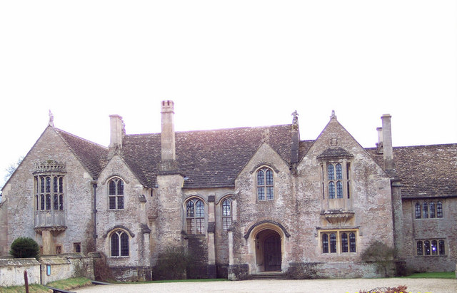
Great Chalfield Manor is an English country house at Great Chalfield, about northeast of the town of Bradford on Avon in the west of the county of Wiltshire. History Pevsner describes Great Chalfield as "one of the most perfect examples of the late medieval English manor house". The moated manor house was built around 1465–1480 for Thomas Tropenell, a modest member of the landed gentry who made a fortune as a clothier. It is on the site of an earlier fortified house, of which traces remain: the bases of curtain walls to the east and north, and parts of two towers. The independent hall, lit on both sides, is flanked by unusually symmetrical gabled cross wings, with oriel windows and lower gabled porches in the inner corners, in the north-facing former entrance court, for which the richest effects were reserved. Its external symmetry, unusual for its date, is superficial. The intimately connected parish church, largely rebuilt by Tropenell, also faces into the court, whic ... [...More Info...] [...Related Items...] OR: [Wikipedia] [Google] [Baidu] |
Chippenham (UK Parliament Constituency)
Chippenham is a constituency represented in the House of Commons of the Parliament of the United Kingdom since 2015 by Michelle Donelan, a Conservative, who also currently serves as Secretary of State for Digital, Culture, Media and Sport. The 2010 constituency includes the Wiltshire towns of Bradford on Avon, Chippenham, Corsham and Melksham. A parliamentary borough of Chippenham was enfranchised in 1295. It sent two burgesses to Parliament until 1868 and one thereafter until the borough constituency was abolished in 1885. There was a county division constituency named after the town of Chippenham from 1885 to 1983, when the name of that constituency was changed to North Wiltshire. Following the 2003–2005 review into parliamentary representation in Wiltshire, the Boundary Commission created a new county constituency, reviving the name of Chippenham as a seat. It is formed from parts of the previously existing Devizes, North Wiltshire and Westbury constituencies. Bou ... [...More Info...] [...Related Items...] OR: [Wikipedia] [Google] [Baidu] |
Box, Wiltshire
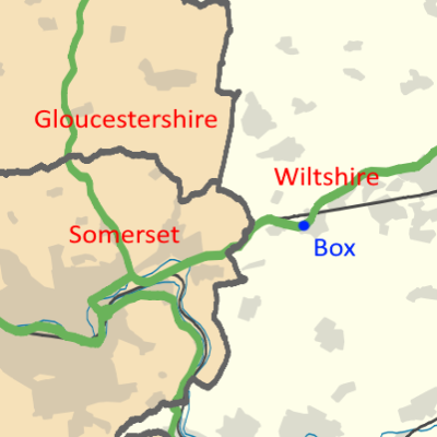
Box is a large village and civil parish within the Cotswolds Area of Outstanding Natural Beauty in Wiltshire, England, about west of Corsham and northeast of Bath. Box also falls in the easternmost part of the Avon Green Belt. Besides the village of Box, the parish includes the villages of Ashley and Box Hill; Hazelbury manor; and the hamlets of Alcombe, Blue Vein, Chapel Plaister, Ditteridge, Henley, Kingsdown, Middlehill, and Wadswick. To the east the parish includes much of Rudloe, formerly a hamlet but now a housing estate, and the defence establishments and related businesses on the site of RAF Rudloe Manor. Occupation here dates back at least to Roman times. The area is known for its fine stone and for centuries Box quarries were famous for their product. Today Box is perhaps better known for its Brunel-designed Box railway tunnel. Box has been twinned with Sorigny, a commune in central France, since 2016. Geography Box lies in Wiltshire, close to the bounda ... [...More Info...] [...Related Items...] OR: [Wikipedia] [Google] [Baidu] |
Bradford On Avon
Bradford-on-Avon (sometimes Bradford on Avon or Bradford upon Avon) is a town and civil parish in west Wiltshire, England, near the border with Somerset, which had a population of 9,402 at the 2011 census. The town's canal, historic buildings, shops, pubs and restaurants make it popular with tourists. The history of the town can be traced back to Roman origins. It has several buildings dating from the 17th century, when the town grew due to the thriving English woollen textile industry. Geography The town lies partly in the Avon Valley, and partly on the hill that marks the Vale's western edge, southeast of Bath, in the hilly area between the Mendip Hills, Salisbury Plain and the Cotswold Hills. The local area around Bath provides the Jurassic limestone known as Bath stone, from which the older buildings are constructed. The River Avon (the Bristol Avon) runs through the town. The larger town of Trowbridge is nearby to the southeast. The town includes the suburbs of Bea ... [...More Info...] [...Related Items...] OR: [Wikipedia] [Google] [Baidu] |
Church Of England
The Church of England (C of E) is the established Christian church in England and the mother church of the international Anglican Communion. It traces its history to the Christian church recorded as existing in the Roman province of Britain by the 3rd century and to the 6th-century Gregorian mission to Kent led by Augustine of Canterbury. The English church renounced papal authority in 1534 when Henry VIII failed to secure a papal annulment of his marriage to Catherine of Aragon. The English Reformation accelerated under Edward VI's regents, before a brief restoration of papal authority under Queen Mary I and King Philip. The Act of Supremacy 1558 renewed the breach, and the Elizabethan Settlement charted a course enabling the English church to describe itself as both Reformed and Catholic. In the earlier phase of the English Reformation there were both Roman Catholic martyrs and radical Protestant martyrs. The later phases saw the Penal Laws punish Ro ... [...More Info...] [...Related Items...] OR: [Wikipedia] [Google] [Baidu] |
.jpg)


