|
Asia Islands
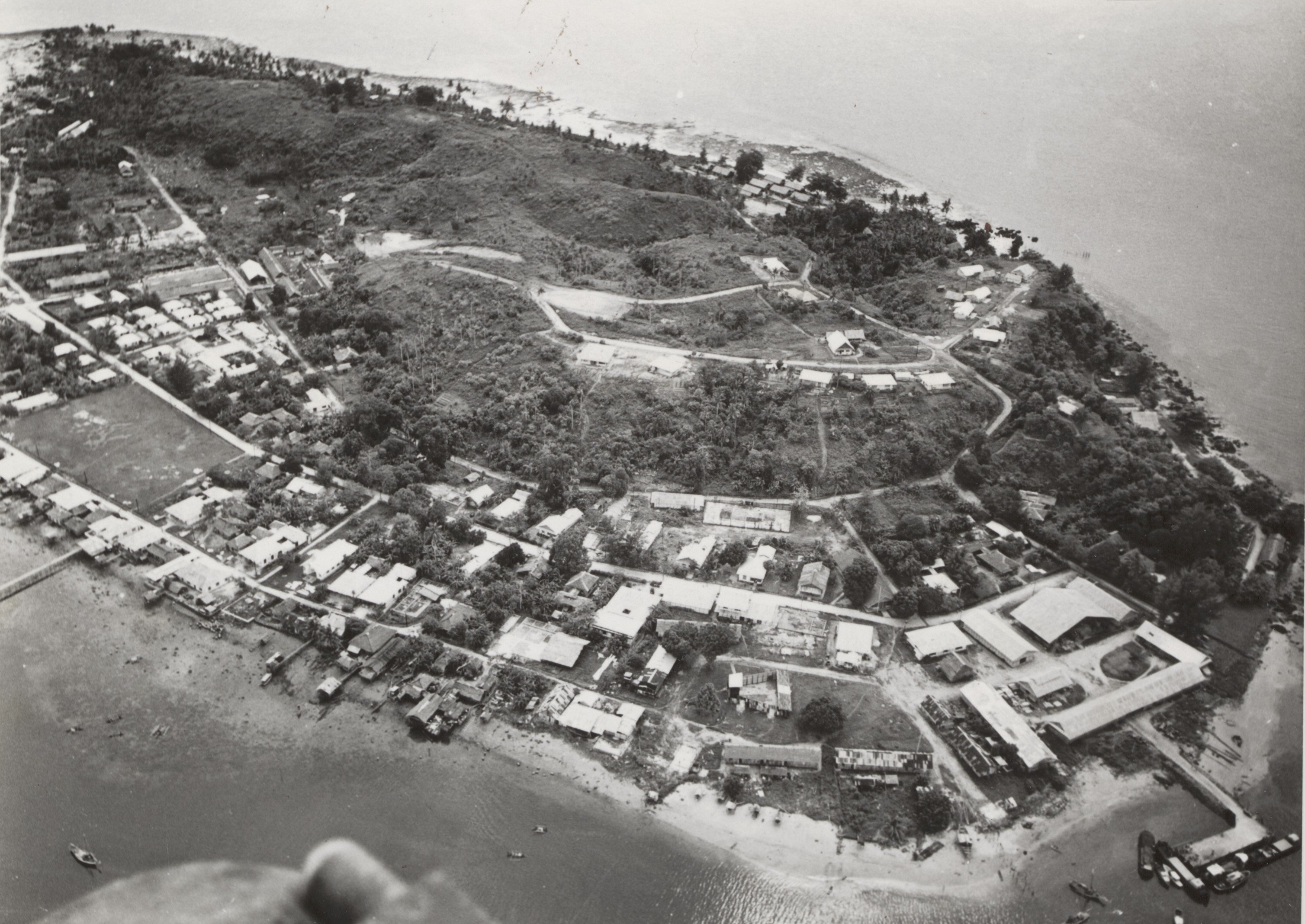
The Asia Islands ( id, Kepulauan Asia) are a group of three small islands in the open sea north of the Raja Ampat Archipelago of eastern Indonesia. They are located north of the island of Waigeo, around north of the last of the Ayu Islands (both in the Raja Ampat Achipelago), and south of the island of Tobi in Palau. The individual islands are known as Fani, Igi and Miarin. On the largest island of Fani, there is a pier and a small settlement, intermittently inhabited by visitors from Reni and Rutum. Administratively the Asia Islands are part of the Raja Ampat Regency of the province of Southwest Papua Southwest Papua ( id, Papua Barat Daya) is a province of Indonesia, and is a fraction of Western New Guinea. Despite being named southwest, it is a misnomer and this province is actually located in the northwest edge of Papua. The area that belo .... References Islands of Indonesia Raja Ampat Islands Archipelagoes of Indonesia {{SwPapua-geo-stub ... [...More Info...] [...Related Items...] OR: [Wikipedia] [Google] [Baidu] |
Raja Ampat Archipelago
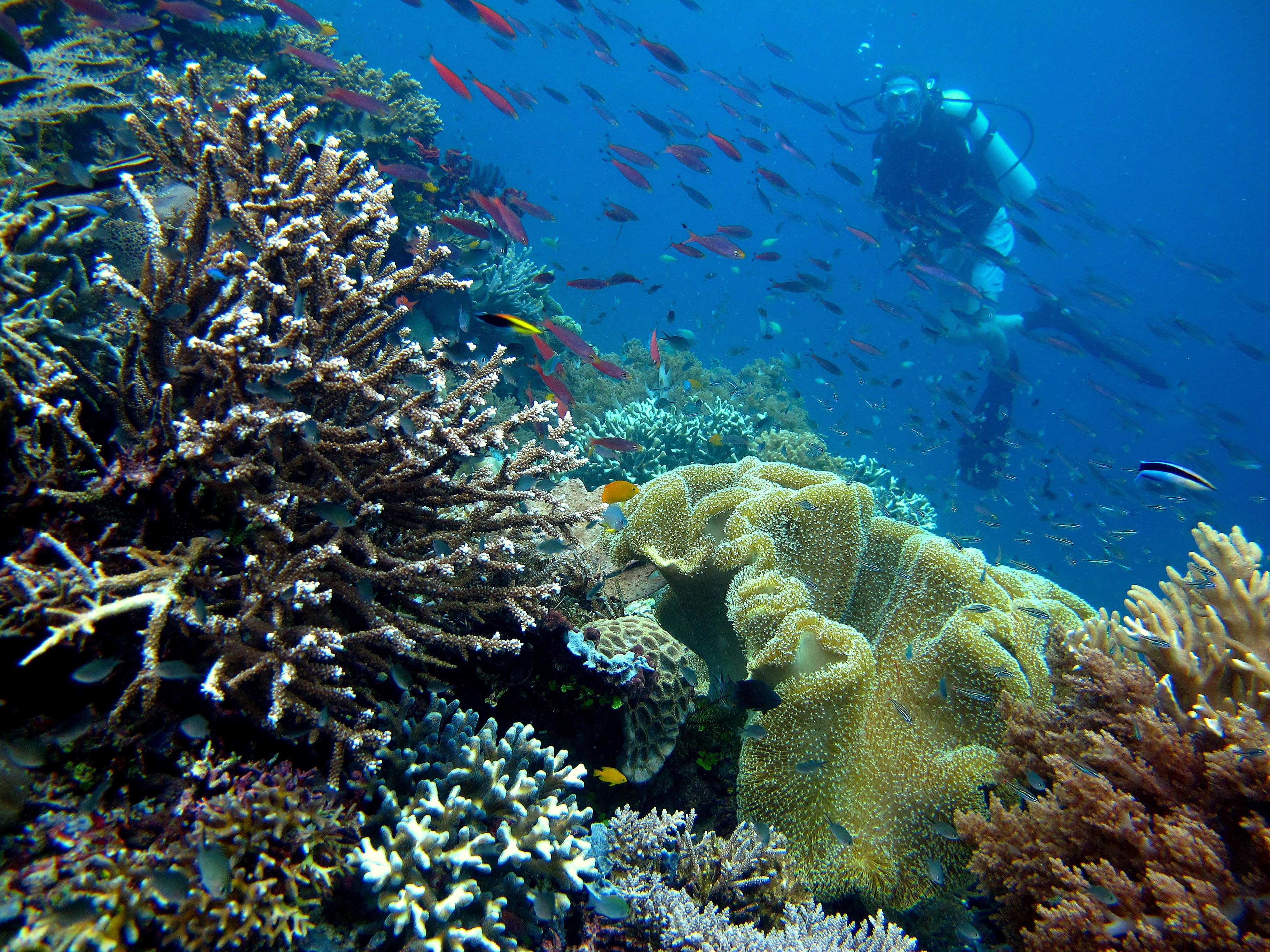
Raja Ampat, or the ''Four Kings'', is an archipelago located off the northwest tip of Bird's Head Peninsula on the island of New Guinea, in Indonesia's Southwest Papua province. It comprises over 1,500 small islands, cays, and shoals surrounding the four main islands of Misool, Salawati, Batanta, and Waigeo, and the smaller island of Kofiau. The Raja Ampat archipelago straddles the Equator and forms part of Coral Triangle which contains the richest marine biodiversity on earth. Administratively, the archipelago is part of the province of Southwest Papua. Most of the islands constitute the Raja Ampat Regency, which was separated out from Sorong Regency in 2004. The regency encompasses around of land and sea, of which 8,034.44 km2 constitutes the land area and has a population of 64,141 at the 2020 Census. This excludes the southern half of Salawati Island, which is not part of this regency but instead constitutes the Salawati Selatan and Salawati Tengah Districts of Sorong ... [...More Info...] [...Related Items...] OR: [Wikipedia] [Google] [Baidu] |
Southwest Papua
Southwest Papua ( id, Papua Barat Daya) is a province of Indonesia, and is a fraction of Western New Guinea. Despite being named southwest, it is a misnomer and this province is actually located in the northwest edge of Papua. The area that belongs to this province includes the Greater Sorong area which consists of Sorong City, Sorong Regency, South Sorong Regency, Maybrat Regency, Tambrauw Regency, and Raja Ampat Regency. The Draft Law (RUU) on the Establishment of the Southwest Papua Province has been passed into law and becomes the 38th province in Indonesia. Southwest Papua is located at the northwestern tip of an area called the Doberai Peninsula or the Bird's Head Peninsula. The westernmost tip of this province is the Raja Ampat Regency Regional Marine Protected Area whose beauty is worldwide and has a high diversity of marine life such as coral reefs, giant turtles, manta rays to whale sharks so that it is called a diver's paradise. Raja Ampat Islands consists of vari ... [...More Info...] [...Related Items...] OR: [Wikipedia] [Google] [Baidu] |
Western New Guinea
Western New Guinea, also known as Papua, Indonesian New Guinea, or Indonesian Papua, is the western half of the Melanesian island of New Guinea which is administered by Indonesia. Since the island is alternatively named as Papua, the region is also called West Papua ( id, Papua Barat). Lying to the west of Papua New Guinea and considered a part of the Australian continent, the territory is almost entirely in the Southern Hemisphere and includes the Schouten and Raja Ampat archipelagoes. The region is predominantly covered with ancient rainforest where numerous traditional tribes live such as the Dani of the Baliem Valley although a large proportion of the population live in or near coastal areas with the largest city being Jayapura. Within five years following its proclamation of independence in 1945, the Republic of Indonesia (for a time part of the United States of Indonesia) took over all the former territories of the Dutch East Indies except Western New Guinea, accor ... [...More Info...] [...Related Items...] OR: [Wikipedia] [Google] [Baidu] |
Waigeo
Waigeo is an island in Southwest Papua province of eastern Indonesia. The island is also known as Amberi, or Waigiu. It is the largest of the four main islands in the Raja Ampat Islands archipelago, between Halmahera and about to the north-west coast of New Guinea. The Dampier Strait (a.k.a. Augusta's Strait) separates it from Batanta, and the Bougainville Strait from the Kawe Islands to its north-west. The "inner sea" that nearly cleaves the island in two is Mayalibit Bay, also known as the Majoli Gulf. The area of the island is ; the highest elevations are Buffalo Horn (Gunung Nok) and Serodjil. From west to east the island measures approximately , north–south about . The town of Waisai in the south of the island is the capital of the Raja Ampat Regency. History Jorge de Menezes, a Portuguese explorer, landed on Waigeo Island in 1526–27. Islam first arrived in the Raja Ampat archipelago in the 15th century due to political and economic contacts with the Bac ... [...More Info...] [...Related Items...] OR: [Wikipedia] [Google] [Baidu] |
Ayu Islands
The Ayu Islands (Kepulauan Ayu), are a small archipelago south of the Asia Islands and north of Raja Ampat Islands in Indonesia. This group is formed by two coral atolls. The highest point is 106 m.Pub164, 2004 Sailing Directions (Enroute): New Guinea In older maps these islands appear as the Ajoe Islands, following the Dutch spelling "Ajoe-eilanden". The beaches of these islands are a breeding ground for the leatherback turtle ''(Dermochelys coriacea)''. The waters off the Ayu Islands are a good snorkeling and scuba diving site. Administratively the Ayu Islands belong to the Indonesian province of Southwest Papua Southwest Papua ( id, Papua Barat Daya) is a province of Indonesia, and is a fraction of Western New Guinea. Despite being named southwest, it is a misnomer and this province is actually located in the northwest edge of Papua. The area that belo .... References Atolls of the Pacific Ocean Archipelagoes of Indonesia Islands of Western New Guinea Landforms ... [...More Info...] [...Related Items...] OR: [Wikipedia] [Google] [Baidu] |
Tobi (island)
Tobi is an island in the Palauan state of Hatohobei. With a population of about 30, it holds all of the state's people, with the exception of a weather base on Helen Island. Most of the inhabitants live on the island's west side and speak Tobian. Tobi, Helen Reef (''Hotsarihie''), Transit Reef (''Pieraurou''), and the islands in the state of Sonsorol make up the Republic of Palau's Southwest Islands. Tobi Island is 1.6 km long and 0.8 km wide, and has an area of about . Climate Tobi Island has a tropical rainforest climate (Af) with heavy to very heavy rainfall year-round. The Joint Typhoon Warning Center The Joint typhoon Warning Center (JTWC) is a joint United States Navy – United States Air Force command in Pearl Harbor, Hawaii. The JTWC is responsible for the issuing of tropical cyclone warnings in the North-West Pacific Ocean, South P ... (JTWC) a United States Navy – United States Air Force command in Hawaii uses "KOBI" as a bearing and distance i ... [...More Info...] [...Related Items...] OR: [Wikipedia] [Google] [Baidu] |
Palau
Palau,, officially the Republic of Palau and historically ''Belau'', ''Palaos'' or ''Pelew'', is an island country and microstate in the western Pacific. The nation has approximately 340 islands and connects the western chain of the Caroline Islands with parts of the Federated States of Micronesia. It has a total area of . The most populous island is Koror, home to the country's most populous city of the same name. The capital Ngerulmud is located on the nearby island of Babeldaob, in Melekeok State. Palau shares maritime boundaries with international waters to the north, the Federated States of Micronesia to the east, Indonesia to the south, and the Philippines to the northwest. The country was originally settled approximately 3,000 years ago by migrants from Maritime Southeast Asia. Palau was first drawn on a European map by the Czech missionary Paul Klein based on a description given by a group of Palauans shipwrecked on the Philippine coast on Samar. Pa ... [...More Info...] [...Related Items...] OR: [Wikipedia] [Google] [Baidu] |
Reni Island
Pulau Reni is a small Indonesian island located in the Ayu Archipelago above the northern tip of the Waigeo Islands. Pulau Reni is part of the Raja Ampat regency of the Southwest Papua geographical and administrative region of Indonesia. The island is surrounded by two large reefs. Pulau Ayu and Pulau Kanobe are two other small inhabited islands south-west and south of Pulau Reni. Pulau Reni lies north-east of Pulau Ayu and north of Pulau Kanobe. Access to the island is limited to small boats due to the reefs and the small size of the island. World War II Pulau Reni and all the islands in the Ayu Archipelago were occupied by the Japanese Empire during World War II World War II or the Second World War, often abbreviated as WWII or WW2, was a world war that lasted from 1939 to 1945. It involved the vast majority of the world's countries—including all of the great powers—forming two opposing ... from 1942 until the end of the war in 1945. External l ... [...More Info...] [...Related Items...] OR: [Wikipedia] [Google] [Baidu] |
Raja Ampat Regency
Raja Ampat Regency is a regency of Southwest Papua Province of Indonesia. The regency, which was formed based on the Law 26 of 2002, was inaugurated on 12 April 2003, and consists of a number of groups of islands situated off the north-west end of West Papua; the four main islands from south to north are Misool, Salawati, Batanta, and Waigeo. At present, the regency covers a land area of 7,559.60 km2, with a total area (including 59,820.01 km2 of sea area) stated as 67,379.61 km2. It had a population of 42,508 at the 2010 Census, and 64,141 at the 2020 Census;Badan Pusat Statistik, Jakarta, 2021. the official estimate as at mid 2021 was 65,403. The principal town lies at Waisai on Waigeo Island. On 25 October 2013 the People's Representative Council (DPR) began reviewing draft laws on the establishment of new regencies, including two new regencies of North Raja Ampat and South Raja Ampat within the borders of the existing Raja Ampat Regency. As at June 2022, these c ... [...More Info...] [...Related Items...] OR: [Wikipedia] [Google] [Baidu] |
Raja Ampat Islands
Raja Ampat, or the ''Four Kings'', is an archipelago located off the northwest tip of Bird's Head Peninsula on the island of New Guinea, in Indonesia's Southwest Papua , Southwest Papua province. It comprises over 1,500 small islands, cays, and shoals surrounding the four main islands of Misool, Salawati, Batanta, and Waigeo, and the smaller island of Kofiau. The Raja Ampat archipelago straddles the Equator and forms part of Coral Triangle which contains the richest marine biodiversity on earth. Administratively, the archipelago is part of the province of Southwest Papua , Southwest Papua. Most of the islands constitute the Raja Ampat Regency, which was separated out from Sorong Regency in 2004. The regency encompasses around of land and sea, of which 8,034.44 km2 constitutes the land area and has a population of 64,141 at the 2020 Census. This excludes the southern half of Salawati Island, which is not part of this regency but instead constitutes the Salawati Selatan and Sa ... [...More Info...] [...Related Items...] OR: [Wikipedia] [Google] [Baidu] |


