|
Arques, Pas-de-Calais
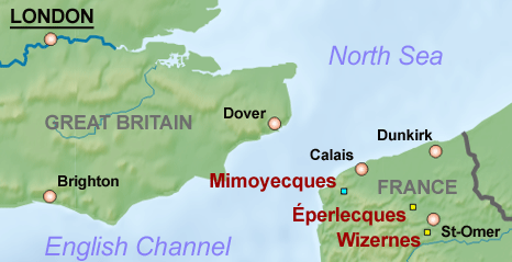
Arques () is a commune in the Pas-de-Calais department in northern France, bordering Saint-Omer. Geography Arques is situated in the middle of the Hauts-de-France region, 40 km from Calais and Dunkerque, and 45 km from Boulogne-sur-Mer. It lies on the border of the departments of Pas-de-Calais and Nord. The town is crossed by the Neufossé Canal, which connects the rivers Aa and Lys. The commune also includes several lakes—Beauséjour, Arc-en-ciel, Malhôve, Batavia—and part of the forest of Rihout-Clairmarais. History Arques is in the region of French Flanders. As this area has been under Belgian, English, French and Spanish rule, many of the names are French versions of names in other languages. In the wake of the Battle of the Golden Spurs a battle was fought here in April 1303 between French and Flemish. The Flemish were victorious in the Battle of Arques (1303). Arques is not to be confused with Arques-la-Bataille, where the Battle of Arques (158 ... [...More Info...] [...Related Items...] OR: [Wikipedia] [Google] [Baidu] |
Communes Of France
The () is a level of administrative divisions, administrative division in the France, French Republic. French are analogous to civil townships and incorporated municipality, municipalities in the United States and Canada, ' in Germany, ' in Italy, or ' in Spain. The United Kingdom's equivalent are civil parishes, although some areas, particularly urban areas, are unparished. are based on historical geographic communities or villages and are vested with significant powers to manage the populations and land of the geographic area covered. The are the fourth-level administrative divisions of France. vary widely in size and area, from large sprawling cities with millions of inhabitants like Paris, to small hamlet (place), hamlets with only a handful of inhabitants. typically are based on pre-existing villages and facilitate local governance. All have names, but not all named geographic areas or groups of people residing together are ( or ), the difference residing in the l ... [...More Info...] [...Related Items...] OR: [Wikipedia] [Google] [Baidu] |
Arques-la-Bataille
Arques-la-Bataille () is a commune in the Seine-Maritime department in the Normandy region in north-western France. The zoologist Henri Marie Ducrotay de Blainville (1777–1850) was born in Arques. Geography Arques is situated near the confluence of the rivers Eaulne, Varenne and Béthune, with the forest of Arques to the north-east. It lies southeast of Dieppe at the junction of the D23, D154, and D56 roads. Population Main sights The centre houses a castle dominating the town, which was built in the 11th century by William of Talou; his nephew, William the Conqueror, regarding it as a menace to his own power, besieged and occupied it. After frequently changing hands, it came into the possession of the English, who were expelled in 1449 after an occupation of thirty years. In 1589, its cannon decided the Battle of Arques in favour of King Henry IV of France. Since 1869, the castle has been state property. The first line of fortification was the work of Francis I; the sec ... [...More Info...] [...Related Items...] OR: [Wikipedia] [Google] [Baidu] |
Blockhaus D'Éperlecques
The ''Blockhaus d'Éperlecques'' ( en, Bunker of Éperlecques, also referred to as "the Watten bunker" or simply "Watten") is a Second World War bunker, now part of a museum, near Saint-Omer in the northern Pas-de-Calais ''département'' of France, and only some 14.4 kilometers (8.9 miles) north-northwest from the more developed La Coupole V-2 launch facility, in the same general area. The bunker, built by Nazi Germany under the codename Kraftwerk Nord West (Powerplant Northwest) between March 1943 and July 1944, was originally intended to be a launching facility for the V-2 (A-4) ballistic missile. It was designed to accommodate over 100 missiles at a time and to launch up to 36 daily. The facility would have incorporated a liquid oxygen factory and a bomb-proof train station to allow missiles and supplies to be delivered from production facilities in Germany. It was constructed using the labour of thousands of prisoners of war and forcibly conscripted workers used as slave ... [...More Info...] [...Related Items...] OR: [Wikipedia] [Google] [Baidu] |
Forest Of Éperlecques
The Forest of Éperlecques (french: Forêt d'Éperlecques) is a large forest covering some 850 hectares in the commune of Éperlecques in the Pas-de-Calais department in the Nord-Pas-de-Calais region of France. Trails through the forest provide leisure opportunities for walkers. At its south-eastern edge is the Blockhaus d'Éperlecques, a museum preserving the Second World War ''Kraftwerk Nord West'' bunker built by the Germans as a launch site for V-2 The V-2 (german: Vergeltungswaffe 2, lit=Retaliation Weapon 2), with the technical name ''Aggregat 4'' (A-4), was the world’s first long-range guided ballistic missile. The missile, powered by a liquid-propellant rocket engine, was develope ... rockets. References {{DEFAULTSORT:Forest Of Eperlecques Forests of France Geography of the Pas-de-Calais Tourist attractions in Pas-de-Calais ... [...More Info...] [...Related Items...] OR: [Wikipedia] [Google] [Baidu] |
Côte D'Opale
The Opal Coast ( ; ) is a coastal region in northern France on the English Channel, popular with tourists. Geography The ''Côte d'Opale'' is a coastal region in northeastern France, in the departments of Nord and Pas-de-Calais. It extends over of French coast between the Belgian border and the border with Picardy. This coastline faces the English Channel and the North Sea, and is situated directly opposite the chalk cliffs of southeast England, which at the closest point are only away. The Côte d'Opale is composed of many varied landscapes including beaches, dunes, swamps, estuaries and cliffs. The coast is marked by the presence of two large promontories situated between Calais and Boulogne: the Cap Gris Nez (literally "grey nose cape" in English), reaching an elevation of above sea level, and the Cap Blanc Nez (literally "white nose cape" in English), which reaches . These capes are the closest points to England on the entire French coast. Cities * Boulogne-sur ... [...More Info...] [...Related Items...] OR: [Wikipedia] [Google] [Baidu] |
Marais Audomarois
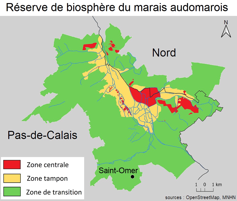
The Marais Audomarois is a wetland biosphere reserve in the north of France. The renowned Ramsar site covers some 22 300 hectares, including the city Saint-Omer. Geography The Audomarois landscape owes its richness to its particular geography. It is located on an intersection between three natural regions: the coastal plain, the Flanders intérieure and the Artois hills. These multifaceted landscapes are host to a wide variety of flora and fauna. The main natural habitats are reedbeds, tall herbs, peaty woods, meadows, ditches and rivers. The many species of flora include aquatic vegetation such as flowering rush (''Butomus umbellatus''), greater spearwort ('' Ranunculus lingua'') and marsh fern (''Thelypteris palustris''), as well as underwater and floating vegetation. These habitat types enable many species of birds to breed, feed and rest. There are also a number of endangered species in the region, including cowbane (''Cicuta virosa''), river water-dropwort (''Oenanthe f ... [...More Info...] [...Related Items...] OR: [Wikipedia] [Google] [Baidu] |
Lumbres
Lumbres (; ) is a commune in the Pas-de-Calais department in the Hauts-de-France region of France. Geography Lumbres is an industrial town built on former marshes at the crossroads of the valleys of the rivers Aa and Bléquin, some 6 miles (10 km) southwest of Saint-Omer, at the junction of the D342 and D225 road. The commune is now by-passed by the N42. The landscape is marred by the vast quarries and the huge chimney of the cement works. Population History Evidence of prehistoric occupation, at the place known as the ''Montagne de Lumbres'' has been discovered by. Pontier and Canon Collet, of the abbey of Wisques, who were the first to study the prehistory of the area, including Arques, Elnes and Wavrans. Because of its industrial importance, and proximity to fortified V2 sites, the commune suffered heavily from Allied bombing during World War II. Places of interest * The church of St.Sulpice, dating from the seventeenth century. * The fourteenth century Château ... [...More Info...] [...Related Items...] OR: [Wikipedia] [Google] [Baidu] |
Lock (water Navigation)
A lock is a device used for raising and lowering boats, ships and other watercraft between stretches of water of different levels on river and canal waterways. The distinguishing feature of a lock is a fixed chamber in which the water level can be varied; whereas in a caisson lock, a boat lift, or on a canal inclined plane, it is the chamber itself (usually then called a caisson) that rises and falls. Locks are used to make a river more easily navigable, or to allow a canal to cross land that is not level. Later canals used more and larger locks to allow a more direct route to be taken. Pound lock A ''pound lock'' is most commonly used on canals and rivers today. A pound lock has a chamber with gates at both ends that control the level of water in the pound. In contrast, an earlier design with a single gate was known as a flash lock. Pound locks were first used in China during the Song Dynasty (960–1279 AD), having been pioneered by the Song politician and naval ... [...More Info...] [...Related Items...] OR: [Wikipedia] [Google] [Baidu] |
Arc International (tableware)
Arc Holdings is the holding company of the Arc Group, specializing in the design and manufacturing of glass tableware. The Arc Group markets its collections in France and exports them abroad under the registered trademarks Luminarc, Arcopal, Cristal d’Arques Paris, Arcoroc and Chef&Sommelier. It also designs products for the private label and B2B markets. History 19th century In 1825, Alexander des Lyons de Noircarm created a glass-making firm under the name ''Verrerie des Sept Ecluses''. On 8 April 1826, the latter partnered with another glassworks. The Carpentier-Mancel glassworks, founded in 1823 in Saint-Martin-au-Laërt by Charles Carpentier under his management. On 5 September 1835, an ordinance authorized Carpentier to build a new glasswork furnace. On 3 July 1853, the Arques glassworks was taken over by Mr. Allard and Mr. Ladey. It was damaged by a fire in July 1856 which caused the roofs to collapse. Once rebuilt, the glassworks was taken over by the company Lade ... [...More Info...] [...Related Items...] OR: [Wikipedia] [Google] [Baidu] |
Lead Crystal
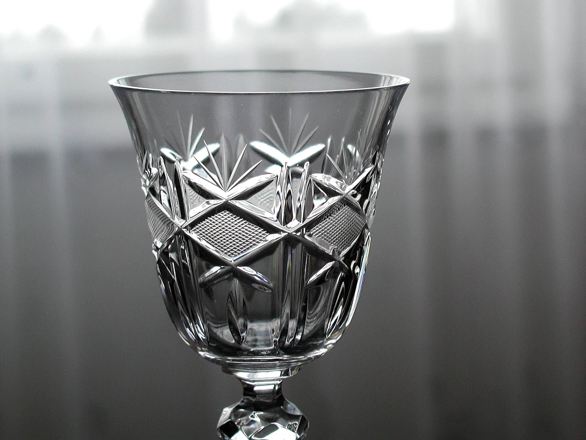
Lead glass, commonly called crystal, is a variety of glass in which lead replaces the calcium content of a typical potash glass. Lead glass contains typically 18–40% (by weight) lead(II) oxide (PbO), while modern lead crystal, historically also known as flint glass due to the original silica source, contains a minimum of 24% PbO. Lead glass is often desirable for a variety of uses due to its clarity. The term ''lead crystal'' is, technically, not an accurate term to describe lead glass, because glass lacks a crystalline structure and is instead an amorphous solid. The use of the term ''lead crystal'' or just "crystal" remains popular for historical and commercial reasons, and because "lead" sounds toxic to consumers. It is retained from the Venetian word ''cristallo'' to describe the rock crystal imitated by Murano glassmakers. This naming convention has been maintained to the present day to describe decorative hollow-ware. Lead crystal glassware was formerly used to store an ... [...More Info...] [...Related Items...] OR: [Wikipedia] [Google] [Baidu] |
Saxon Shore
The Saxon Shore ( la, litus Saxonicum) was a military command of the late Roman Empire, consisting of a series of fortifications on both sides of the Channel. It was established in the late 3rd century and was led by the " Count of the Saxon Shore". In the late 4th century, his functions were limited to Britain, while the fortifications in Gaul were established as separate commands. Several Saxon Shore forts survive in east and south-east England. Background During the latter half of the 3rd century, the Roman Empire faced a grave crisis. Internally, it was weakened by civil wars, the violent succession of brief emperors, and secession in the provinces, while externally it faced a new wave of attacks by barbarian tribes. Most of Britain had been part of the empire since the mid-1st century. It was protected from raids in the north by the Hadrianic and Antonine Walls, while a fleet of some size was also available. However, as the frontiers came under increasing external pre ... [...More Info...] [...Related Items...] OR: [Wikipedia] [Google] [Baidu] |


