|
Assateague
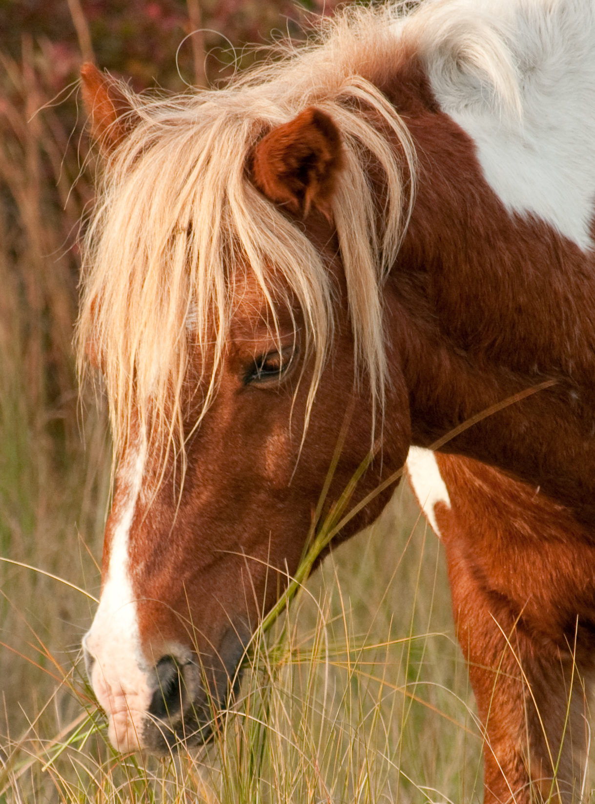
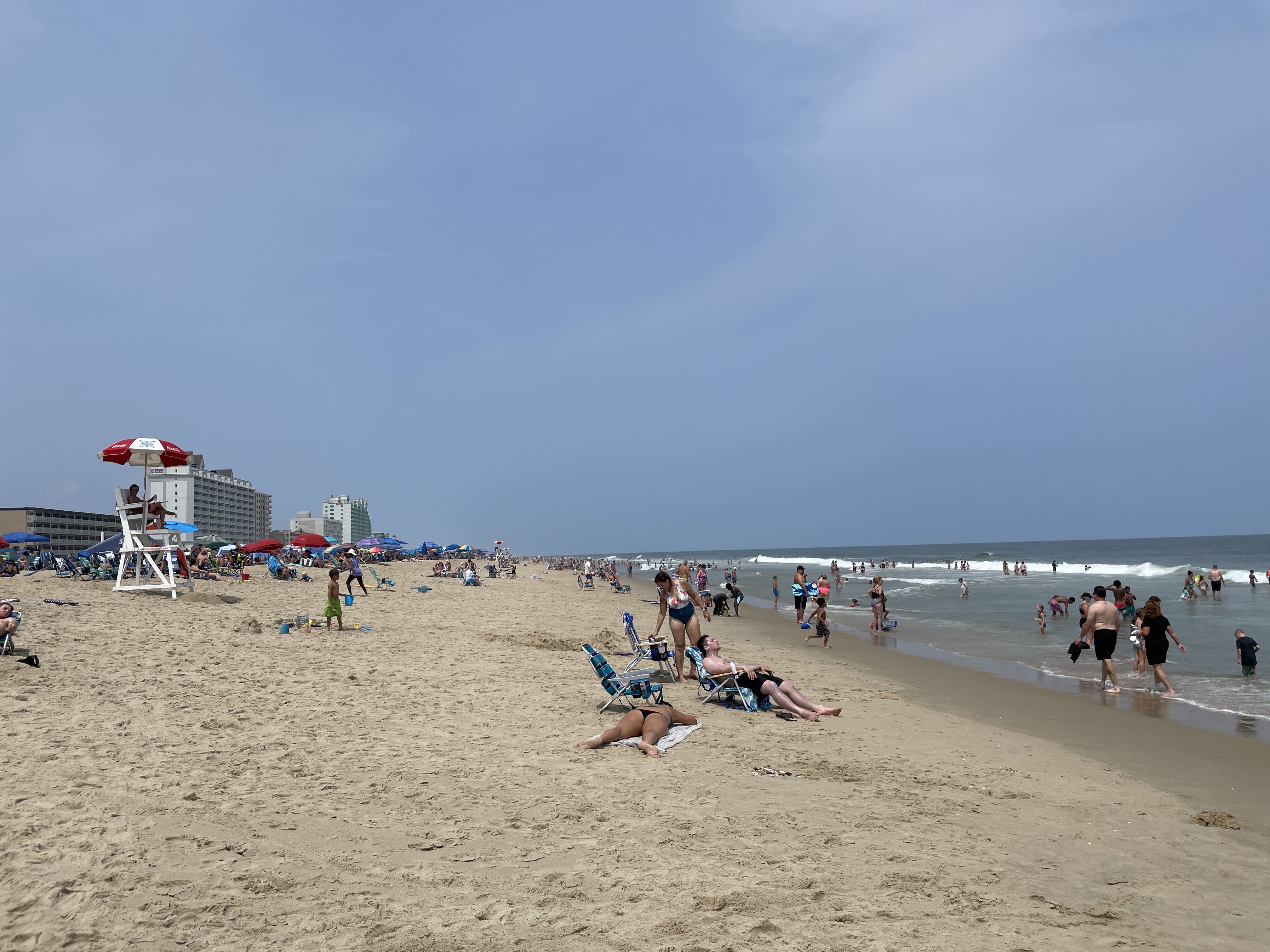
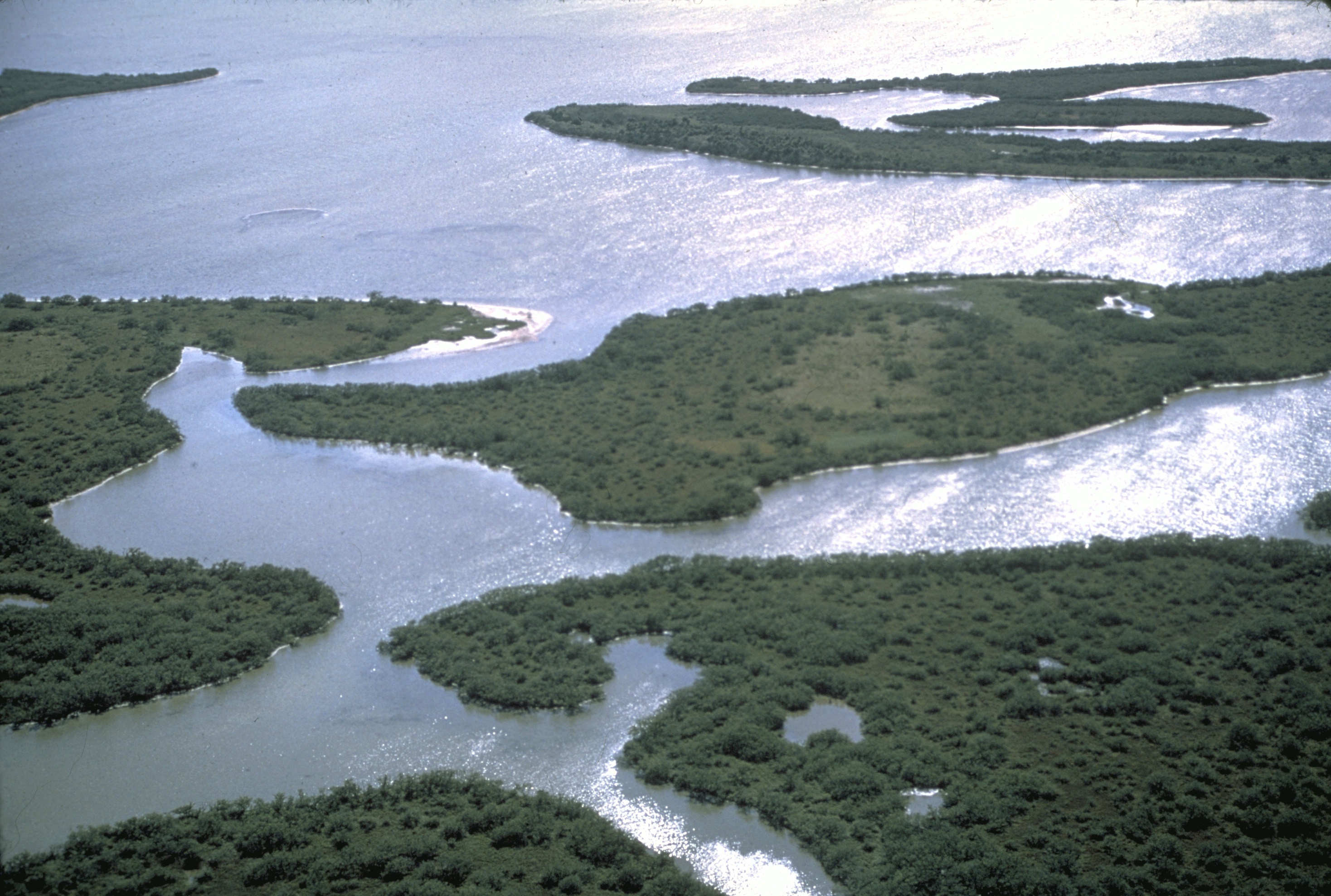
Assateague Island is a long barrier island located off the eastern coast of the Delmarva Peninsula facing the Atlantic Ocean. The northern two-thirds of the island are in Maryland, and the southern third is in Virginia. The entire island is designated as Assateague Island National Seashore, though management is shared by three entities. The Maryland section contains the majority of Assateague Island National Seashore and Assateague State Park. The Virginia section contains Chincoteague National Wildlife Refuge and a one-mile stretch of land containing the lifeguarded recreational beach and interpretive facilities managed by the National Park Service (NPS). It is best known for its herds of feral horses, pristine beaches, and the Assateague Lighthouse. The island also contains numerous marshes, bays, and coves, including Toms Cove. Bridge access for cars is possible from both Maryland and Virginia, though no road runs the full north/south length of the island. History ... [...More Info...] [...Related Items...] OR: [Wikipedia] [Google] [Baidu] |
Assateague Island National Seashore
Assateague Island National Seashore is a unit of the National Park Service system of the U.S. Department of the Interior. Located on the East Coast along the Atlantic Ocean in Maryland and Virginia, Assateague Island is the largest natural barrier island ecosystem in the Middle Atlantic states region that remains predominantly unaffected by human development. Located within a three-hour drive to the east and south of Richmond, Washington, Baltimore, Wilmington, Philadelphia major metropolitan areas plus north of the several clustered smaller cities around Hampton Roads harbor of Virginia with Newport News, Hampton, Norfolk, Portsmouth, Chesapeake and Virginia Beach. The National Seashore offers a setting in which to experience a dynamic barrier island and to pursue a multitude of recreational opportunities. The stated mission of the park is to preserve and protect “unique coastal resources and the natural ecosystem conditions and processes upon which they depend, provi ... [...More Info...] [...Related Items...] OR: [Wikipedia] [Google] [Baidu] |
Assateague Light
Assateague Light is the lighthouse located on the southern end of Assateague Island off the coast of the Virginia Eastern Shore, United States. The lighthouse is located within the Chincoteague National Wildlife Refuge and can be accessed by road from Chincoteague Island over the Assateague Channel. It is owned by the U.S. Fish and Wildlife Service and operated by the U.S. Coast Guard and is still used as an active aid in navigation. The keeper's quarters are used as seasonal housing for refuge temporary employees, volunteers, and interns. Constructed in 1867 to replace a shorter lighthouse built in 1833, the lighthouse is conical in shape and is painted in alternating bands of red and white. A $1.5 million renovation was completed in October 2013. This included replacement of the lower gallery deck, removal & replacement of glass, restoration of the widow's walk & painting of the exterior. History Originally, no light existed between Cape Henlopen, Delaware and Cap ... [...More Info...] [...Related Items...] OR: [Wikipedia] [Google] [Baidu] |
Chincoteague National Wildlife Refuge
The Chincoteague National Wildlife Refuge is a wildlife preserve operated by the United States Fish and Wildlife Service, U.S. Fish & Wildlife Service. It is primarily located on the Virginia half of Assateague Island with portions (only about 3%) located on the Maryland side of the island, as well as Morris Island and Wildcat Marsh. Mostly composed of beach, dunes, marsh, and maritime forest, the refuge contains a large variety of wildlife, including the Chincoteague pony. The purpose of the refuge is to maintain, regulate, and preserve animal and plant species as well as their habitats for present and future generations. Chincoteague National Wildlife Refuge is one of the most-visited wildlife refuges in the country, drawing 1.5 million annual visitors via neighboring Chincoteague, Virginia, Chincoteague, with most arriving in the summer for the public beach. The refuge is also popular for the Chincoteague Island Pony Swim, in which the refuge's herd of ponies is rounded up a ... [...More Info...] [...Related Items...] OR: [Wikipedia] [Google] [Baidu] |
Assateague State Park
Assateague State Park is a public recreation area in Worcester County, Maryland, located at the north end of Assateague Island, a barrier island bordered by the Atlantic Ocean on the east and Sinepuxent Bay on the west. The state park is bordered on both its north and south sides by Assateague Island National Seashore and is reached via the Verrazano Bridge which carries Maryland Route 611 across Sinepuxent Bay. The park offers wildlife viewing, beach activities, and camping facilities. It is managed by the Maryland Park Service of the larger Maryland Department of Natural Resources with the support of volunteers working under the auspices of the non-profit Friends of Assateague State Park. History State planners suggested establishing a state park on Assateague Island in 1940 and again in 1952. The park was finally created in 1956 when the state Board of Public Works accepted a gift of 540 acres from North Ocean Beach, Incorporated. Funds for further acquisitions were allocat ... [...More Info...] [...Related Items...] OR: [Wikipedia] [Google] [Baidu] |
Delmarva Peninsula
The Delmarva Peninsula, or simply Delmarva, is a peninsula on the East Coast of the United States, occupied by the majority of the state of Delaware and parts of the Eastern Shore of Maryland and Eastern Shore of Virginia. The peninsula is long. In width, it ranges from near its center, to at the isthmus on its northern edge, to less near its southern tip of Cape Charles (headland), Cape Charles. It is bordered by the Chesapeake Bay on the west, Pocomoke Sound on the southwest, and the Delaware River, Delaware Bay, and the Atlantic Ocean on the east. The population of the twelve counties entirely on the peninsula totals 818,014 people as of the 2020 census. Etymology In older sources, the peninsula between Delaware Bay and Chesapeake Bay was variously known as the Delaware and Chesapeake Peninsula or simply the Chesapeake Peninsula. The toponym ''Delmarva'' is a clipped compound of Delaware, Maryland, and Virginia (ISO 3166-2:US#Current codes, official abbreviation ''VA'' ... [...More Info...] [...Related Items...] OR: [Wikipedia] [Google] [Baidu] |
Ocean City, Maryland
Ocean City, officially the Town of Ocean City, is an Atlantic Ocean, Atlantic resort city in Worcester County, Maryland, Worcester County, Maryland, along the East Coast of the United States. The population was 6,844 at the 2020 United States census, 2020 U.S. census, although during summer weekends the city hosts between 320,000 and 345,000 vacationers and up to eight million visitors annually. During the summer, Ocean City becomes the second most populated municipality in Maryland, after Baltimore. It is part of the Salisbury metropolitan area as defined by the United States Census Bureau. During peak vacation season, the city gains over 1000 seasonal police officers, plus extra firefighters and other workers. Numerous events take place within the town during the shoulder-season, including Sunfest, Springfest, Bike Week, Cruisin' Weekend, Winterfest of Lights, and Reach the Beach, which take place on the Boardwalk and the Roland E. Powell Convention Center. Ocean City is also ... [...More Info...] [...Related Items...] OR: [Wikipedia] [Google] [Baidu] |
List Of United States National Lakeshores And Seashores
The United States has ten protected areas known as national seashores and three known as national lakeshores, which are public lands operated by the National Park Service (NPS), an agency of the Department of the Interior. National seashores and lakeshores are coastal areas federally designated by Congress as being of natural and recreational significance as a preserved area. All of the national lakeshores are on Lakes Michigan and Superior, and nine of the ten national seashores are on the Atlantic Ocean, including two on the Gulf of Mexico. Point Reyes is the only national seashore on the Pacific coast. While all of these protected sites have extensive beaches for recreation, they extend inland to include other natural resources like wetlands and marshes, forests, lakes and lagoons, and dunes. Many also feature historic lighthouses and estates. National seashores are located in ten states and national lakeshores are in two other states. Florida, North Carolina, and Michi ... [...More Info...] [...Related Items...] OR: [Wikipedia] [Google] [Baidu] |
Maryland
Maryland ( ) is a U.S. state, state in the Mid-Atlantic (United States), Mid-Atlantic region of the United States. It borders the states of Virginia to its south, West Virginia to its west, Pennsylvania to its north, and Delaware to its east, as well as with the Atlantic Ocean to its east, and the national capital and federal district of Washington, D.C. to the southwest. With a total area of , Maryland is the List of U.S. states and territories by area, ninth-smallest state by land area, and its population of 6,177,224 ranks it the List of U.S. states and territories by population, 18th-most populous state and the List of states and territories of the United States by population density, fifth-most densely populated. Maryland's capital city is Annapolis, Maryland, Annapolis, and the state's most populous city is Baltimore. Maryland's coastline was first explored by Europeans in the 16th century. Prior to that, it was inhabited by several Native Americans in the United States ... [...More Info...] [...Related Items...] OR: [Wikipedia] [Google] [Baidu] |
Ash Wednesday Storm Of 1962
The Ash Wednesday Storm of 1962 occurred on March 5–9, 1962 along the Atlantic Ocean, mid-Atlantic coast of the United States. Also known as the Great March Storm of 1962, it was considered by the U.S. Geological Survey to be one of the most destructive storms ever to affect the mid-Atlantic states. Classified as a level 5 or Extreme Nor'easter by the Dolan-Davis scale for classification of Atlantic Nor'easters it was one of the ten worst storms in the United States in the 20th century. It lingered through five high tides over a three-day period, killing 40 people, injuring over 1,000, and causing hundreds of millions in property damage in six states. The storm also deposited significant snowfall over the Southeastern United States, Southeast, with a regional snowfall index of 12.663. Meteorological history and naming On March 4, 1962, a large low-pressure area developed along a cold front off the southeast coast of the United States, with several ill-defined circulatio ... [...More Info...] [...Related Items...] OR: [Wikipedia] [Google] [Baidu] |
Toms Cove
Toms Cove is an embayment on the southern end of Assateague Island in Virginia Virginia, officially the Commonwealth of Virginia, is a U.S. state, state in the Southeastern United States, Southeastern and Mid-Atlantic (United States), Mid-Atlantic regions of the United States between the East Coast of the United States ... with the mouth near Chincoteague Inlet.GMCO Maps & Charts. ''GMCO's Fishing & Recreation Map of Chincoteague-Assateague, Virginia'', 2003. A U.S. Coast Guard station was located there. Toms Cove also contains the Toms Cove Visitor Center run by the U.S. National Park Service. Notes Coves of the United States Bodies of water of Accomack County, Virginia Bays of Virginia {{AccomackCountyVA-geo-stub ... [...More Info...] [...Related Items...] OR: [Wikipedia] [Google] [Baidu] |


