|
Arteaga, Coahuila
Arteaga () is a town that is part of the Saltillo metropolitan area located in the Mexican state of Coahuila. It is considered a Pueblo Mágico. It serves as the administrative centre for the surrounding municipality of the same name. Geography It stands some east of state capital Saltillo, on Federal Highways 57 and 54. The municipality covers a total surface area of and, in 1995, reported a total population of 18,907. In addition to the municipal seat, it contains the settlements of San Antonio de las Alazanas, El Tunal, San Juan de los Dolores, Huachichil, Los Lirios, Mesa de Tablas, Bella Unión, Escobedo, and Jamé. Climate Arteaga residents often boast that they have a year-round median temperature of 22 °C (72 °F), and say theirs is the "most perfect" climate in North America. History The area was first inhabited by settlers from Tlaxcala Tlaxcala, officially the Free and Sovereign State of Tlaxcala, is one of the 32 federal entities th ... [...More Info...] [...Related Items...] OR: [Wikipedia] [Google] [Baidu] |
States Of Mexico
A Mexican State (), officially the Free and Sovereign State (), is a constituent Federated state, federative Polity, entity of Mexico according to the Constitution of Mexico. Currently there are 31 states, each with its own constitution, State governments of Mexico, government, Lists of Mexican state governors, state governor, and List of Mexican state congresses, state congress. In the hierarchy of Administrative divisions of Mexico, Mexican administrative divisions, states are further divided into municipalities of Mexico, municipalities. Currently there are 2,462 municipalities in Mexico. Although not formally a state, political reforms have enabled Mexico City (), the capital city of the Mexico, United Mexican States to have a federative entity status equivalent to that of the states since January 29, 2016. Current Mexican governmental publications usually lists 32 federative entities (31 states and Mexico City), and 2,478 municipalities (including the 16 boroughs of Mexico ... [...More Info...] [...Related Items...] OR: [Wikipedia] [Google] [Baidu] |
Populated Places In Coahuila
Population is a set of humans or other organisms in a given region or area. Governments conduct a census to quantify the resident population size within a given jurisdiction. The term is also applied to non-human animals, microorganisms, and plants, and has specific uses within such fields as ecology and genetics. Etymology The word ''population'' is derived from the Late Latin ''populatio'' (a people, a multitude), which itself is derived from the Latin word ''populus'' (a people). Use of the term Social sciences In sociology and population geography, population refers to a group of human beings with some predefined feature in common, such as location, race, ethnicity, nationality, or religion. Ecology In ecology, a population is a group of organisms of the same species which inhabit the same geographical area and are capable of interbreeding. The area of a sexual population is the area where interbreeding is possible between any opposite-sex pair within the are ... [...More Info...] [...Related Items...] OR: [Wikipedia] [Google] [Baidu] |
Querétaro De Arteaga
Querétaro, officially the Free and Sovereign State of Querétaro, is one of the 32 federal entities of Mexico. It is divided into 18 municipalities. Its capital city is Santiago de Querétaro. It is located in north-central Mexico, in a region known as Bajío. It is bordered by the states of San Luis Potosí to the north, Guanajuato to the west, Hidalgo to the east, México to the southeast and Michoacán to the southwest. The state is one of the smallest in Mexico, but also one of the most heterogeneous geographically, with ecosystems varying from deserts to tropical rainforest, especially in the Sierra Gorda, which is filled with microecosystems. The area of the state was located on the northern edge of Mesoamerica, with both the Purépecha Empire and Aztec Empire having influence in the extreme south, but neither really dominating it. The area, especially the Sierra Gorda, had a number of small city-states, but by the time the Spanish arrived, the area was independent from ... [...More Info...] [...Related Items...] OR: [Wikipedia] [Google] [Baidu] |
José María Arteaga Magallanes
José is a predominantly Spanish and Portuguese form of the given name Joseph. While spelled alike, this name is pronounced very differently in each of the two languages: Spanish ; Portuguese (or ). In French, the name ''José'', pronounced , is an old vernacular form of Joseph, which is also in current usage as a given name. José is also commonly used as part of masculine name composites, such as José Manuel, José Maria or Antonio José, and also in female name composites like Maria José or Marie-José. The feminine written form is ''Josée'' as in French. In Netherlandic Dutch, however, ''José'' is a feminine given name and is pronounced ; it may occur as part of name composites like Marie-José or as a feminine first name in its own right; it can also be short for the name ''Josina'' and even a Dutch hypocorism of the name ''Johanna''. In England, Jose is originally a Romano-Celtic surname, and people with this family name can usually be found in, or traced to, the ... [...More Info...] [...Related Items...] OR: [Wikipedia] [Google] [Baidu] |
San Isidro De Las Palomas
Arteaga () is a town that is part of the Saltillo metropolitan area located in the Mexican state of Coahuila. It is considered a Pueblo Mágico. It serves as the administrative centre for the surrounding municipality of the same name. Geography It stands some east of state capital Saltillo, on Federal Highways 57 and 54. The municipality covers a total surface area of and, in 1995, reported a total population of 18,907. In addition to the municipal seat, it contains the settlements of San Antonio de las Alazanas, El Tunal, San Juan de los Dolores, Huachichil, Los Lirios, Mesa de Tablas, Bella Unión, Escobedo, and Jamé. Climate Arteaga residents often boast that they have a year-round median temperature of 22 °C (72 °F), and say theirs is the "most perfect" climate in North America. History The area was first inhabited by settlers from Tlaxcala in 1580, who named it San Isidro de las Palomas. On 29 December 1866 it was renamed in honour of Genera ... [...More Info...] [...Related Items...] OR: [Wikipedia] [Google] [Baidu] |
Tlaxcala
Tlaxcala, officially the Free and Sovereign State of Tlaxcala, is one of the 32 federal entities that comprise the Political divisions of Mexico, Federal Entities of Mexico. It is divided into Municipalities of Tlaxcala, 60 municipalities and the capital city and the largest city is Tlaxcala de Xicohténcatl. It is located in east-central Mexico, in the Mexican plateau, altiplano region, with the eastern portion dominated by the Sierra Madre Oriental. It is bordered by the states of Puebla to the north, east and south, State of Mexico, México to the west and Hidalgo (state), Hidalgo to the northwest. It is the smallest state of the republic, accounting for only 0.2% of the country's territory. The state is named after its capital, Tlaxcala, which was also the name of the Pre-Columbian city and culture. The Tlaxcaltec, Tlaxcaltec people allied themselves with the Spanish to defeat the Aztecs, with concessions from the Spanish that allowed the territory to remain mostly intact t ... [...More Info...] [...Related Items...] OR: [Wikipedia] [Google] [Baidu] |
Escobedo (municipality Of Coahuila)
Escobedo is one of the 38 municipalities of Coahuila, in north-eastern Mexico Mexico, officially the United Mexican States, is a country in North America. It is the northernmost country in Latin America, and borders the United States to the north, and Guatemala and Belize to the southeast; while having maritime boundar .... The municipal seat lies at Escobedo. The municipality covers an area of 973.9 km². As of 2005, the municipality had a total population of 2,778. References Municipalities of Coahuila {{Coahuila-geo-stub ... [...More Info...] [...Related Items...] OR: [Wikipedia] [Google] [Baidu] |
Mesa De Tablas
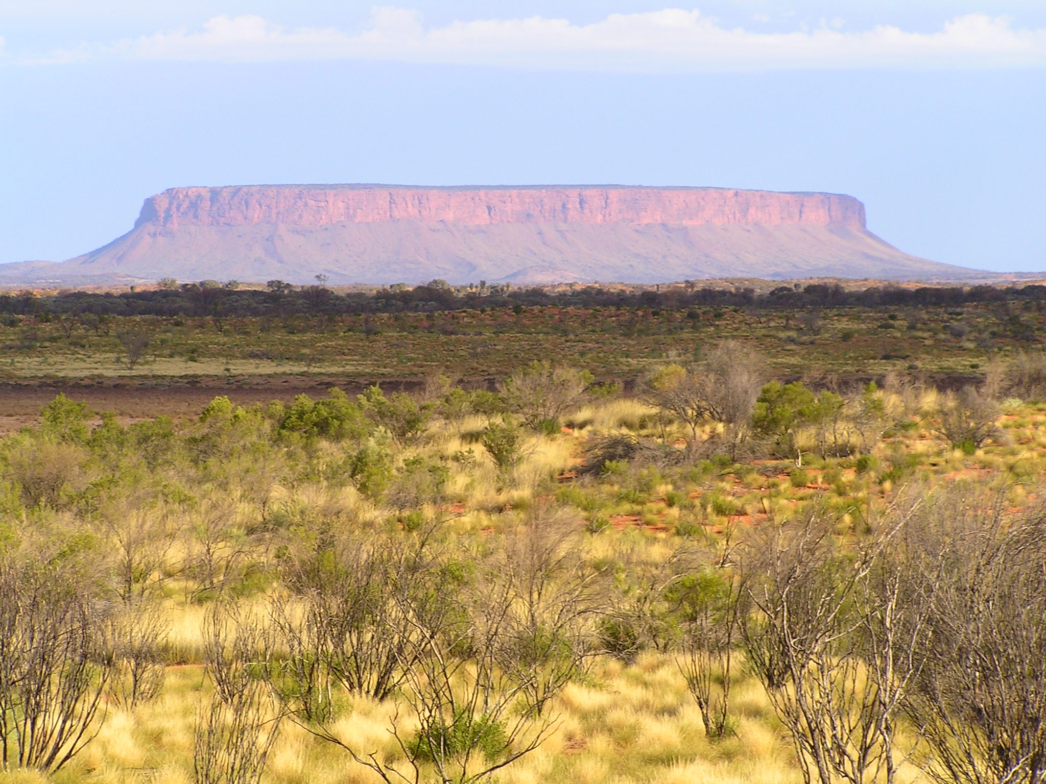
A mesa is an isolated, flat-topped elevation, ridge, or hill, bounded from all sides by steep escarpments and standing distinctly above a surrounding plain. Mesas consist of flat-lying soft sedimentary rocks, such as shales, capped by a resistant layer of harder rock, like sandstone or limestone, forming a caprock that protects the flat summit. The caprock may also include dissected lava flows or eroded duricrust. Unlike a ''plateau'', which is a broader, elevated region that may not have horizontal bedrock (e.g., Tibetan Plateau), a mesa is defined by flat-lying strata and steep-sided isolation. Large, flat-topped plateaus with horizontal strata, less isolated and often part of extensive plateau systems, are called '' tablelands''. A ''butte'' is a smaller, eroded mesa with a limited summit, while a ''cuesta'' has a gentle dip slope and one steep escarpment due to tilted strata.Duszyński, F., Migoń, P. and Strzelecki, M.C., 2019. ''Escarpment retreat in sedimentary tabl ... [...More Info...] [...Related Items...] OR: [Wikipedia] [Google] [Baidu] |
Los Lirios
LOS, or Los, or LoS may refer to: Science and technology * Length of stay, the duration of a single episode of hospitalisation * Level of service, a measure used by traffic engineers * Level of significance, a measure of statistical significance * Line-of-sight (other) * LineageOS, a free and open-source operating system for smartphones and tablet computers * Loss of signal ** Fading **End of pass (spaceflight) * Loss of significance, undesirable effect in calculations using floating-point arithmetic Medicine and biology * Lipooligosaccharide, a bacterial lipopolysaccharide with a low-molecular-weight * Lower oesophageal sphincter Arts and entertainment * ''The Land of Stories'', a series of children's novels by Chris Colfer * Los, or the Crimson King, a character in Stephen King's novels * Los (band), a British indie rock band from 2008 to 2011 * Los (Blake), a character in William Blake's poetry * Los (rapper) (born 1982), stage name of American rapper Carlos Col ... [...More Info...] [...Related Items...] OR: [Wikipedia] [Google] [Baidu] |
Huachichil
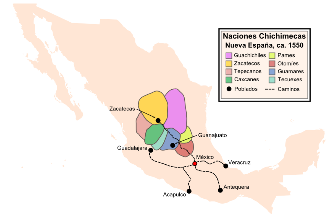
The Guachichil, Cuauchichil, or Quauhchichitl are an exonym for an Indigenous people of Mexico. Prior to European contact, they occupied the most extensive territory of all the Indigenous Chichimeca tribes in pre-Columbian central Mexico. The Guachichiles settled a large region of Zacatecas; as well as portions of San Luis Potosí, Guanajuato, and northeastern Jalisco; south to the northern corners of Michoacán; and north to Saltillo in Coahuila. History Considered both warlike and brave, the Guachichiles played a major role in provoking the other Chichimeca tribes to resist the Spanish settlement. The historian Philip Wayne Powell wrote: :::" ''Their strategic position in relation to Spanish mines and highways, made them especially effective in raiding and in escape from Spanish reprisal''." These warriors were known to fight fiercely even if mortally wounded and were a key component in the Spanish defeat during the Chichimeca Wars. The children learned to use the bow at walk ... [...More Info...] [...Related Items...] OR: [Wikipedia] [Google] [Baidu] |


