|
Armadale, Western Australia
Armadale is a suburb of Perth within the City of Armadale, located on the south-eastern edge of the Perth metropolitan region. The major junction of the South Western and Albany Highways, which connect Perth with the South West and Great Southern regions of Western Australia respectively, is located within the suburb. It is also the terminus of the Armadale railway line, one of five major railway lines to service Perth. History Plentiful in natural resources, the area now known as Armadale was long occupied by Aboriginal people prior to the founding of the Swan River Colony. Records of encounters with the original Aboriginal inhabitants of this district are sparse in detail, but early on there was conflict between these inhabitants and the settlers, which led to the establishment of a small garrison at Kelmscott. The township of Kelmscott was gazetted in 1830, and for the next sixty years was the administrative and social hub for those colonists who took up land between p ... [...More Info...] [...Related Items...] OR: [Wikipedia] [Google] [Baidu] |
Perth
Perth () is the list of Australian capital cities, capital city of Western Australia. It is the list of cities in Australia by population, fourth-most-populous city in Australia, with a population of over 2.3 million within Greater Perth . The Extremes on Earth#Other places considered the most remote, world's most isolated major city by certain criteria, Perth is part of the South West Land Division of Western Australia, with most of Perth metropolitan region, Perth's metropolitan area on the Swan Coastal Plain between the Indian Ocean and the Darling Scarp. The city has expanded outward from the original British settlements on the Swan River (Western Australia), Swan River, upon which its #Central business district, central business district and port of Fremantle are situated. Perth was founded by James Stirling (Royal Navy officer), Captain James Stirling in 1829 as the administrative centre of the Swan River Colony. The city is situated on the traditional lands of the Whadju ... [...More Info...] [...Related Items...] OR: [Wikipedia] [Google] [Baidu] |
Albany Highway
Albany Highway links Western Australia's capital city Perth with its oldest settlement, Albany, Western Australia, Albany, on the state's South coast of Western Australia, south coast. The highway travels through the southern Wheatbelt (Western Australia), Wheatbelt and Great Southern (Western Australia), Great Southern regions, and is designated List of road routes in Western Australia#30, State Route 30 for most of its length. Outside of Perth the highway is predominately a sealed road, sealed, single carriageway with regular overtaking lanes in some undulating areas. Albany Highway commences at The Causeway, a river crossing that connects to Perth (suburb), Perth's central business district. The highway heads south-east through Perth's metropolitan region, bypassed in part by Shepperton Road and Kenwick Link, and continues south-eastwards through to Albany. It intersects several major roads in Perth, including the Leach Highway, Leach, Tonkin Highway, Tonkin, Brookton H ... [...More Info...] [...Related Items...] OR: [Wikipedia] [Google] [Baidu] |
Wungong, Western Australia
Wungong (older spelling Wongong), pronounced is a semi-rural south-eastern suburb of Perth, Western Australia, located midway between Armadale, Western Australia, Armadale and Byford, Western Australia, Byford and located in the local government area of the City of Armadale. History Colonial period The first survey in this area was by Alfred Hillman in January 1835. Hillman named the perennial stream that flows through the district the ‘Marshall River’ after Captain Marshall MacDermott who was a prominent figure in the Swan River Colony during its earliest years, but this name did not gain hold. The earliest documented use of the suburb's name is in J W Gregory's survey of Canning Location 22 dated April 1844 which maps the course of the 'Woongan River' for the first kilometre west of the hills and shows the land selected by G & J Armstrong which they developed into what became known as 'Wongong' farm. The name, Aboriginal in origin, is said to mean "embracing" in the ... [...More Info...] [...Related Items...] OR: [Wikipedia] [Google] [Baidu] |
Canning Dam
The Canning Dam and reservoir are a major source of fresh water for the city of Perth, Western Australia. The dam is situated on the Darling Scarp and is an impoundment of the Canning River. It is noted for its innovative structural and hydraulic design that was considered to be at the forefront of concrete gravity dam design at the time of construction in from 1933 to its completion 1940. The Canning Dam was Perth's primary water supply up until the 1961 when other sources of fresh water were tapped, such as the Serpentine dam. Currently the dam supplies approximately 20 percent of Perth's fresh water. Inflow into the Canning Reservoir is estimated to be , and it has a storage capacity of . Since its completion in 1940, the Canning Dam has contributed to a wide range of environmental and ecological problems in surrounding regions, problems include more common algal blooms, habitat loss and sedimentation. Despite these issues, Canning Dam and the adjacent parks and forest ... [...More Info...] [...Related Items...] OR: [Wikipedia] [Google] [Baidu] |
Churchman Brook Dam
Churchman Brook Dam is an earth-fill embankment dam approximately southeast of Perth, Western Australia in the City of Armadale. The reservoir is a water source for Perth. It has a capacity of for a catchment area of . The creation of the dam was announced in March 1923 by Premier James Mitchell. Along with Canning Dam and Wungong Dam, it formed part of the Hills Water Supply Scheme which was intended to rectify severe water shortages in metropolitan Perth. Its capacity was initially estimated at 595 million gallons. Construction of the dam commenced in 1923 and was completed in 1929; the resident engineer was Sir Russell John Dumas. The dam is on the City of Armadale's heritage list, having been registered on 1 December 2008. See also *Darling Scarp *List of reservoirs and dams in Australia Dams and reservoirs in Australia is a link page for any dam or reservoir (water), reservoir in Australia. Australian Capital Territory There are three key water storage facili ... [...More Info...] [...Related Items...] OR: [Wikipedia] [Google] [Baidu] |
Araluen Botanic Park
Araluen Botanic Park is located in a sheltered valley in the Darling Ranges, approximately south of Perth, Western Australia, in the suburb of Roleystone. The Botanical Park covers an area of about . There is a small entry fee to the park, and it is open every day of the year. There is a mixture of exotic plant varieties, however the park also contains many remnants of native bush. History Jack Simons bought the property in 1929 on behalf of the Young Australia League (YAL) to use as a holiday camp. The YAL put the Araluen Botanic Gardens up for sale in 1985 (but retained Camp Simons). A private investor was going to redevelop the land, however the local communities rallied the state government to purchase the park. Encouraged by strong community support, the state government purchased the park in 1990. The Araluen Botanic Park Foundation became incorporated in July 1990 with the aim of working with the Western Australian Planning Commission to restore the park. Since 1995, t ... [...More Info...] [...Related Items...] OR: [Wikipedia] [Google] [Baidu] |
Old Jarrah Tree
The Old Jarrah tree is an exceptionally large and old ''Eucalyptus marginata'' (Jarrah) tree near inside the carpark the entrance at the corner Third Road and Church Avenue in Armadale, Western Australia. It is estimated to be between 400 and 800 years old. Trees of such a great size and age are rare in and around the Perth metropolitan area, because of extensive logging of the area in the 19th century. The tree is in fairly poor condition: about three quarters of its canopy is dead or gone, and it is less than half its normal height due to lopping. It was ringbarked by vandals in 1997, and it has responded by producing numerous epicormic shoots on its north side. Despite these issues, the tree is considered to be in a stable condition. Attempts to have the tree destroyed were twice defeated by community groups, in 1987 and again in 1997. In 1997 a Conservation Order was issued for the tree after the Minister for Heritage received 1,147 submissions asking that it be saved. It ... [...More Info...] [...Related Items...] OR: [Wikipedia] [Google] [Baidu] |
Canning River
The Canning River ( or ) is a major tributary of the Swan River in the South West Land Division of Western Australia. It is home to much wildlife including dolphins, pelicans, swans and many other bird species. Source and route With headwaters on the Darling Scarp, the Canning meanders through suburbs of Perth on the Swan Coastal Plain, including Cannington, Thornlie, Riverton, Shelley, Rossmoyne and Mount Pleasant, before joining the Swan at Melville Water just downstream of the Canning Bridge. Bridges * Canning Bridge * Mount Henry Bridge * Shelley Bridge * Riverton Bridge * Kent Street Weir Bridge * Greenfield Street Bridge * Canning River Downstream Bridge * Canning River Upstream Bridge * Djarlgarra Bridge Easthbound * Djarlgarra Bridge Westbound * unnamed railway bridge * Royal Street Bridge * unnamed pedestrian bridge * Burslem Bridge * unnamed railway bridge * Jenna Biddi Footbridge * unnamed railway bridge * unnamed pedestrian bridge * Cargeeg Bridge * u ... [...More Info...] [...Related Items...] OR: [Wikipedia] [Google] [Baidu] |
Byford, Western Australia
Byford is a suburb on the south-eastern edge of Perth, Western Australia, within the Shire of Serpentine-Jarrahdale. The town has its origins in a township that was gazetted under the name "Beenup" in 1906. In 1920, the name of the township was changed to Byford. Toponym The original name of Byford was 'Beenup'. "Beenup", a corruption of the Aboriginal Australians, Aboriginal name associated with nearby Beenyup Brook, was the spelling that had been applied to a railway siding there. The uncorrupted form, "Bienyup" received mention in surveyor Robert Austin's account of an expedition through the area in 1848. On April 23, 1920, the name of the township was changed to Byford. Byford was chosen through a ballot which included other names such as Beenup, Beenyup, Glengeorge and Winterbourne. From 19 to 22 November 2020, the Byford Progress Association held centenary celebrations of the naming. History Colonial period and early 20th century Little has been documented of the Abor ... [...More Info...] [...Related Items...] OR: [Wikipedia] [Google] [Baidu] |
Swan River Colony
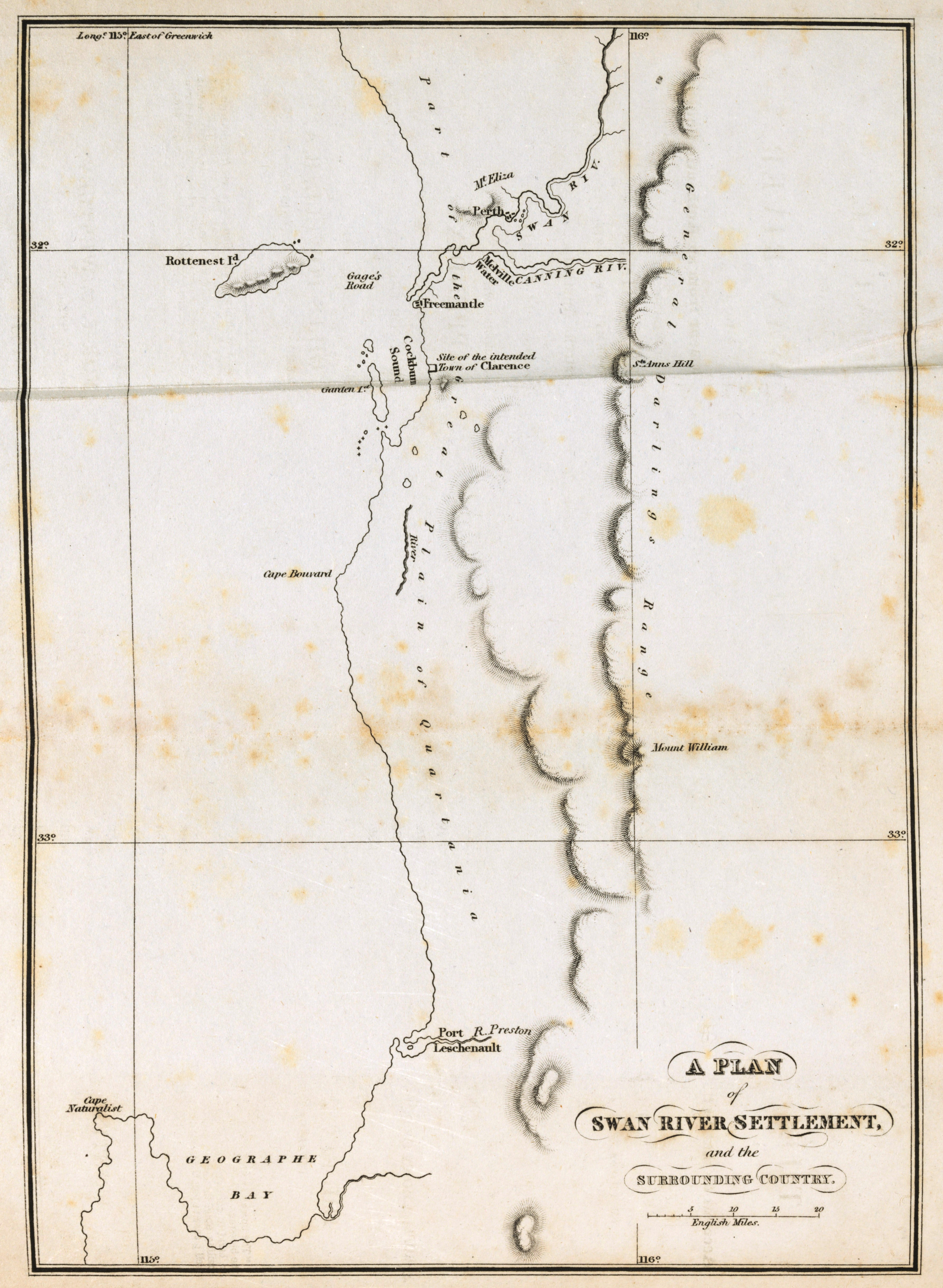
The Swan River Colony, also known as the Swan River Settlement, or just ''Swan River'', was a British colony established in 1829 on the Swan River, in Western Australia. This initial settlement place on the Swan River was soon named Perth, and it became the capital city of Western Australia. The name was a ''pars pro toto'' for Western Australia. On 6 February 1832, the colony was renamed the Colony of Western Australia, when the colony's founding lieutenant-governor, Captain James Stirling, belatedly received his commission. However, the name ''Swan River Colony'' remained in informal use for many years. European exploration The first recorded Europeans to sight land where the city of Perth is now located were Dutch sailors. Most likely the first visitor to the Swan River area was Frederick de Houtman on 19 July 1619, travelling on the ships and . His records indicate he first reached the Western Australian coast at latitude 32°20', which is approximately at Warn ... [...More Info...] [...Related Items...] OR: [Wikipedia] [Google] [Baidu] |
Armadale Railway Line
The Armadale line is a partially-closed suburban railway service in Perth, Western Australia, operated by the Public Transport Authority as part of the Transperth system. The Armadale line is long, and starts at Perth station, heading south-east of there to serve Perth's south-eastern suburbs, terminating at Armadale station. Since June 2025, the line has been closed from Beckenham Station to Armadale for the Rail Revitalisation Program and Byford extension with services operating between Perth and Cannington, as Beckanham is only being serviced by Thornlie-Cockburn Line services. The Armadale line originated from suburban services along the South Western Railway in the 1890s. Suburban services were extended over the first half of the 20th century to eventually reach Armadale station. Diesel services commenced in 1954, which allowed for the opening of more stations closer together. Electrification occurred in the early 1990s, and in 2005, the Thornlie line opened as a branc ... [...More Info...] [...Related Items...] OR: [Wikipedia] [Google] [Baidu] |
Armadale Railway Station, Perth
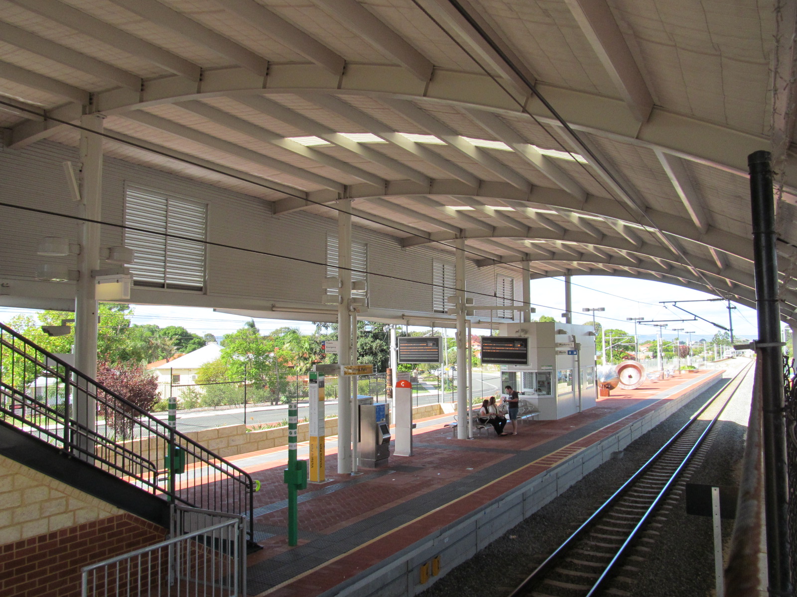
Armadale railway station is a temporarily closed suburban and regional railway station, located on the South Western Railway 30 kilometres from Perth station serving the suburb of Armadale, Brookdale and Haynes. It was demolished in November 2023 as part of a project to rebuild the station on an elevated viaduct and extend the Armadale line to Byford. Before closure, it was the terminating point for Transperth Armadale line services and a calling point for Transwa ''Australind'' services. History The original station opened on 2 May 1893 when the South Western Railway opened from Claisebrook to Pinjarra. On 15 July 1907, Armadale became a junction station when the Spearwood–Armadale line opened. This line closed on 23 January 1964. 1990s and 2004 rebuild As part of the electrification of the line in the early 1990s, a new station was built with the former signal box relocated to the Armadale Tourist Centre. On 6 November 2004, another new, more substantial station open ... [...More Info...] [...Related Items...] OR: [Wikipedia] [Google] [Baidu] |


