|
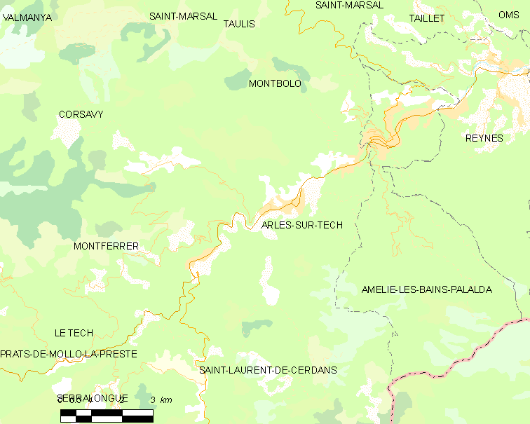
Amélie-les-Bains-Palalda
Amélie-les-Bains-Palalda (; ) is a commune in the Pyrénées-Orientales department in southern France. It is situated in the Tech valley, and combines the old and the new with a mix of narrow cobbled streets and modern accommodation. It has become a 'station verte' meaning that it must strive at all times to ensure that tourists benefit from a calm and natural environment. Geography Location Amélie-les-Bains-Palalda is located in the canton of Le Canigou and in the arrondissement of Céret. It sits at the confluence of the Mondony with the Tech, SSW of Perpignan by road. The town is situated at a height of and has both a winter and summer season. Climate In the winter season the average temperature is about 10 degrees Celsius, and in the summer it is roughly 29 degrees Celsius with the occasional thunderstorm late afternoon. Springs The town has numerous sulphur springs (20-60C.). They have been used as baths by those with rheumatism and illnesses of the l ... [...More Info...] [...Related Items...] OR: [Wikipedia] [Google] [Baidu] |
Communes Of The Pyrénées-Orientales Department
The Pyrénées-Orientales departments of France, department is composed of 226 communes of France, communes. Most of the territory (except for the district of Fenolheda) formed a part of the Principality of Catalonia until 1659, and Catalan language, Catalan is still spoken (in addition to French language, French) by a significant minority of the population. The Catalan names of communes are taken from the ''Enciclopèdia catalana'' and are intended for comparison with the official French names: they do not indicate the current or former linguistic status of the commune. List of intercommunalities The communes cooperate in the following Communes of France#Intercommunality, intercommunalities (as of 2025):Périmètre des groupements en 2025 BANATIC. Accessed 28 May 2025. *Communauté urbaine Perpignan Médit ... [...More Info...] [...Related Items...] OR: [Wikipedia] [Google] [Baidu] |
Palalda
Palalda (; ) is a former commune in Pyrénées-Orientales, now part of Amélie-les-Bains-Palalda. Geography Palalda is located above the river Tech, to the northeast of Amélie-les-Bains and to the east of Montbolo. History The first mention of Palalda is from the year 814, as being the western limit of the territory of Céret. On 1 October 1942, the commune of Palalda is linked to Amélie-les-Bains to create the new commune of Amélie-les-Bains-Palalda. Politics and administration Canton In 1790, Palalda is included in the canton of Arles, which remains the same after being united to Amélie-les-bains in 1942.Jean-Pierre Pélissier, Paroisses et communes de France : dictionnaire d'histoire administrative et démographique, vol. 66 : Pyrénées-Orientales, Paris, CNRS, 1986 Mayors Demography ;Ancien Régime Population under the Ancien Régime is calculated either in number of ''feu fiscal'' (''f'', fire tax), or in number of inhabitants (''H''). ;Modern tim ... [...More Info...] [...Related Items...] OR: [Wikipedia] [Google] [Baidu] |
Canton Of Le Canigou
The canton of Le Canigou is an administrative division of the Pyrénées-Orientales department, in southern France. It was created at the French canton reorganisation which came into effect in March 2015. Its seat is in Amélie-les-Bains-Palalda. It consists of the following communes: # Amélie-les-Bains-Palalda # Arles-sur-Tech # Baillestavy # La Bastide # Boule-d'Amont # Bouleternère # Casefabre # Casteil # Corneilla-de-Conflent # Corsavy # Coustouges # Espira-de-Conflent # Estoher # Fillols # Finestret # Fuilla # Glorianes # Joch # Lamanère # Mantet # Marquixanes # Montbolo # Montferrer # Prats-de-Mollo-la-Preste # Prunet-et-Belpuig # Py # Reynès # Rigarda # Rodès # Sahorre #Saint-Laurent-de-Cerdans Saint-Laurent-de-Cerdans (; ) is a commune in the Pyrénées-Orientales department in southern France. Geography Saint-Laurent-de-Cerdans is located in the canton of Le Canigou and in the arrondissement of Céret. Government and politic ... # Saint-Marsal # Sai ... [...More Info...] [...Related Items...] OR: [Wikipedia] [Google] [Baidu] |
Arles-sur-Tech
Arles-sur-Tech (, literally ''Arles on Tech''; ; ) is a commune in the Pyrénées-Orientales Pyrénées-Orientales (; ; ; ), also known as Northern Catalonia, is a departments of France, department of the Regions of France, region of Occitania (administrative region), Occitania, Southern France, adjacent to the northern Spain, Spanish ... Departments of France, department in southern France. Geography Location Arles-sur-Tech is located in the canton of Le Canigou and in the arrondissement of Céret. Arles-sur-Tech is situated in the southernmost valley in mainland France before Spain, the Vallespir, through which the long river "Tech" flows. This small town is surrounded by the eastern Pyrenees which dominate the skyline around Arles-sur-Tech. The town sits on the only main road which passes through the valley, the D 115, making it accessible from Spain in the west and the plane of Roussillon and Perpignan in the east. It is located close to the larger and more well-kno ... [...More Info...] [...Related Items...] OR: [Wikipedia] [Google] [Baidu] |
Maçanet De Cabrenys
'Maçanet de Cabrenys'' () is a municipalities of Spain, municipality in the ''Comarques of Catalonia, comarca'' of Alt Empordà, Province of Girona, Girona, Catalonia, Spain. It also belongs to the ''subcomarca'' of :ca:Alta_Garrotxa, Alta Garrotxa. It includes the villages of Arnera, Les Creus, Les Mines, Les Salines, Tapis, Els Vilars, and Oliveda. It is situated at the foot of the Eastern Pyrenees, with the Rivers Arnera and Frausa. It has numerous springs, which makes it attractive for tourism, the largest source of revenue, together with dryland farming and animal husbandry. It has a water bottling facility. The center (370 m) is located in a valley between the two highest points of the municipal territory, the '':ca:Puig_de_les_Pedrisses, Puig de Les Pedrisses''(1330,6 m) and the ''Roc de Frausa'' (1421 m). History Last century, near the river Arnera there were found neolitical axe, together with the menhir called La Pedra Dreta. Those findings show that the valley of th ... [...More Info...] [...Related Items...] OR: [Wikipedia] [Google] [Baidu] |

