|
Amherst, Massachusetts
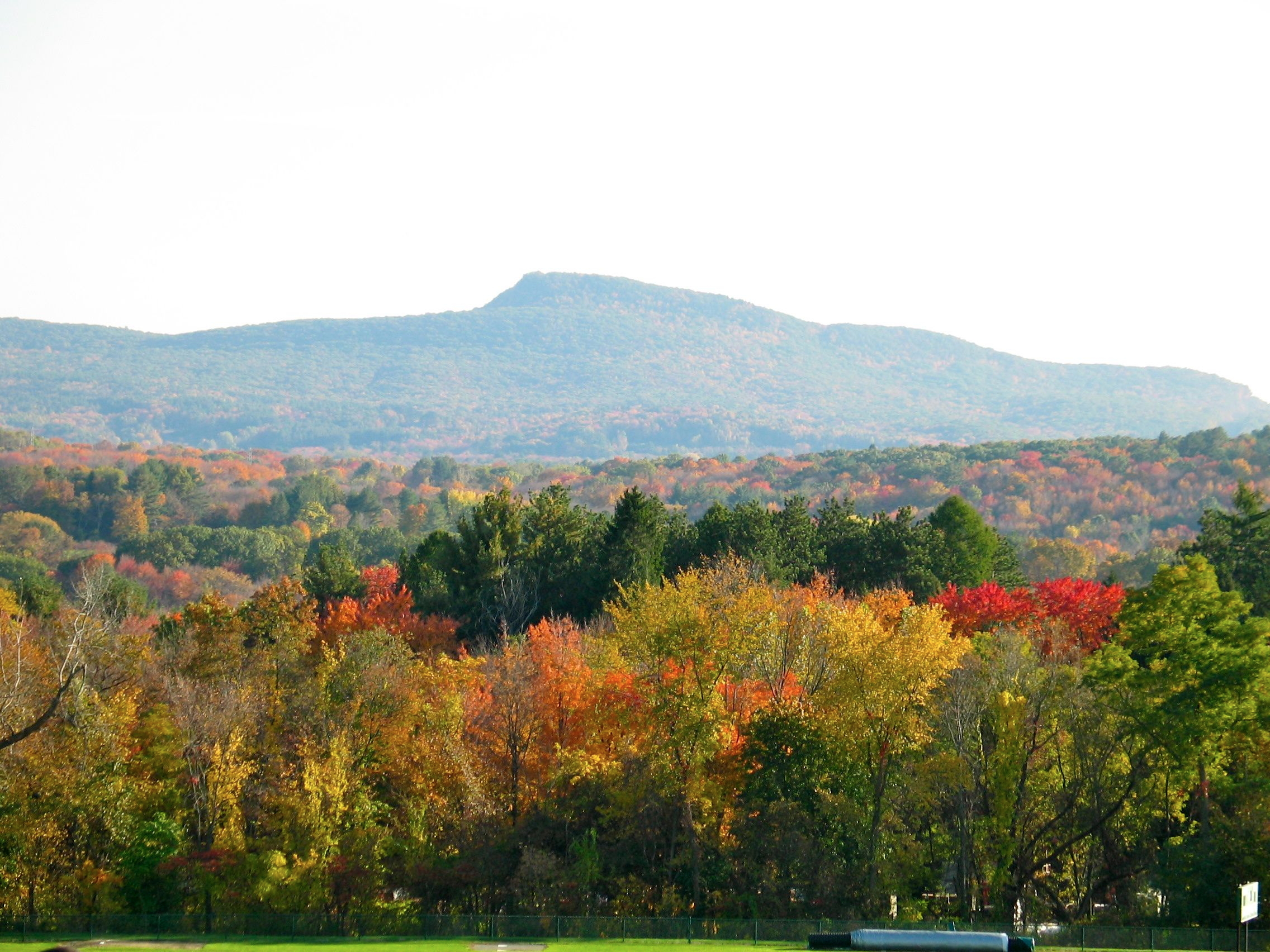
Amherst () is a city in Hampshire County, Massachusetts, United States, in the Connecticut River valley. Amherst has a council–manager form of government, and is considered a city under Massachusetts state law. Amherst is one of several Massachusetts municipalities that have city forms of government but retain "The Town of" in their official names. At the 2020 United States census, 2020 census, the population was 39,263, making it the highest populated municipality in Hampshire County (although the county seat is Northampton, Massachusetts, Northampton). The town is home to Amherst College, Hampshire College, and the University of Massachusetts Amherst, three of the Five College Consortium, Five Colleges. Amherst has three census-designated places: Amherst Center, Massachusetts, Amherst Center, North Amherst, Massachusetts, North Amherst, and South Amherst, Massachusetts, South Amherst. Amherst is part of the Springfield, Massachusetts Springfield metropolitan area, Massachuse ... [...More Info...] [...Related Items...] OR: [Wikipedia] [Google] [Baidu] |
North Amherst
North Amherst is a census-designated place (CDP) in the city of Amherst in Hampshire County, Massachusetts, United States. The population was 6,819 at the 2010 census, up from 6,019 at the 2000 census. It is part of the Springfield, Massachusetts Metropolitan Statistical Area. herst is located in the northern part of the city of Amherst at (42.406192, -72.521217). It is bordered to the south by the Amherst Center CDP and to the southwest by the town of Hadley. The CDP border follows the Mill River north from the Hadley town line, then east across Massachusetts Route 116 as far as Massachusetts Route 63. The border then follows Pulpit Hill Road, Mill Street, Sand Hill Road, and Pine Street east to the New England Central Railroad line, which it follows south to Tilson Farm Road. The CDP boundary then proceeds west along Tilson Farm Road and Eastman Lane to North Pleasant Street, which it follows north to a brook near the Hadley town line. According to the United States C ... [...More Info...] [...Related Items...] OR: [Wikipedia] [Google] [Baidu] |
Amherst & Sunderland Streetcar, Amherst, 1903
Amherst may refer to: People * Amherst (surname), including a list of people with the name * Earl Amherst of Arracan in the East Indies, a title in the British Peerage; formerly ''Baron Amherst'' * Baron Amherst of Hackney of the City of London, a title in the British Peerage Places Australia * Amherst, Victoria Burma * Kyaikkami, Myanmar, formerly known as Amherst Canada * Amherst Cove, Newfoundland and Labrador * Middle Amherst Cove, Newfoundland and Labrador * Upper Amherst Cove, Newfoundland and Labrador *Amherst, Nova Scotia * Amherst Head, Nova Scotia * Amherst Internment Camp, Nova Scotia (1915–1919) * Amherst Point, Nova Scotia * Amherst Shore, Nova Scotia * East Amherst, Nova Scotia * West Amherst, Nova Scotia *Amherst Island, Ontario * Amherst Pointe, Ontario *Amherstburg, Ontario * Amherstview, Ontario *Amherst, Quebec * Saint-Rémi-d'Amherst, Quebec * Amherst Island (Nunavut) United States *Amherst, Colorado * Amherst, Maine *Amherst, Massachusetts * Amherst C ... [...More Info...] [...Related Items...] OR: [Wikipedia] [Google] [Baidu] |
Pioneer Valley
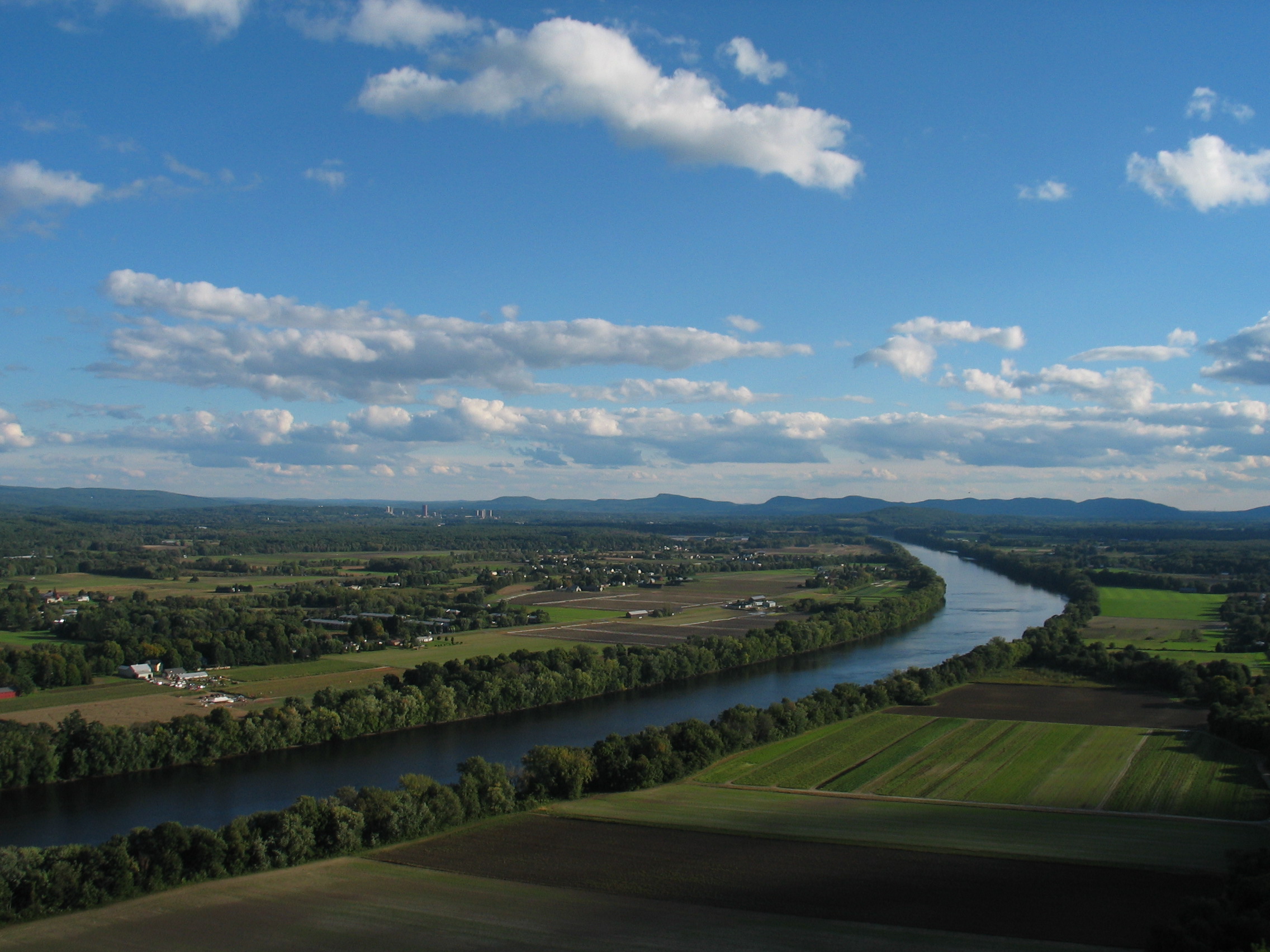
The Pioneer Valley is the colloquial and promotional name for the portion of the Connecticut River Valley that is in Massachusetts in the United States. It is generally taken to comprise the three counties of Hampden County, Massachusetts, Hampden, Hampshire County, Massachusetts, Hampshire, and Franklin County, Massachusetts, Franklin. The lower Pioneer Valley corresponds to the Springfield, Massachusetts metropolitan area, the region's urban center, and the seat of Hampden County, Massachusetts, Hampden County. The upper Pioneer Valley region includes the smaller cities of Northampton, Massachusetts, Northampton and Greenfield, Massachusetts, Greenfield, the county seats of Hampshire County, Massachusetts, Hampshire and Franklin County, Massachusetts, Franklin counties, respectively. Historically the northern part of the Valley was an agricultural region, known for growing Connecticut shade tobacco and other specialty crops like Hadley, Massachusetts, Hadley asparagus; howe ... [...More Info...] [...Related Items...] OR: [Wikipedia] [Google] [Baidu] |
Hartford–Springfield
The greater Hartford–Springfield area is an urban region and surrounding suburban areas that encompasses both north-central Connecticut and the southern Connecticut River Valley in western Massachusetts; its major city centers are Springfield, Massachusetts and Hartford, Connecticut. The area is also sometimes called the Knowledge Corridor, initially employed as a 2012 rename ("New England's Knowledge Corridor") for the Hartford–Springfield Economic Partnership, an interstate cooperative venture to foster an economic, cultural, and civic partnership between the two major cities on the Connecticut River. The term Knowledge Corridor has gained a degree of currency, mostly with some government organizations as well as local businesses and universities using the name. The New Haven–Springfield Line and Connecticut River Line form the primary rail route through the region, and are sometimes themselves called the Knowledge Corridor in planning documents. The Hartford–Sprin ... [...More Info...] [...Related Items...] OR: [Wikipedia] [Google] [Baidu] |
Springfield Metropolitan Area, Massachusetts
The Springfield metropolitan area, also known as Greater Springfield, is a region that is socio-economically and culturally tied to the City of Springfield, Massachusetts. The U.S. Office of Management and Budget defines the Springfield, MA Metropolitan Statistical Area (MSA) as consisting of three counties in Western Massachusetts. As of 2023, the metropolitan area's population was estimated at 460,291, making it the 117th-largest metropolitan area in the United States. Historically, the census has also identified the region as "Springfield–Holyoke, Mass.–Conn." as those cities were the area's population centers as recently as 1980; since that time the population has become further distributed, including new growth in Amherst, Westfield, and West Springfield, and Northern Connecticut. Greater Springfield is one of two combined statistical areas in Massachusetts; the other is Greater Boston. An alternative system of measuring New England metropolitan areas was developed ... [...More Info...] [...Related Items...] OR: [Wikipedia] [Google] [Baidu] |
Springfield, Massachusetts
Springfield is the most populous city in Hampden County, Massachusetts, United States, and its county seat. Springfield sits on the eastern bank of the Connecticut River near its confluence with three rivers: the western Westfield River, the eastern Chicopee River, and the eastern Mill River (Springfield, Massachusetts), Mill River. At the 2020 United States census, 2020 census, the city's population was 155,929, making it the List of municipalities in Massachusetts, third most populous city in the U.S. state of Massachusetts and the fourth most populous city in New England after Boston, Worcester, Massachusetts, Worcester, and Providence, Rhode Island, Providence. Springfield metropolitan area, Massachusetts, Metropolitan Springfield, as one of two metropolitan areas in Massachusetts (the other being Greater Boston), had a population of 699,162 in 2020. Springfield was founded in 1636, the first Springfield (toponym), Springfield in the New World. In the late 1700s, during the ... [...More Info...] [...Related Items...] OR: [Wikipedia] [Google] [Baidu] |
South Amherst, Massachusetts
South Amherst is a census-designated place (CDP) in the town of Amherst in Hampshire County, Massachusetts, United States. The population was 4,994 at the 2010 census. The CDP includes the village of South Amherst and residential subdivisions south of the Amherst town center. South Amherst is part of the Springfield, Massachusetts Metropolitan Statistical Area. Geography South Amherst is located in the southwest part of the town of Amherst at (42.339586, -72.522426). It is bordered to the north by Amherst Center and to the west by the Hadley town line. The CDP extends south to Bay Road. According to the United States Census Bureau, the CDP has a total area of , of which , or 0.58%, are water. The original village of South Amherst is near the eastern edge of the CDP, at the junction of Shays Street, South East Street, and Station Road. The village has a town common area between South East and Middle streets, known as the South Amherst Common or Fiddlers Green,Scott Merzbac ... [...More Info...] [...Related Items...] OR: [Wikipedia] [Google] [Baidu] |
Amherst Center, Massachusetts
Amherst Center is a census-designated place (CDP) in the City of Amherst in Hampshire County, Massachusetts, United States. The CDP covers the primary village in town. The population was 19,065 at the 2010 census, out of a total city population of 37,819. It is part of the Springfield, Massachusetts Metropolitan Statistical Area. Geography Amherst Center is located in the west-central part of the town of Amherst at (42.380392, -72.519821). It is bordered to the north by North Amherst, to the south by South Amherst, and to the west by the town of Hadley. The CDP extends north as far as Eastman Lane and Tilson Farm Road, east to the New England Central Railroad and East Street, and south to Mill Lane and East Hadley Road. Amherst College is in the center of the CDP, south of College Street and east of Pleasant Street, while the University of Massachusetts Amherst is in the northwestern part of the CDP. According to the United States Census Bureau, the CDP has a total area o ... [...More Info...] [...Related Items...] OR: [Wikipedia] [Google] [Baidu] |
Census-designated Place
A census-designated place (CDP) is a Place (United States Census Bureau), concentration of population defined by the United States Census Bureau for statistical purposes only. CDPs have been used in each decennial census since 1980 as the counterparts of incorporated places, such as self-governing city (United States), cities, town (United States), towns, and village (United States), villages, for the purposes of gathering and correlating statistical data. CDPs are populated areas that generally include one officially designated but currently unincorporated area, unincorporated community, for which the CDP is named, plus surrounding inhabited countryside of varying dimensions and, occasionally, other, smaller unincorporated communities as well. CDPs include small rural communities, Edge city, edge cities, colonia (United States), colonias located along the Mexico–United States border, and unincorporated resort and retirement community, retirement communities and their environs. ... [...More Info...] [...Related Items...] OR: [Wikipedia] [Google] [Baidu] |
Five College Consortium
The Five College Consortium (often referred to as simply the Five Colleges) comprises four Liberal arts colleges in the United States, liberal arts colleges and one university in the Connecticut River Pioneer Valley of Western Massachusetts: Amherst College, Hampshire College, Mount Holyoke College, Smith College, and the University of Massachusetts Amherst, totaling approximately 38,000 students. They are geographically close to one another and are linked by frequent bus service that operates between the campuses during the school year. The consortium was formally established in 1965, but its roots lay in cooperative efforts between the oldest four members of the consortium dating back to 1914. History In 1914, Massachusetts Agricultural College (now UMass), Amherst, Mount Holyoke, and Smith joined International YMCA College (now Springfield College (Massachusetts), Springfield College) to form the Committee on University Extension of the Connecticut Valley Colleges, a joint c ... [...More Info...] [...Related Items...] OR: [Wikipedia] [Google] [Baidu] |
Hampshire College
Hampshire College is a Private college, private Liberal arts colleges in the United States, liberal arts college in Amherst, Massachusetts. It was opened in 1970 as an experiment in alternative education, in association with four other colleges in the Pioneer Valley: Amherst College, Smith College, Mount Holyoke College, and the University of Massachusetts Amherst. Together they are known as the Five College Consortium. The campus also houses the Yiddish Book Center, National Yiddish Book Center and Eric Carle Museum of Picture Book Art, Eric Carle Museum, and hosts the annual Hampshire College Summer Studies in Mathematics. The college utilizes an alternative curriculum, with an emphasis on Progressive education, progressive pedagogy and self-directed academic concentrations, a focus on portfolios rather than distribution requirements, and a reliance on narrative evaluations instead of grades and GPAs. In January 2019, following the announcement that the college would seek a m ... [...More Info...] [...Related Items...] OR: [Wikipedia] [Google] [Baidu] |


