|
Albeck, Carinthia
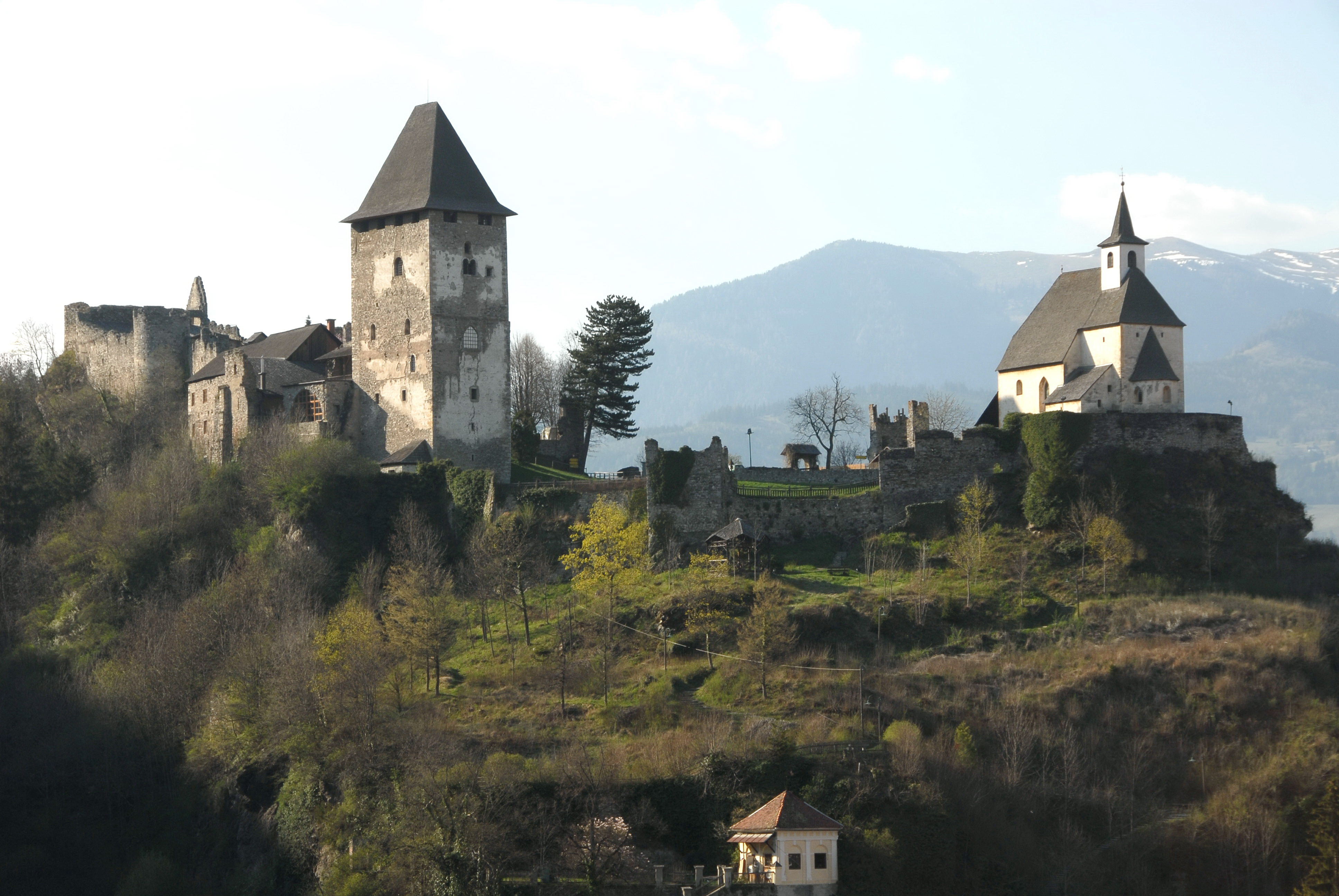
Albeck is a municipality in the district of Feldkirchen in the Austrian state of Carinthia. Geography The municipal area stretches along the valley of the Sirnitzbach creek, a tributary of the Gurk river, within the Gurktal Alps. In the northwest, Albeck borders on the state of Styria near Mt Eisenhut and Turracher Höhe Pass. In the west, the road leads from Sirnitz to Reichenau via Hochrindl Pass. The upper Gurk valley and its sources, two small cirque lakes (Gurksee and Torersee), are a protected area since 1981. Albeck comprises the cadastral communities of Albeck proper, Großreichenau, Sankt Leonhard, and Sirnitz. The main settlement is the village of Sirnitz. Neighbouring municipalities History Albeck is a settlement area since the 10th century, when the surrounding estates were held by the Counts of Friesach, ancestors of Saint Hemma of Gurk. In 1043 Hemma granted the Lordship of Albeck to the short-lived Benedictine nunnery of Gurk. When Archbishop Gebhard o ... [...More Info...] [...Related Items...] OR: [Wikipedia] [Google] [Baidu] |
Municipality (Austria)
In the Republic of Austria, the municipality (, sometimes also ) is the administrative division encompassing a single village, town, or city. The municipality has municipal corporation, corporate status and local self-government on the basis of parliamentary democracy, parliamentary-style representative democracy: a municipal council () elected through a form of party-list proportional representation, party-list system enacts municipal laws, a municipal executive board () and a mayor (, grammatical gender, fem. ) appointed by the council are in charge of municipal administration. Austria is currently (January 1, 2020) partitioned into 2,095 municipalities, ranging in population from about fifty (the village of Gramais in Tyrol (state), Tyrol) to almost two million (the city of Vienna). There is no unincorporated area, unincorporated territory in Austria. Basics The existence of municipalities and their role as carriers of the right to self-administration are guaranteed by the ... [...More Info...] [...Related Items...] OR: [Wikipedia] [Google] [Baidu] |
Reichenau, Carinthia
Reichenau () is a municipality in the district of Feldkirchen (district), Feldkirchen in the Austrian state of Carinthia (state), Carinthia. Geography The municipal area is situated in the upper valley of the Gurk (river), Gurk River within the Nock Mountains range (part of the Gurktal Alps). In the north, the road from Feldkirchen in Kärnten, Feldkirchen leads up to Turracher Höhe Pass and Turracher See at a height of Metres above the Adriatic, AA on the border with Predlitz-Turrach in Styria and further down into the Mur (river), Mur Valley. Another small mountain lake is Falkertsee at in the west. Reichenau is the eastern terminus of the ''Nockalmstraße'' scenic route through the Nock Mountains to Krems, Carinthia, Krems. Reichenau consists of the Cadastral community, cadastral communities Ebene Reichenau, Sankt Lorenzen, Sankt Margarethen, Wiedweg, and Winkl. Neighboring municipalities History The remote and densely forested area of the upper Gurk Valley was settled ... [...More Info...] [...Related Items...] OR: [Wikipedia] [Google] [Baidu] |
Order Of Saint Benedict
The Benedictines, officially the Order of Saint Benedict (, abbreviated as O.S.B. or OSB), are a mainly contemplative monastic order of the Catholic Church for men and for women who follow the Rule of Saint Benedict. Initiated in 529, they are the oldest of all the religious orders in the Latin Church. The male religious are also sometimes called the Black Monks, especially in English speaking countries, after the colour of their habits, although some, like the Olivetans, wear white. They were founded by Benedict of Nursia, a 6th-century Italian monk who laid the foundations of Benedictine monasticism through the formulation of his Rule. Benedict's sister, Scholastica, possibly his twin, also became a religious from an early age, but chose to live as a hermit. They retained a close relationship until her death. Despite being called an order, the Benedictines do not operate under a single hierarchy. They are instead organized as a collection of autonomous monasteries a ... [...More Info...] [...Related Items...] OR: [Wikipedia] [Google] [Baidu] |
Hemma Of Gurk
Hemma of Gurk (; 27 June 1045),29 June according t also called Emma of Gurk (), was a noblewoman and founder of several churches and monasteries in the Duchy of Carinthia. Buried at Gurk Cathedral since 1174, she was beatified on 21 November 1287 and canonised on 5 January 1938 by Pope Pius XI. Her feast day is 27 June. Hemma is venerated as a saint by both the Catholic Church and the Eastern Orthodox Church, and as patroness of the current Austrian state of Carinthia. Biography Little is known about Hemma's descent; she was probably born between 995 and 1000 (other sources mention 980 AD), her ancestors were related to the Bavarian Luitpoldings and thus to Emperor Henry II, Holy Roman Emperor, Henry II. Her grandmother Imma (''Emma'') was vested with market rights, market and Mint (facility), minting rights at her estates in Lieding (today part of Straßburg, Austria, Straßburg) by Emperor Otto II, Holy Roman Emperor, Otto II in 975. The bestowal raised objections by the Archb ... [...More Info...] [...Related Items...] OR: [Wikipedia] [Google] [Baidu] |
Friesach
Friesach () is a historic town in the Sankt Veit an der Glan (district), Sankt Veit an der Glan district of Carinthia (state), Carinthia, Austria. First mentioned in an 860 deed, it is known as the oldest town in Carinthia. Geography Location Friesach covers an area of 120.83 km2 and its mean elevation is 631 meters above sea level. It is located in northern Carinthia near the border with Styria, about north of its capital Klagenfurt. Populated places The municipality of Friesach consists of the following cadastral community, cadastral communities (or ''katastralgemeinden''): Friesach, St. Salvator and Zeltschach; while further subdivided into 43 populated places (with population in brackets as of 1 January 2022). * Dobritsch (13) * Dörfl (13) * Engelsdorf (377) * Friesach (Breže) (1933) * Gaisberg (77) * Grafendorf (246) * Guldendorf (4) * Gundersdorf (5) * Gunzenberg (8) * Gwerz (51) * Harold (18) * Hartmannsdorf (11) * Hundsdorf (5) * Ingolsthal (90) * Judendor ... [...More Info...] [...Related Items...] OR: [Wikipedia] [Google] [Baidu] |
Sirnitz Burgruine Alt-Albeck 16072013 943
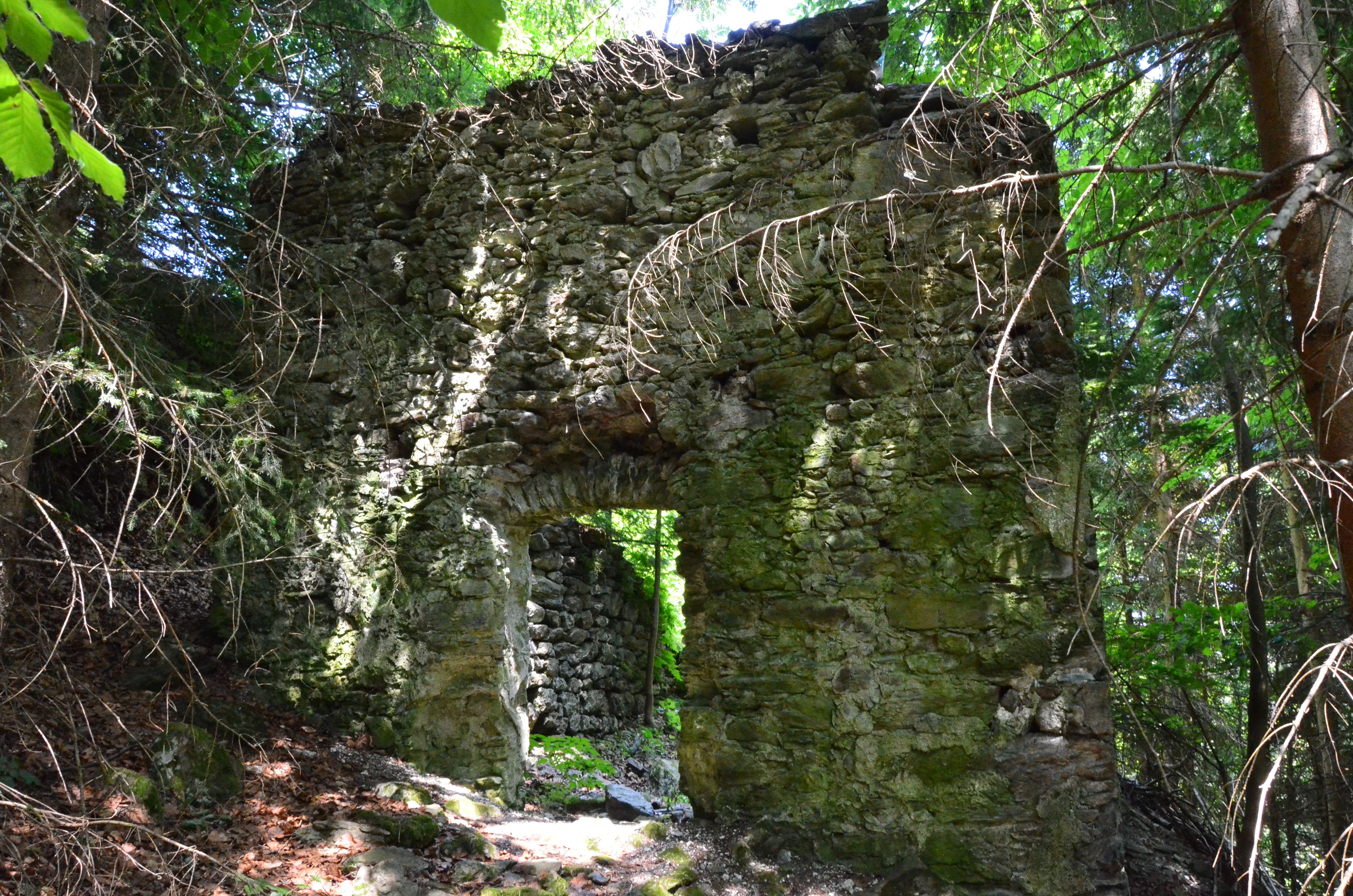
Albeck is a municipality in the district of Feldkirchen in the Austrian state of Carinthia. Geography The municipal area stretches along the valley of the Sirnitzbach creek, a tributary of the Gurk river, within the Gurktal Alps. In the northwest, Albeck borders on the state of Styria near Mt Eisenhut and Turracher Höhe Pass. In the west, the road leads from Sirnitz to Reichenau via Hochrindl Pass. The upper Gurk valley and its sources, two small cirque lakes (Gurksee and Torersee), are a protected area since 1981. Albeck comprises the cadastral communities of Albeck proper, Großreichenau, Sankt Leonhard, and Sirnitz. The main settlement is the village of Sirnitz. Neighbouring municipalities History Albeck is a settlement area since the 10th century, when the surrounding estates were held by the Counts of Friesach, ancestors of Saint Hemma of Gurk. In 1043 Hemma granted the Lordship of Albeck to the short-lived Benedictine nunnery of Gurk. When Archbishop Gebhard of Sa ... [...More Info...] [...Related Items...] OR: [Wikipedia] [Google] [Baidu] |
Steuerberg
Steuerberg () is a town in the district of Feldkirchen in the Austrian state of Carinthia Carinthia ( ; ; ) is the southernmost and least densely populated States of Austria, Austrian state, in the Eastern Alps, and is noted for its mountains and lakes. The Lake Wolayer is a mountain lake on the Carinthian side of the Carnic Main .... Geography Steuerberg lies in the Gurktal Alps between the Gurk valley and the Wimitz valley, about 10 km north of Feldkirchen. Neighboring municipalities References Cities and towns in Feldkirchen District {{Carinthia-geo-stub ... [...More Info...] [...Related Items...] OR: [Wikipedia] [Google] [Baidu] |
Gnesau
Gnesau is a town in the district of Feldkirchen in the Austrian state of Carinthia Carinthia ( ; ; ) is the southernmost and least densely populated States of Austria, Austrian state, in the Eastern Alps, and is noted for its mountains and lakes. The Lake Wolayer is a mountain lake on the Carinthian side of the Carnic Main .... Geography Gnesau lies in the upper Gurk valley in the Gurktal Alps. The Gurk runs from northwest to southeast through the municipality. Right tributaries are the Haidenbach and the Kirchergrabenbach; left tributaries are the Görzbach and the Peiningerbach. Neighboring municipalities References Cities and towns in Feldkirchen District {{Carinthia-geo-stub ... [...More Info...] [...Related Items...] OR: [Wikipedia] [Google] [Baidu] |
Weitensfeld Im Gurktal
Weitensfeld im Gurktal () is a market town in the district of Sankt Veit an der Glan in the Austrian state of Carinthia. First settlemenets were established when the Romans built a connecting road through the Gurk valley to Salzburg. Between 1050 and 1065 a settlement at the Zammelsberg (Zumoltiperg) arose due to immigration from Bavaria. In 1479, emperor Friedrich III granted castle Weitensfeld to exiled members of Branković dynasty of Serbia , image_flag = Flag of Serbia.svg , national_motto = , image_coat = Coat of arms of Serbia.svg , national_anthem = () , image_map = , map_caption = Location of Serbia (gree .... After the formation of the local municipality in 1850, the cadastral municipalities of Thurnhof and Zweinitz were annexed to Weitensfeld in 1871. From 1973 onwards, Weitensfeld became part of the large municipality of Weitensfeld-Flattnitz. After a referendum, the municipalities of Deut ... [...More Info...] [...Related Items...] OR: [Wikipedia] [Google] [Baidu] |
Deutsch-Griffen
Deutsch-Griffen () is a municipality in the district of Sankt Veit an der Glan District, Sankt Veit an der Glan in Austrian state of Carinthia (state), Carinthia. Geography Deutsch-Griffen lies in the north of Carinthia, about northwest of the state capital Klagenfurt. It is situated in the eastern Nock Mountains, in a left tributary valley of the Gurk (river), Gurk River on the Griffnerbach creek. The municipal area extends from the Gurk up to the Styrian border in the north. On the northern edge, there is a sparsely populated area along the Paalbach, which is cut off from the rest of the municipality and can only be reached in a very roundabout way. Therefore, it is locally considered to belong to the Flattnitz Pass, Flattnitz plateau, part of the neighbouring municipality of Glödnitz. In the west, Deutsch-Griffen borders on Albeck, Carinthia, Albeck in the Feldkirchen District. The municipal area comprises the only cadastral community Deutsch-Griffen made up of 25 villages and ... [...More Info...] [...Related Items...] OR: [Wikipedia] [Google] [Baidu] |
Predlitz-Turrach
Predlitz-Turrach is a former municipality in the district of Murau in Styria, Austria. Since the 2015 Styria municipal structural reform, it is part of the municipality Stadl-Predlitz. Geography The municipality lies in the upper valley of the Mur in the Gurktal Alps The Gurktal Alps (, ) is a mountain range in the Central Eastern Alps in Austria which is named after the valley of the Gurk river. The range stretches west to Lake Millstatt and east to Neumarkter Sattel (north-northwest of Neumarkt in Steie .... References Cities and towns in Murau District {{Styria-geo-stub ... [...More Info...] [...Related Items...] OR: [Wikipedia] [Google] [Baidu] |
Cadastral Community
A cadastral community (or cadastre community, cadastral r cadastremunicipality, cadastral r cadastrecommune,Problémy s překladem termínu „katastrální území“ do angličtiny. in: Geodetický a kartografický Obzor. Český úřad zeměměřický a katastrální, Úrad geodézie, kartografie a katastra Slovenskej republiky. 3, March 2015. p. 66, 67 cadastral r cadastreunit, cadastral r cadastredistrict, cadastral r cadastrearea, cadastral r cadastreterritory) is a cadastral subdivision of municipalities in the nations of Austria,Cadastral Template for Austria, web-pageCT-AT Bosnia and Herzegovina, Croatia, the Czech Republic, Serbia, Slovakia, Slovenia, the Netherlands, and the Italian provinces of South Tyrol, Trentino, Gorizia and Trieste. A cadastral community records property ownership in a cadastre, which is a register describing property ownership by boundary lines of the real estate. The common etymology in the Central European successor states of the ... [...More Info...] [...Related Items...] OR: [Wikipedia] [Google] [Baidu] |


