|
Aigualluts
The Forau d'Aigualluts is a karst formation and waterfall in the Province of Huesca, northeastern Spain. It lies along the Ésera River, at 2074 m above sea level on Aneto, Pico Aneto. Description The Forau de Aiguallut is a Rift, chasm through which the waters from the Aneto glacier disappear to resurface again in the Val d'Aran, in the Garonne river basin, which flows into the Atlantic Sea in the French city of Bordeaux. Before its disappearance, the waters coming from the Aneto glacier flow into the great meadow of the Plan d’Aigualluts, where it meanders in small meanders until it falls through the colorful Aiguallut waterfall which flows directly into the great chasm of Aiguallut. References Landforms of the Province of Huesca Waterfalls of Spain Landforms of Aragon {{huesca-geo-stub ... [...More Info...] [...Related Items...] OR: [Wikipedia] [Google] [Baidu] |
Garonne
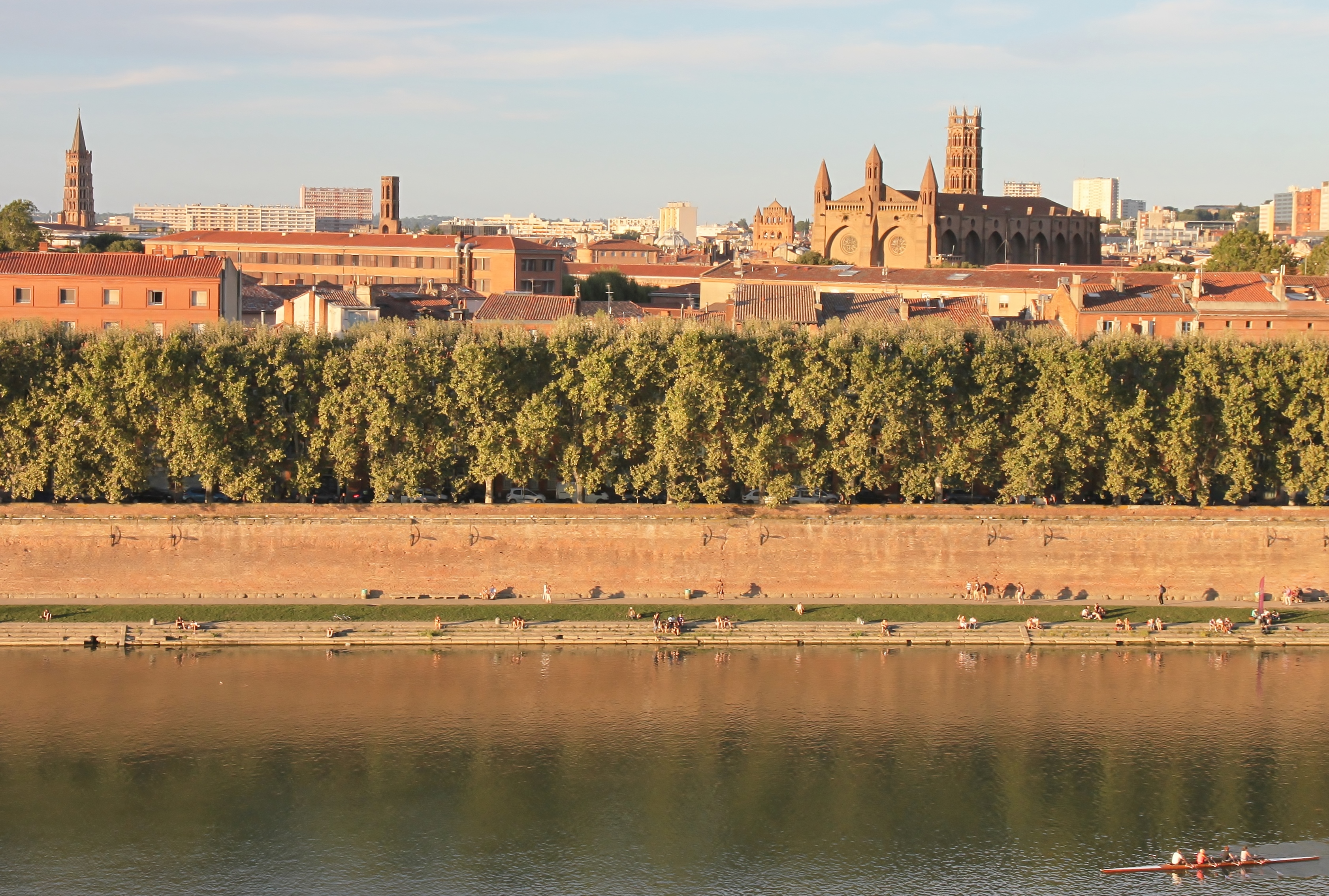
The Garonne ( , ; Catalan language, Catalan, Basque language, Basque and , ; or ) is a river that flows in southwest France and northern Spain. It flows from the central Spanish Pyrenees to the Gironde estuary at the French port of Bordeaux – a length of , of which is in Spain (Val d'Aran);Le bassin versant de la Garonne Syndicat Mixte d'Études & d'Aménagement de la Garonne the total length extends to if one includes the Gironde estuary between the river and the sea. Its basin area is , which increases to if the Dordogne (river), Dordogne River, which flows from the east and joins the Garonne at Bec d'Ambès to form the Gironde estuary, is included. Umayyad and Duchy of Aquitaine , Aquitanian forces fought the Battle of the River Garonne in 732 beside the river near present-day ... [...More Info...] [...Related Items...] OR: [Wikipedia] [Google] [Baidu] |
Val D'Aran
Aran (; ; ) (often known as the Aran Valley, or Val d'Aran in Aranese Occitan; in other forms of Occitan: ''Vath d'Aran'' or ''Vau d'Aran'', in Catalan: ''Vall d'Aran'', in Spanish: ''Valle de Arán'') is an autonomous administrative entity (formerly considered a comarca) in northwest Catalonia, Spain, consisting of in area, located in the Pyrenees mountains, in the Alt Pirineu i Aran region and in the province of Lleida. The capital is Vielha e Mijaran. This valley constitutes the only contiguous part of Catalonia located on the northern side of the Pyrenees. Hence, this valley holds the only Catalan rivers to flow into the Atlantic Ocean (for the same reason, the region is characterized by an Atlantic climate, instead of a Mediterranean one). The Garonne river flows through Aran from its source on the Pla de Beret (Beret Flat) near the Port de la Bonaigua. It is joined by the Joèu river (from the slopes of Aneto mountain) which passes underground at the '' Forau d'Aiguallu ... [...More Info...] [...Related Items...] OR: [Wikipedia] [Google] [Baidu] |
Aneto
Aneto is the highest mountain in the Pyrenees and in Aragon, Spain's third-highest mountain, reaching a height of . It is in the Spanish province of Huesca, the northernmost of three Aragonese provinces, south of the France–Spain border. It forms the southernmost part of the Maladeta massif. Aneto is located in the Posets-Maladeta Natural Park, in the municipality of Benasque, Huesca province, an autonomous community of Aragon, Spain. It is part of the Maladeta massif and is located in the Benasque valley. It consists of Paleozoic terrain of a granitic nature and Mesozoic materials. Its northern side holds the largest glacier in the Pyrenees, covering in 2005; it is shrinking rapidly due to warming summer temperatures and decreasing winter precipitations over the 20th century – it covered 106.7 ha in 1981, and over 200 ha in the 19th century. It is estimated that it has lost more than half of its surface in the last 100 years, and may disappear around 2050. ... [...More Info...] [...Related Items...] OR: [Wikipedia] [Google] [Baidu] |
Benasque - Aigualluts - Cascada 03
Benasque (; in Benasquese dialect: ''Benás''; ) () is a town in the comarca of Ribagorza, province of Huesca, (Spain). It is the main town in the Benasque Valley, located in the heart of the Pyrenees and surrounded by the highest peaks in that range. Climate The climate is of a high mountain type, with cool summers, and cold winters and frequent snow. Its average annual temperature is 9.4 degrees Celsius (at 1138 meters above sea level). Language The regional language of Benasque is a Catalan– Aragonese transitional dialect that shares features with Gascon (Occitan). It is usually called ''patués'' ("patois") by its native speakers. Possessing features that are transitional between Aragonese and Catalan, it has sometimes been classified as a variety of Catalan. To promote the local language, the local council has held an annual writing and poetry competition in ''patués'' since 1999. Separate awards are given to young and grown-up authors. Gallery File:Bena ... [...More Info...] [...Related Items...] OR: [Wikipedia] [Google] [Baidu] |
Karst
Karst () is a topography formed from the dissolution of soluble carbonate rocks such as limestone and Dolomite (rock), dolomite. It is characterized by features like poljes above and drainage systems with sinkholes and caves underground. There is some evidence that karst may occur in more weathering-resistant rocks such as quartzite given the right conditions. Subterranean drainage may limit surface water, with few to no rivers or lakes. In regions where the dissolved bedrock is covered (perhaps by debris) or confined by one or more superimposed non-soluble rock strata, distinctive karst features may occur only at subsurface levels and can be totally missing above ground. The study of ''paleokarst'' (buried karst in the stratigraphic column) is important in petroleum geology because as much as 50% of the world's Oil and gas reserves and resource quantification, hydrocarbon reserves are hosted in carbonate rock, and much of this is found in porous karst systems. Etymology ... [...More Info...] [...Related Items...] OR: [Wikipedia] [Google] [Baidu] |
Province Of Huesca
Huesca (; ), officially Huesca/Uesca, is a province of northeastern Spain, in northern Aragon. The capital is Huesca. Positioned just south of the central Pyrenees, Huesca borders France and the French departments of Haute-Garonne, Pyrénées-Atlantiques, and Hautes-Pyrénées. Within Spain, Huesca's neighboring provinces are Navarre, Zaragoza, and Lleida. Geography Covering a primarily mountainous area of km², the province of Huesca has a total population of 219,345 in 2018, with almost a quarter of its people living in the capital city of Huesca. The low population density, 14.62/km², has meant that Huesca's lush valleys, rivers, and lofty mountain ranges have remained relatively pristine and unspoiled by progress. Home to majestic scenery, the tallest mountain in the Pyrenees, the Aneto; eternal glaciers, such as at Monte Perdido; and the National Park of Ordesa and Monte Perdido, rich in flora and protected fauna. Popular with mountaineers, spelunkers, paraglide ... [...More Info...] [...Related Items...] OR: [Wikipedia] [Google] [Baidu] |
Ésera River
The Ésera () is a tributary of the Cinca in the High Aragon. It is part of the valley of the Ebro and its drainage basin. Its etymology is Celtic and it is cognate with several European rivers: Isar, Jizera, Isère, Isel, IJssel, and Eisack The Eisack (, ; ; or ) is a river in Northern Italy, the second largest river in South Tyrol. Its source is near the Brenner Pass, at an altitude of about 1990 m above sea level. The river draws water from an area of about 4,200 km2. After a .... References Ebro basin {{Spain-river-stub ... [...More Info...] [...Related Items...] OR: [Wikipedia] [Google] [Baidu] |
Rift
In geology, a rift is a linear zone where the lithosphere is being pulled apart and is an example of extensional tectonics. Typical rift features are a central linear downfaulted depression, called a graben, or more commonly a half-graben with normal faulting and rift-flank uplifts mainly on one side. Where rifts remain above sea level they form a rift valley, which may be filled by water forming a rift lake. The axis of the rift area may contain volcanic rocks, and active volcanism is a part of many, but not all, active rift systems. Major rifts occur along the central axis of most mid-ocean ridges, where new oceanic crust and lithosphere is created along a divergent boundary between two tectonic plates. ''Failed rifts'' are the result of continental rifting that failed to continue to the point of break-up. Typically the transition from rifting to spreading develops at a triple junction where three converging rifts meet over a hotspot. Two of these evolve to t ... [...More Info...] [...Related Items...] OR: [Wikipedia] [Google] [Baidu] |
Bordeaux
Bordeaux ( ; ; Gascon language, Gascon ; ) is a city on the river Garonne in the Gironde Departments of France, department, southwestern France. A port city, it is the capital of the Nouvelle-Aquitaine region, as well as the Prefectures in France, prefecture of the Gironde department. Its inhabitants are called "''Bordelais'' (masculine) or "''Bordelaises'' (feminine). The term "Bordelais" may also refer to the city and its surrounding region. The city of Bordeaux proper had a population of 259,809 in 2020 within its small municipal territory of , but together with its suburbs and exurbs the Bordeaux Functional area (France), metropolitan area had a population of 1,376,375 that same year (Jan. 2020 census), the sixth-most populated in France after Paris, Lyon, Marseille, Lille, and Toulouse. Bordeaux and 27 suburban municipalities form the Bordeaux Métropole, Bordeaux Metropolis, an Indirect election, indirectly elected Métropole, metropolitan authority now in charge of wi ... [...More Info...] [...Related Items...] OR: [Wikipedia] [Google] [Baidu] |
Aneto Glacier
The Aneto glacier ( Aragonese: Glaciar d'Aneto, Spanish : ''Glaciar del Aneto'') is a glacier located on the northwestern flank of Aneto in the Pyrenees. It is the greatest glacier in the Pyrenees and the Iberian Peninsula The Iberian Peninsula ( ), also known as Iberia, is a peninsula in south-western Europe. Mostly separated from the rest of the European landmass by the Pyrenees, it includes the territories of peninsular Spain and Continental Portugal, comprisin ... and the 8th southernmost glacier in Europe. The Aneto glacier has been affected severely by climate change, losing 30 meters of thickness since 1981, and in total losing 64% of its mass. In 2023, scientists conducting a study on the Aneto glacier found the glacier to be in a terminal state, and predicted that the Aneto glacier will be gone by the 2030s. See also * Southernmost glacial mass in Europe * List of glaciers in Europe References {{reflist Glaciers of Spain Glaciers of the Pyrenees ... [...More Info...] [...Related Items...] OR: [Wikipedia] [Google] [Baidu] |
Landforms Of The Province Of Huesca
A landform is a land feature on the solid surface of the Earth or other planetary body. They may be natural or may be anthropogenic (caused or influenced by human activity). Landforms together make up a given terrain, and their arrangement in the landscape is known as topography. Landforms include hills, mountains, canyons, and valleys, as well as shoreline features such as bays, peninsulas, and seas, including submerged features such as mid-ocean ridges, volcanoes, and the great oceanic basins. Physical characteristics Landforms are categorized by characteristic physical attributes such as elevation, slope, orientation, structure stratification, rock exposure, and soil type. Gross physical features or landforms include intuitive elements such as berms, cliffs, hills, mounds, peninsulas, ridges, rivers, valleys, volcanoes, and numerous other structural and size-scaled (e.g. ponds vs. lakes, hills vs. mountains) elements including various kinds of inland and oceanic waterbodi ... [...More Info...] [...Related Items...] OR: [Wikipedia] [Google] [Baidu] |
Waterfalls Of Spain
A waterfall is any point in a river or stream where water flows over a vertical drop or a series of steep drops. Waterfalls also occur where meltwater drops over the edge of a tabular iceberg or ice shelf. Waterfalls can be formed in several ways, but the most common method of formation is that a river courses over a top layer of resistant bedrock before falling onto softer rock, which erodes faster, leading to an increasingly high fall. Waterfalls have been studied for their impact on species living in and around them. Humans have had a distinct relationship with waterfalls since prehistory, travelling to see them, exploring and naming them. They can present formidable barriers to navigation along rivers. Waterfalls are religious sites in many cultures. Since the 18th century, they have received increased attention as tourist destinations, sources of hydropower, andparticularly since the mid-20th centuryas subjects of research. Definition and terminology A waterfall is g ... [...More Info...] [...Related Items...] OR: [Wikipedia] [Google] [Baidu] |


