|
Agios Athanasios, Thessaloniki
Agios Athanasios () is a town and a former municipality in the Thessaloniki regional unit, Macedonia, Greece. Since the 2011 local government reform it is part of the Chalkidona Municipality, of which it is a municipal unit. In 2021 the population was 13,026. The municipal unit of Agios Athanasios has an area of 155.34 km2, and the community of Agios Athanasios has an area of 35.527 km2. Geography Agios Athanasios is a small town in Central Macedonia. It is situated 20 km west of Thessaloniki, on the old national road from Thessaloniki to Athens. According to the general population census 2011, the population of Agios Athanasios is 4,932 and the total population of the former Municipality of Agios Athanasios is 14,683. Agios Athanasios is the biggest Greek refugee town in the Thessaloniki regional unit. It is built on the old national road that linked, in the past, Thessaloniki to the Western Macedonia and to the Southern Greece. History The modern town was founded by refuge ... [...More Info...] [...Related Items...] OR: [Wikipedia] [Google] [Baidu] |
Central Macedonia
Central Macedonia ( ; , ) is one of the thirteen Regions of Greece, administrative regions of Greece, consisting the central part of the Geographic regions of Greece, geographical and historical region of Macedonia (Greece), Macedonia. With a population of almost 1.8 million, it is the second most populous region in Greece after Attica (region), Attica. Geography The region of Central Macedonia is situated in Northern Greece, bordering the Administrative regions of Greece, regions of Western Macedonia (west), Thessaly (south), Eastern Macedonia and Thrace (east), and bounded to the north at the international borders of Greece by the Republic of North Macedonia and Bulgaria. The southern part is coastal and is bathed by the Thermaic Gulf, Thermaic, Toronean Gulf, Toroneos, Singitic Gulf, Singitic and Strymonian Gulf, Strymonic gulfs. The largest city and capital of the region is Thessaloniki. Serres is the second most populous city, followed by Katerini, Veria and Giannitsa. Cen ... [...More Info...] [...Related Items...] OR: [Wikipedia] [Google] [Baidu] |
East Thrace
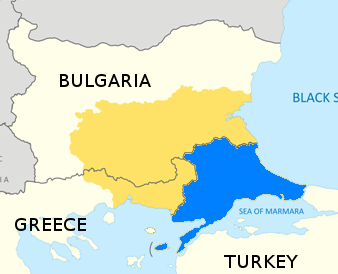
East Thrace or Eastern Thrace, also known as Turkish Thrace or European Turkey, is the part of Turkey that is geographically in Southeast Europe. Turkish Thrace accounts for 3.03% of Turkey's land area and 15% of its population. The largest city is Istanbul, which straddles the Bosporus between Europe and Asia. East Thrace is of historic importance as it is next to a major sea trade corridor and constitutes what remains of the once-vast Ottoman region of Rumelia. It is currently also of specific geostrategic importance because the sea corridor, which includes two narrow straits, provides access to the Mediterranean Sea from the Black Sea for the navies of five countries: Russia, Ukraine, Romania, Bulgaria, and Georgia (country), Georgia. The region also serves as a future connector of existing Turkish, Bulgarian, and Greek high-speed rail networks. Due to the guest worker agreement with Turkey and Germany, some Turks in Germany originally come from Eastern Thrace, mostly fr ... [...More Info...] [...Related Items...] OR: [Wikipedia] [Google] [Baidu] |
Populated Places In Thessaloniki (regional Unit)
Population is a set of humans or other organisms in a given region or area. Governments conduct a census to quantify the resident population size within a given jurisdiction. The term is also applied to non-human animals, microorganisms, and plants, and has specific uses within such fields as ecology and genetics. Etymology The word ''population'' is derived from the Late Latin ''populatio'' (a people, a multitude), which itself is derived from the Latin word ''populus'' (a people). Use of the term Social sciences In sociology and population geography, population refers to a group of human beings with some predefined feature in common, such as location, Race (human categorization), race, ethnicity, nationality, or religion. Ecology In ecology, a population is a group of organisms of the same species which inhabit the same geographical area and are capable of Sexual reproduction, interbreeding. The area of a sexual population is the area where interbreeding is possi ... [...More Info...] [...Related Items...] OR: [Wikipedia] [Google] [Baidu] |
Sarissa
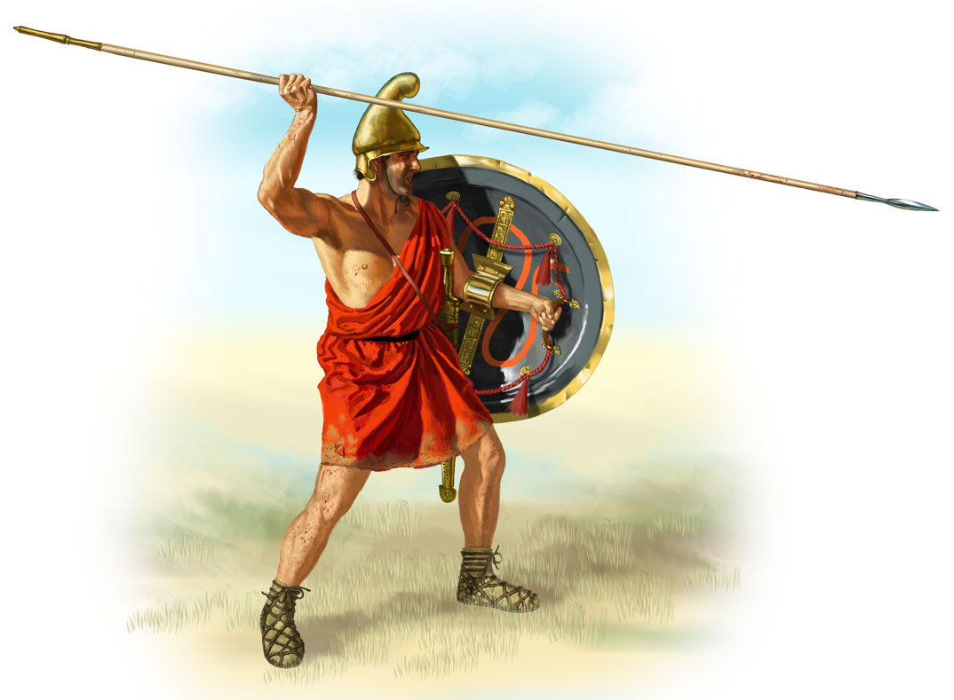
The sarissa or sarisa was a long spear or pike about in length. It was introduced by Philip II of Macedon and was used in his Macedonian phalanxes as a replacement for the earlier dory, which was considerably shorter. These longer spears improved the strength of the phalanx by extending the rows of overlapping weapons projecting towards the enemy. After the conquests of Alexander the Great, the sarissa was a mainstay during the Hellenistic era (4th–1st centuries BCE) by the Hellenistic armies of the diadochi Greek successor states of Alexander's empire, as well as some of their rivals. Composition and utility The sarissa is made of two core parts: a long wooden shaft and a metal tip. A third part that may have existed for some sarissas was a metal spear-butt at the reverse end. The metal butt of the sarissa could be used to safely stow it in the ground without damaging the shaft when not in use. Two types of wood are favored as likely candidates for the shaft: ... [...More Info...] [...Related Items...] OR: [Wikipedia] [Google] [Baidu] |
Ancient Macedonian Army
The Kingdom of Macedon possessed one of the greatest armies in the ancient world. It is reputed for the speed and efficiency with which it emerged from Greece to conquer large swathes of territory stretching from Egypt in the west to India in the east. Initially of little account in the Greek world, it was widely regarded as a second-rate power before being made formidable by Philip II, whose son and successor Alexander the Great conquered the Achaemenid Empire in just over a decade's time. The latest innovations in weapons and tactics were adopted and refined by Philip, and he created a uniquely flexible and effective army. By introducing military service as a full-time occupation, Philip was able to drill his men regularly, ensuring unity and cohesion in his ranks. In a remarkably short time, this led to the development of one of what was among the world's finest military machines for the era. Tactical improvements included the latest developments in the deployment of the tra ... [...More Info...] [...Related Items...] OR: [Wikipedia] [Google] [Baidu] |
Ancient Macedonia
Macedonia ( ; , ), also called Macedon ( ), was an ancient kingdom on the periphery of Archaic and Classical Greece, which later became the dominant state of Hellenistic Greece. The kingdom was founded and initially ruled by the royal Argead dynasty, which was followed by the Antipatrid and Antigonid dynasties. Home to the ancient Macedonians, the earliest kingdom was centered on the northeastern part of the Greek peninsula,. and bordered by Epirus to the southwest, Illyria to the northwest, Paeonia to the north, Thrace to the east and Thessaly to the south. Before the 4th century BC, Macedonia was a small kingdom outside of the area dominated by the great city-states of Athens, Sparta and Thebes, and briefly subordinate to Achaemenid Persia. During the reign of the Argead king PhilipII (359–336 BC), Macedonia subdued mainland Greece and the Thracian Odrysian kingdom through conquest and diplomacy. With a reformed army containing phalanxes wielding the '' ... [...More Info...] [...Related Items...] OR: [Wikipedia] [Google] [Baidu] |
Smyrna
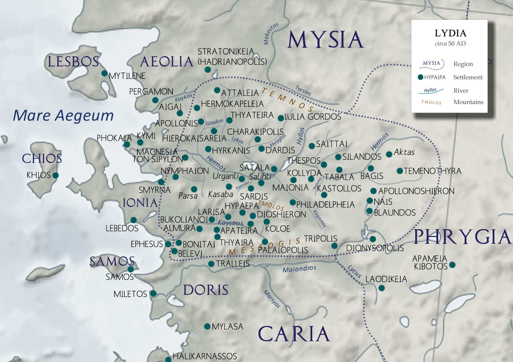
Smyrna ( ; , or ) was an Ancient Greece, Ancient Greek city located at a strategic point on the Aegean Sea, Aegean coast of Anatolia, Turkey. Due to its advantageous port conditions, its ease of defence, and its good inland connections, Smyrna rose to prominence. Since about 1930, the city's name has been İzmir. Two sites of the ancient city are today within İzmir's boundaries. The first, probably founded by indigenous peoples, rose to prominence during the Archaic period in Greece, Archaic Period as one of the principal ancient Greek settlements in western Anatolia. The second, whose foundation is associated with Alexander the Great, reached metropolitan proportions during the period of the Roman Empire. Most of the ancient city's present-day remains date to the Roman era, the majority from after a 2nd-century AD earthquake. In practical terms, a distinction is often made between these. ''Old Smyrna'' was the initial settlement founded around the 11th century BC, first as an ... [...More Info...] [...Related Items...] OR: [Wikipedia] [Google] [Baidu] |
Anatolia
Anatolia (), also known as Asia Minor, is a peninsula in West Asia that makes up the majority of the land area of Turkey. It is the westernmost protrusion of Asia and is geographically bounded by the Mediterranean Sea to the south, the Aegean Sea to the west, the Turkish Straits to the northwest, and the Black Sea to the north. The eastern and southeastern limits have been expanded either to the entirety of Asiatic Turkey or to an imprecise line from the Black Sea to the Gulf of Alexandretta. Topographically, the Sea of Marmara connects the Black Sea with the Aegean Sea through the Bosporus and the Dardanelles, and separates Anatolia from Thrace in Southeast Europe. During the Neolithic, Anatolia was an early centre for the development of farming after it originated in the adjacent Fertile Crescent. Beginning around 9,000 years ago, there was a major migration of Anatolian Neolithic Farmers into Neolithic Europe, Europe, with their descendants coming to dominate the continent a ... [...More Info...] [...Related Items...] OR: [Wikipedia] [Google] [Baidu] |
Southern Greece
Southern Greece () is a loosely defined geographical term, usually encompassing the Peloponnese peninsula and varying parts of Continental Greece (Attica is usually included), as well as the islands of the Cyclades, the Dodecanese, and Crete. It has never corresponded to a specific administrative or other entity, but is usually defined in juxtaposition with Northern Greece. See also * Northern Greece Northern Greece () is used to refer to the northern parts of Greece, and can have various definitions. Administrative term The term "Northern Greece" is widely used to refer mainly to the two northern regions of Macedonia and (Western) Thra ... * Central Greece References Administrative regions of Greece Geography of Greece {{Greece-geo-stub ... [...More Info...] [...Related Items...] OR: [Wikipedia] [Google] [Baidu] |
Thessaloniki (regional Unit)
Thessaloniki ( ''Mitropolitiki enotita Thessaloníkis'', ''Metropolitan unit of Thessaloniki'') is one of the regional units of Greece. It is part of the Modern regions of Greece, Region of Central Macedonia and its capital is the city of Thessaloniki. Geography The regional unit stretches from the Thermaic Gulf in the southwest to the Strymonian Gulf, Strymonic Gulf in the east. Two bodies of water are located in the north, Lake Koroneia in the heart of the regional unit and Lake Volvi in the east. There are farmlands throughout the west and southwest, with fewer in the northeast, north and along the Axios River valley. Mountainous areas include the Chortiatis in the west-central part, the Vertiskos in the north and parts of the Kerdylio mountains in the northeast. The regional unit borders on the Imathia regional unit to the southwest, Pella (regional unit), Pella to the west, Kilkis (regional unit), Kilkis to the north, Serres (regional unit), Serres to the east and Chalkidiki ... [...More Info...] [...Related Items...] OR: [Wikipedia] [Google] [Baidu] |
Western Macedonia
Western Macedonia (, ) is one of the thirteen Regions of Greece, administrative regions of Greece, consisting of the western part of Macedonia (Greece), Macedonia. Located in north-western Greece, it is divided into the regional units of Greece, regional units of Florina (regional unit), Florina, Grevena (regional unit), Grevena, Kastoria (regional unit), Kastoria, and Kozani (regional unit), Kozani. With a population of approximately 255,000 people, as of 2021, the region had one of the highest unemployment rates in the European Union. Geography The region of Western Macedonia is situated in north-western Greece, bordering with the regions of Central Macedonia (east), Thessaly (south), Epirus (region), Epirus (west), and bounded to the north at the international borders of Greece with the Republic of North Macedonia (Bitola Municipality, Bitola, Resen Municipality, Resen and Novaci Municipality, Novaci municipalities) and Albania (Korçë County). Although it covers a total su ... [...More Info...] [...Related Items...] OR: [Wikipedia] [Google] [Baidu] |


