|
Africa Inland Mission
Established in 1895, Africa Inland Mission (AIM) is a Christian mission sending agency focused on Africa. Their stated mission is to see "Christ-centered churches established among all African peoples." AIM established the Kapsowar Hospital in 1933. It developed into the Africa Inland Church (AIC), based in Kenya. History of AIM Africa Inland Mission had its beginning in the work of Peter Cameron Scott (1867–1896), a Scottish-American missionary who served two years in the Congo before being forced to seek medical care in Britain in 1892 because of a near-fatal illness. While recuperating, he developed his idea of establishing a network of mission stations which would stretch from the southeast coast of Africa to the interior's Lake Chad. He was unable to interest any churches in the idea (including his own), but managed to captivate several friends in Philadelphia. In 1895 they formed the Philadelphia Missionary Council. Beginnings More important than specialized train ... [...More Info...] [...Related Items...] OR: [Wikipedia] [Google] [Baidu] [Amazon] |
Peter Cameron Scott
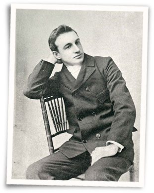
Peter Cameron Scott (1867–1896) was a Scottish-American missionary and founder of Africa Inland Mission. Biography Scott was born to a Christian family in Glasgow, which later migrated to the United States and settled in Philadelphia. However, at the age of twenty, due to poor health his doctor advised him to change climates and returned to Scotland to recover. It was in Glasgow that he visited the grave of his sister, considered his own death, and dedicated his life to Christian work. He served two years in the French Congo before returning to Britain in 1892 because of a near-fatal illness. While recuperating, he developed his idea of establishing a network of mission stations that would stretch from the southeast coast of Africa to Lake Chad. While he was unable to interest any churches in the idea (including his own), he captivated several friends in Philadelphia. In 1895 they formed the Philadelphia Missionary Council. On August 17, 1895, AIM's first mission party s ... [...More Info...] [...Related Items...] OR: [Wikipedia] [Google] [Baidu] [Amazon] |
Manyatta
The Eastern Province () of Kenya was one of 8 Provinces of Kenya. Its northern boundary ran along with that of Ethiopia; the North Eastern Province and Coast Province lay to the east and south; and the remainder of Kenya's provinces, including Central Province, ran along its western border. The provincial capital was Embu. Overview On 16 July 2009, the province was sub-divided into three: Lower Eastern with Machakos as headquarters, Central Eastern with Embu as headquarters, and Upper Eastern with Marsabit as headquarters; however, those changes never took effect due to the political wrangles in the Kenyan coalition government at the time. The sub-division of provinces was carried out in seven provinces of Kenya, excluding Nairobi. As of March 2013 after the Kenyan general election, 2013, the Eastern Province was subdivided into eight counties, namely: The province was principally inhabited by the Meru, Kamba, Embu, and several pastoralist communities. In 1979, its po ... [...More Info...] [...Related Items...] OR: [Wikipedia] [Google] [Baidu] [Amazon] |
Tanzania
Tanzania, officially the United Republic of Tanzania, is a country in East Africa within the African Great Lakes region. It is bordered by Uganda to the northwest; Kenya to the northeast; the Indian Ocean to the east; Mozambique and Malawi to the south; Zambia to the southwest; and Rwanda, Burundi, and the Democratic Republic of the Congo to the west. According to a 2024 estimate, Tanzania has a population of around 67.5 million, making it the most populous country located entirely south of the equator. Many important hominid fossils have been found in Tanzania. In the Stone and Bronze Age, prehistoric migrations into Tanzania included South Cushitic languages, Southern Cushitic speakers similar to modern day Iraqw people who moved south from present-day Ethiopia; Eastern Cushitic people who moved into Tanzania from north of Lake Turkana about 2,000 and 4,000 years ago; and the Southern Nilotic languages, Southern Nilotes, including the Datooga people, Datoog, who originated fro ... [...More Info...] [...Related Items...] OR: [Wikipedia] [Google] [Baidu] [Amazon] |
German East Africa
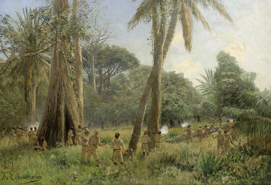
German East Africa (GEA; ) was a German colonial empire, German colony in the African Great Lakes region, which included present-day Burundi, Rwanda, the Tanzania mainland, and the Kionga Triangle, a small region later incorporated into Portuguese Mozambique, Mozambique. GEA's area was , which was nearly three times the area of present-day Germany and almost double the area of metropolitan Germany at the time. The colony was organised when the German military was asked in the late 1880s to put down a revolt against the activities of the German East Africa Company. It ended with German Empire, Imperial Germany's defeat in World War I. Ultimately the territory was divided amongst Britain, Belgium and Portugal, and was reorganised as a League of Nations mandate, mandate of the League of Nations. History Like other colonial powers, the Germans expanded their empire in the Africa Great Lakes region, ostensibly to explore the region's rich resources and its people. Unlike other imp ... [...More Info...] [...Related Items...] OR: [Wikipedia] [Google] [Baidu] [Amazon] |
Kikuyu People
The Kikuyu (also ''Agĩkũyũ/Gĩkũyũ'') are a Bantu peoples, Bantu ethnic group native to Central Province (Kenya), Central Kenya. At a population of 8,148,668 as of 2019, they account for 17.13% of the total population of Kenya, making them Kenya's largest ethnic group. The term ''Kikuyu'' is the Swahili language, Swahili borrowing of the Endonym and exonym, autonym () History Origin The Kikuyu belong to the Northeast Bantu languages, Northeastern Bantu branch. Their language is most closely related to that of the Embu people, Embu and Mbeere people, Mbeere. Geographically, they are concentrated in the vicinity of Mount Kenya. The exact place that the Northeast Bantu speakers migrated from after the initial Bantu expansion is uncertain. Some authorities suggest that the Kikuyu arrived in their present Mount Kenya area of habitation from earlier settlements further to the north and east,Joseph Bindloss, Tom Parkinson, Matt Fletcher, ''Lonely Planet Kenya'', (Lonely ... [...More Info...] [...Related Items...] OR: [Wikipedia] [Google] [Baidu] [Amazon] |
Kapsowar
Kapsowar is a town in Elgeyo-Marakwet County, Kenya. Prior to March 2013, it was located in the former Rift Valley Province, Kenya, Rift Valley Province. In 1994, Kapsowar became the headquarters of the former Marakwet district. Furthermore, Kapsowar is the proposed headquarters for the Elgeyo Marakwet County. Prior to this, the Marakwet people, Marakwet and Elgeyo people, Keiyo people were collectively grouped into the Elgeiyo-Markwet District. In 2010, the two districts were again merged into Elgeyo-Marakwet County. The Marakwet number approximately 200,000 and are a part of the Kalenjin people, Kalenjin family of tribes, which collectively are the second-largest ethnic group in Kenya. The fast growing town is located between the Kerio Valley and the Cherangani Hills. The land surrounding Kapsowar town is fertile and the elevation creates a mild climate with a temperature range of 70-85 °F (21–29 °C). Kapsowar town has a population of 66,684 (2019/census, total popula ... [...More Info...] [...Related Items...] OR: [Wikipedia] [Google] [Baidu] [Amazon] |
Kinyona
The Central Province (, ) was a region in central Kenya until 2013, when Kenya's provinces were replaced by a system of counties. It covered an area of and was located to the north of Nairobi and west of Mount Kenya (''see maps''). The province had 4,383,743 inhabitants according to the 2009 census. The provincial headquarters was Nyeri. Central Province was the ancestral home of the Gikuyu people. Climate The climate of Central Province is generally cooler than that of the rest of Kenya, due to the region's higher altitude. Rainfall is fairly reliable, falling in two seasons, one from early March to May (the long rains) and a second during October and November (the short rains). General information Central Province is a key producer of coffee, one of Kenya's key exports. Much of Kenya's dairy industry is also based in this province. The provincial headquarters were in Nyeri. Central Province was divided into seven districts ( ''wilaya'at'') until 2007: [...More Info...] [...Related Items...] OR: [Wikipedia] [Google] [Baidu] [Amazon] |
Roosevelt
Roosevelt most often refers to two American presidents: * Theodore Roosevelt (1858–1919, president 1901–1909), 26th president of the United States * Franklin D. Roosevelt (1882–1945, president 1933–death), 32nd president of the United States It may also refer to: Education United States * Eleanor Roosevelt College, University of California, San Diego * Roosevelt University, Illinois, a private university with campuses in Chicago and Schaumburg * Roosevelt High School (other) * President Theodore Roosevelt High School, Honolulu, Hawaii * Roosevelt Junior High School (other) * Roosevelt Middle School (other) * Roosevelt Elementary School (other) * Roosevelt Intermediate School, Westfield, New Jersey * Roosevelt School (other), various school buildings on the National Register of Historic Places * Roosevelt School District (other) Elsewhere * Roosevelt Institute for American Studies, a research institute and graduate s ... [...More Info...] [...Related Items...] OR: [Wikipedia] [Google] [Baidu] [Amazon] |
Kijabe
Kijabe is a town in Kenya. Etymology The name Kijabe likely derives from the Maasai 'Donyo Kejabe' meaning 'Gold mountain'. Description It stands on the edge of the Great Rift Valley at an altitude of 2200m, some 50 kilometres north-west of Nairobi. Kijabe is located in the sub-county of Lari, Kiambu County. Kijabe had a population of 2,026 people in 2019. Kijabe has a railway station along the Uganda Railway. The town is located between Limuru and Naivasha. There are actually two places called Kijabe. Kijabe Town is located approximately 2 km north-west of Kijabe Mission Station. Kijabe Town is the closest settlement to the Railway Station of the same name and is a community of small land holders. Kijabe mission station is the home of Kijabe Hospital, AIC-CURE International Children's Hospital of Kenya, Moffatt Bible College, Kijabe Youth Charity initiative, a group that helps the less privileged in the society, and Rift Valley Academy, a school for children of miss ... [...More Info...] [...Related Items...] OR: [Wikipedia] [Google] [Baidu] [Amazon] |
Blackwater Fever
Blackwater fever is a complication of malaria infection in which red blood cells burst in the bloodstream (hemolysis), releasing hemoglobin directly into the blood vessels and into the urine, frequently leading to kidney failure. The disease was first linked to malaria by the Sierra Leone Creole physician John Farrell Easmon in his 1884 pamphlet entitled ''The Nature and Treatment of Blackwater Fever.'' Easmon coined the name "blackwater fever" and was the first to successfully treat such cases following the publication of his pamphlet. Signs and symptoms Within a few days of onset there are chills, with rigor, high fever, jaundice, vomiting, rapidly progressive anemia, and dark red or black urine. Causes The cause of hemolytic crises in this disease is unknown (mainly due to intravascular haemolysis). There is rapid and massive destruction of red blood cells resulting in hemoglobinemia (hemoglobin in the blood, but outside the red blood cells), hemoglobinuria (hemoglobin ... [...More Info...] [...Related Items...] OR: [Wikipedia] [Google] [Baidu] [Amazon] |
Africa Map Small
Africa is the world's second-largest and second-most populous continent after Asia. At about 30.3 million km2 (11.7 million square miles) including adjacent islands, it covers 20% of Earth's land area and 6% of its total surface area.Sayre, April Pulley (1999), ''Africa'', Twenty-First Century Books. . With nearly billion people as of , it accounts for about of the world's human population. Demographics of Africa, Africa's population is the youngest among all the continents; the median age in 2012 was 19.7, when the worldwide median age was 30.4. Based on 2024 projections, Africa's population will exceed 3.8 billion people by 2100. Africa is the least wealthy inhabited continent per capita and second-least wealthy by total wealth, ahead of Oceania. Scholars have attributed this to different factors including Geography of Africa, geography, Climate of Africa, climate, corruption, Scramble for Africa, colonialism, the Cold War, and neocolonialism. Despite this lo ... [...More Info...] [...Related Items...] OR: [Wikipedia] [Google] [Baidu] [Amazon] |


