|
ALOS
Advanced Land Observing Satellite (ALOS), also called Daichi (a Japanese word meaning "land"), was a 3810 kg Japanese satellite launched in 2006. After five years of service, the satellite lost power and ceased communication with Earth, but remains in orbit. Launch ALOS was launched from Tanegashima, Japan, on 24 January 2006 by H-IIA No. 8. The launch had been delayed three times by weather and sensor problems. Mission The satellite contained three sensors that were used for cartography and disaster monitoring of Asia and the Pacific Ocean. The Japan Aerospace Exploration Agency (JAXA) initially hoped to be able to launch the successor to ALOS during 2011, but this plan did not materialize. In 2008, it was announced that the images generated by ALOS were too blurry to be of any use for map making. Only 52 of 4,300 images of Japan could be updated based on data from ALOS. Then, JAXA announced the problem was solved. ALOS was used to analyze several disaster sites. I ... [...More Info...] [...Related Items...] OR: [Wikipedia] [Google] [Baidu] |
ALOS-2
Advanced Land Observing Satellite-2 (ALOS-2), also called Daichi-2, is a Japanese satellite launched in 2014. Although the predecessor ALOS satellite had featured 2 optical cameras in addition to L-band (1.2 GHz/25 cm) radar, ALOS-2 had optical cameras removed to simplify construction and reduce costs. The PALSAR-2 radar is a significant upgrade of the PALSAR radar, allowing higher-resolution (1 x 3 m per pixel) spotlight modes in addition to the 10 m resolution survey mode inherited from the ALOS spacecraft. Also, the SPAISE2 automatic ship identification system and the Compact Infra Red Camera (CIRC) will provide supplementary data about sea-going ships and provide early warnings of missile launches. Launch ALOS-2 was launched from Tanegashima is one of the Ōsumi Islands belonging to Kagoshima Prefecture, Japan. The island, in area, is the second largest of the Ōsumi Islands, and has a population of 33,000 people. Access to the island is by ferry, or by air t ... [...More Info...] [...Related Items...] OR: [Wikipedia] [Google] [Baidu] |
JAXA
The is the Japanese national air and space agency. Through the merger of three previously independent organizations, JAXA was formed on 1 October 2003. JAXA is responsible for research, technology development and launch of satellites into orbit, and is involved in many more advanced missions such as asteroid exploration and possible human exploration of the Moon. Its motto is ''One JAXA'' and its corporate slogan is ''Explore to Realize'' (formerly ''Reaching for the skies, exploring space''). History On 1 October 2003, three organizations were merged to form the new JAXA: Japan's Institute of Space and Astronautical Science (ISAS), the National Aerospace Laboratory of Japan (NAL), and National Space Development Agency of Japan (NASDA). JAXA was formed as an Independent Administrative Institution administered by the Ministry of Education, Culture, Sports, Science and Technology (MEXT) and the Ministry of Internal Affairs and Communications (MIC). Before the mer ... [...More Info...] [...Related Items...] OR: [Wikipedia] [Google] [Baidu] |
Japan Aerospace Exploration Agency
The is the Japanese national Aeronautics, air and space agency. Through the merger of three previously independent organizations, JAXA was formed on 1 October 2003. JAXA is responsible for research, technology development and launch of satellites into Geocentric orbit, orbit, and is involved in many more advanced missions such as asteroid exploration and possible human exploration of the Moon. Its motto is ''One JAXA'' and its corporate slogan is ''Explore to Realize'' (formerly ''Reaching for the skies, exploring space''). History On 1 October 2003, three organizations were merged to form the new JAXA: Japan's Institute of Space and Astronautical Science (ISAS), the National Aerospace Laboratory of Japan (NAL), and National Space Development Agency of Japan (NASDA). JAXA was formed as an Independent Administrative Institution administered by the Ministry of Education, Culture, Sports, Science and Technology (MEXT) and the Ministry of Internal Affairs and Communications ... [...More Info...] [...Related Items...] OR: [Wikipedia] [Google] [Baidu] |
H-IIA
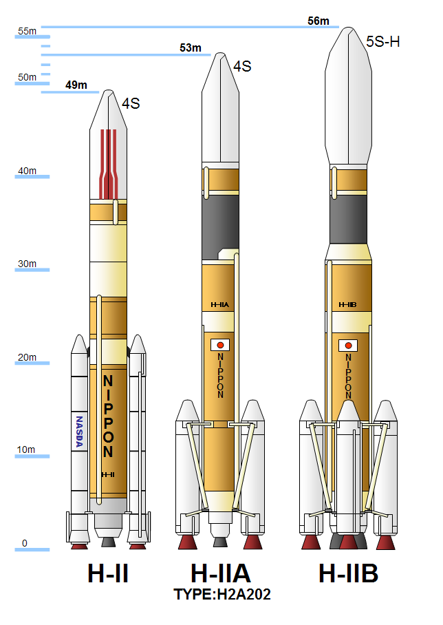
H-IIA (H-2A) is an active expendable launch system operated by Mitsubishi Heavy Industries (MHI) for the Japan Aerospace Exploration Agency. These liquid fuel rockets have been used to launch satellites into geostationary orbit; lunar orbiting spacecraft; '' Akatsuki'', which studied the planet Venus; and the Emirates Mars Mission, which was launched to Mars in July 2020. Launches occur at the Tanegashima Space Center. The H-IIA first flew in 2001. , H-IIA rockets were launched 49 times, including 43 consecutive missions without a failure, dating back to 29 November 2003. Production and management of the H-IIA shifted from JAXA to MHI on 1 April 2007. Flight 13, which launched the lunar orbiter SELENE, was the first H-IIA launched after this privatization. The H-IIA is a derivative of the earlier H-II rocket, substantially redesigned to improve reliability and minimize costs. There have been four variants, with two in active service (as of 2020) for various purposes. A d ... [...More Info...] [...Related Items...] OR: [Wikipedia] [Google] [Baidu] |
2006 In Spaceflight
This article outlines notable events occurring in 2006 in spaceflight, including major launches and EVAs. 2006 saw Brazil, Iran, and Sweden all get a national into space for the first time. Launches , colspan=8, January , - , colspan=8, February , - , colspan=8, March , - , colspan=8, April , - , colspan=8, May , - , colspan=8, June , - , colspan=8, July , - , colspan=8, August , - , colspan=8, September , - , colspan=8, October , - , colspan=8, November , - , colspan=8, December , - Suborbital launches , colspan=8, January , - , colspan=8, February , - , colspan=8, March , - , colspan=8, April , - , colspan=8, May , - , colspan=8, June , - , colspan=8, July , - , colspan=8, August , - , colspan=8, September , - , colspan=8, October , - , colspan=8, November , - , colspan=8, Dec ... [...More Info...] [...Related Items...] OR: [Wikipedia] [Google] [Baidu] |
Japan Coast Guard
The is the coast guard responsible for the protection of the Geography of Japan#Composition, topography and geography, coastline of Japan under the oversight of the Ministry of Land, Infrastructure, Transport and Tourism. It consists of about 13,700 personnel. The Japan Coast Guard was founded in 1948 as the Maritime Safety Agency and received its current English name in 2000. The motto of the Japan Coast Guard is . History Coast guard operations were performed by the Imperial Japanese Navy during the Empire of Japan, but the ability of maintaining maritime security declined significantly following the surrender of Japan in August 1945 and the resulting dissolution of the Imperial Japanese Navy. Maritime trade and smuggling had increased dramatically, and even pirates had begun to appear. Consultations were undertaken between the Japanese government, which wanted to restore its public security capacity as soon as possible, and the Allies of World War II, Allied countries w ... [...More Info...] [...Related Items...] OR: [Wikipedia] [Google] [Baidu] |
Earth Observation Satellite
An Earth observation satellite or Earth remote sensing satellite is a satellite used or designed for Earth observation (EO) from orbit, including spy satellites and similar ones intended for non-military uses such as environmental monitoring, meteorology, cartography and others. The most common type are Earth imaging satellites, that take satellite images, analogous to aerial photographs; some EO satellites may perform remote sensing without forming pictures, such as in GNSS radio occultation. The first occurrence of satellite remote sensing can be dated to the launch of the first artificial satellite, Sputnik 1, by the Soviet Union on October 4, 1957. Sputnik 1 sent back radio signals, which scientists used to study the ionosphere. The United States Army Ballistic Missile Agency launched the first American satellite, Explorer 1, for NASA's Jet Propulsion Laboratory on January 31, 1958. The information sent back from its radiation detector led to the discovery of the Earth's Van ... [...More Info...] [...Related Items...] OR: [Wikipedia] [Google] [Baidu] |
Meteoroid
A meteoroid ( ) is a small rocky or metallic body in outer space. Meteoroids are distinguished as objects significantly smaller than ''asteroids'', ranging in size from grains to objects up to wide. Objects smaller than meteoroids are classified as ''micrometeoroids'' or ''space dust''. Many are fragments from comets or asteroids, whereas others are impact event, collision impact space debris, debris ejected from bodies such as the Moon or Mars. The visible passage of a meteoroid, comet, or asteroid atmospheric entry, entering Earth's atmosphere is called a meteor, and a series of many meteors appearing seconds or minutes apart and appearing to originate from the same fixed point in the sky is called a meteor shower. An estimated 25 million meteoroids, micrometeoroids and other space debris enter Earth's atmosphere each day, which results in an estimated 15,000 tonnes of that material entering the atmosphere each year. A ''meteorite'' is the remains of a meteoroid that has surv ... [...More Info...] [...Related Items...] OR: [Wikipedia] [Google] [Baidu] |
JERS-1
Japanese Earth Resources Satellite 1 (JERS-1) was a satellite launched in 1992 by the National Space Development Agency of Japan (NASDA, now part of JAXA). It carried three instruments: *An L-band (HH polarization) synthetic aperture radar (SAR); *A nadir The nadir is the direction pointing directly ''below'' a particular location; that is, it is one of two vertical directions at a specified location, orthogonal to a horizontal flat surface. The direction opposite of the nadir is the zenith. Et ...-pointing optical camera (OPS); *A side-looking optical camera (AVNIR). The satellite had a designated lifespan of only two years, however the mission was extended and it operated until 1998. Jers-1 re-entered the Earth's atmosphere in 2001. The satellite was used to map the largest of Earth's forests and observe coastal regions. References ESA third party missions overview Earth observation satellites of Japan Spacecraft launched in 1992 Spacecraft which reentered in 2001 ... [...More Info...] [...Related Items...] OR: [Wikipedia] [Google] [Baidu] |
ADEOS I
ADEOS I (Advanced Earth Observing Satellite 1) was an Earth observation satellite launched by NASDA in 1996. The mission's Japanese name, Midori means "green". The mission ended in July 1997 after the satellite sustained structural damage to the solar panel. Its successor, ADEOS II, was launched in 2002. Like the first mission, it ended after less than a year, also following solar panel malfunctions. Mission ADEOS was designed to observe Earth's environmental changes, focusing on global warming, depletion of the ozone layer, and deforestation. Instruments On board the satellite are eight instruments developed by NASDA, NASA, and CNES. The Ocean Color and Temperature Scanner (OCTS) is a whisk broom radiometer developed by NASDA. The Advanced Visible and Near Infrared Radiometer (AVNIR), an optoelectronic scanning radiometer with CCD detectors, was also produced by NASDA. The NASA Scatterometer (NSCAT), developed with the Jet Propulsion Laboratory (JPL), used fan-beam ... [...More Info...] [...Related Items...] OR: [Wikipedia] [Google] [Baidu] |


