|
2019–20 Southern Combination Football League
The 2019–20 Southern Combination Football League season was the 95th in the history of the competition, which lies at levels 9 and 10 of the English football league system. The provisional club allocations for steps 5 and 6 were first announced by the FA on 19 May 2019. This season was also the first season the sin bin rule applied to this level of football. League suspension and season abandonment On 16 March 2020, both the Football Association and the Sussex County Football Association announced that all football competitions for Non-League football would be put on hold until further notice due to the coronavirus pandemic. A video conference between the FA and other leagues at levels 9 and 10 was held on 24 March with a view to start proceedings whether to cancel null the league or to award promotion or relegation based on points per game. As a result of the COVID-19 pandemic, this season's competition was formally abandoned on 26 March 2020, with all results from the seaso ... [...More Info...] [...Related Items...] OR: [Wikipedia] [Google] [Baidu] |
Southern Combination Football League
The Southern Combination Football League (named Premier Sports Southern Combination Football League) is a association football, football league broadly covering the counties of East Sussex, West Sussex, Surrey and London, South West London, England. The league consists of eight divisions – three for first teams (Premier Division, Division One and Division Two), two for Under 23 teams (East Division and West Division) and three for Under 18 teams (East Division, Central Division and West Division). History Formed in 1920 as the Sussex County Football League, started with just one league with 12 teams. By the end of the 1929–30 season, six of the original twelve teams remained, having played in every campaign since the competition began. The league saw regular changes in members between 1921 and 1928 and saw 23 clubs taking part. The league closed down during the Second World War and the league ran two competition sections in the 1945–46 season, an Eastern division with eigh ... [...More Info...] [...Related Items...] OR: [Wikipedia] [Google] [Baidu] |
Steyning Town F
Steyning ( ) is a town and civil parish in the Horsham district of West Sussex, England. It is located at the north end of the River Adur gap in the South Downs, north of the coastal town of Shoreham-by-Sea. The smaller villages of Bramber and Upper Beeding constitute, with Steyning, a built-up area at this crossing-point of the river. Demography The parish has a land area of . In the 2001 census 5,812 people lived in 2,530 households, of whom 2,747 were economically active. History Saxon Steyning has existed since Anglo-Saxon times. Legend has it that St Cuthman built a church, at one time dedicated to him, later to St Andrew, and now jointly to St Andrew and St Cuthman, where he stopped after carrying his mother in a wheelbarrow. Several of the signs that can be seen on entering Steyning bear an image of his feat. King Alfred the Great's father, Æthelwulf of Wessex, was originally buried in that church, before being transferred to Winchester – a Saxon grave slab ... [...More Info...] [...Related Items...] OR: [Wikipedia] [Google] [Baidu] |
Eastbourne United Association F
Eastbourne () is a town and seaside resort in East Sussex, on the south coast of England, east of Brighton and south of London. It is also a local government district with borough status. Eastbourne is immediately east of Beachy Head, the highest chalk sea cliff in Great Britain and part of the larger Eastbourne Downland Estate. The seafront consists largely of Victorian hotels, a pier, theatre, contemporary art gallery and a Napoleonic era fort and military museum. Although Eastbourne is a relatively new town, there is evidence of human occupation in the area from the Stone Age. The town grew as a fashionable tourist resort largely thanks to prominent landowner William Cavendish, later to become the Duke of Devonshire. Cavendish appointed architect Henry Currey to design a street plan for the town, but not before sending him to Europe to draw inspiration. The resulting mix of architecture is typically Victorian and remains a key feature of Eastbourne. As a seaside r ... [...More Info...] [...Related Items...] OR: [Wikipedia] [Google] [Baidu] |
Crawley Down Gatwick F
Crawley () is a town and borough in West Sussex, England. It is south of London, north of Brighton and Hove, and north-east of the county town of Chichester. Crawley covers an area of and had a population of 118,493 at the time of the 2021 Census. Southern parts of the borough lie immediately next to the High Weald National Landscape. The area has been inhabited since the Stone Age, and was a centre of ironworking in the Iron Age and Roman times. The area was probably used by the kings of Sussex for hunting.'The Kent and Sussex Weald, Peter Brandon, published by Phillimore and Company, 2003 Initially a clearing in the vast forest of the Weald, Crawley began as a settlement on the boundary of two of the sub-regions particular to Sussex, known as Rapes, the Rape of Bramber and the Rape of Lewes. Becoming a market town in 1202, Crawley developed slowly, serving the surrounding villages in the Weald. In the medieval period, its location on the main road from London to the ... [...More Info...] [...Related Items...] OR: [Wikipedia] [Google] [Baidu] |
Broadbridge Heath F civil parish
{{Disambiguation ...
Broadbridge may refer to : * Broadbridge (surname) * Baron Broadbridge, title in the Peerage of the United Kingdom * Broadbridge Heath, village in West Sussex, England * Broadbridge, West Sussex, a settlement in Bosham Bosham () is a coastal village, ecclesiastical parish and civil parish in the Chichester District of West Sussex, within the historic county of Sussex, England, centred about west of Chichester with its clustered developed part west of this. ... [...More Info...] [...Related Items...] OR: [Wikipedia] [Google] [Baidu] |
Combined Counties Football League
The Combined Counties Football League is a regional men's Association football, football league in south-eastern England with members in Berkshire, Buckinghamshire, Hampshire, Hertfordshire, Kent, Middlesex, Oxfordshire, Surrey, and the western half of Greater London, featuring a number of semi-professional clubs. It is sponsored by Cherry Red Records and is officially known as the Cherry Red Records Combined Counties Football League. It was founded in 1922 as the Surrey Senior League and was renamed in 1978 to the Combined Counties League. Initially, the league was a single division, but it consists now of 63 teams in three divisions: Premier Division North, Premier Division South and Division One. The league also has a new Division Two of nine teams, many being reserve and development teams, six teams competing in an Under-23 Development Division, known as the John Bennett Development Division, and 20 Under-18 teams split across North and South divisions, known as the Tony Fo ... [...More Info...] [...Related Items...] OR: [Wikipedia] [Google] [Baidu] |
Alfold F
Alfold is a village and civil parish in Surrey, England on the West Sussex border. Alfold is a dispersed or polyfocal village in the Green Belt, which is buffered from all other settlements. The Greensand Way runs north of the village along the Greensand Ridge and two named localities exist to the north and south of the historic village centre which features pubs, a set of stocks and a whipping post. Alfold Crossways has a country park, recreational ground and a garden centre whereas Alfold's centre has a village store and the Anglican parish church. The population was 1,059 in the 2011 UK census. Etymology Alfold—also recorded as Aldfold or Awfold—meant the " old fold" or clearing enclosure for cattle, which is apt as it was in a much-wooded area of The Weald (meaning forest in Old and Middle English) prior to being cleared for farming. History Early glass making, evidence of which can be seen in Sidney Wood, appears to provide the oldest trace of land use in the vill ... [...More Info...] [...Related Items...] OR: [Wikipedia] [Google] [Baidu] |
Isthmian League
The Isthmian League () is a regional Association football, football league covering Greater London, East of England, East and South East England, featuring mostly semi-professional clubs. Founded in 1905 by amateur clubs in the London area, the league now consists of 88 teams in four divisions: the Premier Division above its three feeder divisions, the North, South Central and South East divisions. Together with the Southern Football League, Southern League and the Northern Premier League, it forms the seventh and eighth levels of the English football league system. It has various regional feeder leagues and the league as a whole is a feeder league mainly to the National League South. History Before the Isthmian League was formed, there were no leagues in which amateur football clubs could compete, only knock-out cup competitions. Therefore, a meeting took place between representatives of Casuals F.C., Casuals, Civil Service F.C., Civil Service, Clapton F.C., Clapton, Ealing A ... [...More Info...] [...Related Items...] OR: [Wikipedia] [Google] [Baidu] |
Chichester City F
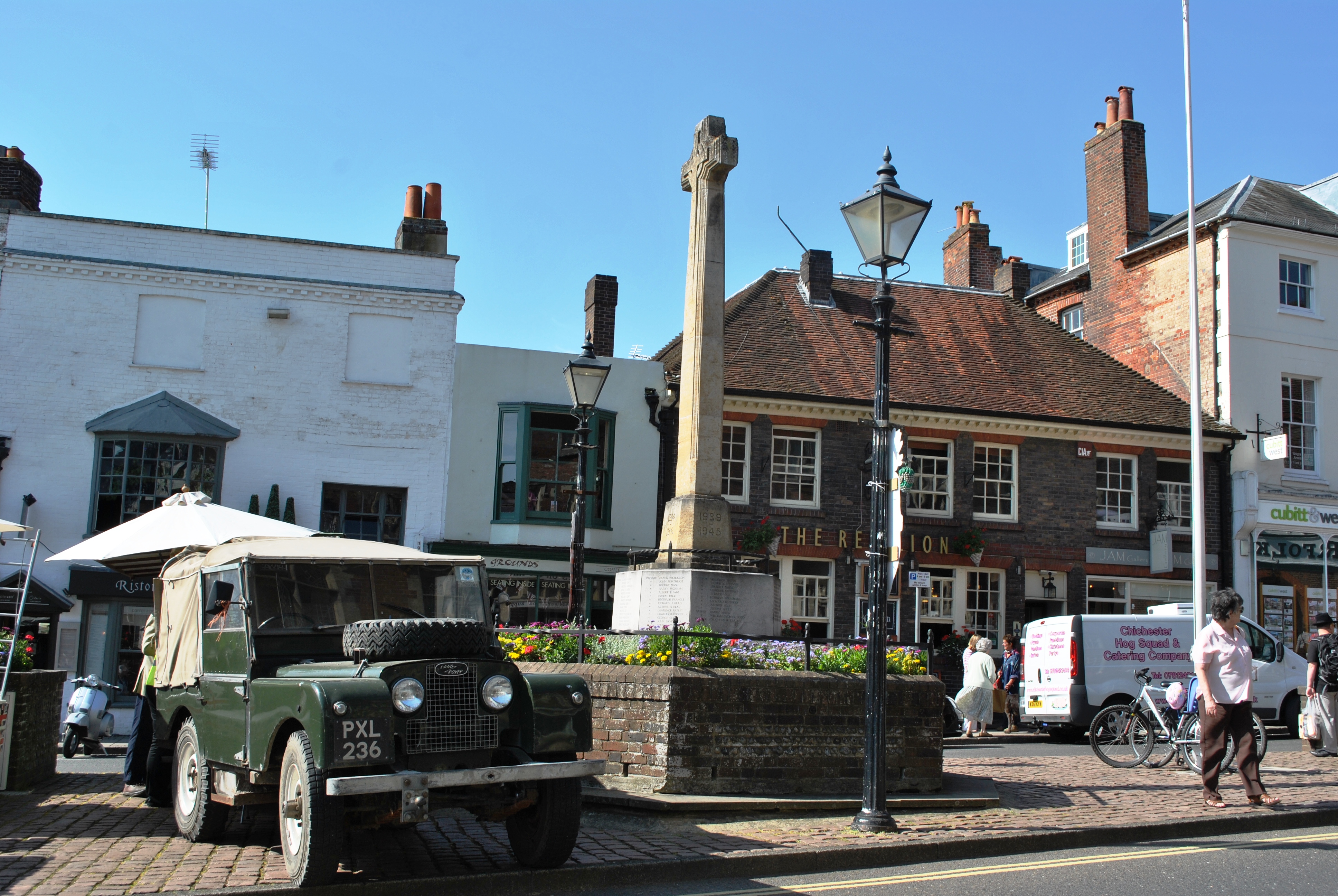
Chichester ( ) is a cathedral city and civil parish in the Chichester district of West Sussex, England.OS Explorer map 120: Chichester, South Harting and Selsey Scale: 1:25 000. Publisher:Ordnance Survey – Southampton B2 edition. Publishing Date:2009. It is the only city in West Sussex and is its county town. It was a Roman and Anglo-Saxon settlement and a major market town from those times through Norman and medieval times to the present day. It is the seat of the Church of England Diocese of Chichester and is home to a 12th-century cathedral. The city has two main watercourses: the Chichester Canal and the River Lavant. The Lavant, a winterbourne, runs to the south of the city walls; it is hidden mostly in culverts when close to the city centre. History Roman period There is no recorded evidence that Chichester was a settlement of any size before the coming of the Romans. The area around Chichester is believed to have played a significant part during the Roman in ... [...More Info...] [...Related Items...] OR: [Wikipedia] [Google] [Baidu] |
Shoreham F
Shoreham may refer to: Places Australia * Shoreham, Victoria United Kingdom * Shoreham, Kent ** Shoreham railway station * Shoreham-by-Sea, West Sussex ** Shoreham (UK Parliament constituency) 1974-1997 ** New Shoreham (UK Parliament constituency) 1295-1885 ** Shoreham (electoral division), a West Sussex County Council constituency ** Shoreham Airport ** Shoreham Airshow ** 2015 Shoreham Airshow crash ** Shoreham-by-Sea railway station United States * Shoreham, Michigan * Shoreham, New York ** Shoreham Nuclear Power Plant ** Shoreham station (LIRR), an abandoned Long Island Railroad station * Shoreham, Vermont * Omni Shoreham Hotel, Washington, D.C., US * The Shoreham, a building in the Lakeshore East development, Chicago, Illinois, US * New Shoreham, Rhode Island, the primary town on Block Island Block Island is an island of the Outer Lands coastal archipelago in New England, located approximately south of mainland Rhode Island and east of Long Island's Montauk Poin ... [...More Info...] [...Related Items...] OR: [Wikipedia] [Google] [Baidu] |
Arundel F
Arundel ( ) is a market town and civil parish in the Arun District of the South Downs, West Sussex, England. The much-conserved town has a medieval castle and Roman Catholic cathedral. Arundel has a museum and comes second behind much larger Chichester in its number of listed buildings in West Sussex. The River Arun runs through the eastern side of the town. Arundel was one of the boroughs reformed by the Municipal Reform Act 1835. From 1836 to 1889 the town had its own Borough police force with a strength of three. In 1974 it became part of the Arun district, and is now a civil parish with a town council. Name The name comes from the Old English ''Hārhūnedell'', meaning "valley of horehound", and was first recorded in the Domesday Book. Folk etymology, however, connects the name with the Old French word ''arondelle'', meaning "swallow", and swallows appear on the town's arms. Governance An electoral ward of the same name exists. This ward stretches north to Hou ... [...More Info...] [...Related Items...] OR: [Wikipedia] [Google] [Baidu] |
Saltdean United F
Saltdean is a coastal village in the city of Brighton and Hove, with part (known as East Saltdean) outside the city boundary in Lewes (district), Lewes district. Saltdean is approximately east of central Brighton, west of Newhaven, and south of Lewes. It is bordered by farmland and the South Downs National Park. History Saltdean was open farmland, originally a part of the village of Rottingdean, and almost uninhabited until 1924 when land was sold off for speculative housing and property development. Some of this was promoted by entrepreneur Charles W. Neville, who had set up a company to develop the site (he also eventually built nearby towns Peacehaven and parts of Rottingdean). Saltdean has a mainly shingle beach, fronted by a promenade, the Undercliff Walk, which can be reached directly from the cliff top, by steps from the coast road, or by a subway tunnel from the nearby Lido. The Undercliff Walk continues to Brighton, ending by the Palace Pier. The buildings nearest ... [...More Info...] [...Related Items...] OR: [Wikipedia] [Google] [Baidu] |


