|
1983–84 Western Football League
The 1983–84 season was the 82nd in the history of the Western Football League. The league champions for the first time in their history were Exmouth Town. The champions of Division One were Bristol City Reserves.Robinson, Michael (ed.), Non-League Football Tables 1889–2006, Soccer Books, 2006 Final tables Premier Division The Premier Division remained at twenty clubs after Falmouth Town and Bridport left the league, and Keynsham Town and Portway Bristol were relegated to the First Division. Four clubs joined: * Bristol Manor Farm, champions of the First Division. * Mangotsfield United, runners-up in the First Division. *Minehead, from the Southern League – returning to the league after leaving in 1972. *Taunton Town, from the Southern League – returning to the league after leaving in 1977. First Division The First Division consisted of 21 clubs, increased from 19 the previous season, after Bristol Manor Farm and Mangotsfield United were promoted to the Premier Divisi ... [...More Info...] [...Related Items...] OR: [Wikipedia] [Google] [Baidu] |
Western Football League
The Western Football League is a football league in South West England, covering Bristol, Cornwall, Devon, Somerset, western Dorset, parts of Gloucestershire and Wiltshire. The league's current main sponsor is Toolstation, so it is also known as the Toolstation League. Recent restructuring of the English football league system has placed the two divisions, known as the Premier Division and Division One (each a maximum of twenty-two clubs) at the ninth and tenth tiers overall, known as Step 5 and Step 6 of the National League System. The champion club may apply for promotion to a Step 4 league, which in practice will almost certainly be the Southern League Division One South and West. Below the Western League are four local leagues covering smaller areas, the Gloucestershire County League, the Somerset County League, the Dorset Premier League and the Wiltshire League. The South West Peninsula League Premier Divisions East and West are also feeders to the Western League but ... [...More Info...] [...Related Items...] OR: [Wikipedia] [Google] [Baidu] |
Clevedon Town F
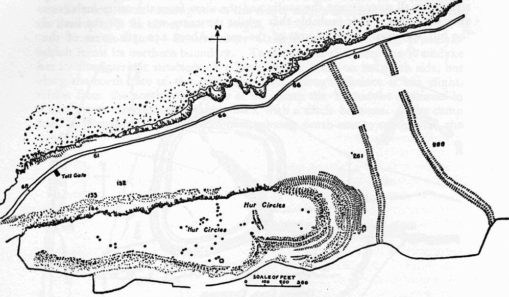
Clevedon (, ) is an English seaside town and civil parish in the unitary authority of North Somerset, part of the ceremonial county of Somerset. It recorded a parish population of 21,281 in the United Kingdom Census 2011, estimated at 21,442 in 2019. It lies along the Severn Estuary, among small hills that include Church Hill, Wain's Hill (topped by the remains of an Iron Age hill fort), Dial Hill, Strawberry Hill, Castle Hill, Hangstone Hill and Court Hill, a Site of Special Scientific Interest with overlaid Pleistocene deposits. It features in the ''Domesday Book'' of 1086. Clevedon grew in the Victorian period as a seaside resort and in the 20th century as a dormitory town for Bristol. Facilities and functions The seafront has ornamental gardens, a Victorian bandstand and other attractions. Salthouse Field has a light railway running round the perimeter and is used for donkey rides in the summer. The shore consists of pebbled beaches and low rocky cliffs, with an old harb ... [...More Info...] [...Related Items...] OR: [Wikipedia] [Google] [Baidu] |
Portway Bristol F
Portway or Port Way may refer to: Places in England * Portway, Worcestershire, a hamlet in Beoley parish, near Redditch Roads in England *Port Way, a Roman road between London and Weymouth *Portway, Bristol, a road from Bristol to Avonmouth ** Portway Bristol F.C., a defunct football team **Portway park and ride ** Portway Park and Ride railway station *Derbyshire Portway, an ancient track * H5 Portway, part of the grid road system in Milton Keynes People *Joshua Portway Joshua Portway (born 1967) is an artist and game designer. He is a frequent collaborator with Lise Autogena, for example on their Black Shoals stock market. He is also the author of thNoodle series of interactive music pieces, which was originall ... (born 1967), British artist and game designer * Thomas Portway (by 1524–1557), English politician {{Disambiguation, surname ... [...More Info...] [...Related Items...] OR: [Wikipedia] [Google] [Baidu] |
Keynsham Town F
Keynsham ( ) is a town and civil parish located between Bristol and Bath in Somerset, England. It has a population of 16,000. It was listed in the Domesday Book as ''Cainesham'' (as it is pronounced), which is believed to mean the home of Saint Keyne. The site of the town has been occupied since prehistoric times, and may have been the site of the Roman settlement of Trajectus. The remains of at least two Roman villas have been excavated, and an additional 15 Roman buildings have been detected beneath the Keynsham Hams. Keynsham developed into a medieval market town after Keynsham Abbey was founded around 1170. It is situated at the confluence of the River Chew and River Avon and was subject to serious flooding before the creation of Chew Valley Lake and river level controls at Keynsham Lock in 1727. The Chew Stoke flood of 1968 inundated large parts of the town. It was home to the Cadbury's chocolate factory, Somerdale, which opened in 1935 as a major employer in t ... [...More Info...] [...Related Items...] OR: [Wikipedia] [Google] [Baidu] |
Somerset County League
The Somerset County League is a football competition based in England. The Premier Division sits at step 7 (or level 11) of the National League System. It is a feeder to the Western League Division One and has promoted a club in seven of the last ten seasons – Hengrove Athletic, Portishead, Radstock Town, Oldland Abbotonians, Wells City, Cheddar, Ashton & Backwell United and Nailsea & Tickenham. Presently, the league has four divisions. It is fed by the Bath and North Somerset District League, the Mid-Somerset League, the Perry Street and District League, the Taunton & District Saturday League, the Yeovil and District League, and the Weston-super-Mare and District League. It is affiliated to the Somerset County FA which was formed in 1885. History The Somerset County League, also known as the Somerset Senior League, was founded in 1890. Six of the current teams in the Somerset County League have competed at a higher level, namely: *Chard Town * Clevedon United ... [...More Info...] [...Related Items...] OR: [Wikipedia] [Google] [Baidu] |
Ashton & Backwell United F
Ashton may refer to: Names *Ashton (given name) * Ashton (surname) Places Australia * Ashton, Elizabeth Bay, a heritage-listed house in Sydney, New South Wales * Ashton, South Australia Canada * Ashton, Ontario New Zealand *Ashton, New Zealand South Africa * Ashton, Western Cape United Kingdom England *Ashton, Cambridgeshire *Ashton, Cornwall * Ashton, Devon *Ashton, Hampshire *Ashton, Herefordshire * Ashton, North Northamptonshire, near Oundle *Ashton, West Northamptonshire, near Northampton *Ashton, Somerset, a hamlet in the parish of Chapel Allerton, Sedgemoor district * Long Ashton or Ashton, North Somerset **Ashton Court **Ashton Gate, Bristol ** Ashton Vale, now in Bristol ** Bower Ashton, now in Bristol *Ashton Common, Wiltshire *Ashton Green, East Sussex *Ashton Hayes, Cheshire *Ashton Keynes, Wiltshire *Ashton under Hill, Worcestershire *Ashton upon Mersey, Greater Manchester * Ashton-in-Makerfield, Greater Manchester in the Metropolitan Borough of Wigan *Ashton (w ... [...More Info...] [...Related Items...] OR: [Wikipedia] [Google] [Baidu] |
Wellington A
Wellington ( mi, Te Whanganui-a-Tara or ) is the capital city of New Zealand. It is located at the south-western tip of the North Island, between Cook Strait and the Remutaka Range. Wellington is the second-largest city in New Zealand by metro area, and is the administrative centre of the Wellington Region. It is the world's southernmost capital of a sovereign state. Wellington features a temperate maritime climate, and is the world's windiest city by average wind speed. Legends recount that Kupe discovered and explored the region in about the 10th century, with initial settlement by Māori iwi such as Rangitāne and Muaūpoko. The disruptions of the Musket Wars led to them being overwhelmed by northern iwi such as Te Āti Awa by the early 19th century. Wellington's current form was originally designed by Captain William Mein Smith, the first Surveyor General for Edward Wakefield's New Zealand Company, in 1840. The Wellington urban area, which only includes ... [...More Info...] [...Related Items...] OR: [Wikipedia] [Google] [Baidu] |
Devizes Town F
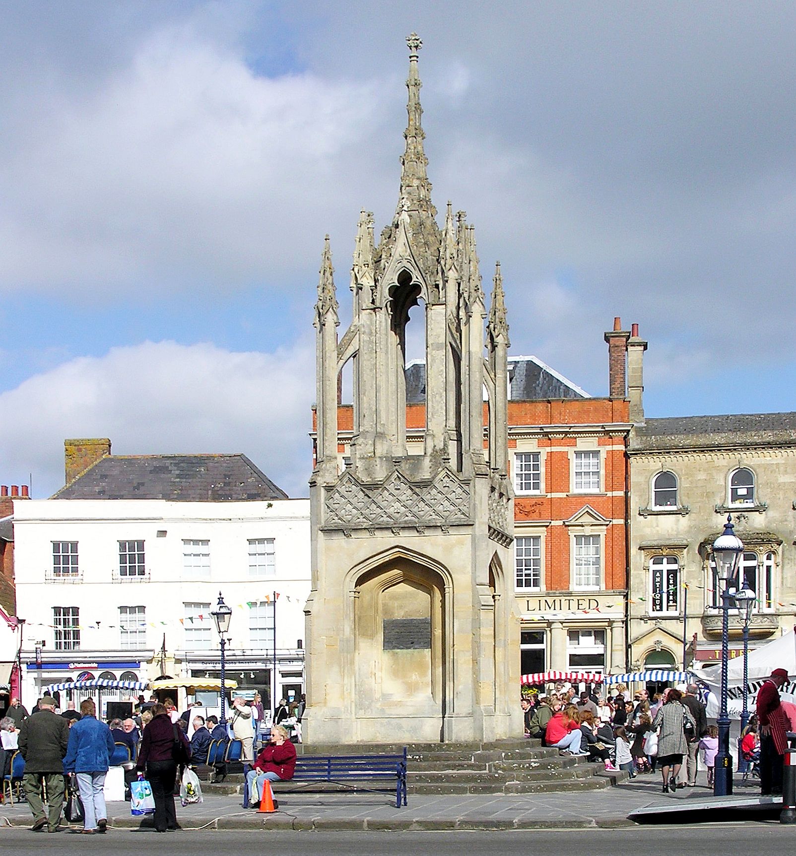
Devizes is a market town and civil parish in Wiltshire, England. It developed around Devizes Castle, an 11th-century Norman castle, and received a charter in 1141. The castle was besieged during the Anarchy, a 12th-century civil war between Stephen of England and Empress Matilda, and again during the English Civil War when the Cavaliers lifted the siege at the Battle of Roundway Down. Devizes remained under Royalist control until 1645, when Oliver Cromwell attacked and forced the Royalists to surrender. The castle was destroyed in 1648 on the orders of Parliament, and today little remains of it. From the 16th century Devizes became known for its textiles, and by the early 18th century it held the largest corn market in the West Country, constructing the Corn Exchange in 1857. In the 18th century, brewing, curing of tobacco, and snuff-making were established. The Wadworth Brewery was founded in the town in 1875. Standing at the west edge of the Vale of Pewsey, the town is abo ... [...More Info...] [...Related Items...] OR: [Wikipedia] [Google] [Baidu] |
Melksham Town F
Melksham () is a town on the River Avon in Wiltshire, England, about northeast of Trowbridge and south of Chippenham. At the 2011 census, the Melksham built-up area had a population of 19,357, making it Wiltshire's fifth-largest settlement after Swindon, Salisbury, Chippenham and Trowbridge. History Early history Excavations in 2021 in the grounds of Melksham House found fragments of locally made pottery from the early Iron Age (7th to 4th centuries BC). There is evidence of settlement continuing into the later Iron Age and Roman periods, including Roman clay roof tiles. Melksham developed at a ford across the River Avon. The name is presumed to derive from "''meolc''", the Old English for milk, and ''"ham"'', a village. On John Speed's map of Wiltshire (1611), the name is spelt both ''Melkesam'' (for the hundred) and ''Milsham'' (for the town itself). Melksham is also the name of the Royal forest that occupied the surrounding of the area in the Middle Ages. Landowner ... [...More Info...] [...Related Items...] OR: [Wikipedia] [Google] [Baidu] |
Clandown F
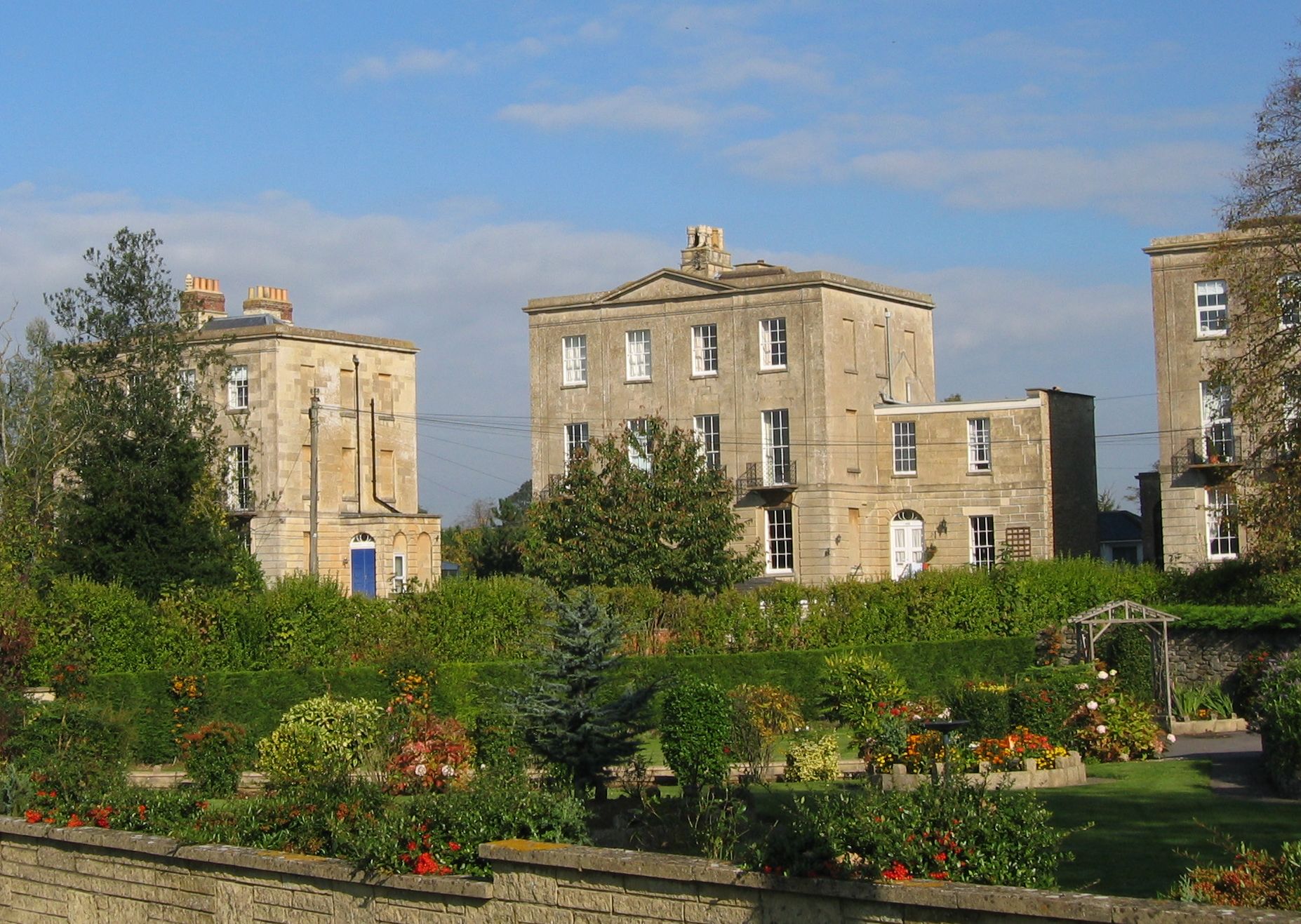
Clandown is a village lying north of Radstock in Somerset, England, just off the Fosseway. It is north of Radstock. The nearby Bowlditch Quarry is a 0.25 hectare geological Site of Special Scientific Interest. History Clandown was formerly a mining village, on the Somerset Coalfield, but the last pits in the area closed in the late 1960s. The colliery at Clandown opened in 1811 and closed in 1929 and had a maximum shaft depth of . In 1896 it was owned by the trustees of the late C. Hollewy and by 1908 by the Clandown Colliery Co. Artefacts from a Roman site have been found close to the village. Clandown Farmhouse on Pow's Hill was built in the 1720s. As well as a church, there were two chapels and three public houses. One of the chapels has been demolished and the other has been converted to apartments. Two pubs have been demolished. A school was opened in 1861 (there having been a dame school before this) and closed in 2006. Governance Clandown forms part of the North Eas ... [...More Info...] [...Related Items...] OR: [Wikipedia] [Google] [Baidu] |
Chippenham Town F
Chippenham is a market town in northwest Wiltshire, England. It lies northeast of Bath, west of London, and is near the Cotswolds Area of Natural Beauty. The town was established on a crossing of the River Avon and some form of settlement is believed to have existed there since before Roman times. It was a royal vill, and probably a royal hunting lodge, under Alfred the Great. The town continued to grow when the Great Western Railway arrived in 1841. The town had a population of 36,548 in 2021. Geography Location Chippenham is in western Wiltshire, at a prominent crossing of the River Avon, between the Marlborough Downs to the east, the southern Cotswolds to the north and west and Salisbury Plain to the southeast. The town is surrounded by sparsely populated countryside and there are several woodlands in or very near the town, such as Bird's Marsh, Vincients Wood and Briars Wood. Suburbs Suburbs include Cepen Park (North & South), Hardenhuish, Monkton, Lowden, Pewsham, P ... [...More Info...] [...Related Items...] OR: [Wikipedia] [Google] [Baidu] |
Weston-super-Mare A
Weston-super-Mare, also known simply as Weston, is a seaside town in North Somerset, England. It lies by the Bristol Channel south-west of Bristol between Worlebury Hill and Bleadon Hill. It includes the suburbs of Mead Vale, Milton, Oldmixon, West Wick, Worlebury, Uphill and Worle. Its population at the 2011 census was 76,143. Since 1983, Weston has been twinned with Hildesheim in Germany. The local area has been occupied since the Iron Age. It was still a small village until the 19th century when it developed as a seaside resort. A railway station and two piers were built. In the second half of the 20th century it was connected to the M5 motorway but the number of people holidaying in the town declined and some local industries closed, although the number of day visitors has risen. Attractions include The Helicopter Museum, Weston Museum, and the Grand Pier. Cultural venues include The Playhouse, the Winter Gardens and the Blakehay Theatre. The Bristol Channel has ... [...More Info...] [...Related Items...] OR: [Wikipedia] [Google] [Baidu] |


