|
ŇĆmaha
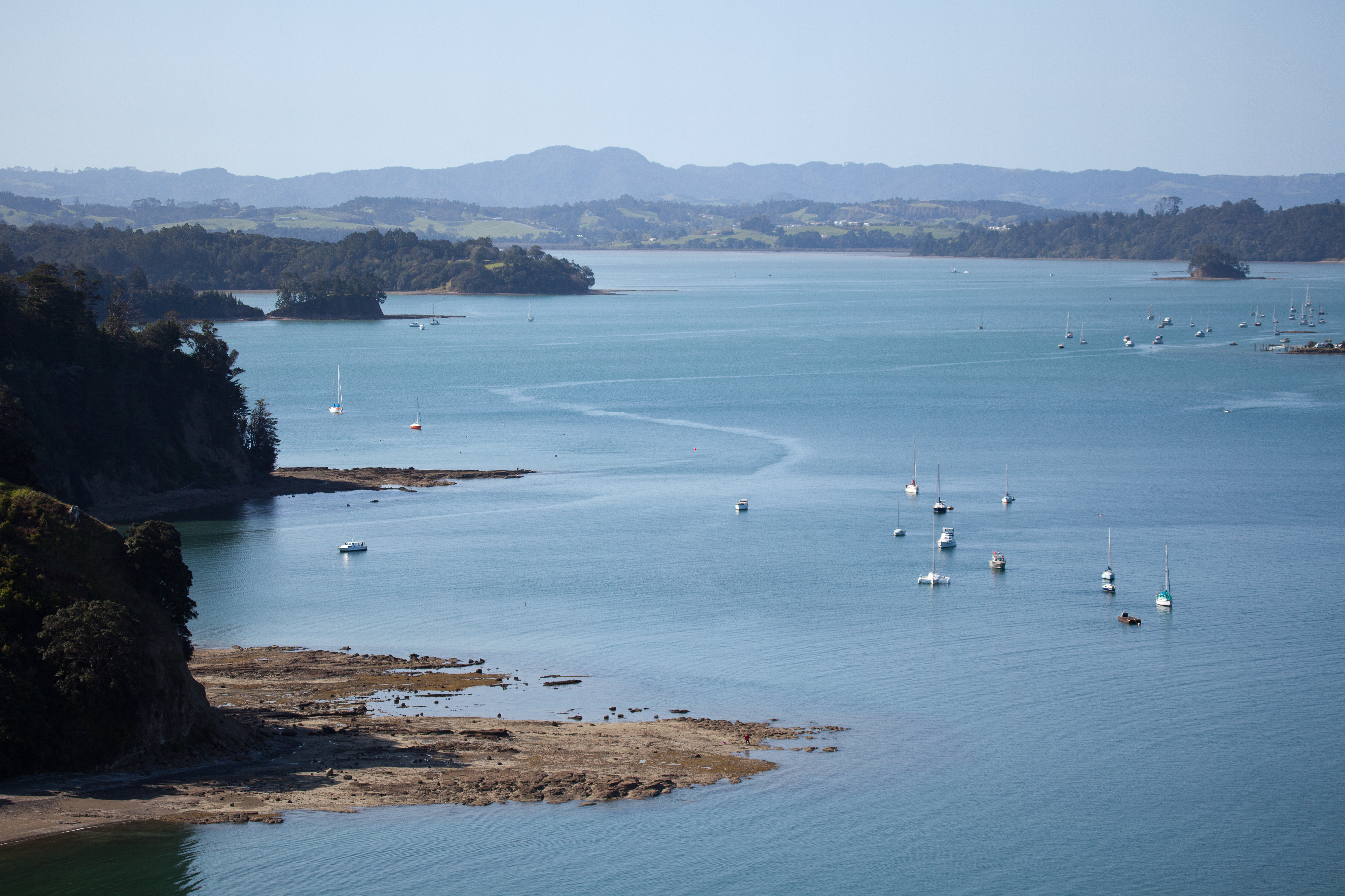
ŇĆmaha is a small beach town on ŇĆmaha Bay in the Auckland Region, in the north of New Zealand. It is located 74.7 km north of central Auckland. It is on a sandspit that adjoins TńĀwharanui Peninsula and separates Whangateau Harbour from ŇĆmaha Bay. The nearest sizeable town is Warkworth, New Zealand, Warkworth which is situated 16.8 km south west of ŇĆmaha. History ŇĆmaha was a MarutŇęńĀhu settlement until 1841, when it was bought by the Crown. Early European settlement took place at Sandspit. The MńĀori language, MńĀori name means 'bountiful food' or 'great resources'. Nearby Leigh, New Zealand, Leigh was historically named ŇĆmaha by MńĀori people, MńĀori, and ŇĆmaha Beach was called Mangatawhiri by NgńĀti Manuhiri. The Omaha Road Board was formed 26 September 1867 and administered the area until 1903, when it was dissolved. Omaha saw growth during the 1970s when a bridge to ŇĆmaha was constructed by Broadlands Properties, who then subdivided the land and buil ... [...More Info...] [...Related Items...] OR: [Wikipedia] [Google] [Baidu] [Amazon] |
Whangateau Harbour
The Whangateau Harbour is a natural harbour in New Zealand. It is a sandspit estuary, located on the north-eastern coast of the Auckland Region north-east of Matakana, and empties into the Hauraki Gulf. Due to the harbour's high quality water and dense shellfish beds (primarily Paphies australis, pipi), the harbour is a popular spot for shellfish gathering. Geography The Whangateau Harbour is a sandspit estuary, separated from ŇĆmaha Bay by a sandspit, where the town of ŇĆmaha is located. The modern harbour formed during the Holocene, after the formation of the sandspit. Horseshoe Island is an exposed sand-bar located in the centre of the harbour. The Whangateau Harbour has almost complete tidal flushing, meaning it has some of the best water quality for a harbour in New Zealand. Flora and fauna The harbour has a wide range of intertidal and subtidal reefs, supporting a wide range of benthic wildlife. High numbers of ''Scutus breviculus'', octopuses and Australostichopu ... [...More Info...] [...Related Items...] OR: [Wikipedia] [Google] [Baidu] [Amazon] |
Leigh, New Zealand
Leigh () is a small coastal community in the north of the Auckland Region of New Zealand. It lies on the west side of Omaha Cove, a small inlet within ŇĆmaha Bay to the south of Cape Rodney. It is 13 km from Matakana, 21 km from Warkworth, New Zealand, Warkworth and approximately 92 km north of Auckland, Auckland City. Leigh is the nearest town to Cape Rodney-Okakari Point Marine Reserve surrounding Te HńĀwere-a-Maki / Goat Island. The reserve, the first of its type in New Zealand, is also the location for the University of Auckland's Marine Laboratory.Wises New Zealand Guide, 7th Edition, 1979. p.200. Geography Leigh is located in Rodney (local board area), Rodney in the northeastern Auckland Region, northeast of Whangateau Harbour, near Cape Rodney and Goat Island (Auckland), Goat Island. Two bays border the township: Te Kohuroa / Mathesons Bay to the west, and Omaha Cove to the east. The Kohuroa Stream flows to the west of Leigh township, reaching Te Kohuroa / ... [...More Info...] [...Related Items...] OR: [Wikipedia] [Google] [Baidu] [Amazon] |
TńĀwharanui Peninsula
TńĀwharanui Peninsula is a finger of land projecting into the Hauraki Gulf from the east coast of the much larger North Auckland Peninsula of New Zealand. It separates ŇĆmaha Bay to the north from Kawau Bay and Kawau Island to the south. The nearest sizable town is Warkworth. TńĀwharanui Regional Park covers 588 hectares of the peninsula's land and TńĀwharanui Marine Reserve covers the northern coastal sea. Both are administered by Auckland CouncilTńĀwharanui Marine Reserve Department of Conservation. which also owns the regional park. Geologically the peninsula consists of Waitemata Sandstone on top of folded and uplifted . [...More Info...] [...Related Items...] OR: [Wikipedia] [Google] [Baidu] [Amazon] |
Auckland
Auckland ( ; ) is a large metropolitan city in the North Island of New Zealand. It has an urban population of about It is located in the greater Auckland Region, the area governed by Auckland Council, which includes outlying rural areas and the islands of the Hauraki Gulf, and which has a total population of as of It is the List of cities in New Zealand, most populous city of New Zealand and the List of cities in Oceania by population, fifth-largest city in Oceania. The city lies between the Hauraki Gulf to the east, the Hunua Ranges to the south-east, the Manukau Harbour to the south-west, and the WaitńĀkere Ranges and smaller ranges to the west and north-west. The surrounding hills are covered in rainforest and the landscape is dotted with 53 volcanic centres that make up the Auckland Volcanic Field. The central part of the urban area occupies a narrow isthmus between the Manukau Harbour on the Tasman Sea and the WaitematńĀ Harbour on the Pacific Ocean. Auckland is one of ... [...More Info...] [...Related Items...] OR: [Wikipedia] [Google] [Baidu] [Amazon] |
Warkworth, New Zealand
Warkworth () is a town on the Northland Peninsula in the upper North Island of New Zealand. It is in the northern part of the Auckland Region, north of Auckland and south of WhangńĀrei, at the head of Mahurangi Harbour. State Highway 1 (New Zealand), State Highway 1 runs past it. Mahurangi Harbour and surrounding area has been settled by MńĀori people, MńĀori since at least the 13th century. As Warkworth is the uppermost navigable point on the Mahurangi River, it was a crossroads between overland traffic and waka (canoe), waka, and gained the name , referring to the waterfalls on the river. MńĀori people of the Mahurangi Harbour area moved seasonally between different kńĀinga based on available resources, and came to the dense Agathis australis, kauri forests at Puhinui for food resources such as berries and eels, and to fell trees to build waka. During the 17th and 18th centuries, NgńĀti Rongo, NgńĀti RaupŇć and NgńĀti Manuhiri were active in the Warkworth area. The area was ... [...More Info...] [...Related Items...] OR: [Wikipedia] [Google] [Baidu] [Amazon] |
Quartz
Quartz is a hard, crystalline mineral composed of silica (silicon dioxide). The Atom, atoms are linked in a continuous framework of SiO4 silicon‚Äďoxygen Tetrahedral molecular geometry, tetrahedra, with each oxygen being shared between two tetrahedra, giving an overall chemical formula of Silicon dioxide, SiO2. Quartz is, therefore, classified structurally as a Silicate mineral#Tectosilicates, framework silicate mineral and compositionally as an oxide mineral. Quartz is the second most abundant mineral in Earth's continental crust, behind feldspar. Quartz exists in two forms, the normal őĪ-quartz and the high-temperature ő≤-quartz, both of which are chiral. The transformation from őĪ-quartz to ő≤-quartz takes place abruptly at . Since the transformation is accompanied by a significant change in volume, it can easily induce microfracturing of ceramics or rocks passing through this temperature threshold. There are many different varieties of quartz, several of which are classifi ... [...More Info...] [...Related Items...] OR: [Wikipedia] [Google] [Baidu] [Amazon] |
Longshore Drift
Longshore drift from longshore current is a geological process that consists of the transportation of sediments (clay, silt, pebbles, sand, shingle, shells) along a coast parallel to the shoreline, which is dependent on the angle of incoming wave direction. Oblique incoming wind squeezes water along the coast, generating a water current that moves parallel to the coast. Longshore drift is simply the sediment moved by the longshore current. This current and sediment movement occurs within the surf zone. The process is also known as littoral drift. Beach sand is also moved on such oblique wind days, due to the swash and backwash of water on the beach. Breaking surf sends water up the coast (swash) at an oblique angle and gravity then drains the water straight downslope (backwash) perpendicular to the shoreline. Thus beach sand can move downbeach in a sawtooth fashion many tens of meters (yards) per day. This process is called "beach drift", but some workers regard it as sim ... [...More Info...] [...Related Items...] OR: [Wikipedia] [Google] [Baidu] [Amazon] |
Spinifex (coastal Grass)
''Spinifex'' is a genus of perennial coastal plants in the Poaceae, grass family. They are one of the most common plants that grow in sand dunes along the coasts of Africa, Middle East, Asia, Australia, New Zealand, and New Caledonia, with the ranges of some species extending north and west along the coasts of Asia as far as India and Japan. As they help stabilise the sand, these grasses are an important part of the entire sand dune ecosystem. The single species indigenous to New Zealand, ''Spinifex sericeus'', is also found in Australia. Confusingly, the word "spinifex" is also used as a common name referring to grasses in the related genus ''Triodia (plant), Triodia''. ''Triodia'' however is native to inland Australia and refers to a group of spiny-leaved, tussock grass, tussock-forming grasses. Species Species include: * Spinifex √ó alterniflorus, ''Spinifex'' √ó ''alterniflorus'' Nees ‚Äď Western Australia * ''Spinifex hirsutus'' Labill. ‚Äď all 6 states of Australi ... [...More Info...] [...Related Items...] OR: [Wikipedia] [Google] [Baidu] [Amazon] |
Omaha Beach Vista
Omaha ( ) is the most populous city in the U.S. state of Nebraska. It is located in the Midwestern United States along the Missouri River, about north of the mouth of the Platte River. The nation's 41st-most-populous city, Omaha had a population of 486,051 at the 2020 census. The eight-county Omaha‚ÄďCouncil Bluffs metropolitan area, which extends into Iowa, has approximately 1 million residents and is the 55th-largest metro area in the United States. Omaha is the county seat of Douglas County. Omaha's pioneer period began in 1854, when the city was founded by speculators from neighboring Council Bluffs, Iowa. The city was founded along the Missouri River, and a crossing called Lone Tree Ferry earned the city its nickname, the "Gateway to the West". Omaha introduced this new West to the world in 1898, when it played host to the World's Fair, dubbed the Trans-Mississippi Exposition. During the 19th century, Omaha's central location in the United States spurred the city to ... [...More Info...] [...Related Items...] OR: [Wikipedia] [Google] [Baidu] [Amazon] |
Dredge
Dredging is the excavation of material from a water environment. Possible reasons for dredging include improving existing water features; reshaping land and water features to alter drainage, navigability, and commercial use; constructing dams, dikes, and other controls for streams and shorelines; and recovering valuable mineral deposits or marine life having commercial value. In all but a few situations the excavation is undertaken by a specialist floating plant, known as a dredger. Usually the main objectives of dredging is to recover material of value, or to create a greater depth of water. Dredging systems can either be shore-based, brought to a location based on barges, or built into purpose-built vessels. Dredging can have environmental impacts: it can disturb marine sediments, creating dredge plumes which can lead to both short- and long-term water pollution, damage or destroy seabed ecosystems, and release legacy human-sourced toxins captured in the sediment. ... [...More Info...] [...Related Items...] OR: [Wikipedia] [Google] [Baidu] [Amazon] |
Pingao
''Ficinia spiralis'' (pńęngao, pńękao, or golden sand sedge) is a coastal sedge endemic to New Zealand (including the Chatham Islands). Originally widespread, it has suffered severely from competition with introduced marram grass and animal grazing and now has only a patchy distribution. Description Pńęngao is a stout, grass-like plant, 30‚Äď90 cm tall, from the sedge family, found on active sand dunes. It is found only in New Zealand and is easily distinguished from other dune species such as spinifex or marram grass. Seen from a distance, pńęngao patches have a distinctive orange hue. Most plants produce long, prostrate, tough rope-like stolons that creep along the sand surface until buried by shifting sand, leaving just the upper portion of leaves exposed. Some southern South Island populations produce dense tussock-like plants without extensive stolons. Numerous tough, roughly textured leaves are borne in dense tufts on well-spaced, short, upright stems (tillers), ... [...More Info...] [...Related Items...] OR: [Wikipedia] [Google] [Baidu] [Amazon] |
Disphyma Crassifolium
''Disphyma crassifolium'', commonly known as round-leaved pigface or salty fingers is a species of flowering plant in the family Aizoaceae native to Australia and the Cape Provinces of South Africa. It is a prostrate, succulent annual shrub or short-lived perennial plant with stems up to long, leaves that are three-sided in cross-section with a rounded lower angle, and purple daisy-like flowers with staminodes up to long. Description ''Disphyma crassifolium'' is a prostrate, succulent, annual or short-lived perennial shrub that typically grows to a height of and has stems up to long. Its leaves are club-shaped, more or less round to three-sided in cross-section, long and wide. The flowers are wide with a perianth tube wide, the longer lobes long with purple, petal-like staminodes long that are white on the lower surface. Flowering mainly occurs from October to February and the fruit is a conical capsule that is about long and wide before opening. Taxonomy ''Disphyma ... [...More Info...] [...Related Items...] OR: [Wikipedia] [Google] [Baidu] [Amazon] |


