|
┼īe, Yamagata
is a Towns of Japan, town located in Yamagata Prefecture, Japan. , the town had an estimated population of 7,894 in 2828 households, and a population density of 51 persons per km2. The total area of the town is . Geography ┼īe is located in mountainous central Yamagata. Like many small towns in Japan, ┼īe is a collection of smaller hamlets. Elevation rises and populations decrease from east to west. The easternmost hamlet is Aterazawa, and contains about 4/5 of the town's population. The town extends from the west end of the central part of the Yamagata basin to the Asahi Mountains. In addition, it has several enclaves in Sagae city and Nakayama town, bordering the east. Administratively, the town area is divided from the east into the Sazawa, Hongo, and Shichiken districts. The Mogami River forms the eastern border of the town. Neighboring municipalities *Yamagata Prefecture **Asahi, Yamagata, Asahi **Nakayama, Yamagata, Nakayama **Nishikawa, Yamagata, Nishikawa **Sagae, Yamag ... [...More Info...] [...Related Items...] OR: [Wikipedia] [Google] [Baidu] |
Towns Of Japan
A town (ńö║; ''ch┼Ź'' or ''machi'') is a Local government, local administrative unit in Japan. It is a local public body along with Prefectures of Japan, prefecture (''ken'' or other equivalents), Cities of Japan, city (''shi''), and Villages of Japan, village (''mura''). Geographically, a town is contained within a Districts of Japan, district. The same word (ńö║; ''machi'' or ''ch┼Ź'') is also used in names of smaller regions, usually a part of a Wards of Japan, ward in a city. This is a legacy of when smaller towns were formed on the outskirts of a city, only to eventually merge into it. Towns See also * Municipalities of Japan * List of villages in Japan * List of cities in Japan * Japanese addressing system References External links "Large City System of Japan"; graphic shows towns compared with other Japanese city types at p. 1 [PDF 7 of 40 /nowiki>] {{Asia topic, List of towns in Towns in Japan, * ... [...More Info...] [...Related Items...] OR: [Wikipedia] [Google] [Baidu] |
Population
Population is a set of humans or other organisms in a given region or area. Governments conduct a census to quantify the resident population size within a given jurisdiction. The term is also applied to non-human animals, microorganisms, and plants, and has specific uses within such fields as ecology and genetics. Etymology The word ''population'' is derived from the Late Latin ''populatio'' (a people, a multitude), which itself is derived from the Latin word ''populus'' (a people). Use of the term Social sciences In sociology and population geography, population refers to a group of human beings with some predefined feature in common, such as location, Race (human categorization), race, ethnicity, nationality, or religion. Ecology In ecology, a population is a group of organisms of the same species which inhabit the same geographical area and are capable of Sexual reproduction, interbreeding. The area of a sexual population is the area where interbreeding is possi ... [...More Info...] [...Related Items...] OR: [Wikipedia] [Google] [Baidu] |
Kamakura Period
The is a period of History of Japan, Japanese history that marks the governance by the Kamakura shogunate, officially established in 1192 in Kamakura, Kanagawa, Kamakura by the first ''sh┼Źgun'' Minamoto no Yoritomo after the conclusion of the Genpei War, which saw the struggle between the Taira clan, Taira and Minamoto clan, Minamoto clans. The period is known for the emergence of the samurai, the warrior caste, and for the establishment of feudalism in Japan. There are various theories as to the year in which the Kamakura period and Kamakura shogunate began. In the past, the most popular theory was that the year was 1192, when Minamoto no Yoritomo was appointed . Later, the prevailing theory was that the year was 1185, when Yoritomo established the , which controlled military and police power in various regions, and the , which was in charge of tax collection and land administration. Japanese history textbooks as of 2016 do not specify a specific year for the beginning of the K ... [...More Info...] [...Related Items...] OR: [Wikipedia] [Google] [Baidu] |
Dewa Province
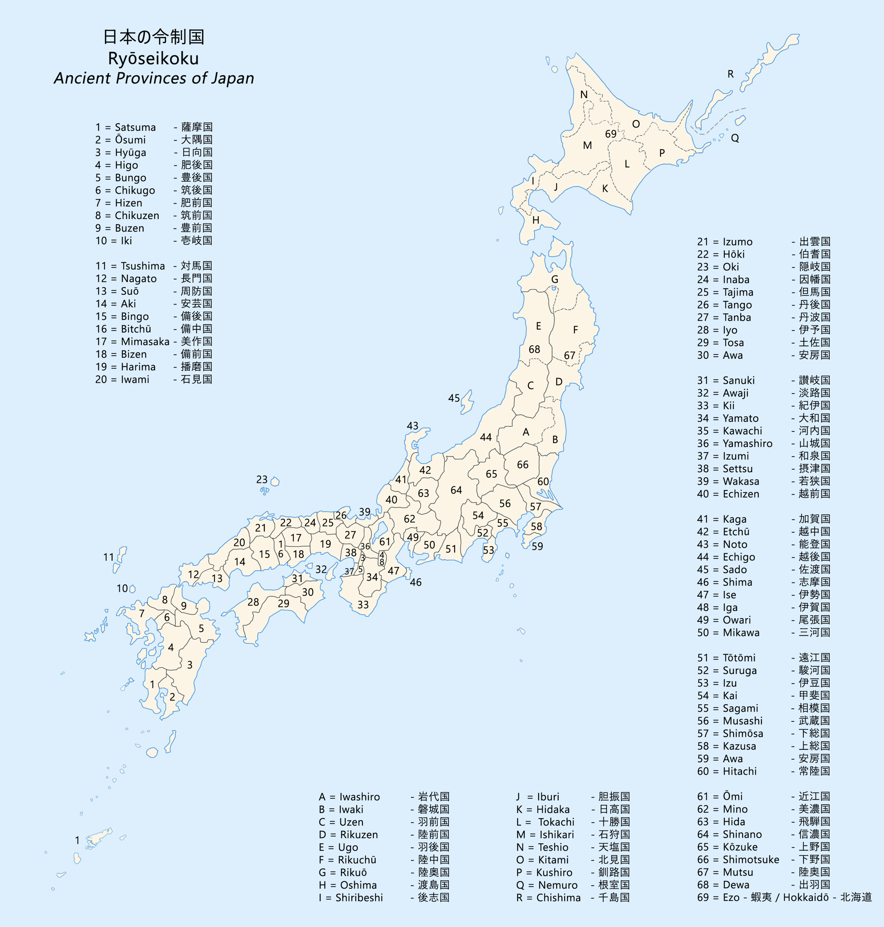
was a province of Japan comprising modern-day Yamagata Prefecture and Akita Prefecture, except for the city of Kazuno and the town of Kosaka. Dewa bordered on Mutsu and Echig┼Ź Provinces. Its abbreviated form name was . History Early period Prior to the Asuka period, Dewa was inhabited by Ainu or Emishi tribes, and was effectively outside of the control of the imperial dynasty. Abe no Hirafu conquered the native Emishi tribes at what are now the cities of Akita and Noshiro in 658 and established a fort on the Mogami River. In 708 AD was created within Echig┼Ź Province. The area of Dewa District was roughly that of the modern Sh┼Źnai area of Yamagata Prefecture, and was gradually extended to the north as the Japanese pushed back the indigenous people of northern Honsh┼½. Dewa District was promoted to the status of a province () in 712 AD, and gained Okitama and Mogami Districts, formerly part of Mutsu Province. A number of military expeditions were sent to the area, ... [...More Info...] [...Related Items...] OR: [Wikipedia] [Google] [Baidu] |
Japan Meteorological Agency
The Japan Meteorological Agency (JMA; ''µ░ŚĶ▒ĪÕ║ü, Kish┼Ź-ch┼Ź'') is a division of the Ministry of Land, Infrastructure, Transport and Tourism dedicated to the Scientific, scientific observation and research of natural phenomena. Headquartered in Minato, Tokyo the government agency, agency collects data on meteorology, hydrology, seismology, volcanology, and other related fields. The JMA is responsible for collecting and disseminating weather data and Forecasting, forecasts to the public, as well as providing specialized information for aviation and Marine weather forecasting, marine sectors. Additionally, the JMA issues warnings for volcanic eruptions and is integral to the nationwide Earthquake Early Warning (Japan), Earthquake Early Warning (EEW) system. As one of the Regional Specialized Meteorological Centers designated by the World Meteorological Organization (WMO), the JMA also Forecasting, forecasts, Tropical cyclone naming, names, and distributes warnings for tropical ... [...More Info...] [...Related Items...] OR: [Wikipedia] [Google] [Baidu] |
Humid Continental Climate
A humid continental climate is a climatic region defined by Russo-German climatologist Wladimir K├Čppen in 1900, typified by four distinct seasons and large seasonal temperature differences, with warm to hot (and often humid) summers, and cold (sometimes severely cold in the northern areas) and snowy winters. Precipitation is usually distributed throughout the year, but often these regions do have dry seasons. The definition of this climate in terms of temperature is as follows: the mean temperature of the coldest month must be below or depending on the isotherm, and there must be at least four months whose mean temperatures are at or above . In addition, the location in question must not be semi-arid or arid. The cooler ''Dfb'', ''Dwb'', and ''Dsb'' subtypes are also known as hemiboreal climates. Although amount of snowfall is not a factor used in defining the humid continental climate, snow during the winter in this type of climate is almost a guarantee, either intermitte ... [...More Info...] [...Related Items...] OR: [Wikipedia] [Google] [Baidu] |
Yamanobe, Yamagata
is a town located in Yamagata Prefecture, Japan. , the town had an estimated population of 14,174 in 4839 households, and a population density of 230 persons per km2. The total area of the town is . Geography Yamanobe is located in the southeast end of the Yamagata Basin in central Yamagata Prefecture, surrounded by mountains. Mount Shirataka is partially within the borders of the town. Neighboring municipalities *Yamagata Prefecture **Asahi ** Nakayama ** Nan'y┼Ź ** ┼īe ** Shirataka ** Yamagata Climate Yamanobe has a Humid continental climate (K├Čppen climate classification ''Cfa'') with large seasonal temperature differences, with warm to hot (and often humid) summers and cold (sometimes severely cold) winters. Precipitation is significant throughout the year, but is heaviest from August to October. The average annual temperature in Yamanobe is 10.1 ┬░C. The average annual rainfall is 1546 mm with September as the wettest month. The temperatures are highest on avera ... [...More Info...] [...Related Items...] OR: [Wikipedia] [Google] [Baidu] |
Sagae, Yamagata
Jion-in temple is a city located in Yamagata Prefecture, Japan. , the city had an estimated population of 40,131, and a population density of 289 persons per km2. The total area of the city is . Geography Sagae is located in the Yamagata Basin in the geographic center of Yamagata Prefecture. The Asahi Mountains and Dewa Mountains form its western border, and the Mogami River forms the eastern border of the city. Neighboring municipalities *Yamagata Prefecture ** Kahoku ** Murayama ** Nakayama ** Nishikawa ** ┼īe ** ┼īkura ** Tendo Climate Sagae has a Humid continental climate (K├Čppen climate classification ''Dfb'') with large seasonal temperature differences, with warm to hot (and often humid) summers and cold (sometimes severely cold) winters. Precipitation is significant throughout the year, but is heaviest from August to October. The average annual temperature in Sagae is 8.2 ┬░C. The average annual rainfall is 1579 mm with September as the wettest month. The t ... [...More Info...] [...Related Items...] OR: [Wikipedia] [Google] [Baidu] |
Nishikawa, Yamagata
Sagae Dam Reservoir is a town located in Yamagata Prefecture, Japan. , the town had an estimated population of 5,225 in 1851 households, and a population density of 145.1 persons per km┬▓. The total area of the town is . Geography Nishikawa is located in mountainous central Yamagata and includes Mount Gassan and Mount Asahi within its borders. The Sagae River passes through the town. Part of the town is within the borders of the Bandai-Asahi National Park. Neighboring municipalities *Niigata Prefecture ** Murakami *Yamagata Prefecture **Asahi ** ┼īe ** Oguni ** ┼īkura ** Sagae ** Sh┼Źnai **Tsuruoka Climate Nishikawa has a Humid continental climate (K├Čppen climate classification ''Dfb'') with large seasonal temperature differences, with warm to hot (and often humid) summers and cold (sometimes severely cold) winters. Precipitation is significant throughout the year, but is heaviest from August to October. The average annual temperature in Nishikawa is . The average annual rai ... [...More Info...] [...Related Items...] OR: [Wikipedia] [Google] [Baidu] |
Nakayama, Yamagata
is a town located in Yamagata Prefecture, Japan. , the town had an estimated population of 11,153 in 3701 households, and a population density of 360 persons per km2. The total area of the town is . Geography Nakayama is located in the western end of the Yamagata Basin in central Yamagata Prefecture, surrounded by mountains. The Mogami River flows through the town. Neighboring municipalities *Yamagata Prefecture ** ┼īe ** Sagae ** Tend┼Ź ** Yamagata ** Yamanobe Climate Nakayama has a Humid continental climate (K├Čppen climate classification ''Cfa'') with large seasonal temperature differences, with warm to hot (and often humid) summers and cold (sometimes severely cold) winters. Precipitation is significant throughout the year, but is heaviest from August to October. The average annual temperature in Nakayama is 11.7 ┬░C. The average annual rainfall is 1398 mm with September as the wettest month. The temperatures are highest on average in August, at around 25.6 ... [...More Info...] [...Related Items...] OR: [Wikipedia] [Google] [Baidu] |


