|
─īrna Prst
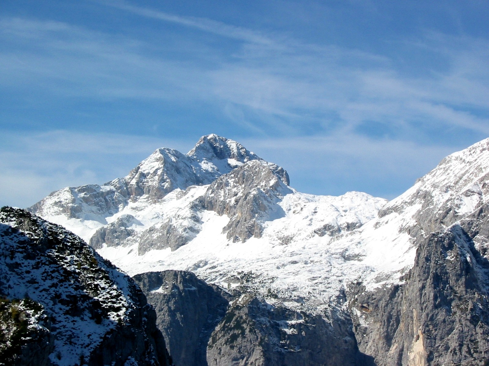
─īrna Prst is a mountain in the southeastern Julian Alps, on the edge of Triglav National Park in Slovenia. Standing at , it is the 370thŌĆōhighest peak in Slovenia. During the interwar period, the mountain ridge formed part of the border between Italy and Yugoslavia. Name The Slovene name ''─īrna Prst'', literally 'black soil', refers to a dark patch of rock near the summit formed of shaley claystones and deposits of the magnesium ore psilomelane. Flora and botany The floral richness of the vast grassy slopes have fascinated botanists and visitors to the mountain world since the late 18th century, in particular the meadows of flowers on ─īrna Prst. The exceptionally diverse flora are due to the geography of the ridge, which experiences a mixed alpine and coastal climate, as well as the unique rock composition. One of the first botanists to visit the mountain may have been Franz Xaver von Wulfen, who in 1789 mentioned a sample of '' Geranium argenteum'' from ─īrna Prst sent ... [...More Info...] [...Related Items...] OR: [Wikipedia] [Google] [Baidu] |
Julian Alps
The Julian Alps (, , , , ) are a mountain range of the Southern Limestone Alps that stretches from northeastern Italy to Slovenia, where they rise to 2,864 m at Mount Triglav, the highest peak in Slovenia. A large part of the Julian Alps is included in Triglav National Park. The second highest peak of the range, the 2,755 m high J├┤f di Montasio, lies in Italy. The Julian Alps cover an estimated 4,400 km2 (of which 1,542 km2 lies in Italy). They are located between the Sava Valley and Canale Valley. They are divided into the Eastern and Western Julian Alps. Name The Julian Alps were known in antiquity as ''Alpes Iuliae'', and also attested as ''Alpes Julianae'' AD 670, ''Alpis Julia'' 734, and ''Alpes Iulias'' in 1090. Like the municipium of ''Forum Julii'' (now Cividale del Friuli) at the foot of the mountains, the range was named after Julius Caesar of the gens Julia, perhaps due to a road built by Julius Caesar and completed by Augustus. Eastern Julian A ... [...More Info...] [...Related Items...] OR: [Wikipedia] [Google] [Baidu] |
Trieste
Trieste ( , ; ) is a city and seaport in northeastern Italy. It is the capital and largest city of the Regions of Italy#Autonomous regions with special statute, autonomous region of Friuli-Venezia Giulia, as well as of the Province of Trieste, regional decentralization entity of Trieste. Trieste is located at the head of the Gulf of Trieste, on a narrow strip of Italian territory lying between the Adriatic Sea and Slovenia; Slovenia lies close, at approximately east and southeast of the city, while Croatia is about to the south of the city. The city has a long coastline and is surrounded by grassland, forest, and karstic areas. As of 2025, it has a population of 198,668. Trieste belonged, as Triest, to the Habsburg monarchy from 1382 until 1918. In the 19th century, the monarchy was one of the Great Powers of Europe and Trieste was its most important seaport. As a prosperous trading hub in the Mediterranean region, Trieste grew to become the fourth largest city of the Aust ... [...More Info...] [...Related Items...] OR: [Wikipedia] [Google] [Baidu] |
Treaty Of Rapallo (1920)
The Treaty of Rapallo was an agreement between the Kingdom of Italy and the Kingdom of Serbs, Croats and Slovenes in the aftermath of the First World War. It was intended to settle the Adriatic question, which referred to Italian claims over territories promised to the country in return for its entry into the war against Austria-Hungary, claims that were made on the basis of the 1915 Treaty of London. The wartime pact promised Italy large areas of the eastern Adriatic. The treaty, signed on 12 November 1920 in Rapallo, Italy, generally redeemed the promises of territorial gains in the former Austrian Littoral by awarding Italy territories generally corresponding to the peninsula of Istria and the former Princely County of Gorizia and Gradisca, with the addition of the Sne┼Šnik Plateau, in addition to what was promised by the London treaty. The articles regarding Dalmatia were largely ignored. Instead, in Dalmatia, Italy received the city of Zadar and several islands. Othe ... [...More Info...] [...Related Items...] OR: [Wikipedia] [Google] [Baidu] |
Podbrdo, Tolmin
Podbrdo (; , ) is a settlement in the Municipality of Tolmin in the Littoral region of Slovenia. It lies in narrow valley of the Ba─Źa River, next to the Bohinj Railway line at the end of the longest railway tunnel in Slovenia (6,327.3 m) and next to the road from Bohinjska Bistrica and ┼Įelezniki across Petrovo Brdo towards Most na So─Źi. Name The name ''Podbrdo'' is a fused prepositional phrase that has lost its case inflection, from ''pod'' 'under' + ''brdo'' 'hill', thus referring to the local geography. History The settlement was founded in the 16th century by German-speaking settlers from Tyrol, but the area was settled earlier. Church The most important building in the village is the parish church; it is dedicated to Saint Nicholas and belongs to the Diocese of Koper. It dates from the |
Campanula Zoysii
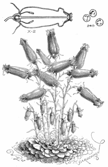
''Favratia zoysii'', known commonly as Zois' bellflower, Zoysi's harebell, or crimped bellflower, is the sole member of the genus ''Favratia'', closely related to '' Campanula '' (bellflowers). Distribution and habitat The plant is endemic to Austria, northern Italy (FriuliŌĆōVenezia Giulia and Veneto), and Slovenia. It grows most readily in limestone crevices in the Julian, KamnikŌĆōSavinja Alps and the Peca Mountain, as well as in the dolomitic Alps of Italy and Austria. A white-flowered form of ''C. zoysii'', called ''Lismore Ice'' was cultured from seeds harvested in the Julian Alps. The plant is much more compact in growth than its purple form. It is also slower growing and has smaller leaves, the tips of which are yellow. ''Favratia zoysii'' can survive in temperatures as low as . Garden pests include slugs and snails. Description The plant tends to grow low, reaching anywhere from in height, though some plants may grow as tall as . Tufts (or "cushions") of the plant ... [...More Info...] [...Related Items...] OR: [Wikipedia] [Google] [Baidu] |
Cypripedium Calceolus
''Cypripedium calceolus'' is a lady's-slipper orchid, and the type species of the genus ''Cypripedium''. It is native to Europe and Asia. Taxonomy ''Cypripedium'' comes from the Greek ╬ÜŽŹŽĆŽü╬╣Žé ŽĆ╬Ą╬┤╬»╬┐╬Į (''Kypris pedion''), meaning Aphrodite's foot (a reference to the goddess Aphrodite, equivalent to the Roman Venus). ''calceolus'' is Latin for a small shoe. ''Cypripedium calceolus'' does not occur in North America, though the closely related '' Cypripedium parviflorum'' and '' C. pubescens'' are often still referred to as subspecies or varieties of ''C. calceolus''. Description This is the largest-flowered orchid species in Europe, growing to 60 cm tall with flowers as wide as 9 cm. Before it flowers, it is distinguished from other orchids by the large size and width of its ovate leaves (as big as 18 cm long, 9 cm wide), which like other orchids exhibit parallel venation. Each shoot has up to four leaves and a small number of flowers (typically one o ... [...More Info...] [...Related Items...] OR: [Wikipedia] [Google] [Baidu] |
Aquilegia Bertolonii
''Aquilegia bertolonii'', common name Bertoloni columbine or Bertoloni's columbine, is a perennial species of flowering plant in the family Ranunculaceae, native to Italy, southern France, and Slovenia. Description This is a dwarf species, growing to in height. In early summer each erect stem produces up to four spurred, blue-purple flowers. Taxonomy ''Aquilegia bertolonii'' is most closely related to '' Aquilegia einseleana'', Einsele's columbine from the Eastern Alps. The two species are estimated to have diverged from each other in the Pliocene around 1.23 million years ago, and form a sister clade to one containing the other European and some North and East Asian species of ''Aquilegia'', from which they diverged approximately 2.5 million years ago. Etymology The specific name ''bertolonii'' honours the Italian botanist Antonio Bertoloni (1775ŌĆō1869). When first describing this species, Heinrich Wilhelm Schott noted that Bertoloni had classified a specimen as '' Aqu ... [...More Info...] [...Related Items...] OR: [Wikipedia] [Google] [Baidu] |
Eryngium Alpinum
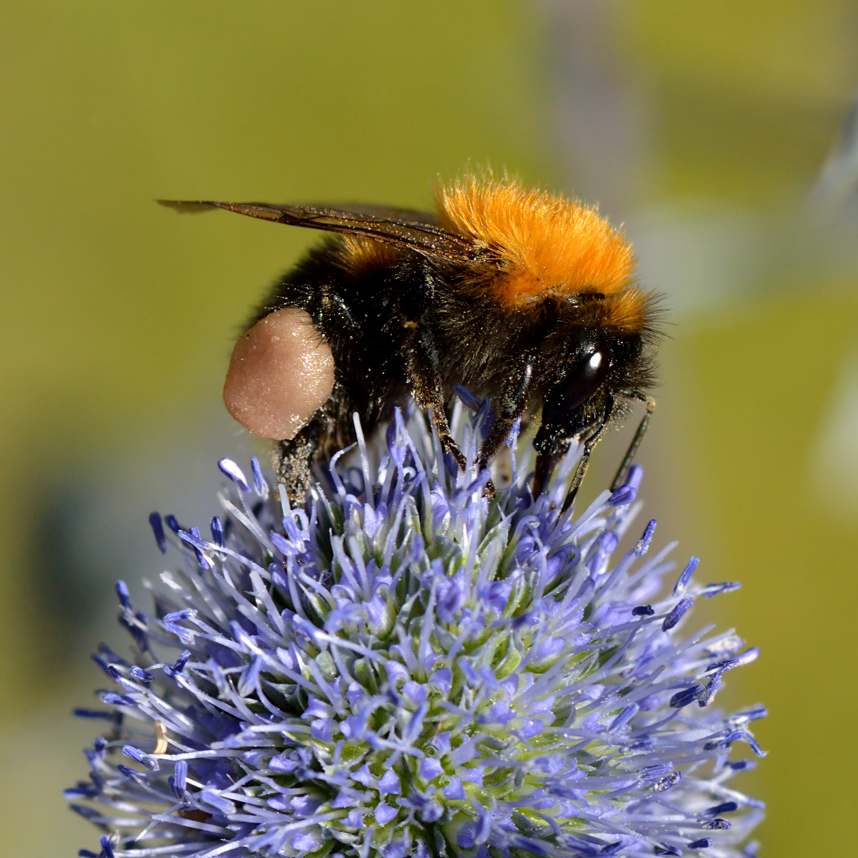
''Eryngium alpinum'', the alpine sea holly, alpine eryngo or queen of the Alps, is a herbaceous perennial plant in the family Apiaceae. Description ''Eryngium alpinum'' is a hemicryptophyte, its overwintering buds are situated just below the soil surface and the floral axis more or less erect with a few leaves.Pignatti S. - Flora d'Italia ŌĆō Edagricole ŌĆō 1982. Vol. II, pag. 176 The roots are deep and robust. The stems are solitary and erect, usually with three branches on the apex and with longitudinal purple stripes. This plant generally reaches about in height, with a maximum of . The basal leaves are oval or heart-shaped, wide and long, with toothed hedges and a long petiole. The cauline leaves are sessile and progressively more divided. The inflorescences are dense umbels at the top of the main branches. They are bright green at the bases and the stiff, bristly bracts are blue. They are about 4 cm long and 2 cm diameter and the bracts are up to long. The fl ... [...More Info...] [...Related Items...] OR: [Wikipedia] [Google] [Baidu] |
Moehringia Villosa
''Moehringia villosa'', commonly known as the short-haired sandwort, is a flowering plant of the family Caryophyllaceae. It is endemic to Slovenia where it has a very limited range with an extent of occurrence of less than in the southern parts of the Julian Alps. It grows in cracks in sunny, rocky and dry areas. Habitat, distribution, and ecology ''Moehringia villosa'' is endemic to Slovenia, with a restricted distribution in the southern Julian Alps and their foothills. Its known distribution area spans from its easternmost locality under Mt. Ho─Ź above the village of Podporezen (┼Įelezniki municipality), to its northeasternmost locality under Skopska Crna Gora in the area of Home (Bohinj municipality). The southernmost populations occur at Hudi─Źev rob under Mt. Kojca (Cerkno municipality), while the northwesternmost localityŌĆöwhich represents the extreme northwestern boundary of the species' entire global rangeŌĆöis at Curk waterfall under Mt. Krn (Kobarid municipality) ... [...More Info...] [...Related Items...] OR: [Wikipedia] [Google] [Baidu] |
Green Alder
''Alnus alnobetula'' is a common tree widespread across much of Europe, Asia, and North America. Many sources refer to it as ''Alnus viridis'', the green alder, but botanically this is considered an illegitimate name synonymous with ''Alnus alnobetula'' subsp. ''fruticosa''. Description It is a large shrub or small tree tall with smooth grey bark even in old age. The leaves are shiny green with light green undersurfaces, ovoid, long and 2ŌĆō6 cm broad. The flowers are catkins, appearing late in spring after the leaves emerge (unlike other alders which flower before leafing out); the male catkins are pendulous, 4ŌĆō8 cm long, the female catkins 1 cm long and 0.7 cm broad when mature in late autumn, in clusters of 3ŌĆō10 on a branched stem. The seeds are small, long, light brown with a narrow encircling wing. The roots of ''Alnus viridis subsp. sinuata'' have nitrogen-fixing nodules. A study in Alaska showed that Sitka alder seedlings were able to invade coa ... [...More Info...] [...Related Items...] OR: [Wikipedia] [Google] [Baidu] |


