|
ĂśskĂĽdar
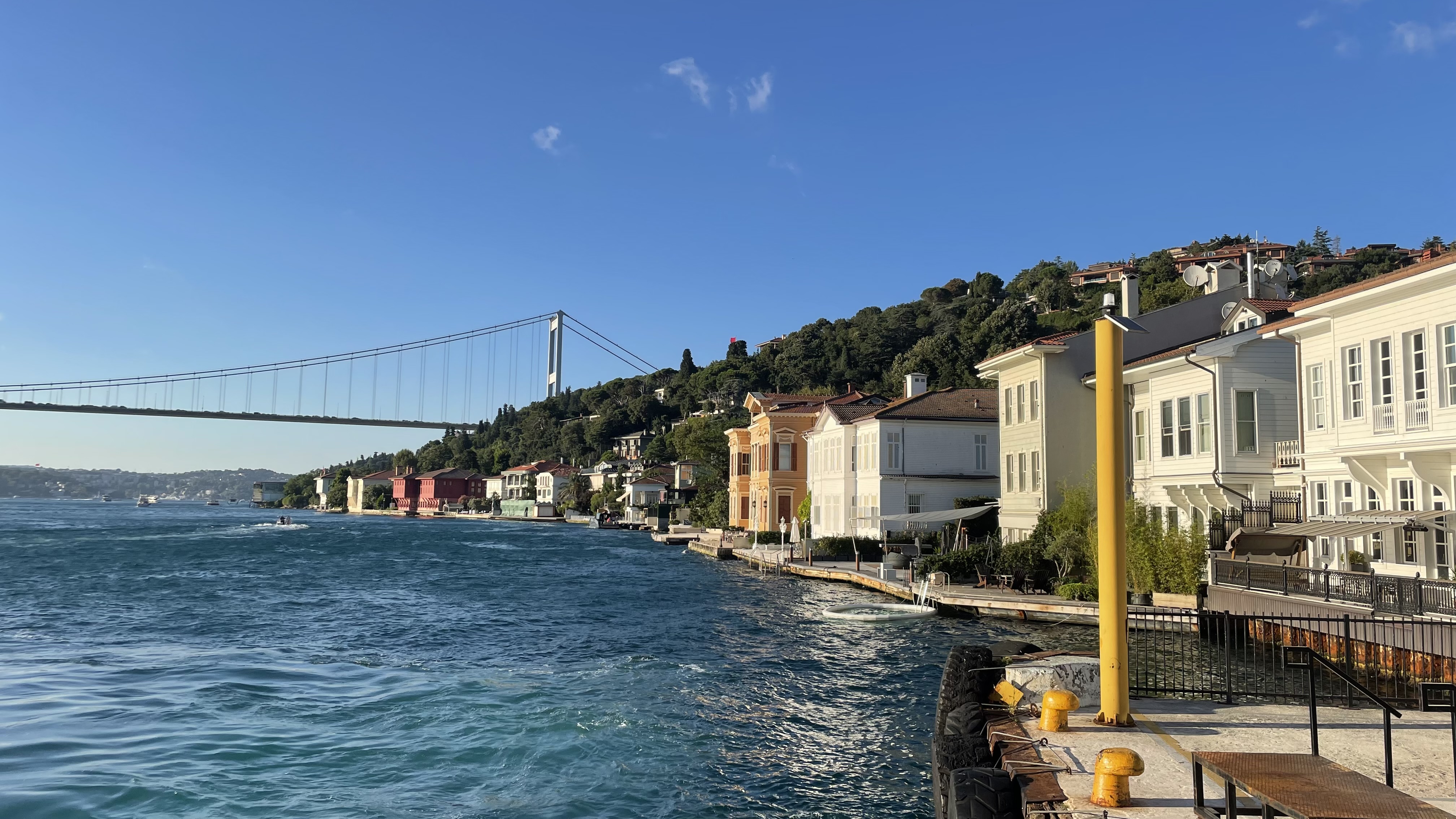
Üsküdar () is a municipality and district of Istanbul Province, Turkey. Its area is 35 km2, and its population is 524,452 (2022). It is a large and densely populated district on the Anatolian (Asian) shore of the Bosphorus. It is bordered to the north by Beykoz, to the east by Ümraniye, to the southeast by Ataşehir and to the south by Kadıköy; with Karaköy, Kabataş, Beşiktaş, and the historic Sarayburnu quarter of Fatih facing it on the opposite shore to the west. Üsküdar has been a conservative cultural center of the Anatolian side of Istanbul since Ottoman times with its landmark as well as numerous tiny mosques and dergahs. Üsküdar is a major transport hub, with ferries to Eminönü, Karaköy, Kabataş, Beşiktaş and some of the Bosphorus suburbs. Üsküdar is a stop on the Marmaray rail service at the point where it starts its journey under the Bosphorus, re-emerging on the European side at Sirkeci. Via Marmaray, Üsküdar is linked to Gebz ... [...More Info...] [...Related Items...] OR: [Wikipedia] [Google] [Baidu] [Amazon] |
Istanbul Metro
The Istanbul Metro () is a rapid transit railway network that serves the city of Istanbul, Turkey. Apart from the M11 line, which is operated by TCDD Taşımacılık, the system is operated by Metro Istanbul, a public enterprise controlled by the Istanbul Metropolitan Municipality. The oldest section of the metro is the M1 line, which opened on 3 September 1989. As of 2024, the system now includes 159 stations in service, with 36 more under construction. With 243.3 kilometers, Istanbul has the 21st longest metro line in the world and the 4th longest in Europe as of 2024. The system consists of eleven lines: the lines designated M1A (Istanbul Metro), M1A, M1 (Istanbul Metro), M1B, M2 (Istanbul Metro), M2, M3 (Istanbul Metro), M3, M6 (Istanbul Metro), M6, M7 (Istanbul Metro), M7, M9 (Istanbul Metro), M9 and M11 (Istanbul Metro), M11 are on the European side of the Bosporus, while lines M4 (Istanbul Metro), M4, M5 (Istanbul Metro), M5 and M8 (Istanbul Metro), M8 are on the Asian si ... [...More Info...] [...Related Items...] OR: [Wikipedia] [Google] [Baidu] [Amazon] |
Bosphorus
The Bosporus or Bosphorus Strait ( ; , colloquially ) is a natural strait and an internationally significant waterway located in Istanbul, Turkey. The Bosporus connects the Black Sea to the Sea of Marmara and forms one of the continental boundary between Asia and Europe, boundaries between Asia and Europe. It also divides Turkey by separating Anatolia, Asia Minor from East Thrace, Thrace. It is the world's narrowest strait used for international waterway, international navigation. Most of the shores of the Bosporus Strait, except for the area to the north, are heavily settled, with the city of Istanbul's metropolitan area, metropolitan population of 17 million inhabitants extending inland from both banks. The Bosporus Strait and the Dardanelles Strait at the opposite end of the Sea of Marmara are together known as the Turkish Straits. Sections of the shore of the Bosporus in Istanbul have been reinforced with concrete or rubble and those sections of the strait prone t ... [...More Info...] [...Related Items...] OR: [Wikipedia] [Google] [Baidu] [Amazon] |
Ĺžemsi Pasha Mosque
The Şemsi Pasha Mosque (, also spelled ''Chamsi-Pasha'') is an Ottoman mosque located in the large and densely populated district of Üsküdar, in Istanbul, Turkey. History The Şemsi Pasha Mosque was designed by Ottoman imperial architect Mimar Sinan for Şemsi Pasha. The Mosque is one of the smallest of Mimar Sinan's works in Istanbul, however its miniature dimensions combined with its picturesque waterfront location have made it one of the most attractive mosques in the city. The Mosque is a celebrated example of the chief architect's skill in organically blending architecture with the natural landscape. Architecture The complex stands on a roughly rectangular site aligned east–west with the Bosphorus shoreline. The square, single domed mosque abuts the coast at an angle, with the adjoining mausoleum of the donor projecting towards the waterfront. The garden, which over-looks the Bosphorus, is surrounded on two sides by the madrasa, with the mosque on the third side ... [...More Info...] [...Related Items...] OR: [Wikipedia] [Google] [Baidu] [Amazon] |
Maiden's Tower
__NOTOC__ The Maiden's Tower (), also known as Leander's Tower (''Tower of Leandros'') since the Byzantine period, is a tower on a small islet at the southern entrance of the Bosphorus strait, from the coast of ĂśskĂĽdar in Istanbul, Turkey. The tower appeared on the Obverse and reverse, reverse of the Turkish 10 Turkish lira, lira banknote from 1966 to 1981. History After the Battle of Cyzicus, naval victory at Cyzicus, in 408 BC the Athens, Athenian general Alcibiades probably built a custom station for ships coming from the Black Sea on a small rock called Arcla (small castle) and Damialis (its calf) in front of ĂśskĂĽdar#Chrysopolis, Chrysopolis (today's ĂśskĂĽdar).MĂĽller-Wiener (1976), p. 334 In 1110 Byzantine Empire, Byzantine Emperor Alexios I Komnenos, Alexius Comnenus built a wooden tower protected by a stone wall. From the tower an iron chain stretched across to another tower erected on the European shore in the Mangana (Constantinople), Mangana quarter of Con ... [...More Info...] [...Related Items...] OR: [Wikipedia] [Google] [Baidu] [Amazon] |
Ăśmraniye
Ümraniye () is a municipality and Districts of Turkey, district of Istanbul Province, Istanbul Province, Turkey. Its area is 46 km2, and its population is 723,760 (2023). It was separated from Üsküdar in 1987. It is bordered by Çekmeköy to the northeast, Sancaktepe to the east, Ataşehir to the south, Üsküdar to the west and Beykoz to the northwest. History Ümraniye is located on high ground just inland from Üsküdar. It was originally a small village of less than 900 inhabitants, mainly coming from the Black Sea Region in the 1950s. Its population grew far beyond its capacity during the 1970s and 1980s due to human migration, migration to the cities from rural areas of Anatolia. On 17 March 1978, Ümraniye massacre, 5 workers were massacred by Communist militants in the district. The growth of Ümraniye was relatively better controlled than other districts that also attracted workers on the European side (such as Esenler or Gaziosmanpaşa); there are wider roads thr ... [...More Info...] [...Related Items...] OR: [Wikipedia] [Google] [Baidu] [Amazon] |
Kadıköy
Kadıköy () is a municipality and Districts of Turkey, district on the Asian side of Istanbul Province, Istanbul Province, Turkey. Its area is 25 km2, and its population is 467,919 (2023). It is a large and populous area in the Asian side of Istanbul, on the northern shore of the Sea of Marmara. It partially faces the historic city centre of Fatih on the European side of the Bosporus. It is bordered by the districts of Üsküdar, to the northwest, Ataşehir, to the northeast, and Maltepe, Istanbul, Maltepe, to the southeast. Kadıköy was known in classical antiquity and during the Roman Empire, Roman and Byzantine Empire, Byzantine eras as Chalcedon (). Chalcedon was known as the 'city of the blind'. The settlement has been under control of many empires, finally being taken by the Ottomans before the fall of Constantinople. At first, Chalcedon was Rural area, rural, but with time it Urbanization, urbanized. Kadıköy separated from the Üsküdar district in 1928. One o ... [...More Info...] [...Related Items...] OR: [Wikipedia] [Google] [Baidu] [Amazon] |
Beylerbeyi Palace
The Beylerbeyi Palace () is a 19th-century Ottoman palace located in the Beylerbeyi neighborhood of Istanbul’s Üsküdar district, on the Asian shore of the Bosporus. Commissioned by Sultan Abdulaziz and completed between 1861 and 1865, the palace served as a summer residence and a place to host foreign dignitaries. Its design combines European architectural influences, particularly Neo-Baroque, with traditional Ottoman interior decoration. Today, it functions as a museum open to the public. History Beylerbeyi Palace was commissioned by Sultan Abdülaziz (1830–1876) and constructed between 1861 and 1865 to serve as a summer residence and a venue for hosting visiting heads of state. Empress Eugénie of France visited Beylerbeyi on her way to the opening of the Suez Canal in 1869. Empress Eugénie of France was so delighted by the elegance of the palace that she had a copy of the window in the guest room made for her bedroom in Tuileries Palace, in Paris. The palace also wel ... [...More Info...] [...Related Items...] OR: [Wikipedia] [Google] [Baidu] [Amazon] |
Anadolukavağı
Anadolukavağı (sometimes written as Anadolu Kavağı) is a neighbourhood in the municipality and district of Beykoz, Istanbul Province, Turkey. Its population is 1,517 (2022). It is at the northern end of the Bosphorus. "Anadolu" is the Turkish name for Anatolia, and "kavak" meant "control post" in Ottoman Turkish, suggesting the strategic importance of its location. It is directly across from Rumeli Kavağı, the Greek or European control post on the other side of the Bosphorus. Anadolu Kavağı was originally called Hieron () and was an important outpost for the Romans and the Byzantines. It has been suggested that in the past some villagers acted as 'wreckers', lighting fires to disorient ships and ground them in the narrow Strait so that they could seize their cargo. Others claim that Anadolu Kavağı served as a refuge where trade ships could shelter from storms. Once a fishing village, it retains a village atmosphere and has many fish restaurants offering lunches for pa ... [...More Info...] [...Related Items...] OR: [Wikipedia] [Google] [Baidu] [Amazon] |
Shkodër
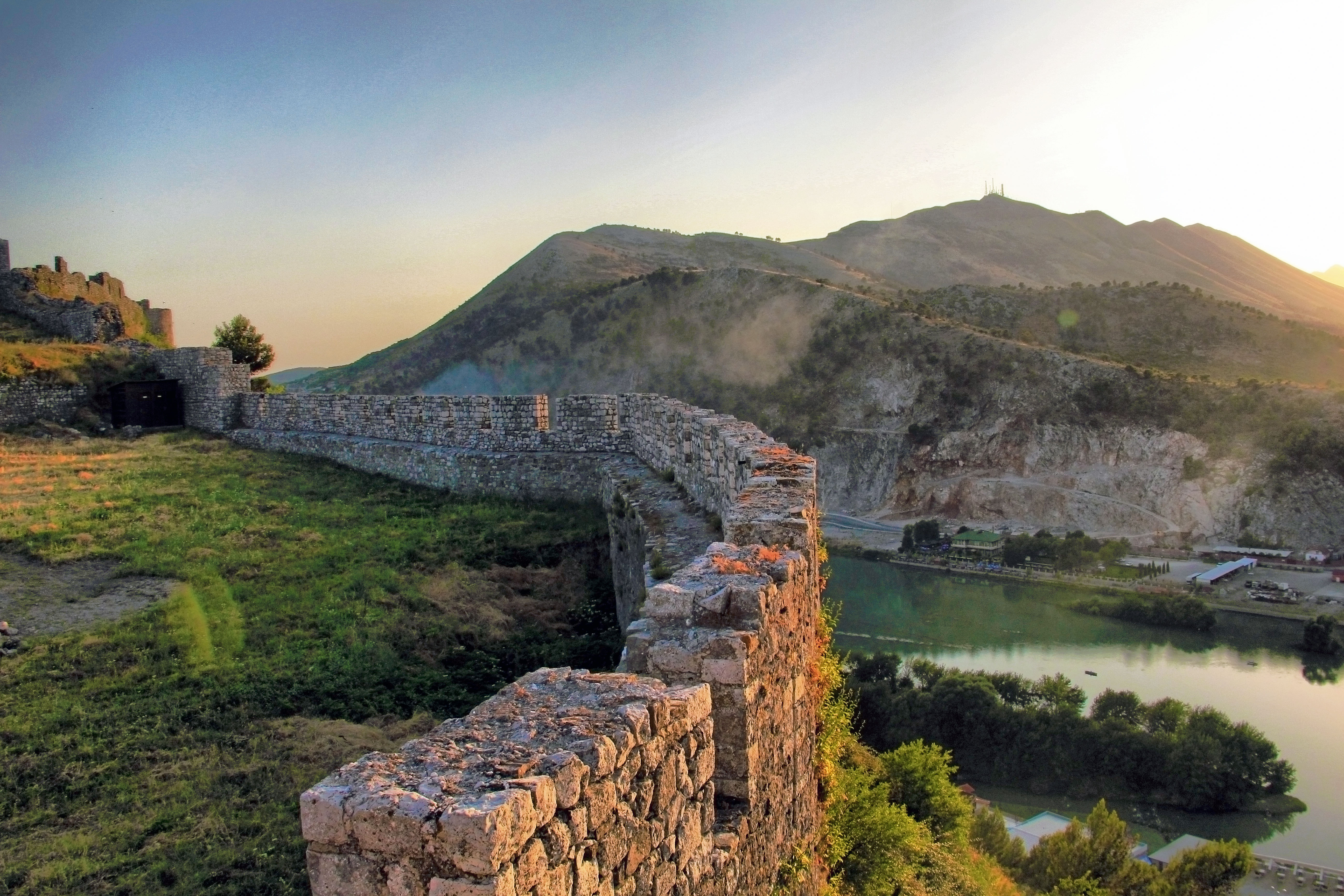
Shkodër ( , ; sq-definite, Shkodra; historically known as Scodra or Scutari) is the List of cities and towns in Albania, fifth-most-populous city of Albania and the seat of Shkodër County and Shkodër Municipality. Shkodër has been List of oldest continuously inhabited cities, continuously inhabited since the Early Bronze Age ( 2250–2000 BC), and has roughly 2,200 years of recorded history. The city sprawls across the Plain of Mbishkodra between the southern part of Lake Skadar, Lake Shkodër and the foothills of the Albanian Alps on the banks of the Buna (Adriatic Sea), Buna, Drin (river), Drin and Kir (river), Kir rivers. Due to its proximity to the Adriatic Sea, Shkodër is affected by a seasonal Mediterranean climate with Continental climate, continental influences. An urban settlement called ''Skodra'' was founded by the Illyrians, Illyrian tribe of Labeatae in the 4th century BCE. It became the capital of the Illyrian kingdom under the Ardiaei and Labeatae and was one ... [...More Info...] [...Related Items...] OR: [Wikipedia] [Google] [Baidu] [Amazon] |
Çekmeköy (Istanbul Metro)
Çekmeköy is an underground station on the M5 line of the Istanbul Metro in Çekmeköy. The station is located on Şile Highway in the Mehmet Akif neighborhood of Çekmeköy. Connection to IETT city buses is available at street level. The M5 line operates as fully automatic unattended train operation (UTO). The station consists of an island platform with two tracks. Since the M5 is an ATO line, protective gates on each side of the platform open only when a train is in the station. Çekmeköy station was opened on 21 October 2018. It was the eastern terminus of the line until the extension to Samandıra Merkez opened on 16 March 2024. The station has 2 exits. There are 6 elevators and 12 escalators. Station layout Connections Connection to IETT The Istanbul Electricity, Tram and Tunnel Establishments () or İETT is the transportation authority in Istanbul connected to the Istanbul Metropolitan Municipality specializing in public transportation. History Afte ... [...More Info...] [...Related Items...] OR: [Wikipedia] [Google] [Baidu] [Amazon] |
Marmaray
Marmaray () is a commuter rail line located in Istanbul, Turkey. The line runs from Halkalı, on the European side, to Gebze, on the Asian side, along the north shore of the Sea of Marmara. Mostly using the right-of-way of two existing commuter rail lines, the Marmaray line linked the two lines via a tunnel under the Bosporus strait, becoming the first standard gauge rail connection between Europe and Asia (all prior connections ran through Russia and used the incompatible Russian broad gauge). The two existing sections of the line were rebuilt and expanded from two tracks to three tracks, to allow for higher capacity with intercity and freight rail. The name ''Marmaray'' is a portmanteau of the words ''Marmara'' and ''Ray'', which is Turkish for ''rail''. History Construction started in 2004 and was originally intended to be completed by April 2009. [...More Info...] [...Related Items...] OR: [Wikipedia] [Google] [Baidu] [Amazon] |
AtaĹźehir
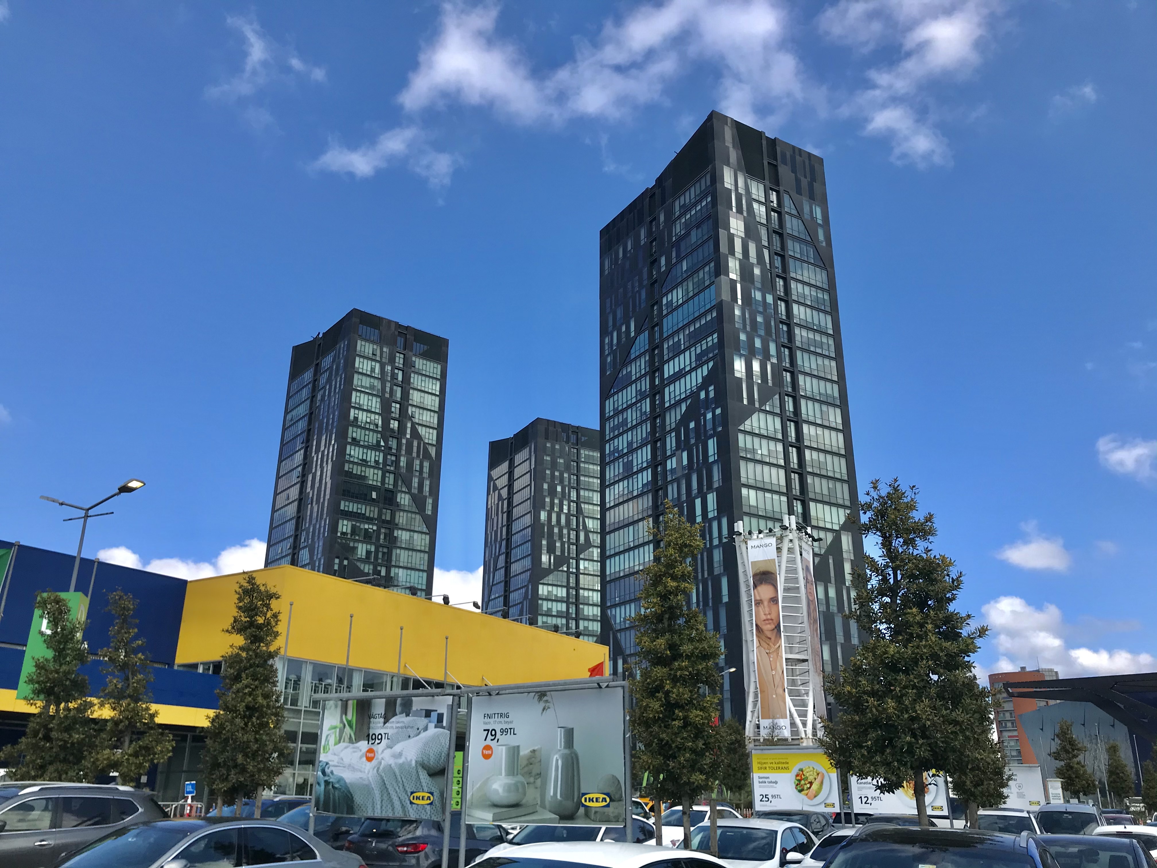
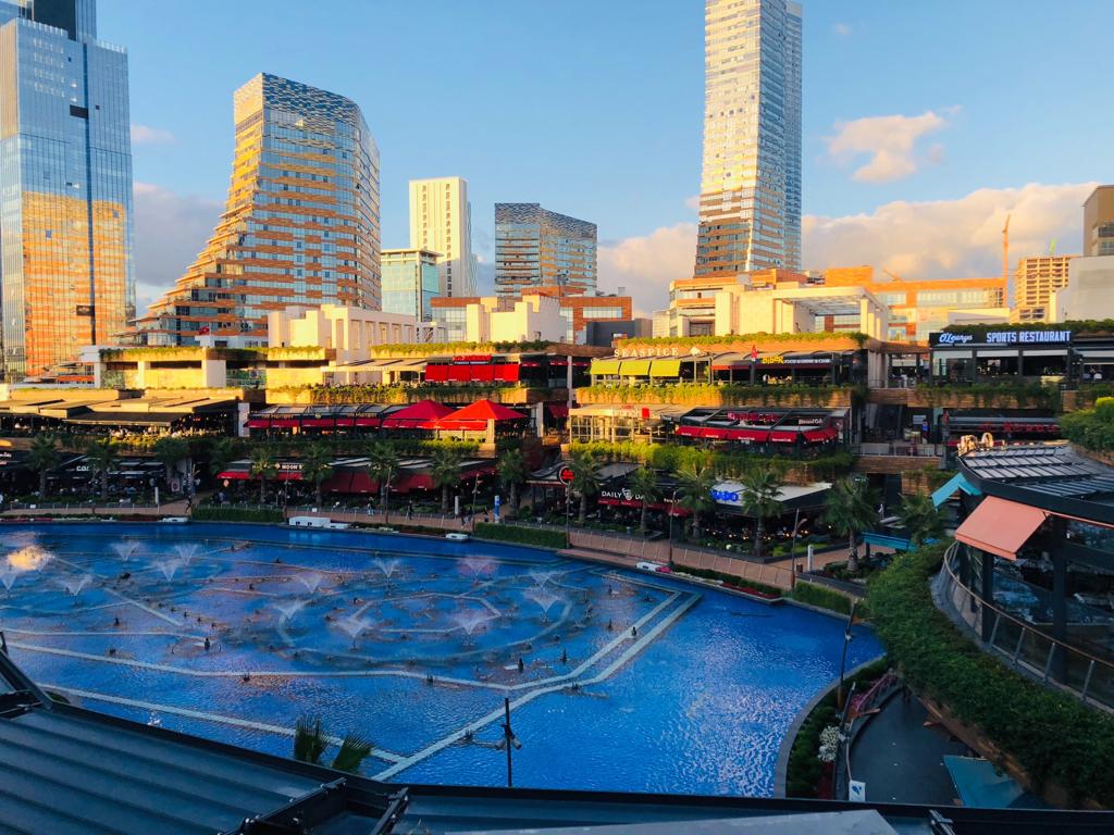
Ataşehir is a municipality and Districts of Turkey, district of Istanbul, Istanbul, Turkey. Its area is 25 km2, and its population is 423,127 (2022). It is located at the junction of the Otoyol 2, O-2 and Otoyol 4, O-4 motorways on the Anatolian (Asian) side of Istanbul. Its neighbours are the districts of Ümraniye to the north, Sancaktepe to the northeast, Maltepe, Istanbul, Maltepe to the east, Kadıköy to the south and Üsküdar to the west. Since 2023, Ataşehir is home to the Istanbul Financial Center (IFC), where the new headquarters of the state-owned Turkish banks, such as the Central Bank of the Republic of Turkey, Turkish Central Bank, Ziraat Bank, VakıfBank and Halkbank, are located. Until 2023, the headquarters of these banks were in Ankara. As of 2024, the tallest buildings in Ataşehir are the CBRT Tower, Turkish Central Bank Tower, which is followed by Metropol Istanbul Tower, Metropol Istanbul Tower A (70 floors / 301 metres including its twin spires). Un ... [...More Info...] [...Related Items...] OR: [Wikipedia] [Google] [Baidu] [Amazon] |


