|
Étienne Martellange
Étienne Martellange (22 December 1569 – 3 October 1641) was a French Jesuit architect and draftsman. He travelled widely in France as an architect for the Jesuit order and designed more than 25 buildings, mostly schools and their associated chapels or churches. His buildings reflect the Baroque style of the Counter-Reformation and include the Chapelle de la Trinité in Lyon and the church of Saint-Paul-Saint-Louis in Paris. In the course of his travels he made almost 200 detailed pen drawings depicting views of towns, buildings and monuments. These pictures have survived and provide an important historical record of French towns in the first third of the 17th century. Life Martellange was born in Lyon on 22 December 1569. His father, also named Étienne Martellange, was a well-known painter in the town. Martellange had two brothers, Bernoît and Olivier, who both became Jesuits. Almost nothing is known about his early life. Although it was once believed that he may have spent ... [...More Info...] [...Related Items...] OR: [Wikipedia] [Google] [Baidu] |
Lyon
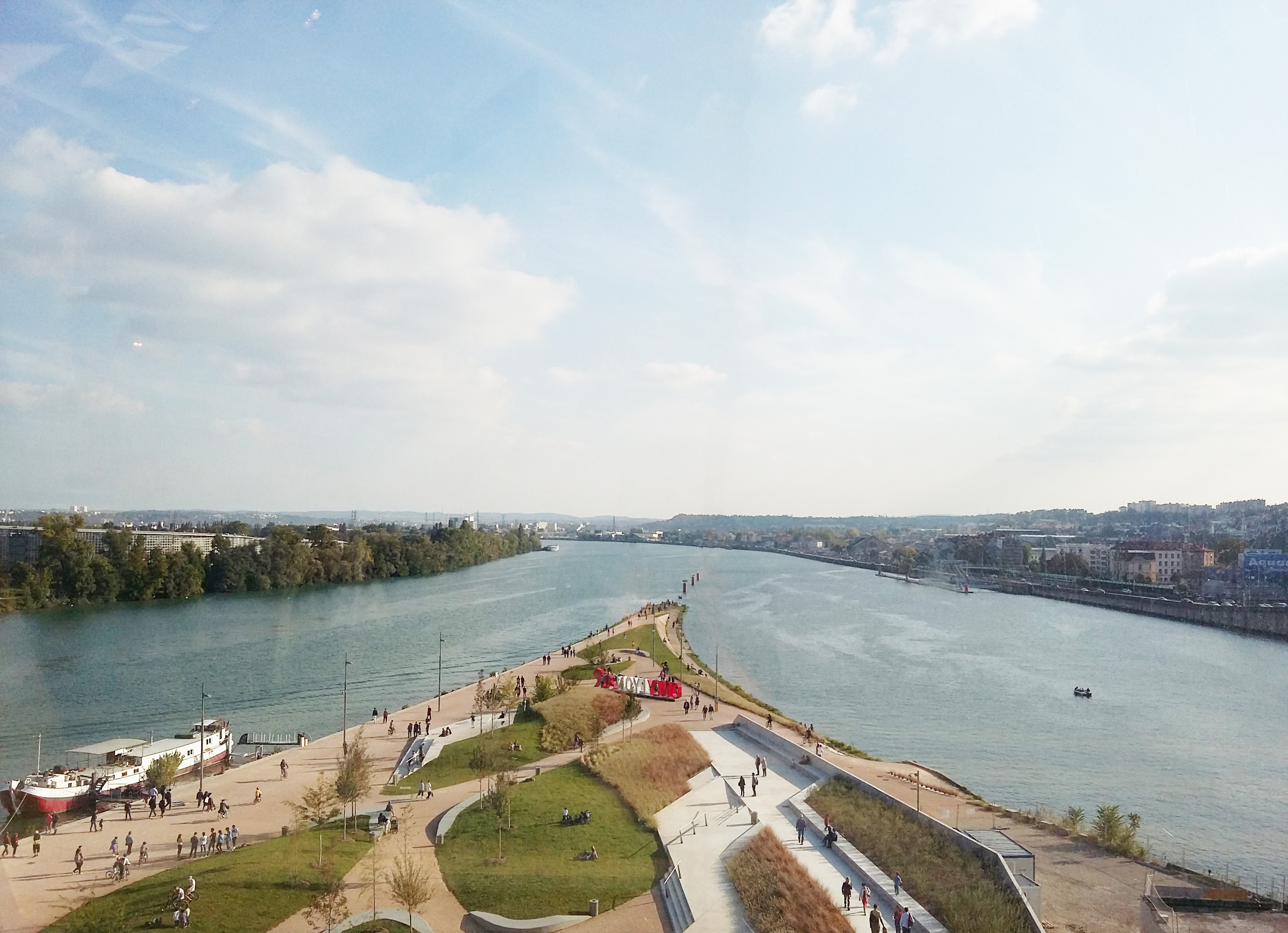
Lyon (Franco-Provençal: ''Liyon'') is a city in France. It is located at the confluence of the rivers Rhône and Saône, to the northwest of the French Alps, southeast of Paris, north of Marseille, southwest of Geneva, Switzerland, northeast of Saint-Étienne. The City of Lyon is the List of communes in France with over 20,000 inhabitants, third-largest city in France with a population of 522,250 at the Jan. 2021 census within its small municipal territory of , but together with its suburbs and exurbs the Lyon Functional area (France), metropolitan area had a population of 2,308,818 that same year, the second largest in France. Lyon and 58 suburban municipalities have formed since 2015 the Lyon Metropolis, Metropolis of Lyon, a directly elected metropolitan authority now in charge of most urban issues, with a population of 1,424,069 in 2021. Lyon is the Prefectures in France, prefecture of the Auvergne-Rhône-Alpes Regions of France, region and seat of the Departmental co ... [...More Info...] [...Related Items...] OR: [Wikipedia] [Google] [Baidu] |
National Library Of Malta
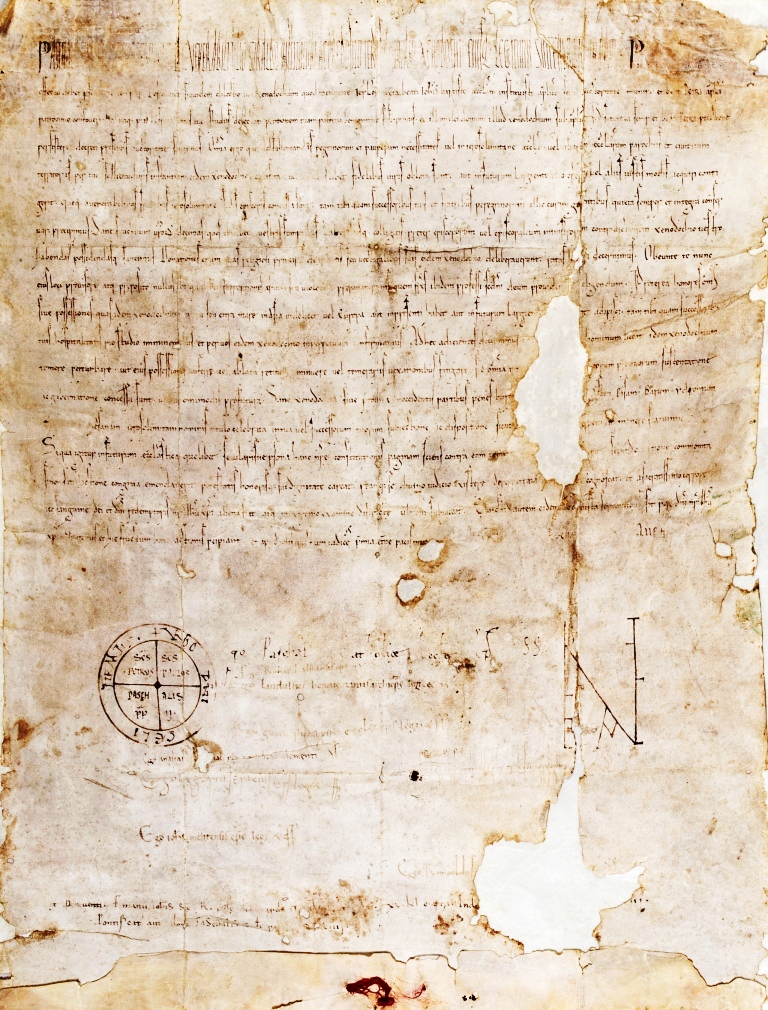
The National Library of Malta (), often known as the Bibliotheca (), is a reference library in Republic Square, Valletta, Republic Square, Valletta, Malta. It was founded by Grand Master Emmanuel de Rohan-Polduc in 1776 out of the collections of the knight Louis Guérin de Tencin. It has been a legal deposit library since 1925, and it has the largest collection of Melitensia along with that of the University of Malta. The library also contains the archives of the Knights Hospitaller, Order of St. John, the Università of Mdina and the Università of Valletta. The library is housed in a late 18th-century Neoclassical architecture, neoclassical building in the city centre, close to the Grandmaster's Palace (Valletta), Grandmaster's Palace, designed by Polish-Italian architects Stefano Ittar and his son Sebastiano Ittar. History The origins of the National Library of Malta go back to 1555, when Grand Master Claude de la Sengle decreed that all books belonging to deceased members ... [...More Info...] [...Related Items...] OR: [Wikipedia] [Google] [Baidu] |
Blois
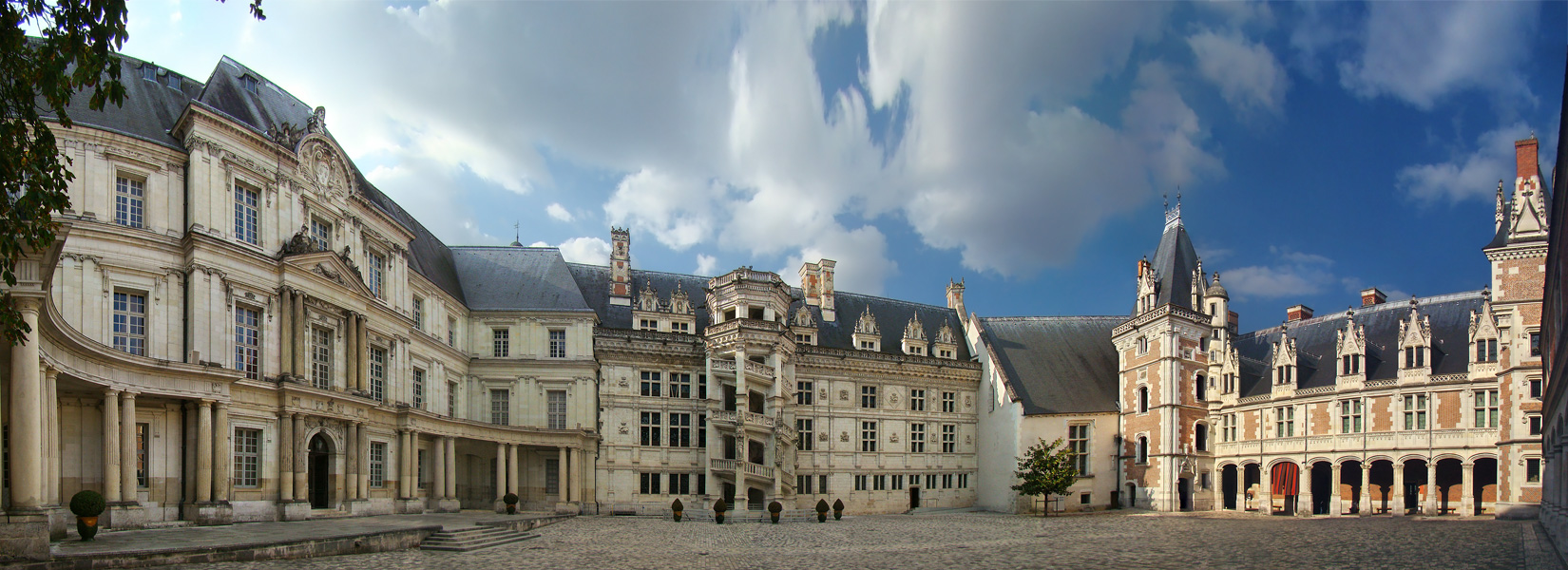
Blois ( ; ) is a commune and the capital city of Loir-et-Cher Departments of France, department, in Centre-Val de Loire, France, on the banks of the lower Loire river between Orléans and Tours. With 45,898 inhabitants by 2019, Blois is the most populated city of the department, and the 4th of the region. Historically, the city was the capital of the County of Blois, created in 832 until its integration into the Royal domain in 1498, when Count Louis II of Orléans became Louis XII, King Louis XII of France. During the Renaissance, Blois was the official residence of the King of France. History Pre-history Since 2013, excavations have been conducted by French National Institute of Preventive Archaeological Research (''INRAP'' in French) in Blois-Vienne, Vienne where evidence was found of "one or more camps of Prehistory, Prehistoric hunter-gatherers, who also fished due to fishing traps found there. They were Neolithic farmer-herders, who were present in the area around 6,0 ... [...More Info...] [...Related Items...] OR: [Wikipedia] [Google] [Baidu] |
Rennes
Rennes (; ; Gallo language, Gallo: ''Resnn''; ) is a city in the east of Brittany in Northwestern France at the confluence of the rivers Ille and Vilaine. Rennes is the prefecture of the Brittany (administrative region), Brittany Regions of France, region and Ille-et-Vilaine Departments of France, department. In 2021, its Urban unit, urban area had a population of 371,464 inhabitants, while the larger Functional area (France), metropolitan area had a population of 771,320.Comparateur de territoire Unité urbaine 2020 de Rennes (35701), Aire d'attraction des villes 2020 de Rennes (013) INSEE. The inhabitants of Rennes are called ''Rennais'' (masculine) and ''Rennaises'' (feminine) in French language, French. ... [...More Info...] [...Related Items...] OR: [Wikipedia] [Google] [Baidu] |
La Flèche
La Flèche () is a town and commune in the French department of Sarthe, in the Pays de la Loire region in the Loire Valley. It is the sub-prefecture of the South-Sarthe, the chief district and the chief city of a canton, and the second most populous city of the department. The city is part of the Community of communes of the Pays La Flèche. The inhabitants of the town are called ''Fléchois''. The Prytanée National Militaire is located in La Flèche. Geography La Flèche is located on the Loir River and is also on the Greenwich Meridian. It is located halfway between Le Mans (45 km) and Angers. City communes * Sainte-Colombe * Saint-Germain-du-Val * Verron Neighboring municipalities * Bazouges Cré sur Loir * Crosmières * Villaines-sous-Malicorne * Bousse * Clermont-Créans * Mareil-sur-Loir * Thorée-les-Pins * Baugé-en-Anjou (Maine-et-Loire) History The origin of the name ''La Flèche'' is uncertain; the word ''flèche'' means "arrow" in French. Hist ... [...More Info...] [...Related Items...] OR: [Wikipedia] [Google] [Baidu] |
Bourges
Bourges ( ; ; ''Borges'' in Berrichon) is a commune in central France on the river Yèvre (Cher), Yèvre. It is the capital of the Departments of France, department of Cher (department), Cher, and also was the capital city of the former provinces of France, province of Berry (province), Berry. History The name of the commune derives either from the Bituriges Cubi, Bituriges, the name of the original inhabitants, or from the Germanic languages, Germanic word ''wikt:burg, Burg'' (French: ''bourg''; Spanish: ''burgo''; English, others: ''burgh'', ''wikt:berg, berg'', or ''borough''), for "hill" or "village". The Celts called it ''Avaricon''; Latin-speakers: ''Avaricum''. In the fourth century BC, as in the time of Julius Caesar, Caesar, the area around it was the center of a Gallic (Celtic) confederacy. In 52 BC, the sixth year of the Gallic Wars, while the Gauls implemented a scorched-earth policy to try to deny Caesar's forces supplies, the inhabitants of Avaricum convinced th ... [...More Info...] [...Related Items...] OR: [Wikipedia] [Google] [Baidu] |
Roanne
Roanne (; ; ) is a commune in the Loire department, central France. It is located northwest of Lyon on the river Loire. It has an important Museum, the ''Musée des Beaux-arts et d'Archéologie Joseph-Déchelette'' (French), with many Egyptian artifacts. Economy Roanne is known for gastronomy (largely because of the famous Troisgros family), textiles, agriculture and manufacturing tanks. Roanne station has rail connections to Clermont-Ferrand, Saint-Étienne, Moulins and Lyon. The Roanne region produces, particularly, fresh red wines designated as of the '' Cote Roannaise.'' History The toponymy is Gaulish, ''Rod-Onna'' ("flowing water") which became ''Rodumna'', then ''Rouhanne'' and ''Roanne''. The town was sited at a strategic point, the head of navigation on the Loire, below its narrow gorges. As a trans-shipping point, its importance declined with the collapse of long-distance trade after the fourth century. In the twelfth century, the site passed to the comte du ... [...More Info...] [...Related Items...] OR: [Wikipedia] [Google] [Baidu] |
Collège-lycée Ampère
The Collège-lycée Ampère () is a school located in the 2nd arrondissement of Lyon. History The school was founded in 1519 by members of the Brotherhood of the Trinity. It was then known as Collège de la Trinité. Under this name it was directed by the Jesuits from 1565 to 1762, then by the Oratorians until 1792. During the French Revolution, the building was occupied by the troops of the National Convention and renamed École centrale. Napoléon Bonaparte, then First Consul, was proclaimed President of the Italian Republic during a gathering called the 'consulte de Lyon' in the high chapel of the school and with a consular order of vendémiaire 24 year XI (16 October 1802), the property was transformed into Lycée impérial. Under the Restoration, it was renamed Collège royal, until the French Revolution of 1848, when it became the Lycée de Lyon. In 1888, it was named Lycée Ampère after physician André-Marie Ampère. It later became the first mixed college in France. ... [...More Info...] [...Related Items...] OR: [Wikipedia] [Google] [Baidu] |
Dijon
Dijon (, ; ; in Burgundian language (Oïl), Burgundian: ''Digion'') is a city in and the Prefectures in France, prefecture of the Côte-d'Or Departments of France, department and of the Bourgogne-Franche-Comté Regions of France, region in eastern France. the Communes of France, commune had a population of 156,920. The earliest archaeological finds within the city limits of Dijon date to the Neolithic Period (geology), period. Dijon later became a Roman Empire, Roman settlement named ''Divio'', located on the road between Lyon and Paris. The province was home to the Duke of Burgundy, Dukes of Burgundy from the early 11th until the late 15th centuries, and Dijon became a place of tremendous wealth and power, one of the great European centres of art, learning, and science. The city has retained varied architectural styles from many of the main periods of the past millennium, including Capetian, Gothic architecture, Gothic, and Renaissance architecture, Renaissance. Many still-i ... [...More Info...] [...Related Items...] OR: [Wikipedia] [Google] [Baidu] |
Le Puy-en-Velay
Le Puy-en-Velay (, ; , before 1988: ''Le Puy'') is the Prefectures in France, prefecture of the Haute-Loire Departments of France, department in the Auvergne-RhĂ´ne-Alpes Regions of France, region of south-central France. Located near the river Loire, the city is famous for its Le Puy Cathedral, cathedral, for a Le Puy green lentil, kind of lentil, for its lace-making, as well as for being the origin of the ''Chemin du Puy,'' one of the principal origin points of the pilgrimage Routes of Santiago de Compostela in France, route of Santiago de Compostela in France. In 2021, the Communes of France, commune had a population of 18,629. History Le Puy-en-Velay was a major Diocese, bishopric by the early period of France in the Middle Ages, medieval France. Its foundation is largely legendary. According to a martyrology compiled by Ado of Vienne, published in many copies in 858, and supplemented in the mid-10th century by Gauzbert of Limoges, a priest named George accompanied a certa ... [...More Info...] [...Related Items...] OR: [Wikipedia] [Google] [Baidu] |
Sisteron
Sisteron (; , ; from ) is a commune in the Alpes-de-Haute-Provence department, Provence-Alpes-CĂ´te d'Azur, southeastern France. Sisteron is situated on the banks of the river Durance just after the confluence of the rivers BuĂ«ch and Sasse. It is sometimes called the "Gateway to Provence" because it is in a narrow gap between two long mountain ridges. Despite its relatively small population, it serves as a long-distance navigation reference point, routinely signed as far away as Grenoble. It is from Marseille, also from Grenoble, from Nice and from Forcalquier. There are of forest and wood within the commune.Roger Brunet, ÂCanton de Sisteron», ''Le TrĂ©sor des rĂ©gions'', read 9 June 2013. History Sisteron has been inhabited for 4,000 years. The Romans used the route through Sisteron as can be shown by a Latin inscription in the rocks near the road to Authon. It escaped the barbarian invasions after the fall of Rome, but was ravaged by the Saracens. It was first ... [...More Info...] [...Related Items...] OR: [Wikipedia] [Google] [Baidu] |


