|
Étang De Crovani
The Étang de Crovani () is a coastal lagoon beside the Mediterranean Sea on the west coast of the Haute-Corse department on the French island of Corsica. Location The Étang de Crovani is on the west coast of Haute-Corse in the commune of Calenzana to the east of the Baie de Crovani. It is a permanent body of water separated from the sea by a bank of pebbles and gravel. The lagoon is behind the center of the Crovani beach (or Argentella beach), a beach of small pebbles more than long, which is known for its natural beauty but is rarely visited by tourists. It is north of the village of L'Argentella and west of the D81b road, which leads to the village of Vignaccia. The lagoon and surrounding marshes cover . Altitude ranges from . The main tributary is the Ruisseau de Marconcellu. Ecology The site is owned by the ''Conservatoire du littoral''. It is classified as a ''Zone naturelle d'intérêt écologique, faunistique et floristique (ZNIEFF) Continentale de type 1''. The lag ... [...More Info...] [...Related Items...] OR: [Wikipedia] [Google] [Baidu] |
Corsica
Corsica ( , , ; ; ) is an island in the Mediterranean Sea and one of the Regions of France, 18 regions of France. It is the List of islands in the Mediterranean#By area, fourth-largest island in the Mediterranean and lies southeast of the Metropolitan France#Hexagon, French mainland, west of the Italian Peninsula and immediately north of the Italian island of Sardinia, the nearest land mass. A single chain of mountains makes up two-thirds of the island. , it had a population of 355,528. The island is a Single territorial collectivity, territorial collectivity of France, and is expected to achieve "a form of autonomy" in the near future. The regional capital is Ajaccio. Although the region is divided into two administrative Departments of France, departments, Haute-Corse and Corse-du-Sud, their respective regional and departmental Territorial collectivity, territorial collectivities were merged on 1 January 2018 to form the single territorial collectivity of Corsica. Corsican aut ... [...More Info...] [...Related Items...] OR: [Wikipedia] [Google] [Baidu] |
Mediterranean Sea
The Mediterranean Sea ( ) is a sea connected to the Atlantic Ocean, surrounded by the Mediterranean basin and almost completely enclosed by land: on the east by the Levant in West Asia, on the north by Anatolia in West Asia and Southern Europe, on the south by North Africa, and on the west almost by the Morocco–Spain border. The Mediterranean Sea covers an area of about , representing 0.7% of the global ocean surface, but its connection to the Atlantic via the Strait of Gibraltar—the narrow strait that connects the Atlantic Ocean to the Mediterranean Sea and separates the Iberian Peninsula in Europe from Morocco in Africa—is only wide. Geological evidence indicates that around 5.9 million years ago, the Mediterranean was cut off from the Atlantic and was partly or completely desiccation, desiccated over a period of some 600,000 years during the Messinian salinity crisis before being refilled by the Zanclean flood about 5.3 million years ago. The sea was an important ... [...More Info...] [...Related Items...] OR: [Wikipedia] [Google] [Baidu] |
Haute-Corse
Haute-Corse (; , or ; ) is a department of France, consisting of the northern part of the island of Corsica. The corresponding departmental territorial collectivity merged with that of Corse-du-Sud on 1 January 2018, forming the single territorial collectivity of Corsica, with territorial elections coinciding with the dissolution of the separate councils. However, even though its administrative powers were ceded to the new territorial collectivity, it continues to remain an administrative department in its own right. In 2019, it had a population of 181,933.Populations légales 2019: 2B Haute-Corse INSEE History [...More Info...] [...Related Items...] OR: [Wikipedia] [Google] [Baidu] |
Calenzana
Calenzana (; ) is a commune in the Haute-Corse department of France on the island of Corsica. In 1732 it was the site of an uprising by Corsican nationalists against the island's Genoese rulers. It is now best known as the starting (or finishing) point of the GR 20 long distance walk. The commune contains the Étang de Crovani, a coastal lagoon, that lies behind the Crovani beach (or Argentella beach) on Crovani bay. Population Monuments * Église Saint-Blaise de Calenzana See also *Communes of the Haute-Corse department The following is a list of the 236 Communes of France, communes of the Haute-Corse Departments of France, department of France. The communes cooperate in the following Communes of France#Intercommunality, intercommunalities (as of 2025): References Communes of Haute-Corse[...More Info...] [...Related Items...] OR: [Wikipedia] [Google] [Baidu] |
Conservatoire Du Littoral
The ''Conservatoire du littoral'' ("Coastal protection agency") (official name: ''Conservatoire de l'espace littoral et des rivages lacustres'') is a French public organisation created in 1975 to ensure the protection of outstanding natural areas on the coast, banks of lakes and stretches of water of 10 square kilometres or more. The Conservatoire is a member of the World Conservation Union. Its creation was inspired by the work of the British National Trust, though the National Trust is a private charity, whereas the Conservatoire du littoral is mainly government funded. Its remit covers all French départements, départements d'outre-mer, Mayotte, and, recently, Saint-Pierre and Miquelon. The Conservatoire acquires land by private agreement, by pre-emption in or, from time to time, by expropriation. Land may also be given to the Conservatoire by donation or legacy. The Conservatoire acquires 20 to 30 km2 of land yearly. After ensuring all the restoration work, the Con ... [...More Info...] [...Related Items...] OR: [Wikipedia] [Google] [Baidu] |
Zone Naturelle D'intérêt écologique, Faunistique Et Floristique
A Zone naturelle d'intérêt écologique, faunistique et floristique (Natural area of ecological, faunal and floristic interest), abbreviated as ZNIEFF, is a type of natural environment recognized by France. The inventory of a ZNIEFF area is an inventory of natural resources and scientific program launched in 1982 by Minister of Environment Huguette Bouchardeau and confirmed by the Act of July 12, 1983 called the Bouchardeau act. A ZNIEFF is not a measure of regulatory protection, but an inventory. It corresponds to the census of outstanding natural land areas in the twenty-two metropolitan areas as well as the overseas departments of France. The designation of a ZNIEFF based primarily on the presence of species or groups of species with strong heritage interest. The presence of at least one population of critical species (:fr:espèce déterminante in French) defines a ZNIEFF. This is one of the bases for prioritizing natural heritage issues as part of the :fr:Stratégies régiona ... [...More Info...] [...Related Items...] OR: [Wikipedia] [Google] [Baidu] |
Tamarix
The genus ''Tamarix'' (tamarisk, salt cedar, taray) is composed of about 50–60 species of flowering plants in the family Tamaricaceae, native to drier areas of Eurasia and Africa. The generic name originated in Latin and may refer to the Tamaris River in Hispania Tarraconensis (Spain). Description They are evergreen or deciduous shrubs or trees growing to in height and forming dense thickets. The largest, ''Tamarix aphylla'', is an evergreen tree that can grow to tall. They usually grow on saline soils, tolerating up to 15,000 ppm soluble salt, and can also tolerate alkaline conditions. Tamarisks are characterized by slender branches and grey-green foliage. The bark of young branches is smooth and reddish brown. As the plants age, the bark becomes gray-brown, ridged and furrowed. The leaves are scale-like, almost like that of junipers, long, and overlap each other along the stem. They are often encrusted with salt secretions. The pink to white flowers appear in dense ... [...More Info...] [...Related Items...] OR: [Wikipedia] [Google] [Baidu] |
Bulrush
Bulrush is a vernacular name for several large wetland graminoid, grass-like plants *Sedge family (Cyperaceae): **''Cyperus'' **''Scirpus'' **''Blysmus'' **''Bolboschoenus'' **''Scirpoides'' **''Isolepis'' **''Schoenoplectus'' **''Trichophorum'' *Typhaceae: **''Typha'' See also Rushes (Juncaceae) References {{Plant common name ... [...More Info...] [...Related Items...] OR: [Wikipedia] [Google] [Baidu] |
Juncaceae
Juncaceae is a family of flowering plants, commonly known as the rush family. It consists of 8 genera and about 464 known species of slow-growing, rhizomatous, herbaceous monocotyledonous plants that may superficially resemble grasses and sedges. They often grow on infertile soils in a wide range of moisture conditions. The best-known and largest genus is '' Juncus''. Most of the ''Juncus'' species grow exclusively in wetland habitats. A few rushes, such as '' Juncus bufonius'' are annuals, but most are perennials. Despite the apparent similarity, Juncaceae are not counted among the plants with the vernacular name bulrush. Description The leaves are evergreen and well-developed in a basal aggregation on an erect stem. They are alternate and tristichous (i.e., with three rows of leaves up the stem, each row of leaves arising one-third of the way around the stem from the previous leaf). Only in the genus '' Distichia'' are the leaves distichous. The rushes of the genus ... [...More Info...] [...Related Items...] OR: [Wikipedia] [Google] [Baidu] |
Pistacia Lentiscus
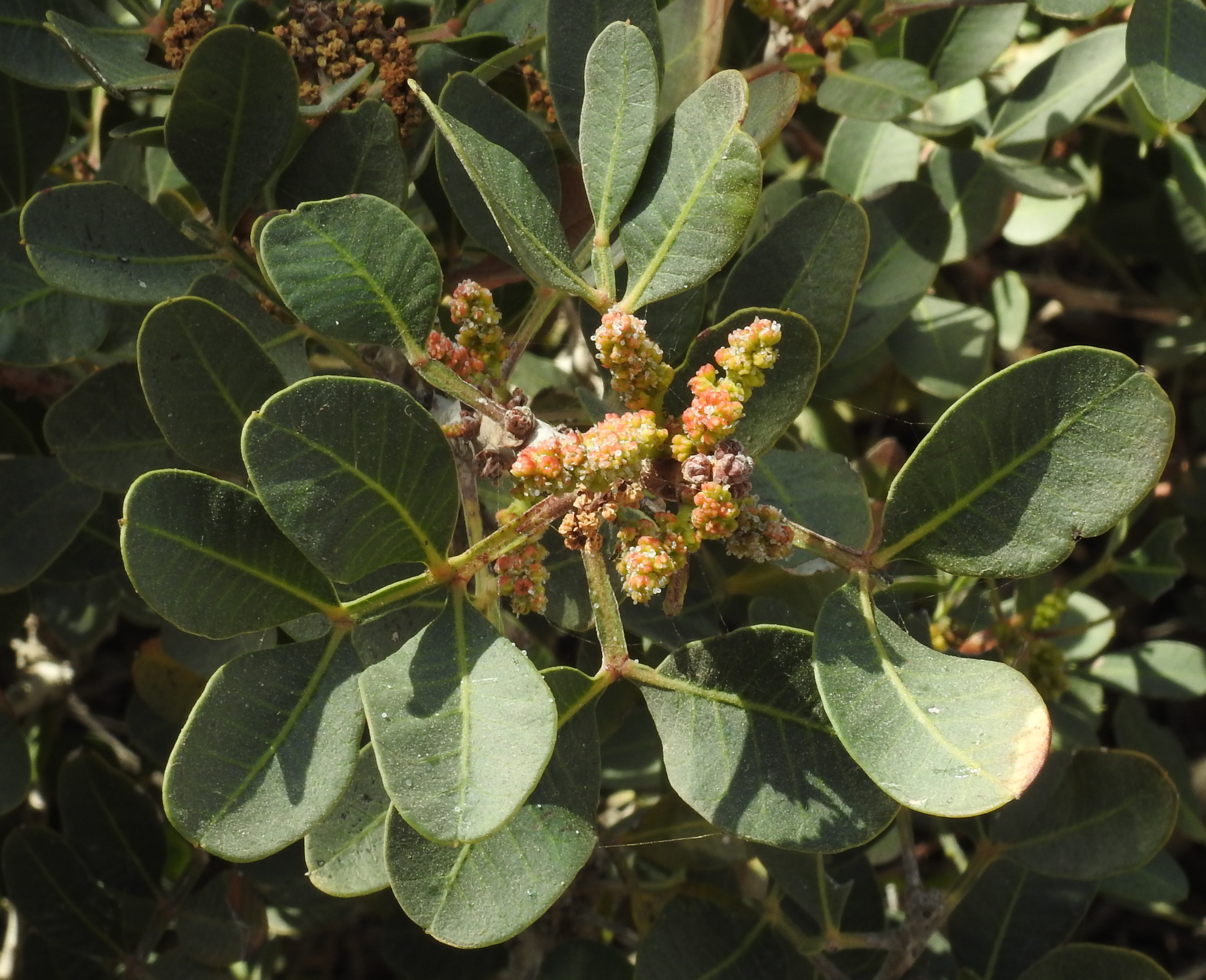
''Pistacia lentiscus'' (also lentisk or mastic) is a dioecious evergreen shrub or small tree of the genus '' Pistacia'' native to the Mediterranean Basin. It grows up to tall and is cultivated for its aromatic resin, mainly on the Greek island of Chios, around the Turkish town of Çeşme''Pistacia lentiscus'' L. a Mansfeld's Database Taxonomy and northern parts of Iraq. Description [...More Info...] [...Related Items...] OR: [Wikipedia] [Google] [Baidu] |
Köppen Climate Classification
The Köppen climate classification divides Earth climates into five main climate groups, with each group being divided based on patterns of seasonal precipitation and temperature. The five main groups are ''A'' (tropical), ''B'' (arid), ''C'' (temperate), ''D'' (continental), and ''E'' (polar). Each group and subgroup is represented by a letter. All climates are assigned a main group (the first letter). All climates except for those in the ''E'' group are assigned a seasonal precipitation subgroup (the second letter). For example, ''Af'' indicates a tropical rainforest climate. The system assigns a temperature subgroup for all groups other than those in the ''A'' group, indicated by the third letter for climates in ''B'', ''C'', ''D'', and the second letter for climates in ''E''. Other examples include: ''Cfb'' indicating an oceanic climate with warm summers as indicated by the ending ''b.'', while ''Dwb'' indicates a semi-Monsoon continental climate, monsoonal continental climate ... [...More Info...] [...Related Items...] OR: [Wikipedia] [Google] [Baidu] |
Sandre
Sandre stands for ''Service d’administration nationale des données et des référentiels sur l’eau'', or National Service for Water Data and Common Repositories Management of France. The Sandre service establishes the common water data language of the French national Water Information System (SIE: ''Système d’information sur l’eau''). Sandre is a division of the National Agency of Water and Aquatic Environments (Onema: ''Office national de l’eau et des milieux aquatiques''). Its technical secretariat is entrusted to the International Office for Water (OIE: ''Office International de l’Eau''). Missions The Sandre is in charge of describing water data and defining technical scenarios to allow data interchange between producers, users and databanks. These data are based on reference datasets (code lists) managed by the Sandre. Services The Sandre makes available specification documents (1) free of charge for water data interchanges. It maintains a permanent helpdesk ... [...More Info...] [...Related Items...] OR: [Wikipedia] [Google] [Baidu] |


