Wangdue Phodrang on:
[Wikipedia]
[Google]
[Amazon]
Wangdue Phodrang (,
 The town shares its name with the Wangdue Phodrang Dzong built in 1638 that dominates the district. The name is said to have been given by Ngawang Namgyal, the 1st Zhabdrung Rinpoche, who was searching for the best location for a dzong to prevent incursions from the south. At the chosen spot, the Zhabdrung encountered a boy named Wangdi playing beside the river and hence named the dzong "Wangdi's Palace".
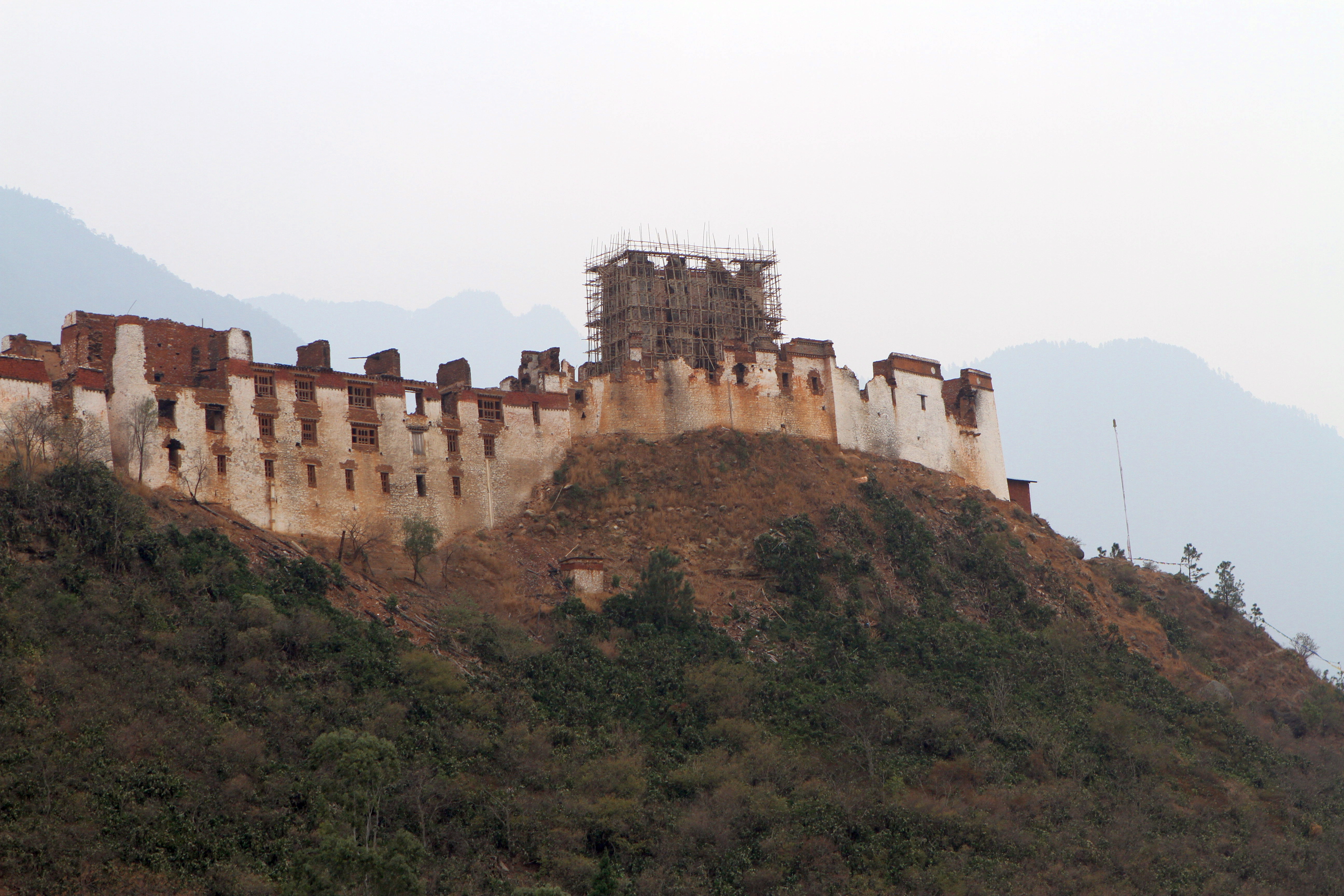
 Wangdi Phodrang Dzong burnt down in the afternoon of 24 June 2012, supposedly because of a faulty electrical water cooker. However, the dzong was being renovated at the time, so most of the historical relics had already been put into storage and were saved from destruction. Shortly after the fire, more than 1000 Japanese sympathizers donated an equivalent of over US$134,500 to the Wangdue Phodrang Reconstruction Fund. Other donations have also arrived, but reconstruction is still underway as of 2014.
Satellite map at Maplandia.com
Populated places in Bhutan Wangdue Phodrang District {{Bhutan-geo-stub
Dzongkha
Dzongkha (; ) is a Sino-Tibetan language that is the official and national language of Bhutan. It is written using the Tibetan script.
The word means "the language of the fortress", from ' "fortress" and ' "language". , Dzongkha had 171,080 ...
'Wangdi Phodr'a) is a town
A town is a human settlement. Towns are generally larger than villages and smaller than cities, though the criteria to distinguish between them vary considerably in different parts of the world.
Origin and use
The word "town" shares an o ...
and capital (dzongkhag
The Kingdom of Bhutan is divided into 20 districts ( Dzongkha: ). Bhutan is located between the Tibet Autonomous Region of China and India on the eastern slopes of the Himalayas in South Asia.
are the primary subdivisions of Bhutan. They po ...
thromde
A thromde (Dzongkha: ཁྲོམ་སྡེ་; Wylie: ''khrom-sde'') is a second-level administrative division in Bhutan. The legal administrative status of thromdes was most recently codified under the Local Government Act of 2009, and the r ...
) of Wangdue Phodrang District
Wangdue Phodrang District ( Dzongkha: དབང་འདུས་ཕོ་བྲང་རྫོང་ཁག་; Wylie: ''Dbang-'dus Pho-brang rdzong-khag''; previously spelled "Wangdi Phodrang") is a dzongkhag (district) of central Bhutan. This ...
in central Bhutan
Bhutan (; dz, འབྲུག་ཡུལ་, Druk Yul ), officially the Kingdom of Bhutan,), is a landlocked country in South Asia. It is situated in the Eastern Himalayas, between China in the north and India in the south. A mountainou ...
. It is located in Thedtsho Gewog.
History
 The town shares its name with the Wangdue Phodrang Dzong built in 1638 that dominates the district. The name is said to have been given by Ngawang Namgyal, the 1st Zhabdrung Rinpoche, who was searching for the best location for a dzong to prevent incursions from the south. At the chosen spot, the Zhabdrung encountered a boy named Wangdi playing beside the river and hence named the dzong "Wangdi's Palace".
Fire and reconstruction
 Wangdi Phodrang Dzong burnt down in the afternoon of 24 June 2012, supposedly because of a faulty electrical water cooker. However, the dzong was being renovated at the time, so most of the historical relics had already been put into storage and were saved from destruction. Shortly after the fire, more than 1000 Japanese sympathizers donated an equivalent of over US$134,500 to the Wangdue Phodrang Reconstruction Fund. Other donations have also arrived, but reconstruction is still underway as of 2014.
Topology
There are three paved roads in Wangdi Phodrang. The Lateral Road enters from the west at Dochula Pass, crosses the Sankosh River (Dzongkha: ''Puna Tsang Chhu'') at Wangdi Phodrang Dzong, and continues east to Tongsa. One spur road heads north from Wangdi Phodrang to Punakha Dzong and slightly beyond. This becomes the footpath to Gasa. A second spur departs the Lateral Road near the Pele Pass halfway between Wangdi and Tongsa, traveling south a short distance toGangteng Monastery
The Gangteng Monastery (Dzongkha: ), generally known as ''Gangtey Gonpa'' or ''Gangtey Monastery'', is an important monastery of Nyingmapa school of Buddhism, the main seat of the Pema Lingpa tradition. located in the Wangdue Phodrang District in ...
and the Phobjikha Valley
The Phobjikha Valley ཕོབ་སྦྱིས་ཁ spelled as Pho-sbis-kha, (the suffix ''kha'' is an element in many place-names in Bhutan and its use is generally optional both in colloquial speech and in literary forms) is a vast U-shaped v ...
, where rare black-necked cranes may be found.
Climate
Wangdue Phodrang features a dry-winterhumid subtropical climate
A humid subtropical climate is a zone of climate characterized by hot and humid summers, and cool to mild winters. These climates normally lie on the southeast side of all continents (except Antarctica), generally between latitudes 25° and 40° ...
( Köppen ''Cwa'').
References
External links
Satellite map at Maplandia.com
Populated places in Bhutan Wangdue Phodrang District {{Bhutan-geo-stub