|
Gasa District
Gasa District or Gasa Dzongkhag ( Dzongkha: མགར་ས་རྫོང་ཁག་; Wylie: ''Mgar-sa rdzong-khag'') is one of the 20 dzongkhags (districts) comprising Bhutan. The capital of Gasa District is Gasa Dzong near Gasa. It is located in the far north of the county and spans the Middle and High regions of the Tibetan Himalayas. The dominant language of the district is Dzongkha, which is the national language. Related languages, Layakha and Lunanakha, are spoken by semi-nomadic communities in the north of the district. The People's Republic of China claims the northern part of Gasa District. Gasa has an area of , formerly . It had a population of 3,116 as of the 2005 census, making it the largest, least populated, and thus least densely populated of all the dzongkhags; it is also the least developed district of Bhutan. History Gasa was formerly a '' drungkhag'' (sub-district) of the Punakha ''dzongkhag'' (district). It became a separate ''dzongkhag'' in 199 ... [...More Info...] [...Related Items...] OR: [Wikipedia] [Google] [Baidu] |
Dispersed Settlement
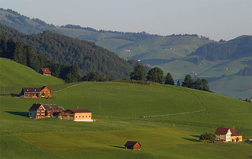
A dispersed settlement, also known as a scattered settlement, is one of the main types of settlement patterns used by landscape historians to classify rural settlements found in England and other parts of the world. Typically, there are a number of separate farmsteads scattered throughout the area. A dispersed settlement contrasts with a nucleated village. It can be known as main human settlements. The French term ''bocage'' is sometimes used to describe the type of landscape found where dispersed settlements are common. In addition to Western Europe, dispersed patterns of settlement are found in parts of Papua New Guinea, as among the Gainj, Ankave, and Baining tribes. It is also frequently met with in nomadic pastoral societies. In Ghana, Kumbyili in the northern region is also an example of a dispersed settlement England In England, dispersed settlements are often found in the areas of ancient enclosure outside the central region—for example, Essex, Kent and the West Cou ... [...More Info...] [...Related Items...] OR: [Wikipedia] [Google] [Baidu] |
Punakha District
Punakha District ( Dzongkha: སྤུ་ན་ཁ་རྫོང་ཁག་; Wylie: ''Spu-na-kha rdzong-khag'') is one of the 20 dzongkhags (districts) comprising Bhutan. It is bordered by Thimphu, Gasa, and Wangdue Phodrang Districts. The dominant language in the district is Dzongkha, the national language. Culture Pungtang Dechen Phodrang Dzong at Punakha, the administrative and religious center of the district, is the winter home of Bhutan's Dratshang Lhentshog (Central Monk Body). Since the 1680s the dzong has also been the site of a continuous vigil over the earthly body of Shabdrung Ngawang Namgyal, the founder of the country, which lies in a special chamber in the dzong. Punakha Dzong was the capital of Bhutan during the time of Shabdrung Ngawang Namgyal. The Punakha Dzong is one of the most historic dzongs in the whole country. Built by Shabdrung Ngawang Namgyal in the 17th century, it is located between the confluence of two rivers: Pho Chhu (male) and Mo Chhu (f ... [...More Info...] [...Related Items...] OR: [Wikipedia] [Google] [Baidu] |
Mustard Plant
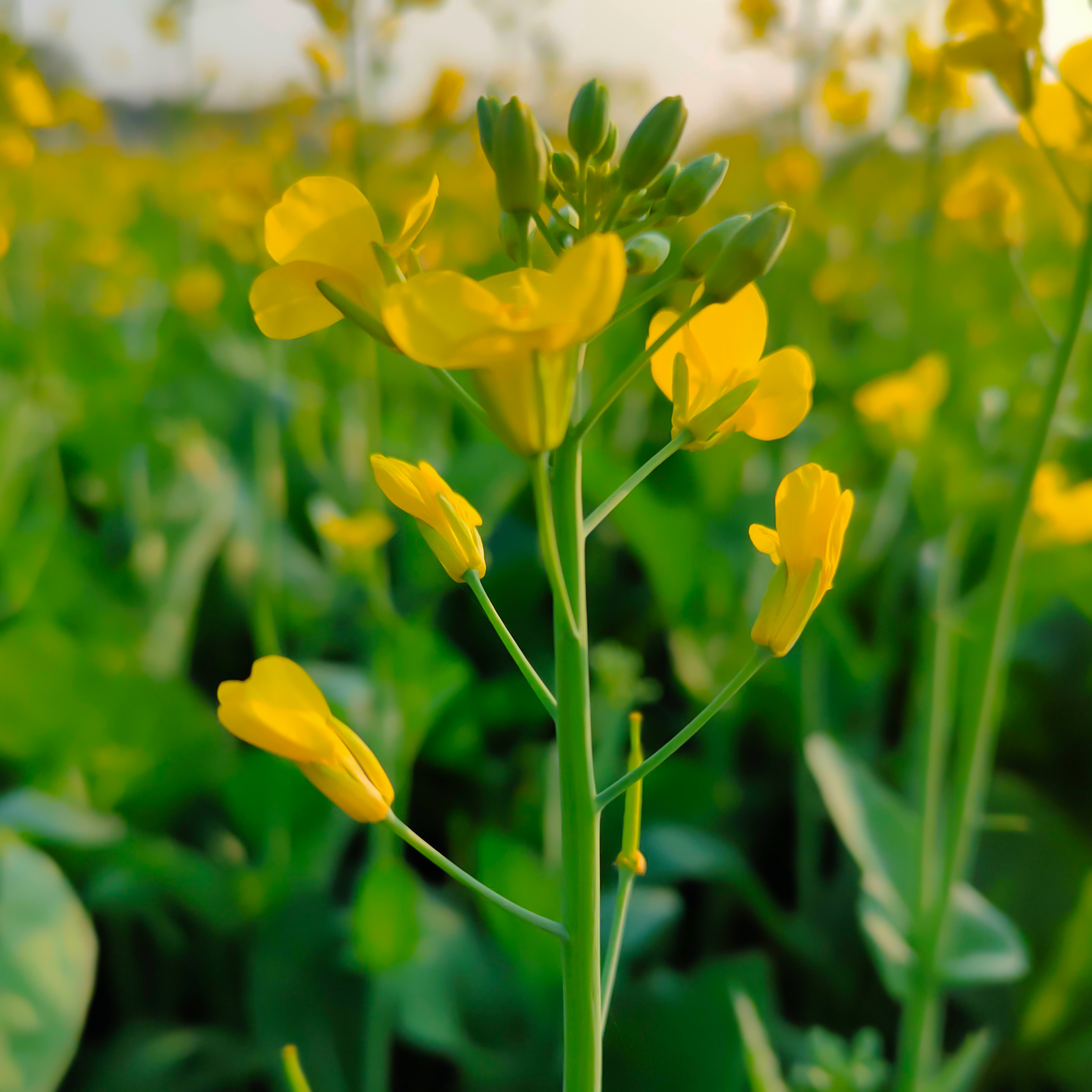
The mustard plant is any one of several plant species in the genera ''Brassica'' and ''Sinapis'' in the family Brassicaceae (the mustard family). Mustard seed is used as a spice. Grinding and mixing the seeds with water, vinegar, or other liquids creates the yellow condiment known as Mustard (condiment), prepared mustard. The seeds can also be pressed to make mustard oil, and the edible leaves can be eaten as Brassica juncea, mustard greens. Many vegetables are cultivated varieties of mustard plants; domestication may have begun 6,000 years ago. History Although some varieties of mustard plants were well-established crops in Hellenistic and Roman Empire, Roman times, Zohary and Hopf note, "There are almost no Archaeology, archeological records available for any of these crops." Wild forms of mustard and its relatives, the radish and turnip, can be found over West Asia and Europe, suggesting their domestication took place somewhere in that area. However, Zohary and Hopf conclu ... [...More Info...] [...Related Items...] OR: [Wikipedia] [Google] [Baidu] |
Mo Chhu
Mo Chhu is a major river in Bhutan. The word "Chhu" means "river" or "water" in Dzongkha, the official national language in Bhutan. The river rises in Gasa Dzongkhag (district) near the border between Bhutan and Tibet. From there, the Mo Chhu flows generally southward to Punakha in central Bhutan, where it joins the Pho Chhu from the northeast. The confluence of the two streams is immediately below the Punakha Dzong, which is the winter home of the Dratshang Lhentshog (Central Monk Body) and the Je Khenpo. The combined streams are then joined by the Dang Chhu near the town of Wangdue Phodrang, and the name of the river becomes the Puna Tsang Chhu. The river then flows through Dagana and Tsirang Districts. After leaving Bhutan near the town of Lhamoidzingkha, formerly known as Kalikhola,From Damphu to Lhamoidzingkha, in the Bhutanese daily "Kuensel", 21 May 2020 https://kuenselonline.com/from-damphu-to-lhamoidzingkha/ the river enters Assam in India and is known as the Sankosh. Th ... [...More Info...] [...Related Items...] OR: [Wikipedia] [Google] [Baidu] |
Dzong
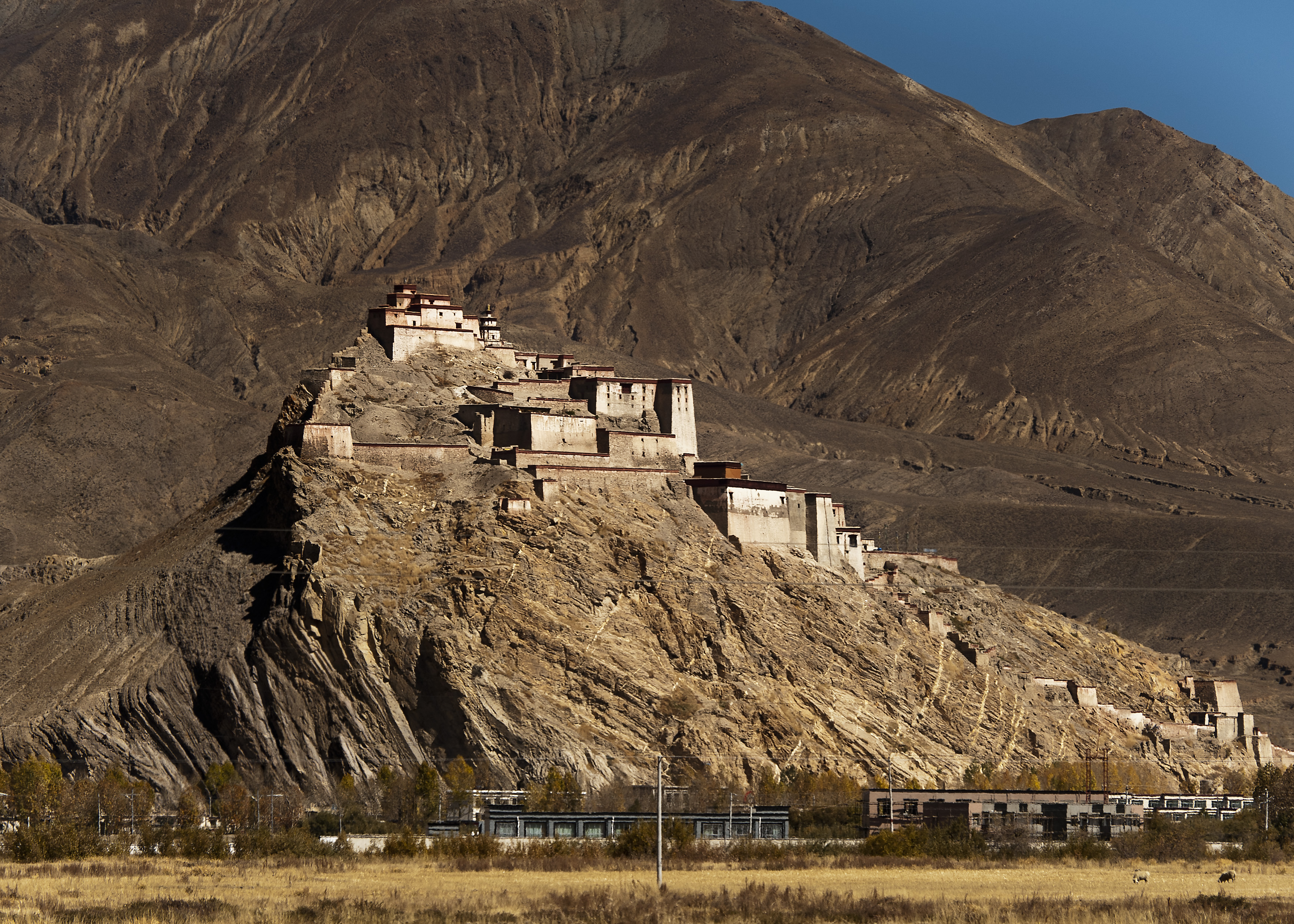
Dzong architecture is used for dzongs, a distinctive type of fortified monastery ( dz, རྫོང, , ) architecture found mainly in Bhutan and Tibet. The architecture is massive in style with towering exterior walls surrounding a complex of courtyards, temples, administrative offices, and monks' accommodation. Characteristics Distinctive features include: * High inward sloping walls of brick and stone painted white with few or no windows in the lower sections of the wall * Use of a surrounding red ochre stripe near the top of the walls, sometimes punctuated by large gold circles * Use of unique style flared roofs atop interior temples * Massive entry doors made of wood and iron * Interior courtyards and temples brightly colored in Buddhist-themed art motifs such as the ashtamangala or swastika Regional differences Bhutan Dzongs serve as the religious, military, administrative, and social centers of their district. They are often the site of an annual ''tsechu'' or religious ... [...More Info...] [...Related Items...] OR: [Wikipedia] [Google] [Baidu] |
Tourist Destination
A tourist attraction is a place of interest that Tourism, tourists visit, typically for its inherent or an exhibited natural or cultural value, historical significance, natural or built beauty, offering leisure and amusement. Types Places of natural beauty such as beaches, tropical island resorts, national parks, mountains, deserts and forests, are examples of traditional tourist attractions which people may visit. Cultural tourist attractions can include historical places, sites of significant historic wikt:event, event, monuments, ancient temples, zoos, public aquarium, aquaria, museums and art galleries, botanical gardens, buildings and structures (such as List of forts, forts, castles, library, libraries, former prisons, skyscrapers, bridges), theme parks and carnivals, living history museums, public art (sculptures, statues, murals), ethnic enclave communities, heritage railway, historic trains and cultural events. Factory tours, industrial heritage, creative art and craft ... [...More Info...] [...Related Items...] OR: [Wikipedia] [Google] [Baidu] |
Wangdue Phodrang District
Wangdue Phodrang District ( Dzongkha: དབང་འདུས་ཕོ་བྲང་རྫོང་ཁག་; Wylie: ''Dbang-'dus Pho-brang rdzong-khag''; previously spelled "Wangdi Phodrang") is a dzongkhag (district) of central Bhutan. This is also the name of the dzong (built in 1638) which dominates the district, and the name of the small market town outside the gates of the dzong—it is the capital (dzongkhag thromde) of Wangdue Phodrang District). The name is said to have been given by the Shabdrung Ngawang Namgyal who was searching for the best location for a dzong to prevent incursions from the south. The word "wangdue" means unification of Country, and "Phodrang" means Palace in Dzongkha. Wangdue Phodrang is the largest dzongkhag in Bhutan by area and is bordered by Dagana and Tsirang dzongkhags to the south, Tongsa dzongkhag to the east, Thimphu and Punakha dzongkhag to the west, and Gasa dzongkhag and a small section of border with Tibet to the north. It is lis ... [...More Info...] [...Related Items...] OR: [Wikipedia] [Google] [Baidu] |
Thimphu District
Thimphu District (Dzongkha: ཐིམ་ཕུ་རྫོང་ཁག་; Wylie: ''Thim-phu rdzong-khag'') is a dzongkhag (district) of Bhutan. Thimphu is also the capital of Bhutan and the largest city in the whole kingdom. Languages The dominant language throughout the district is Dzongkha; however, within the capital nearly every language of Bhutan may be encountered. Administrative divisions Thimphu District is divided into eight '' gewogs'' and one town (Thimphu): * Chang Gewog * Dagala Gewog * Genyekha Gewog * Kawang Gewog * Lingzhi Gewog * Mewang Gewog * Naro Gewog * Soe Gewog Lingzhi, Soe and Naro Gewogs belong to the Lingzhi ''Dungkhag'' subdistrict, the only subdistrict within Thimphu District. The remaining gewogs do not belong to any subdistrict. Environment The northern half of Thimphu District (the ''gewogs'' of Kawang, Lingzhi, Naro and Soe – corresponding roughly to Lingzhi Dungkhag) is subject to environmental protection, falling within Jigme Dorj ... [...More Info...] [...Related Items...] OR: [Wikipedia] [Google] [Baidu] |
Tibet Autonomous Region
The Tibet Autonomous Region or Xizang Autonomous Region, often shortened to Tibet or Xizang, is a Provinces of China, province-level Autonomous regions of China, autonomous region of the China, People's Republic of China in Southwest China. It was overlayed on the traditional Tibetan regions of Ü-Tsang and Kham. It was formally established in 1965 to replace the Tibet Area (administrative division), Tibet Area, the former Administrative divisions of China, administrative division of the People's Republic of China (PRC) established after the annexation of Tibet by the People's Republic of China, annexation of Tibet. The establishment was about five years after the 1959 Tibetan uprising and the dismissal of the Kashag, and about 13 years after the original annexation. The current borders of the Tibet Autonomous Region were generally established in the 18th century and include about half of historic Tibet, or the Tibet, ethno-cultural Tibet. The Tibet Autonomous Region spans ov ... [...More Info...] [...Related Items...] OR: [Wikipedia] [Google] [Baidu] |
Lunana Gewog
Lunana Gewog is a gewog (village block) of Gasa District, Bhutan. The village Lunana is the administrative center of Lunana Gewog. The gewog lies almost entirely within protected areas, mostly in Jigme Dorji National Park, though eastern sections are part of Wangchuck Centennial Park. Lunana contains many of Bhutan's glaciers. In addition to the national language, Dzongkha, many locals speak Lunanakha. The closure of the Tibetan border following the Chinese invasion of Tibet brought changes to neighboring areas, as refugees from Tibet arrived with their yaks, which they sold off at low prices. However, because there were no direct routes into Lunana from Tibet, yaks were brought into Lunana from Laya and Sephu in Wangdue Phodrang District Wangdue Phodrang District ( Dzongkha: དབང་འདུས་ཕོ་བྲང་རྫོང་ཁག་; Wylie: ''Dbang-'dus Pho-brang rdzong-khag''; previously spelled "Wangdi Phodrang") is a dzongkhag (district) of central Bhu ... [...More Info...] [...Related Items...] OR: [Wikipedia] [Google] [Baidu] |
Laya Gewog
Laya Gewog is a gewog (village block) of Gasa District, Bhutan. The capital of gewog is the town Laya. The gewog lies entirely within Jigme Dorji National Park and contains several of Bhutan's glaciers. As well as the national language, Dzongkha, many locals speak Layakha. The closure of the Tibetan border following the Chinese invasion of Tibet brought several changes to the area. Local people were no longer compelled to work as porters for Tibetan and Bhutanese officials, nobles, or religious figures from Gasa Dzong. Refugees from Tibet arrived with their yaks The domestic yak (''Bos grunniens''), also known as the Tartary ox, grunting ox or hairy cattle, is a species of long-haired domesticated cattle found throughout the Himalayan region of the Indian subcontinent, the Tibetan Plateau, Kachin St ..., which they sold off at low prices. Taxes on horses and yaks, which had been a disincentive to livestock production were reduced, and yak production increased. Re ... [...More Info...] [...Related Items...] OR: [Wikipedia] [Google] [Baidu] |
Khatoed Gewog
Khatoed is a '' gewog'' (village block) of the Gasa ''dzongkhag'' (district) in Bhutan Bhutan (; dz, འབྲུག་ཡུལ་, Druk Yul ), officially the Kingdom of Bhutan,), is a landlocked country in South Asia. It is situated in the Eastern Himalayas, between China in the north and India in the south. A mountainous .... It was formerly known as Goenkaatoe. References Gewogs of Bhutan Gasa District {{Bhutan-geo-stub ... [...More Info...] [...Related Items...] OR: [Wikipedia] [Google] [Baidu] |


