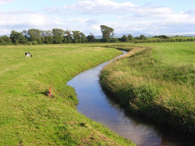
River Waver on:
[Wikipedia]
[Google]
[Amazon]
 The River Waver is a river in
 The River Waver is a river in
 Cumbria
Cumbria ( ) is a ceremonial and non-metropolitan county in North West England, bordering Scotland. The county and Cumbria County Council, its local government, came into existence in 1974 after the passage of the Local Government Act 1972. C ...
, England
England is a country that is part of the United Kingdom. It shares land borders with Wales to its west and Scotland to its north. The Irish Sea lies northwest and the Celtic Sea to the southwest. It is separated from continental Europe b ...
. The river rises at Wavergillhead (as Townthwaite Beck).
It is fed by the northwards flowing Thornthwaite Beck and Pow Gill either side of Bolton Wood Lane.
The "Little Waver", rising at Catlands Hill, joins at Waterside near Woodrow.
The river then takes a northward course via Waverton and Waverbridge, both of which are named for the river, before turning sharply westward at Abbeytown
Abbeytown, also known as Holme Abbey, is a village and civil parish in the Allerdale borough of Cumbria, England.
The name Abbeytown dates to the mid-17th century (''The Towne of the Abbey'', ''Abbey Towne''; ''Abbeytown'' from mid-18th centur ...
. The river then goes north, running into Moricambe Bay, an inlet of the Solway Firth
The Solway Firth ( gd, Tràchd Romhra) is a firth that forms part of the border between England and Scotland, between Cumbria (including the Solway Plain) and Dumfries and Galloway. It stretches from St Bees Head, just south of Whitehaven ...
.
Waver, River
{{England-river-stub