Healey Nab on:
[Wikipedia]
[Google]
[Amazon]
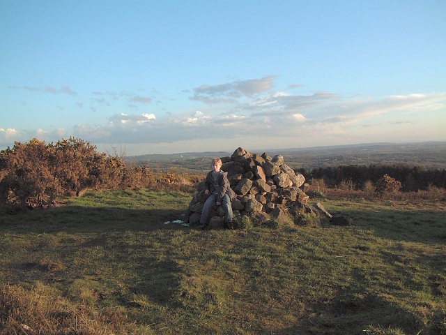
Healey Nab or "The Nab" is an area of countryside owned partly by 
Friends of Healey Nab
{{Borough of Chorley geography Tourist attractions in Chorley West Pennine Moors
Lancashire County Council
Lancashire County Council is the upper-tier local authority for the non-metropolitan county of Lancashire, England. The non-metropolitan county of Lancashire is smaller than the ceremonial county, which additionally includes Blackburn with Dar ...
containing rolling hills, moorland, woodland, ponds and streams to the east of Chorley
Chorley is a town and the administrative centre of the wider Borough of Chorley in Lancashire, England, north of Wigan, south west of Blackburn, north west of Bolton, south of Preston and north west of Manchester. The town's wealth ca ...
, Lancashire
Lancashire ( , ; abbreviated ''Lancs'') is a ceremonial county in North West England. It is bordered by Cumbria to the north, North Yorkshire and West Yorkshire to the east, Greater Manchester and Merseyside to the south, and the Irish Sea to ...
, between the M61 and the West Pennine Moors
The West Pennine Moors is an area of the Pennines covering approximately of moorland and Reservoir (water), reservoirs in Lancashire and Greater Manchester, England. It is a Site of Special Scientific Interest.
The West Pennine Moors are separa ...
. To its southeast is Anglezarke Reservoir
Anglezarke Reservoir is the largest reservoir in the Rivington chain to the west of Anglezarke in Lancashire, England. Anglezarke Reservoir has three embankments: the Charnock Embankment, the longest, is long and high, the Knowsley Embankment ...
and to its northeast is White Coppice
White Coppice is a hamlet near Chorley, Lancashire, England. It was the most populated part of the township of Anglezarke in the 19th century. Close to the settlement in the early 19th century were quarries and small coal mines. The hamlet lies ...
.
The name "Healey Nab" is derived from (high) and (woodland). "Nab" is believed to derive from the Middle-English , meaning promontory or headland.
The area is popular with walkers; a network of hiking trails criss-crosses it. It has two small human-made lakes: Bottom Lodge, and Top Lodge, a private fishing lake. They used to be linked to Lower Healey Bleach Works, a finishing works of the town's cotton industry, whose remaining structure has been incorporated into the site's conversion into a small industrial estate. The summit is Grey Heights, and near it is a disused quarry known as Devil's Rock. Its highest point is Grey Heights, at 682 feet, with views of Chorley, the skyline of Preston, Fiddlers Ferry power station
Fiddler's Ferry power station is a decommissioned coal fired power station in the Borough of Warrington, Cheshire, England. Opened in 1971, the station had a generating capacity of 1,989 megawatts and took water from the River Mersey. After pri ...
in Merseyside, Jodrell Bank Telescope, and the silhouette of Blackpool Tower
Blackpool Tower is a tourist attraction in Blackpool, Lancashire, England, which was opened to the public on 14 May 1894. When it opened, Blackpool Tower was the tallest man-made structure in the British Empire. Inspired by the Eiffel Tower in P ...
, Blackpool Pleasure Beach
Pleasure Beach Resort, best known by its former name Blackpool Pleasure Beach, is an amusement park situated on Blackpool's South Shore, in the county of Lancashire, North West England. The park was founded in 1896 by A. W. G. Bean and his p ...
and the Irish Sea. From Chorley
Chorley is a town and the administrative centre of the wider Borough of Chorley in Lancashire, England, north of Wigan, south west of Blackburn, north west of Bolton, south of Preston and north west of Manchester. The town's wealth ca ...
, "The Nab" dominates the landscape and is the first significant height gain in the transition from a heavily populated area to the moorland
Moorland or moor is a type of Habitat (ecology), habitat found in upland (geology), upland areas in temperate grasslands, savannas, and shrublands and the biomes of montane grasslands and shrublands, characterised by low-growing vegetation on So ...
of the West Pennine Moors.

References
External links
Friends of Healey Nab
{{Borough of Chorley geography Tourist attractions in Chorley West Pennine Moors