Fort Independence (California) on:
[Wikipedia]
[Google]
[Amazon]
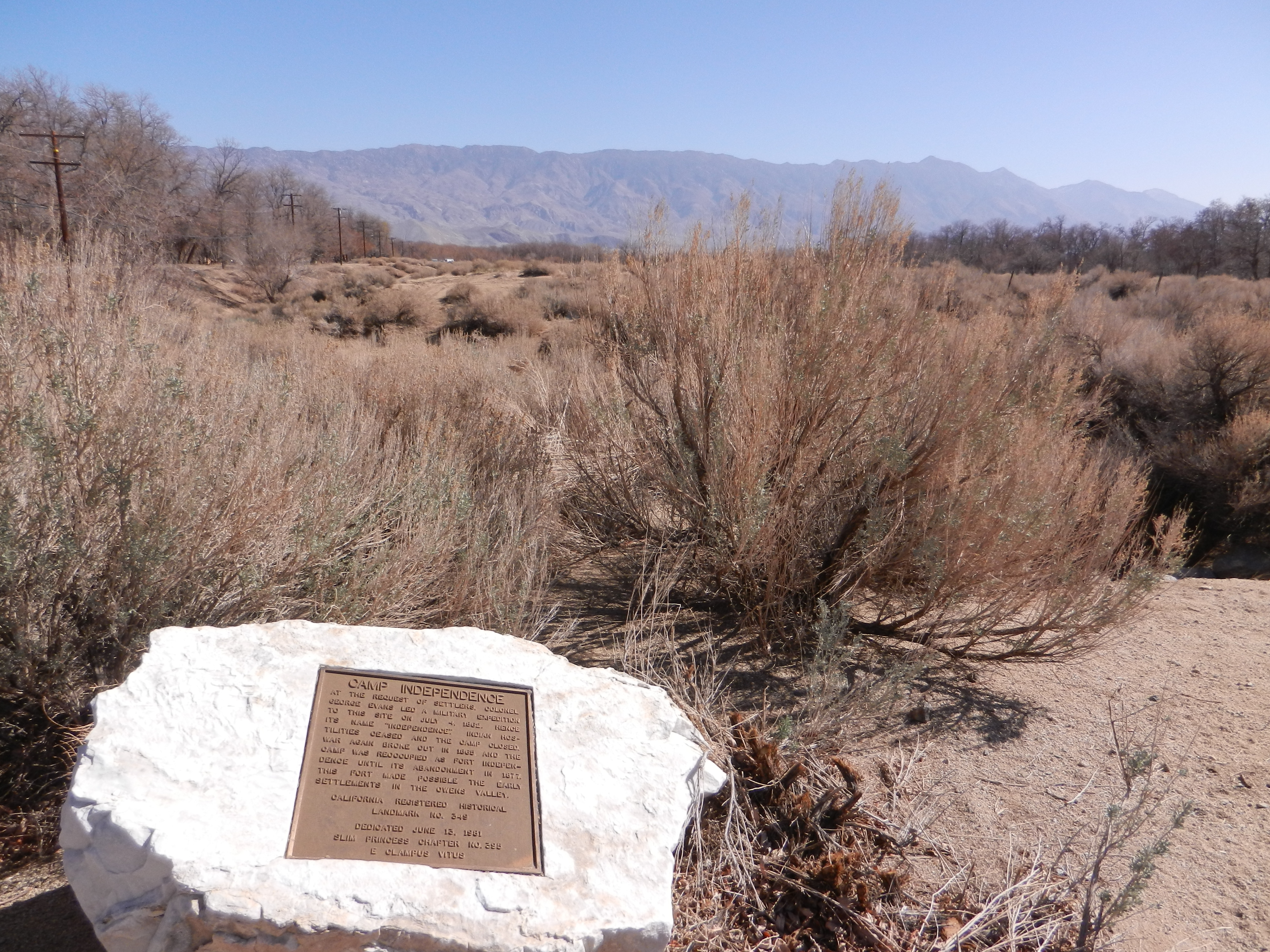
 Fort Independence, originally named Camp Independence, was a fort located in the
Fort Independence Indian Reservation
/ref>
 Fort Independence, originally named Camp Independence, was a fort located in the
 Owens Valley
Owens Valley (Numic
Numic is a branch of the Uto-Aztecan language family. It includes seven languages spoken by Native American peoples traditionally living in the Great Basin, Colorado River basin, Snake River basin, and southern Great Pl ...
, north of present-day Independence
Independence is a condition of a person, nation, country, or state in which residents and population, or some portion thereof, exercise self-government, and usually sovereignty, over its territory. The opposite of independence is the statu ...
, Inyo County
Inyo County () is a county in the eastern central part of the U.S. state of California, located between the Sierra Nevada and the state of Nevada. In the 2020 census, the population was 19,016. The county seat is Independence. Inyo County is o ...
, eastern California
California is a U.S. state, state in the Western United States, located along the West Coast of the United States, Pacific Coast. With nearly 39.2million residents across a total area of approximately , it is the List of states and territori ...
. The U.S. Army post was active from 1862 to 1877.
History
Camp Independence
Camp Independence was established on Oak Creek in the valley on July 4, 1862, during theOwens Valley Indian War
The Owens Valley War was fought between 1862 and 1863, by California Volunteers and local settlers against the Owens Valley Paiutes, and their Shoshone and Kawaiisu allies, in the Owens Valley of California and the southwestern Nevada borde ...
. It also served as an American Civil War
The American Civil War (April 12, 1861 – May 26, 1865; also known by other names) was a civil war in the United States. It was fought between the Union ("the North") and the Confederacy ("the South"), the latter formed by states th ...
army post. The fort was briefly abandoned at the end of hostilities with the Owens Valley Paiute
Paiute (; also Piute) refers to three non-contiguous groups of indigenous peoples of the Great Basin. Although their languages are related within the Numic group of Uto-Aztecan languages, these three groups do not form a single set. The term "Pai ...
in December 1864.
However, it was reoccupied by the Nevada Volunteers in March 1865, due to renewed conflict with the local Paiute. The post was finally abandoned on July 5, 1877. The military reservation was transferred to the Interior Department for disposition on July 22, 1884.California Historical Marker No. 349
Fort Independence Reservation
When the military left the valley, the native Paiute andShoshone
The Shoshone or Shoshoni ( or ) are a Native American tribe with four large cultural/linguistic divisions:
* Eastern Shoshone: Wyoming
* Northern Shoshone: southern Idaho
* Western Shoshone: Nevada, northern Utah
* Goshute: western Utah, easter ...
peoples of the area held various allotments of land adjacent to the fort. The Fort Independence Reservation was officially established through executive orders Number 2264 and 2375 in 1915 and 1916. This provided the tribal members with of land adjacent to Oak Creek in the southern Owens Valley
Owens Valley (Numic
Numic is a branch of the Uto-Aztecan language family. It includes seven languages spoken by Native American peoples traditionally living in the Great Basin, Colorado River basin, Snake River basin, and southern Great Pl ...
, near the Owens River
The Owens River is a river in eastern California in the United States, approximately long.U.S. Geological Survey. National Hydrography Dataset high-resolution flowline dataThe National Map accessed March 17, 2011, It drains into and through the ...
and town of Independence./ref>
Historical landmark
The site is aCalifornia Historical Landmark
A California Historical Landmark (CHL) is a building, structure, site, or place in California that has been determined to have statewide historical landmark significance.
Criteria
Historical significance is determined by meeting at least one of ...
, with a historical marker on Highway 395.
See also
*Fort Independence Indian Community of Paiute Indians
The Fort Independence Indian Community of Paiute Indians of the Fort Independence Reservation is a federally recognized tribe of Mono and Timbisha in the Owens Valley, in Inyo County, eastern California. As of the 2010 Census the population was ...
*California Historical Landmarks in Inyo County, California
This list includes properties and districts listed on the California Historical Landmark listing in Inyo County, California. Click the "Map of all coordinates" link to the right to view a Google map of all properties and districts with latitude and ...
*History of Inyo County, California
Inyo County () is a county in the eastern central part of the U.S. state of California, located between the Sierra Nevada and the state of Nevada. In the 2020 census, the population was 19,016. The county seat is Independence. Inyo County is o ...
References
External links
{{commons category, Fort Independence (California), position=leftIndependence
Independence is a condition of a person, nation, country, or state in which residents and population, or some portion thereof, exercise self-government, and usually sovereignty, over its territory. The opposite of independence is the statu ...
History of Inyo County, California
Owens Valley
California Historical Landmarks
Closed installations of the United States Army
California in the American Civil War
American Civil War army posts
Independence (California)
1862 establishments in California